Top 3 Natural Monuments around Unorganized North Algoma
Best natural monuments around Unorganized North Algoma include a vast array of natural features within this expansive region of Northeastern Ontario. The area is characterized by its Canadian Shield geology, extensive forests, and significant waterways, offering diverse natural landscapes. It provides opportunities to experience untouched wilderness, dramatic cliffs, and unique geological formations. This region is recognized for its ecological importance and varied natural features.
Best natural monuments around Unorganized North Algoma
- The most popular natural monuments is Agawa Rock Pictographs…
Last updated: September 28, 2026
Agawa Rock Pictographs
Highlight • Historical Site
Tip by

Waterfall
Highlight • Waterfall
Showing Translation
Tip by

Sign up now to discover places like this
Get recommendations on the best single tracks, peaks, & plenty of other exciting outdoor places.
Potholes Provincial Nature Reserve
Highlight • Natural Monument
Tip by
Chutes Falls
Highlight • Waterfall
Showing Translation
Tip by
Old Woman Bay
Highlight • Beach
Tip by

Sign up for free to discover even more natural monuments around Unorganized North Algoma.
Already have an account?
Start today with a free account
Your next adventure awaits.


Other adventures around Unorganized North Algoma

Tips from the Community

Potholes Provincial Park is located about 50 kilometers east of Wawa on Highway 101, the road to Timmins, the mining town in northeastern Canada. The nature reserve on the Kinniwabi River was founded in 1985 to protect the geological heritage. (Visit on June 3, 2026) https://www.ontarioparks.ca/park/potholes
0
0
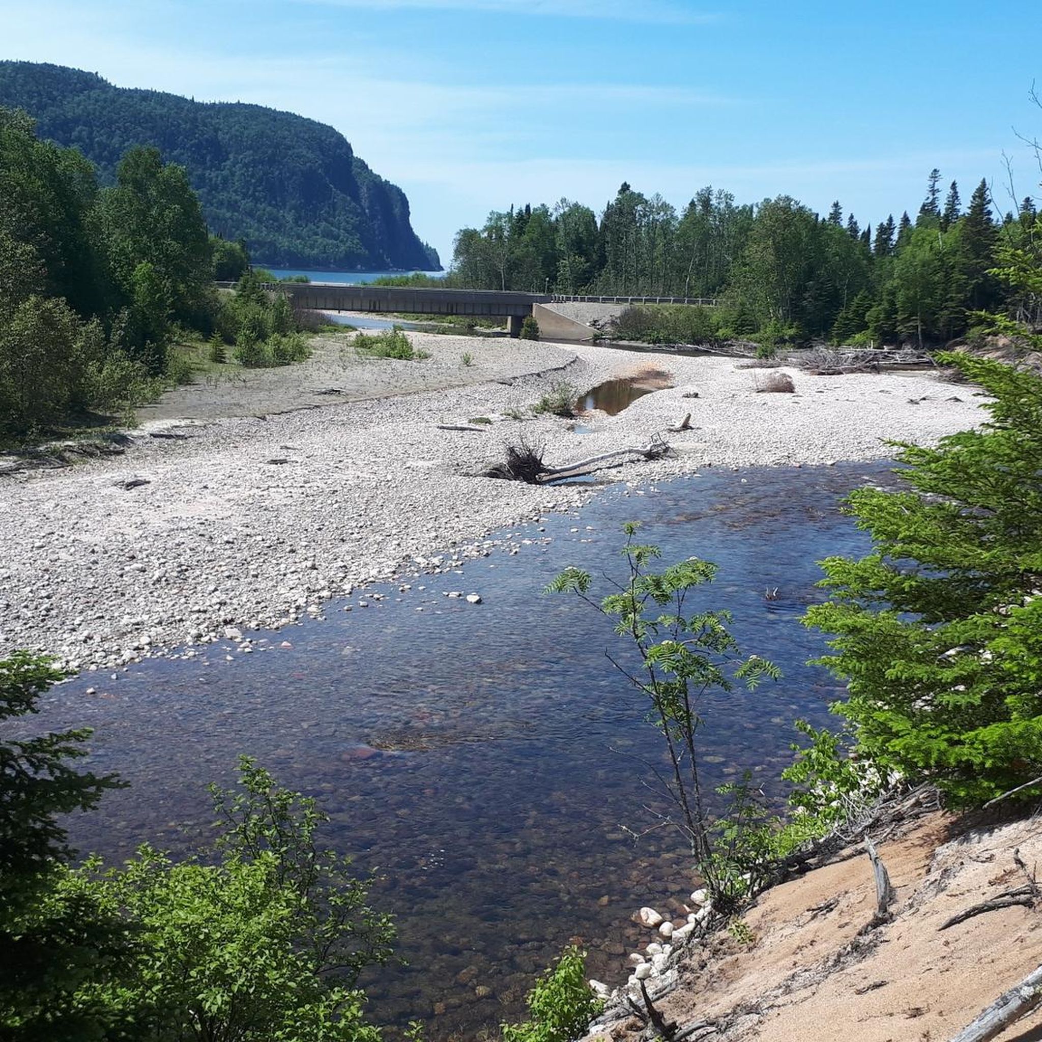
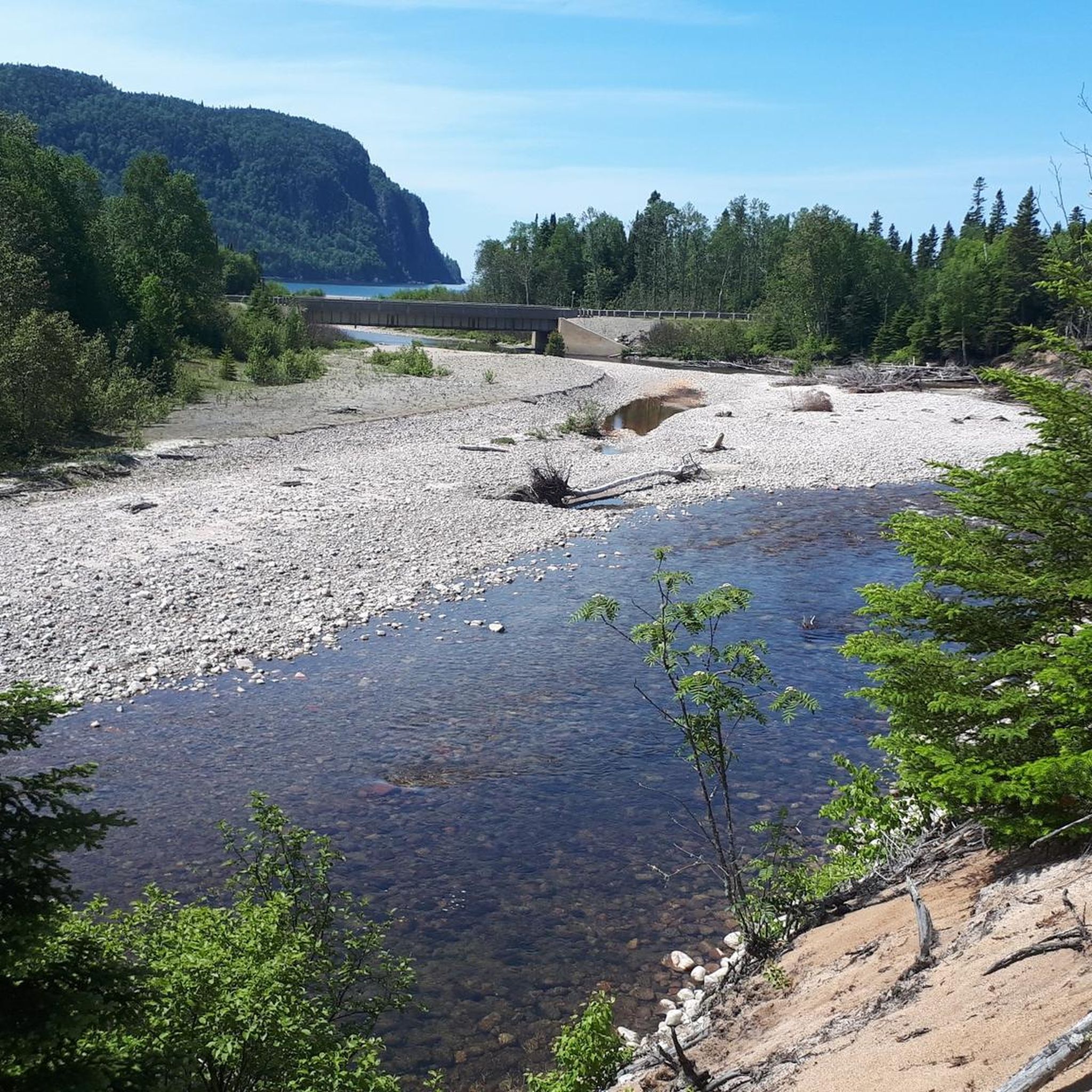
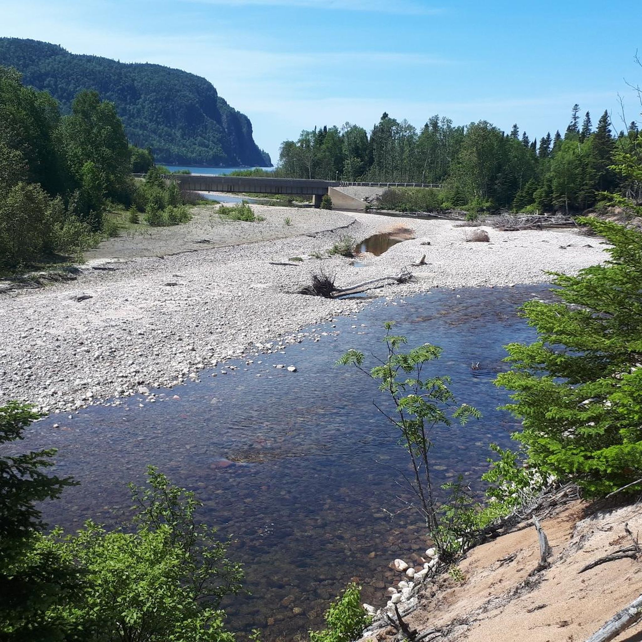
Old Woman Bay is located in the north of Lake Superior Provincial Park – about 25 kilometers away from the small town of Wawa. Access is via Highway 17 (Trans-Canada Highway), which runs directly past the bay. The South Old Woman River flows into Lake Superior on the sandy beach. The name Old Woman Bay comes from a distinctive rock formation in the bay. Viewed from a distance and from a certain angle, the contours of the rock cliffs form the profile of an old woman's face. The popular Nokomis Trail begins at the parking lot by the bay. (Visit on June 2, 2026)
0
0
The visit to the rock art site is a short walk steeply down to the coast. Everywhere there are signs with warnings indicating the dangerous undertaking. The somewhat steep, walkable rocks are extremely exposed to water; during storms and wet conditions, there is a risk to life. People have died or been injured during visits when they were washed into the water. It looks as if there used to be a walkable platform. However, during our visit on May 31, 2026, none of this is an issue: with calm seas and a bright blue sky, we can view the somewhat faded paintings together. The passage on Highway 17 is closed today; since we have already been in Lake Superior Provincial Park since yesterday and will be staying for a few more days, we are not affected by the road closure.
0
0

The Seven Sisters Rapids are located upstream of Chutes Falls. Walking along the Twin Bridges Trail offers the best view of the rapids; in addition to the platform at Chutes Falls, there are two other excellent viewpoints upstream. From both bridges, you can also get a view of the rapids in the Aux Sables River. (Visit on May 25, 2026) https://waterfallsofontario.com/seven-sisters-rapids.php
0
0
The waterfall on the Aux Sables River in Chutes Provincial Park has no official name; it is known as Chutes Falls, Main Falls, or The Chutes. The waterfall gets its name from a historic log chute (chutes) built in the early 1900s to allow logs to be run over the rocks in the Aux Sables River without damage. From the viewpoint on the river below the campground, you have an excellent view of the waterfall and the wide Aux Sables River downstream with a sandy beach. (Visited May 25, 2026)
0
0

The Agawa Rock Pictographs are a collection of 35 red-ochre paintings on the face of Lake Superior's towering granite cliffs. In Ojibwe, the area is known as Mazinaubikinguning, meaning "the adorned rock of Lake Agawa". Although the glyphs are only a short distance from the parking area this is not a hike one should attempt during inclement weather since you need to negotiate a narrow rock shelf right at the water level in order to access the site.
0
0
Potholes Provincial Nature Reserve is a hidden geological gem located about 35 minutes east of Wawa, where the boreal forest meets the Kinniwabi River. The park's main draw is its collection of distinctive potholes, cylindrical pits carved into the bedrock by glacial meltwaters over 10,000 years ago, that now form a series of miniature waterfalls and rock pools. The park is small, but there is a picnic area with toilets at the trailhead.
0
0
Frequently Asked Questions
What unique natural features can I explore in Unorganized North Algoma?
Unorganized North Algoma offers a diverse range of natural features. You can witness the geological wonders of Potholes Provincial Nature Reserve, where glacial meltwaters carved distinctive cylindrical pits and miniature waterfalls. The region is also home to dramatic viewpoints like Robertson Cliffs, offering expansive views of the Goulais River Valley, and the vast wilderness of the Chapleau Crown Game Preserve, the world's largest crown game preserve.
Are there any historical or cultural natural monuments in the area?
Yes, the region holds significant historical and cultural natural monuments. The Agawa Rock Pictographs are a notable example, featuring ancient red-ochre paintings on the towering granite cliffs of Lake Superior, a sacred site for the Ojibwe people. Additionally, Lake Superior Provincial Park, established in 1944, offers insights into the region's rich cultural history at its Agawa Bay Visitor Centre.
What are some family-friendly natural monuments or activities in Unorganized North Algoma?
For families, Potholes Provincial Nature Reserve is an excellent choice with its unique geological formations and a picnic area with toilets at the trailhead. Chippewa Falls, easily accessible from Highway 17, provides convenient walking trails and viewing points. Many easy hiking trails are available, such as 'The Potholes Trail' or 'Bathtub Island' in Lake Superior Provincial Park, which you can find more about in the Family-friendly hikes around Unorganized North Algoma guide.
What is the best time of year to visit the natural monuments in Unorganized North Algoma?
The best time to visit largely depends on your interests. Summer offers ideal conditions for hiking, paddling, and exploring waterfalls. Autumn is particularly spectacular, especially for places like Robertson Cliffs and Agawa Canyon, which are renowned for their vibrant fall colors. Spring brings fresh greenery and flowing waterfalls, while winter offers opportunities for snowshoeing or cross-country skiing in certain areas, though accessibility to some remote sites may be limited.
Are there opportunities for wildlife viewing near these natural monuments?
Absolutely. The vast wilderness of Unorganized North Algoma is a haven for wildlife. The Chapleau Crown Game Preserve is a prime location for spotting moose, black bears, bald eagles, and loons. The remote Algoma Headwaters Provincial Park also protects diverse flora and fauna, offering a true backcountry experience for wildlife enthusiasts.
What kind of hiking trails can I find around the natural monuments?
You'll find a variety of hiking trails. For instance, Lake Superior Provincial Park offers world-class hiking, from accessible paths to more remote backcountry routes. The Robertson Cliffs area features trails leading to dramatic viewpoints. You can explore options like 'Robertson Cliffs via Ila’s Loop' or 'Lake Superior Coastal Trail to Katherine Cove' in the Easy hikes around Unorganized North Algoma guide.
Are permits required to visit natural monuments or hike in provincial parks?
For provincial parks like Lake Superior Provincial Park, day-use permits or camping permits are typically required. Algoma Headwaters Provincial Park is a non-operating park, meaning it has no services or facilities, and while it offers a pristine backcountry experience, it's always best to check with Ontario Parks for specific regulations regarding permits for backcountry access or activities like boating, fishing, and hunting in any provincial park.
What are some accessible natural monuments or viewpoints?
Chippewa Falls is easily accessible directly from Highway 17, offering convenient viewing points. While some natural monuments require more effort, many provincial parks have accessible visitor centers and shorter, well-maintained trails. For specific accessibility details, it's recommended to check the individual park websites or contact Ontario Parks directly.
Can I bring my dog to the natural monuments and on trails?
Many provincial parks and natural areas in Unorganized North Algoma are dog-friendly, but leash rules and specific restrictions may apply. It's always best to check the regulations for each specific park or trail you plan to visit. For example, while dogs are generally allowed on trails in Lake Superior Provincial Park, there might be areas where they are restricted for wildlife protection.
Are there any unique geological formations to see?
Yes, the region is rich in geological wonders. Potholes Provincial Nature Reserve is a prime example, showcasing unique 'potholes' carved into the bedrock by glacial erosion over 10,000 years ago, creating miniature waterfalls along the Kinniwabi River. The entire region sits on the ancient Precambrian rock of the Canadian Shield, contributing to its rugged and dramatic landscapes.
What other outdoor activities can I do near these natural monuments?
Beyond hiking, the area offers excellent opportunities for paddling, especially in Lake Superior Provincial Park and the remote Algoma Headwaters Provincial Park, which protects the headwaters of several significant rivers. Fishing is also popular. For those interested in mountain biking, you can find trails like 'Thayer Reservoir – The Lookout loop' in the MTB Trails around Unorganized North Algoma guide.
Most popular routes around Unorganized North Algoma
Most popular attractions around Unorganized North Algoma

Get inspired with the komoot mobile app


Explore more
Extend your search for the best caves by checking out these guides of the top ones around Unorganized North Algoma:
