The best city hikes and walks around Clitheroe
4.5
(106)
945
hikers
21
hikes
Urban hiking trails around Clitheroe offer a diverse range of experiences within and around the town, situated in the Ribble Valley. The area features a mix of riverside paths, town landmarks, and views of the surrounding hills and woodlands. Trails often follow the Rivers Ribble and Hodder, providing accessible routes through varied terrain. The landscape includes gentle ascents to viewpoints and established footpaths through parks and historical areas.
Best urban hiking trails around Clitheroe
- The most popular urban hiking route…
Last updated: June 23, 2026
4.5
(2)
46
hikers
7.14km
01:52
60m
60m
Easy hike. Great for any fitness level. Easily-accessible paths. Suitable for all skill levels.
3.0
(2)
26
hikers
3.49km
00:57
50m
50m
Easy hike. Great for any fitness level. Easily-accessible paths. Suitable for all skill levels.

Sign up for free
4.3
(3)
16
hikers
10.3km
02:44
110m
110m
Moderate hike. Good fitness required. Easily-accessible paths. Suitable for all skill levels.
13
hikers
4.79km
01:17
60m
60m
Easy hike. Great for any fitness level. Easily-accessible paths. Suitable for all skill levels.
13
hikers
3.98km
01:02
30m
30m
Easy hike. Great for any fitness level. Easily-accessible paths. Suitable for all skill levels.
Get access to more routes and recommendations from other explorers.
Sign up for free
Already have an account?
Our route recommendations are based on thousands of hikes, rides, and runs completed by other people on komoot.
Start today with a free account
Your next adventure awaits.
Login or Signup
Popular around Clitheroe
Other adventures around Clitheroe

Tips from the Community

The link road between Waddington and West Bradford is quiet, no separate footpath but a really quiet road that links up the two beautiful villages.
0
0
A short section of trail path by the river ribble by Brungerly Park - can get pretty muddy after heavy periods of rain.
0
0
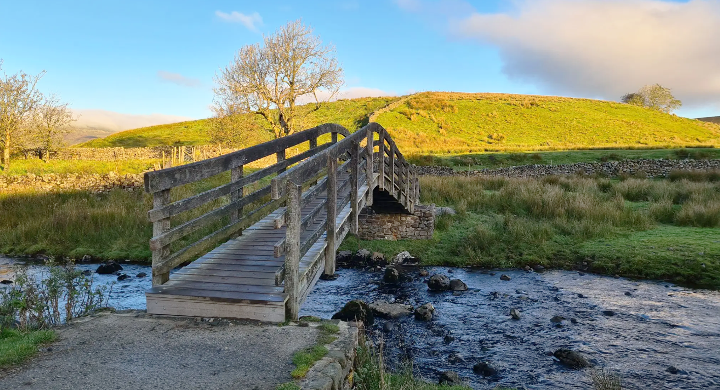
The old bridge leading into Waddington/Brungerly park. From here you can also venture into Waddow Hall.
1
0
One of the more popular pubs in Clitheroe, always has a friendly welcoming atmosphere.
0
0

This cafe has just reopened. Beans on toast with poached egg was spot on. Cash only when we went but that should be fixed now.
0
0
Beautiful off road path along side the river Ribble leading up to Waddington.
1
0
Brungerley park sits next to the river ribble and is a great place to connect parts of a run through clitheroe and along the river.
1
0
Frequently Asked Questions
How many urban hiking trails are available around Clitheroe?
There are over two dozen urban hiking trails around Clitheroe, offering a variety of experiences from easy strolls to more moderate walks. Most of these, 21 out of 24, are rated as easy, making them accessible for many.
Are there any easy urban walks suitable for beginners or families in Clitheroe?
Yes, Clitheroe offers many easy urban walks perfect for beginners and families. An excellent option is the Waddington Bridge loop from Clitheroe, which is just under 5 km and features gentle terrain. Another short and easy route is the Clitheroe Castle Keep – Cowman's Famous Sausage Shop loop from Clitheroe, which is only 2.4 km.
What kind of scenic views or landmarks can I expect on urban hikes in Clitheroe?
Urban hikes in Clitheroe often provide views of the picturesque Ribble Valley and glimpses towards the Forest of Bowland. You can also explore historical sites like Clitheroe Castle, which serves as a starting point for several routes. For example, the Clitheroe Castle – The Ale House, Clitheroe loop from Clitheroe takes you past the castle. Further afield, you might spot iconic landmarks like Pendle Hill or the Trig point at Longridge Fell summit from various viewpoints.
Are there any circular urban walks in Clitheroe?
Many of the urban routes in Clitheroe are circular, allowing you to start and end in the same location. For instance, the Waddington Bridge – Higher Buck loop from Clitheroe is a moderate 10.4 km circular hike, and the Clitheroe Castle – Waddington Village loop from Clitheroe offers a longer 12.7 km circular option.
Can I bring my dog on urban hiking trails in Clitheroe?
Most urban trails in and around Clitheroe are dog-friendly, especially those that follow public footpaths and bridleways. However, always keep dogs on a lead, particularly when passing through farmland or near livestock, and be mindful of local signage. The region's varied landscapes, including riverside paths and woodlands, offer pleasant walks for you and your canine companion.
What is the best time of year for urban hikes in Clitheroe?
Clitheroe's urban trails can be enjoyed year-round. Spring brings blooming wildflowers and fresh greenery, while autumn offers vibrant foliage. Summer provides longer daylight hours, and even winter walks can be beautiful, especially on crisp, clear days, offering expansive views of the surrounding fells. Always check local weather conditions before heading out.
Are there opportunities for pub or cafe stops along urban routes in Clitheroe?
Yes, Clitheroe town centre and nearby villages offer numerous pubs and cafes, making it easy to incorporate a refreshment stop into your urban hike. Routes that pass through or near villages like Waddington, or those that start and end in Clitheroe itself, provide convenient access to local hospitality. For example, the Clitheroe Castle – The Ale House, Clitheroe loop from Clitheroe specifically mentions a pub stop.
What do other hikers enjoy most about urban hiking in Clitheroe?
The urban hiking trails around Clitheroe are highly rated by the komoot community, with an average score of 4.5 out of 5 stars from over 100 reviews. Hikers often praise the accessibility of the trails, the charming blend of town and countryside, and the scenic views of the Ribble Valley and distant fells. The variety of routes, from short town strolls to longer village-to-village walks, is also frequently highlighted.
Are there any notable natural features to look out for on urban walks near Clitheroe?
Beyond the town itself, urban walks often lead to areas with significant natural beauty. You might encounter the tranquil Rivers Ribble and Hodder, which meander through the valley, or enjoy views of the dramatic fells that characterize the Forest of Bowland AONB. The Confluence of the Rivers Calder and Ribble is a notable natural monument nearby.
How accessible are Clitheroe's urban trails by public transport or car parking?
Clitheroe is well-connected by public transport, with a train station and bus services, making many urban trails accessible without a car. For those driving, there are various car parks available within Clitheroe town centre, often serving as convenient starting points for walks. Many routes are designed to begin directly from the town, simplifying logistics.
Most popular routes around Clitheroe
Most popular attractions around Clitheroe

Get inspired with the komoot mobile app


Explore more
Browse the best Hikes in other regions.
