The best hikes from bus stations around Kolitzheim
4.6
(7226)
32,285
hikers
71
hikes
Bus station hiking trails around Kolitzheim traverse a diverse landscape characterized by extensive vineyards, the meandering Main River, and sections of the Steigerwald forest. The region features varied terrain, including gentle riverbanks, rolling hills, and distinct geological formations such as the Gypsum Hills of Sulzheim. Hikers can explore a mix of open agricultural land, dense woodlands, and nature reserves like Grettstädter Ried. The elevation changes are generally moderate, offering accessible routes for various fitness levels.
Best bus station hiking trails around Kolitzheim
- The most popular bus station hiking route is Zeilitzheim – wine Tour, a 9.3 miles (15.0 km) moderate trail that takes 4 hours 5 minutes to complete, leading through vineyards and past Zeilitzheim Castle Park.
- Another top favourite among local hikers is Constitution Column, Gaibach – View of the Konstitutionssäule loop from Wipfeld, a moderate 5.7 miles (9.2 km) path offering views of the Main River and surrounding countryside.
- Local hikers also love the View of Obereisenheim – Stammheim Town Hall loop from Schleifwiesen und Nußloch bei Lindach, a 3.9 miles (6.3 km) trail leading through agricultural fields and small villages, often completed in about 1 hour 47 minutes.
- Hiking around Kolitzheim is defined by picturesque vineyards, the scenic Main River, and sections of the Steigerwald forest. The network offers options for different ability levels, from easy strolls to more challenging routes with moderate elevation gain.
- The routes in Kolitzheim are highly rated by the komoot community with an average score of 4.6 stars from over 6,800 reviews. More than 32,000 hikers have used komoot to explore Kolitzheim's varied terrain.
Last updated: July 11, 2026
2
hikers
15.0km
04:05
230m
180m
Moderate hike. Good fitness required. Easily-accessible paths. Suitable for all skill levels.
4.6
(9)
38
hikers
Easy hike. Great for any fitness level. Easily-accessible paths. Suitable for all skill levels.

Sign up for free
4.6
(7)
23
hikers
Moderate hike. Good fitness required. Easily-accessible paths. Suitable for all skill levels.
4.0
(6)
18
hikers
Moderate hike. Great for any fitness level. Mostly accessible paths. Sure-footedness required.
4.6
(11)
35
hikers
Easy hike. Great for any fitness level. Easily-accessible paths. Suitable for all skill levels.
Get access to more routes and recommendations from other explorers.
Sign up for free
Already have an account?
Our route recommendations are based on thousands of hikes, rides, and runs completed by other people on komoot.
Start today with a free account
Your next adventure awaits.
Login or Signup
Popular around Kolitzheim
Other adventures around Kolitzheim

Tips from the Community

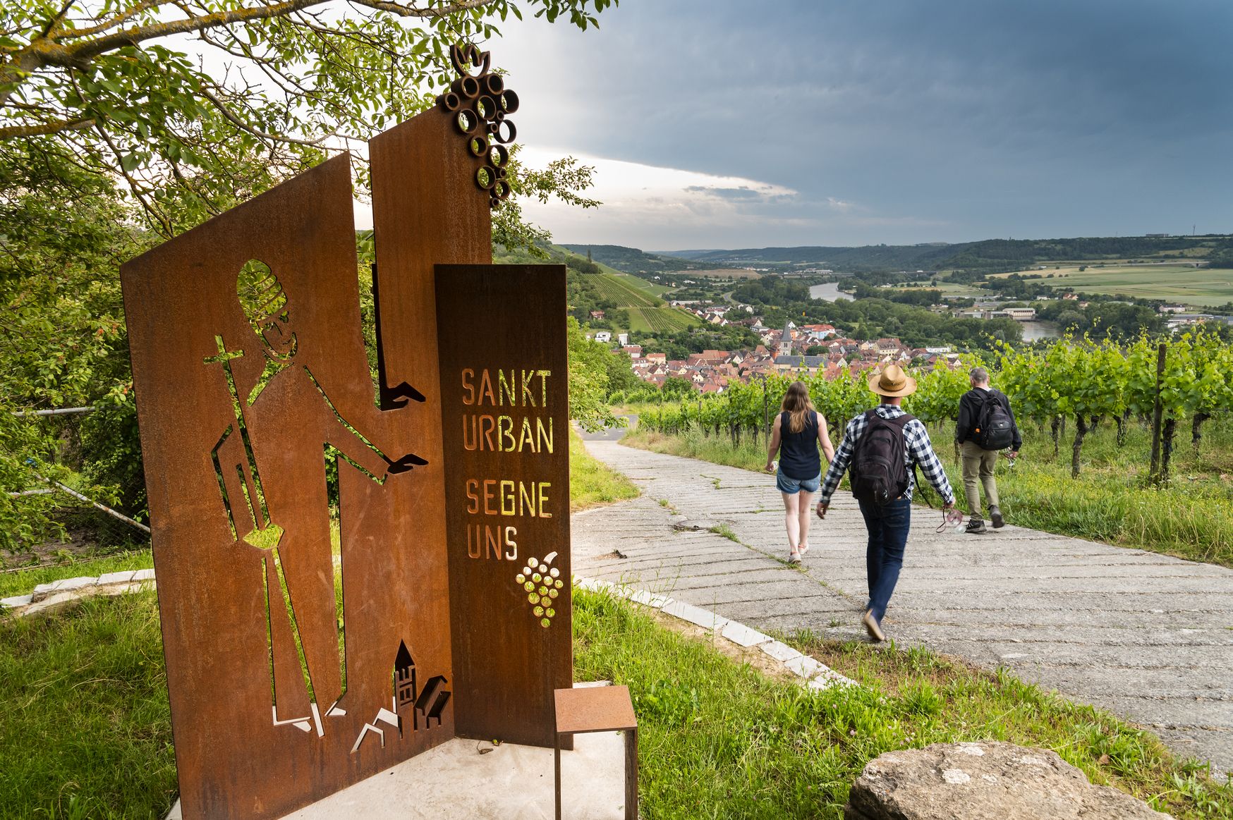
From the Winzerverein Obervolkach, a viewing platform, the Landsknechtlaube, was built in the vineyards near Stettenburg, with the groundbreaking in 2014. A nice resting place with a great panoramic view over the Maintal and the vineyards.
0
0

Beautifully renovated village square
0
0
A very beautiful chapel - donated by the Wiederer family
0
0
Beautifully restored historic half-timbered town hall
0
0


beautiful historic half-timbered house - old town hall
0
0
Frequently Asked Questions
How many hiking trails accessible from bus stations are there around Kolitzheim?
There are over 70 hiking routes around Kolitzheim that are easily accessible from bus stations. These trails offer a wide range of experiences, from leisurely strolls through vineyards to more challenging excursions into the surrounding landscapes.
Are there hiking trails for all skill levels accessible by bus in Kolitzheim?
Yes, the Kolitzheim region offers a diverse selection of bus-accessible trails suitable for various fitness levels. You'll find 34 easy routes perfect for a relaxed walk, 35 moderate trails for a more engaging hike, and 4 difficult options for experienced hikers seeking a challenge. The varied terrain includes vineyard paths, riverbanks along the Main, and forest trails in the Steigerwald.
What natural features or landmarks can I expect to see on bus-accessible hikes?
Many bus-accessible hikes in Kolitzheim lead through picturesque vineyards, along the Main River, or into the Steigerwald forest. You can also discover cultural highlights such as the View of the Volkacher Mainschleife and vineyards, the romantic Zeilitzheim with its castle park, or the Pilgrimage Chapel Maria im Weingarten. Some routes also pass by the Saint Francis Statue and Wine Pavilion at Alten Berg or the Murrleinsnest Hut.
Are there family-friendly hiking options accessible by bus in Kolitzheim?
Yes, several routes are suitable for families. The region offers trails with varied landscapes of meadows, fields, and woods, some featuring interactive stations for discovery and play, such as the "Mainauenpfad" Adventure Trail. Look for the easy-rated routes, which often provide a pleasant experience for all ages.
Can I bring my dog on these bus-accessible hiking trails?
Generally, dogs are welcome on the hiking trails around Kolitzheim. The diverse landscapes, including vineyards, forests, and river paths, offer plenty of opportunities for you and your canine companion to explore. Always ensure your dog is on a leash where required and respect local wildlife and other hikers.
When is the best time of year to hike around Kolitzheim using public transport?
The best seasons for hiking in Kolitzheim are spring and autumn. In spring, you can enjoy the blossoming fruit and cherry trees, while autumn offers vibrant colors as the leaves change in the vineyards and forests. Both seasons provide pleasant temperatures for exploring the region's diverse trails.
Are there circular hiking routes starting from bus stations in Kolitzheim?
Yes, many of the trails accessible by bus are designed as circular routes, allowing you to start and end your hike at the same point, often conveniently near a bus stop. Examples include the "Huckel Loop" and "Am Kranen Loop," which are popular choices for exploring the area's beauty without needing to retrace your steps.
What do other hikers enjoy most about the bus-accessible trails in Kolitzheim?
The komoot community highly rates the trails around Kolitzheim, with an average score of 4.57 stars from over 6,800 ratings. Hikers frequently praise the scenic beauty of the vineyards, the peaceful atmosphere along the Main River, and the well-maintained paths that make exploring the region a pleasure.
Are there any longer or more challenging bus-accessible hikes in the area?
For those seeking longer or more challenging hikes, options like the Zeilitzheim – wine Tour offer a moderate challenge over 15 km. The region also connects to longer routes such as the Mainwanderweg and the Way of the Cistercians, which can be accessed from various bus stops for extended adventures.
Can I find refreshments or places to rest along the bus-accessible routes?
Yes, many routes pass through or near villages where you can find cafes, pubs, or restaurants. Additionally, you might encounter designated rest areas or huts, such as the Historic Schindersbrünnle or a Rest area on the Main with barbecue, perfect for a break during your hike.
Are there any routes that offer panoramic views of the Main Loop?
Absolutely. Several trails provide stunning panoramic views, particularly from the wine slopes overlooking the "Mainschleife bei Volkach" (Main Loop near Volkach). The Constitution Column, Gaibach – View of the Konstitutionssäule loop from Wipfeld is one such route that offers excellent vistas of the surrounding landscape and river.
Most popular routes around Kolitzheim
Most popular attractions around Kolitzheim

Get inspired with the komoot mobile app


Explore more
Browse the best Hikes in other regions.
