The best hikes from bus stations around Weilrod
4.6
(1421)
4,413
hikers
225
hikes
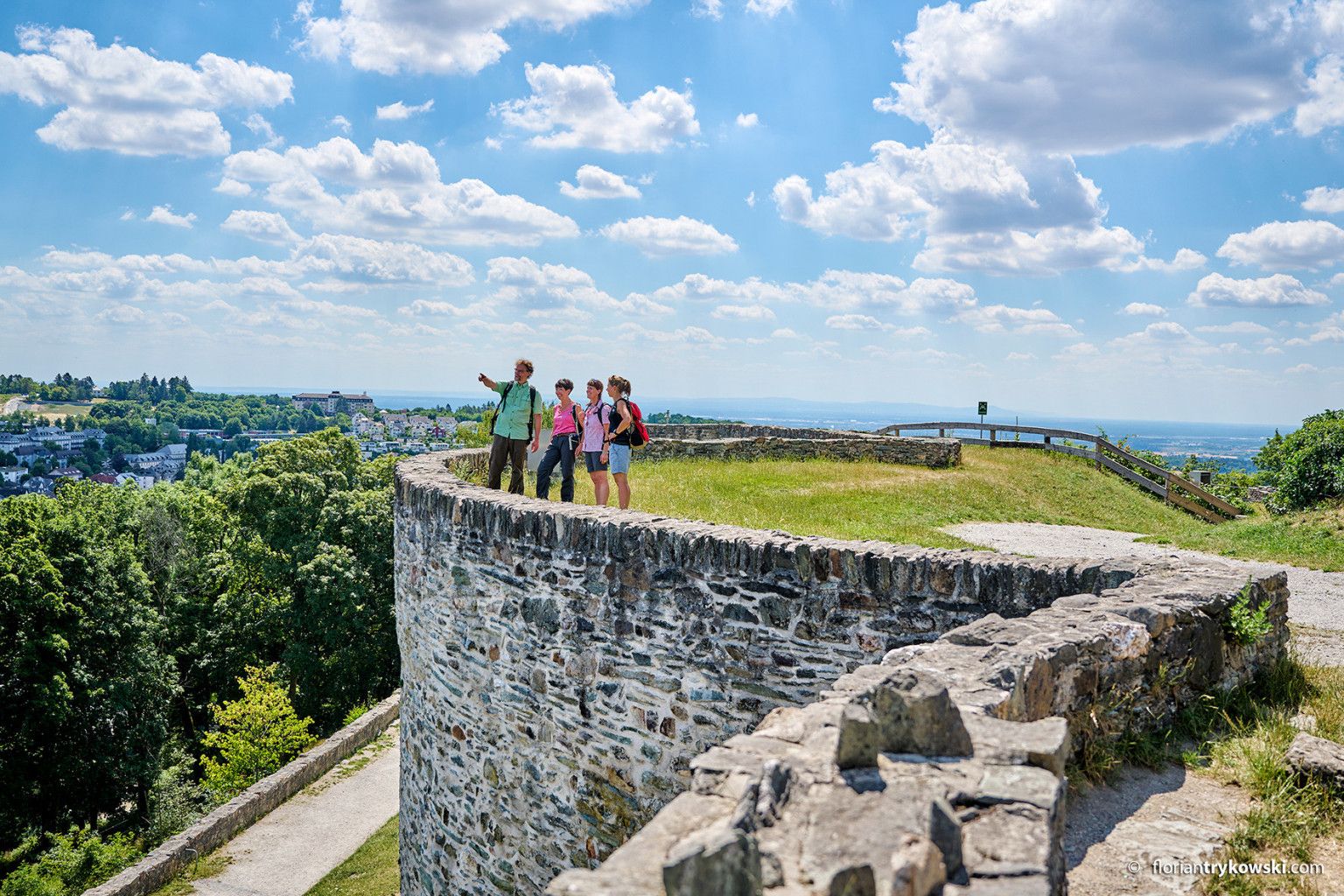
Bus station hiking trails around Weilrod are situated within the Hochtaunuskreis district, at the foot of the Taunus Mountains. The region is characterized by dense forests, rolling hills, and the picturesque Weil Valley, all part of the Hochtaunus Nature Park. This landscape offers varied terrain, from gentle paths along the river to more challenging ascents within the Taunus range. The area provides an extensive network of trails accessible via public transport, catering to various hiking preferences.
Best bus station hiking…
Last updated: August 18, 2026
4.7
(163)
422
hikers
11.5km
03:13
230m
240m
Moderate hike. Good fitness required. Easily-accessible paths. Suitable for all skill levels.
4.7
(65)
228
hikers
Moderate hike. Good fitness required. Easily-accessible paths. Suitable for all skill levels.

Sign up for free
4.7
(28)
79
hikers
7.28km
02:08
210m
210m
Moderate hike. Good fitness required. Easily-accessible paths. Suitable for all skill levels.
4.7
(46)
130
hikers
10.2km
02:53
210m
210m
Moderate hike. Good fitness required. Easily-accessible paths. Suitable for all skill levels.
4.7
(19)
73
hikers
Moderate hike. Good fitness required. Easily-accessible paths. Suitable for all skill levels.
Get access to more routes and recommendations from other explorers.
Sign up for free
Already have an account?
Our route recommendations are based on thousands of hikes, rides, and runs completed by other people on komoot.
Start today with a free account
Your next adventure awaits.
Login or Signup



Other adventures around Weilrod


Tips from the Community

There is one or the other
0
0

Picturesque village center of Altweilnau with a beautiful view from the tower over the Weiltal valley and the surrounding low mountain ranges; the ascent via a steel spiral staircase is, however, very narrow and it is not possible to pass oncoming visitors!
0
0

There are several ponds in the Eichelbach valley. Not much sunlight seems to reach them. That's probably why the facilities look a bit dated...
0
0

The Old Town Hall in Fronhausen is a historic landmark in the heart of the community and a striking example of regional architecture from centuries past. With its half-timbering, detailed wooden beams, and characteristic facade, it conveys a vivid impression of the history and former life of Fronhausen. Formerly a center for administration, commerce, and public events, the building is now a popular meeting place for locals and visitors alike. Benches and small green spaces directly on the Town Hall Square invite visitors to linger, while cyclists and walkers can explore the surrounding area. Events, exhibitions, and cultural activities bring the Old Town Hall to life, demonstrating how history and the present harmoniously blend here. For photography enthusiasts, the building offers many charming perspectives, and the nearby cafés and restaurants invite you to take a break.
0
1


Beautiful church in the village center. A visit inside is worthwhile.
0
0

Nice place to take a short break and watch the planes take off/land
0
0
Frequently Asked Questions
How many bus-accessible hiking trails are there around Weilrod?
There are over 220 bus-accessible hiking trails around Weilrod, offering a wide range of options for exploring the beautiful Taunus region.
Are there bus-accessible hiking trails for all skill levels in Weilrod?
Yes, Weilrod offers a diverse network of trails accessible by bus, catering to various skill levels. You'll find approximately 95 easy routes perfect for a relaxed stroll, over 115 moderate trails for a more engaging hike, and a few challenging options for experienced hikers seeking a greater adventure.
What are some popular circular hiking routes accessible by bus in Weilrod?
Many of Weilrod's bus-accessible trails are circular, allowing you to start and end at the same point. A popular moderate option is the View of Altweilnau – Pferdskopf Observation Tower loop from Altweilnau, which offers scenic views and leads to the impressive Pferdskopf Observation Tower. For a slightly shorter, easy loop, consider the Weilrod Rock Arch – Altweilnau Gate Tower loop from Altweilnau.
Are there any bus-accessible trails that offer historical sights or landmarks?
Absolutely. The Altweilnau Gate Tower – The Red Monk of Landstein loop from Neuweilnau is a moderate trail that takes you past historical points of interest like the Altweilnau — Historic town centre and castle keep and the ruins of Landstein Church. Altweilnau itself features charming half-timbered houses.
Can I find trails with good viewpoints accessible by public transport?
Yes, the region is known for its scenic vistas. The View of Altweilnau – Pferdskopf Observation Tower loop from Altweilnau leads to the 35-meter-high Pferdskopf Observation Tower, offering breathtaking views over the Rhine-Main region. Another route, the View of the Weiltal Valley – Vogelburg Hochtaunus loop from Weilrod, provides lovely views of the Weil Valley.
Are there family-friendly hiking options accessible by bus in Weilrod?
Weilrod is a great destination for families. While specific family-focused bus routes aren't listed, many of the easy and moderate trails are suitable. The Weilrod Zoo also features a circular hiking trail designed for kids, and the Weilrod Rock Arch – Altweilnau Gate Tower loop from Altweilnau is an easy option that could be enjoyable for families.
What is the best time of year to hike the bus-accessible trails around Weilrod?
The bus-accessible trails around Weilrod are beautiful throughout the year, but spring and autumn are particularly recommended. Spring brings vibrant blooming plants, while autumn captivates with its colorful foliage, making for picturesque hiking conditions.
Are there any unique attractions along the bus-accessible hiking routes?
Yes, for a unique experience, consider a route that passes by the Vogelburg Hochtaunus. The View of the Weiltal Valley – Vogelburg Hochtaunus loop from Weilrod connects to this unique bird park, home to over 700 parrots, cockatoos, and parakeets, offering a chance to see these birds up close.
What kind of terrain can I expect on bus-accessible hikes in Weilrod?
The terrain around Weilrod is varied, reflecting its location in the Hochtaunus Nature Park. You can expect a mix of dense forests, rolling hills, and paths along the picturesque Weil Valley. Trails often feature well-maintained forest paths, some gentle ascents and descents, and occasionally more rugged sections, depending on the route's difficulty.
Are there any cafes or pubs near the bus stops or trailheads in Weilrod?
While specific establishments aren't listed in direct proximity to every bus stop, villages like Altweilnau and Neuweilnau, which serve as starting points for several bus-accessible trails, offer local amenities including cafes and pubs where you can refresh before or after your hike.
What do other hikers enjoy most about hiking in Weilrod?
The area is highly rated by the komoot community, with an average score of 4.59 stars from over 1,100 ratings. Reviewers often praise the quiet woodlands, well-marked paths, and the diverse landscapes that make Weilrod an ideal destination for outdoor enthusiasts.
Most popular routes around Weilrod
Most popular attractions around Weilrod

Get inspired with the komoot mobile app


Explore more
Browse the best Hikes in other regions.
