The best traffic-free bike rides in the Mollogon Rim
4.2
(9)
432
riders
35
rides
No traffic touring cycling routes in the Mollogon Rim traverse a dramatic geological escarpment characterized by steep cliffs, expansive plateaus, and diverse terrains. The region transitions from high desert to dense ponderosa pine and mixed conifer forests, featuring breathtaking canyons and elevations up to 8,000 feet. Cyclists encounter a variety of surfaces, including gravel roads and dirt trails, often with significant elevation changes.
Best no traffic touring cycling routes in the Mollogon Rim
- The most popular no traffic touring cycling…
Last updated: October 10, 2026
21
riders
21.0km
01:45
120m
120m
Hard bike ride. Great for any fitness level. You may need to push your bike for some segments of this route.
16
riders
Easy bike ride. Great for any fitness level. Mostly paved surfaces. Suitable for all skill levels.

14
riders
11.1km
01:01
70m
70m
Hard bike ride. Great for any fitness level. You may need to push your bike for some segments of this route.
6
riders
Easy bike ride. Great for any fitness level. Mostly paved surfaces. Suitable for all skill levels.
8
riders
6.22km
00:33
40m
40m
Easy bike ride. Great for any fitness level. Mostly paved surfaces. Suitable for all skill levels.
Get access to more routes and recommendations from other explorers.
Already have an account?
Our route recommendations are based on thousands of hikes, rides, and runs completed by other people on komoot.
Start today with a free account
Your next adventure awaits.
Popular around Mollogon Rim

Bikepack in America's southwest – deserts, cacti and Anasazi culture

Grand Enchantment Trail — Slot canyons, spruce peaks & desert solitude

Arizona Trail — A beautiful 800-mile struggle

The Arizona Trail — From Mexico to Utah in 43 days

Highline National Recreation Trail – The High Road around the Mogollon Rim

Historic Route 66 – curiosities, selfie spots and diners

MTB in cactus country – technical delicacies around Phoenix
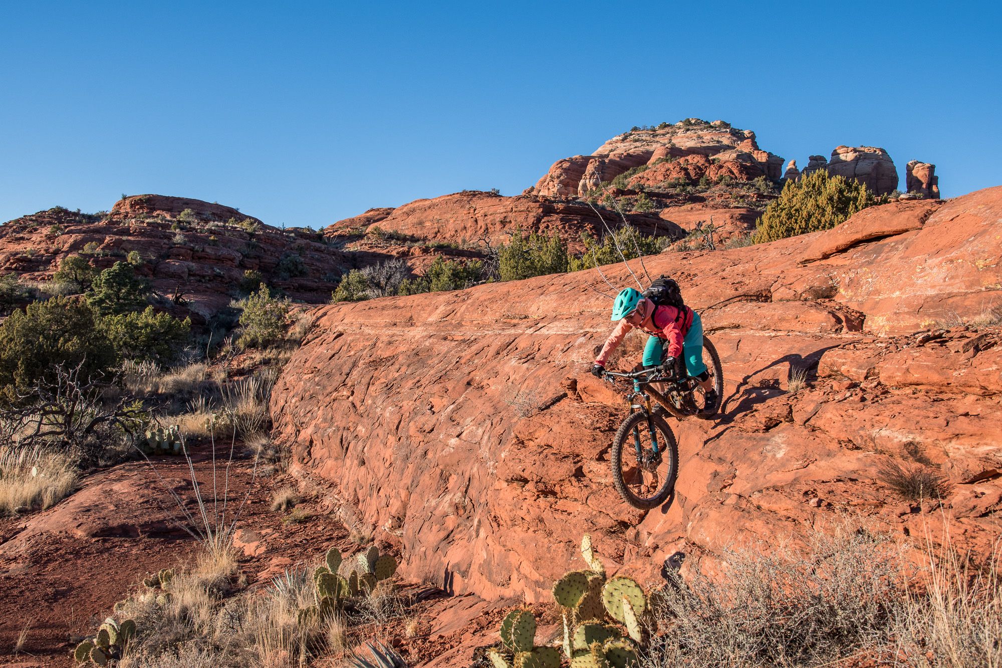
Shred the Red – Mountain biking in Sedona’s MTB hotspot

Traffic-free bike rides in the Mollogon Rim

Traffic-free bike rides in the Mollogon Rim
Other adventures in the Mollogon Rim


Tips from the Community

Blevins Trail in Usery Mountain Regional Park near Mesa, Arizona, is a popular spot for gravel cycling thanks to its well-groomed, mostly flat terrain and scenic desert views. The 3.1-mile loop features crushed gravel and sand surfaces, making it ideal for beginner to intermediate riders. Cyclists can enjoy wide-open views of Pass Mountain and the Superstitions while weaving through classic Sonoran Desert landscape. The trail connects to others like Moon Rock and Cat Peaks, offering options to extend your ride. Accessible year-round, it’s best ridden in cooler months.
0
0

This 320-acre park doesn't get its name from an unlucky traveler, but rather a legendary gold mine that is said to be lost somewhere in the surrounding mountains. You can stay overnight at the campground or just visit for the day on the many trails that access the surrounding Superstition Wilderness, and who knows, maybe you'll stumble on the fabled gold mine!
0
0

Reaching the top of South Cat Peak above Apache Junction treats mountain bikers to serene desert panoramas after a moderate ride up the trail. Challenge yourself pedaling over rocky inclines before stopping at a peaceful summit bench to soak in 360 degree views. It's an easy trail most of the way with rewarding vistas at the top.
0
0

The Levee Trail follows the south side of the Pass Mountain Diversion Channel. It is a long, flat gravel ride with great views and gives the rider a feeling of the wilderness around Phoenix.
1
0
Moon Rock Trail is a hiking and mountain biking trail but one of the easier gravel rides, being smooth with packed dirt, being described as "flowing easy singletrack" and tral with great scenery and round smooth "moon rocks" all around this landscape.
0
0

The trail presents a mostly flat terrain with minimal obstacles, ensuring good trail conditions, and providing opportunities for wildlife sightings, including the distant sound of coyotes. It is important to remain vigilant for bikers since they are quite prevalent along the trail.
0
0
The Blevins Trail features a well-groomed and non-rocky surface, creating an enjoyable hiking experience, and provides breathtaking views of several peaks, ranging from the Superstition Mountains to Cat Peaks.
0
0
You can escape from road noise and traffic on this tranquil trail, which offers a peaceful atmosphere, with well-defined paths that are incredibly easy to follow and breathtaking views of the desert scenery.
0
0
Frequently Asked Questions
How many no-traffic touring cycling routes are available in the Mogollon Rim?
The Mogollon Rim offers nearly 30 dedicated no-traffic touring cycling routes. These routes cater to various skill levels, ensuring a suitable option whether you're looking for an easy spin or a more challenging adventure.
What kind of terrain can I expect on no-traffic touring cycling routes in the Mogollon Rim?
Cyclists in the Mogollon Rim can expect a diverse range of surfaces, from gravel roads and dirt trails to some paved sections. The region is known for its dramatic geological formations, so routes often feature significant elevation changes, providing both challenging climbs and rewarding descents through forests and high desert landscapes.
Are there any easy no-traffic touring cycling routes suitable for beginners?
Yes, there are 11 easy no-traffic touring cycling routes in the Mogollon Rim. A great option for beginners is the Levee Loop, which offers a relatively flat and accessible ride. Another easy choice is the Moon Rock Trail – Blevins Trail loop from Usery Mountain Regional Park, providing a pleasant experience for those new to touring cycling.
What are some challenging no-traffic touring cycling routes in the Mogollon Rim?
For experienced touring cyclists seeking a challenge, the Mogollon Rim has 8 difficult no-traffic routes. Consider the Blevins Trail – View of Superstition Mountain loop or the Levee Trail – Moon Rock Trail loop, both offering substantial elevation gains and varied terrain to test your endurance.
What natural features or landmarks can I see along these routes?
The Mogollon Rim is rich in natural beauty. Many routes offer stunning views of the escarpment itself, dense ponderosa pine forests, and high desert landscapes. You might encounter scenic overlooks like the Rim Lakes Vista Overlook. Nearby attractions include pristine mountain lakes such as Woods Canyon Lake and Bear Canyon Lake, as well as unique geological formations like Tonto Natural Bridge. For specific points of interest, you can explore highlights like Pass Mountain Trail or Fossil Springs.
Are there any circular no-traffic touring cycling routes in the Mogollon Rim?
Yes, many of the no-traffic touring cycling routes in the Mogollon Rim are designed as loops, allowing you to start and end at the same point. Examples include the Levee Loop and the various loops incorporating the Blevins Trail and Moon Rock Trail, such as the Moon Rock Trail – Blevins Trail loop from Usery Mountain Regional Park.
What is the best time of year to go touring cycling in the Mogollon Rim?
The Mogollon Rim offers a cooler retreat from the desert heat, making spring and fall ideal for touring cycling. Elevations reach up to 8,000 feet, so summers are pleasant, but always check local weather conditions. Winters can bring snow, especially at higher elevations, which might limit access to some routes.
What do other touring cyclists say about the no-traffic routes in the Mogollon Rim?
The komoot community highly rates the touring cycling experience in the Mogollon Rim, with an average score of 3.7 stars. Reviewers often praise the dramatic landscapes, the sense of solitude on the no-traffic routes, and the diverse terrain that makes for a rewarding ride. Many appreciate the opportunity to escape the heat and enjoy the lush forests and expansive views.
Are there any routes that pass by lakes or water features?
Yes, the Mogollon Rim is known for its pristine mountain lakes. While specific no-traffic touring routes may not directly hug every shoreline, the region's overall network of trails and roads often provides access to areas near Woods Canyon Lake, Bear Canyon Lake, Willow Springs Lake, and Blue Ridge Reservoir. You can also find highlights like Fossil Springs, known for its turquoise waters.
Are there any family-friendly no-traffic touring cycling options in the Mogollon Rim?
For families, the easier no-traffic routes are generally suitable. Options like the Levee Loop or the shorter Moon Rock Trail – Blevins Trail loop from KVVA-FM (Apache Junction) offer less challenging terrain and shorter distances, making them enjoyable for various ages and skill levels. Always consider the elevation changes and surface types when planning a family outing.
Where can I find parking for these no-traffic touring cycling routes?
Parking availability varies by trailhead. Many routes, especially those starting near regional parks or popular access points, will have designated parking areas. For example, the Moon Rock Trail – Blevins Trail loop starts from Usery Mountain Regional Park, which typically offers parking facilities. It's always recommended to check specific route details on komoot for trailhead information and parking suggestions.
Most popular routes in the Mollogon Rim
Most popular attractions in the Mollogon Rim

Get inspired with the komoot mobile app


Explore more
Browse the best Cycling routes in other regions.
