The best hikes from bus stations around Meerfelder Maar
4.6
(12467)
41,836
hikers
337
hikes
Bus station hiking trails around Meerfelder Maar explore a unique volcanic landscape in the Eifel region, centered around a maar lake within a large crater. The terrain features steep slopes, visible volcanic rock formations, and a diverse nature reserve with wetlands and reed zones. Hikers can experience significant elevation changes, offering varied challenges across the region's well-developed trail network. The area is characterized by its geological importance and rich biodiversity.
Best bus station hiking trails around Meerfelder Maar
- The most…
Last updated: July 13, 2026
4.6
(176)
899
hikers
3.43km
00:54
20m
20m
Easy hike. Great for any fitness level. Easily-accessible paths. Suitable for all skill levels.
4.6
(38)
126
hikers
10.3km
02:53
190m
200m
Moderate hike. Good fitness required. Easily-accessible paths. Suitable for all skill levels.

Sign up for free
4.6
(76)
246
hikers
13.0km
03:41
280m
280m
Moderate hike. Good fitness required. Easily-accessible paths. Suitable for all skill levels.
4.6
(11)
38
hikers
Hard hike. Very good fitness required. Easily-accessible paths. Suitable for all skill levels.
4.4
(38)
119
hikers
11.4km
03:16
270m
280m
Moderate hike. Good fitness required. Easily-accessible paths. Suitable for all skill levels.
Get access to more routes and recommendations from other explorers.
Sign up for free
Already have an account?
Our route recommendations are based on thousands of hikes, rides, and runs completed by other people on komoot.
Start today with a free account
Your next adventure awaits.
Login or Signup
Popular around Meerfelder Maar
Other adventures around Meerfelder Maar

Tips from the Community

The floor is lava! Well, big boulders with solidified lava.
0
0
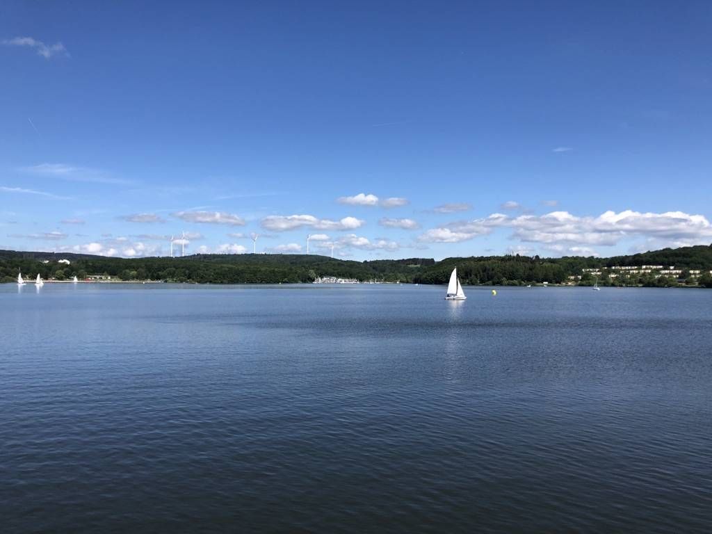
What a relaxing place for a break at this beautiful lake. If you look around you can imagine yourself standing in the crater of a volcano.
0
0

Cowherd in front of Maar-Kulisse
0
0
Great spot for a break
0
0

Once around the maar, a nice little loop. Pleasant to walk.
0
0

Beautiful section of the path that leads us between lava rocks to the Windsborn crater lake.
2
0

There is hardly a more beautiful place to enjoy the cool water of a maar👍
0
0
It really couldn't be more beautiful👍 Definitely worth a trip!!!
3
0
Frequently Asked Questions
How many bus station hiking trails are available around Meerfelder Maar?
There are over 300 hiking trails around Meerfelder Maar that are accessible from bus stations, offering a wide range of options for all skill levels.
Are there easy hiking trails accessible by bus around Meerfelder Maar?
Yes, Meerfelder Maar offers many easy trails perfect for a relaxed outing. An excellent option is the Meerfelder Maar – Meerfelder Maar loop from Meerfeld, which is just over 3 km long with minimal elevation gain, ideal for a gentle walk directly from the village bus stop.
What are some moderate bus-accessible hikes in the Meerfelder Maar region?
For a moderate challenge, consider the Windsborn Crater summit – Meerfelder Maar loop from Meerfeld. This route is about 13 km long and includes some elevation changes, offering diverse scenery and a good workout.
Are there any challenging bus-accessible hikes for experienced hikers?
Experienced hikers can tackle more demanding routes like the View of the Meerfelder Maar – View of the Meerfelder Maar loop from Meerfeld. This difficult trail spans over 24 km with significant elevation, providing a full day's adventure and stunning panoramic views.
What kind of natural features can I expect to see on these bus station trails?
The Meerfelder Maar region is known for its unique volcanic landscape. You'll encounter the impressive maar lake itself, steep crater slopes, and evidence of its volcanic past. The area is also a protected nature reserve, so expect diverse flora and fauna, including wet meadows and a wide reed zone, particularly on trails around the lake.
Are there any viewpoints or landmarks accessible from bus station hiking routes?
Absolutely. Many trails lead to fantastic viewpoints. The "Landesblick" Observation Tower, perched high on the crater rim, offers unforgettable panoramic views of the Maar and surrounding countryside. The picturesque village of Meerfeld, situated within the maar basin, is also a charming spot to explore and often serves as a starting point for bus-accessible hikes.
What is the best time of year to hike around Meerfelder Maar using public transport?
The Meerfelder Maar region is beautiful year-round. However, for the most pleasant hiking conditions and the opportunity to swim in the lake, the period from May to September is ideal. During these months, the weather is generally warmer, and the natural beauty is in full bloom.
Are there circular hiking routes that start and end at a bus station?
Yes, many of the trails around Meerfelder Maar are circular routes designed to bring you back to your starting point, which is often conveniently located near a bus stop in villages like Meerfeld. This makes planning your public transport journey much easier.
What do other hikers say about the bus-accessible trails in Meerfelder Maar?
The komoot community highly rates the hiking experience around Meerfelder Maar, with an average score of 4.6 out of 5 stars. Hikers often praise the stunning volcanic scenery, the well-maintained trails, and the peaceful atmosphere, making it a popular choice for nature lovers.
Can I find places to eat or drink near the bus station hiking trails?
Yes, the idyllic village of Meerfeld, located within the maar basin, offers charming restaurants where you can relax and enjoy local cuisine after your hike. Many bus routes serve Meerfeld, making it a convenient hub for starting or finishing your tour and finding refreshments.
Are there any longer day hikes accessible by bus around Meerfelder Maar?
For a longer day hike, consider the View of the Meerfelder Maar – Meerfelder Maar loop from Meerfeld. This moderate route covers nearly 11.5 km and offers extensive views and a good exploration of the maar's surroundings, easily reachable from the Meerfeld bus stop.
Most popular routes around Meerfelder Maar

Get inspired with the komoot mobile app


Explore more
Browse the best Hikes in other regions.
