The best city hikes and walks around Rotter Lake
4.4
(15644)
68,697
hikers
168
hikes
Urban hiking trails around Rotter Lake are characterized by relatively flat terrain and proximity to the lake itself. The region features a network of paths suitable for easy walks, often passing through green spaces and offering views of the water. Elevation changes are minimal, making the area accessible for casual exploration. The landscape primarily consists of lakeside paths and urban-adjacent green corridors.
Best urban hiking trails around Rotter Lake
- The most popular urban hiking route is Rotter Lake – Kerpekreuz…
Last updated: October 2, 2026
5
hikers
Easy hike. Great for any fitness level. Easily-accessible paths. Suitable for all skill levels.
8
hikers
Easy hike. Great for any fitness level. Easily-accessible paths. Suitable for all skill levels.

5
hikers
4.50km
01:08
10m
10m
Easy hike. Great for any fitness level. Easily-accessible paths. Suitable for all skill levels.
5
hikers
3.71km
00:56
10m
10m
Easy hike. Great for any fitness level. Easily-accessible paths. Suitable for all skill levels.
6
hikers
Easy hike. Great for any fitness level. Easily-accessible paths. Suitable for all skill levels.
Get access to more routes and recommendations from other explorers.
Already have an account?
Our route recommendations are based on thousands of hikes, rides, and runs completed by other people on komoot.
Start today with a free account
Your next adventure awaits.

Tips from the Community

Not only children are often discovered here, but also many adults want to experience the "floating" and the power of gravity again (located directly next to the water playground and skate park).
1
0
The water playground leaves nothing to be desired for children. While older children can let off steam in the skate park directly across the street, there are plenty of opportunities to discover new things here, even when there's no water on cold days. Tip: Have dry clothes and a towel ready!
1
0
The name says it all: This skate park offers plenty of space, especially for older children and teenagers, to try out and practice their tricks. Meanwhile, the younger ones can let off steam at the water playground directly across the street.
1
0
From this spot, you have a good view of the old caretaker's house of Haus Rott. Haus Rott was always a residential area and part of the village of Kriegsdorf, which was then incorporated into the municipality of Sieglar in 1969 along with Haus Rott. During the municipal reorganization in 1969, Haus Rott became part of Troisdorf and, since 1999, has been part of the newly formed Rotter See district. The actual old castle and its ruins, however, lie in the small wooded area at the rear within the inner moat, which is still clearly visible today. This was where the main castle stood as a manor house. The clearly visible embankment there is the remnant of the artificial castle mound, the motte. This is a medieval castle type, built primarily of timber construction, whose main feature is an artificially created earth mound with a tower-like building. The associated outer bailey, which was also surrounded by a moat, was located to the north of the motte. The Annonisbach stream fed the moats of Haus Rott until modern times. In a later phase, around 1300, the castle complex was significantly expanded, and the high medieval castle hill was transformed into a late medieval moated castle and manor house. A new stone residential tower was built outside the old moat and enclosed by a wide and a narrow moat. The old motte was not abandoned, but was incorporated into an extensive fortification system with its outer ramparts and ditches. On August 28/29, 1416, Haus Rott was attacked and destroyed by the Archbishop of Cologne and the city of Cologne during the Stiftsfehde (Diocesan Feud). The site of the former castle lay fallow for centuries afterward. In the 17th/18th centuries, the remains of the castle served as the basis for the construction of a new farm complex with barns and stables, as well as the main building and former administrator's building, which are still well preserved today. In a third phase, the inner ditch was re-excavated and filled on three sides to form a modern military entrenchment. The shape of the entrenchment and finds allow it to be dated to 1795/96 (War of the First Coalition), when the Franco-German battle line ran from Wahn via Spich, very close to Rott and past Kriegsdorf, to Troisdorf. In 2023, modern condominiums were built on the site of the former castle and farm complex.
1
0
Haus Rott has always been a residential area and part of the village of Kriegsdorf, which was then incorporated into the municipality of Sieglar in 1969 along with Haus Rott. Following the municipal reorganization in 1969, Haus Rott became part of Troisdorf, and since 1999, it has been part of the newly formed Rotter See district. The oldest traces of human presence in the Haus Rott area date back to the Neolithic period. The first castle complex existed as early as the 12th and 13th centuries. The Lords of Rott can be traced back to June 20, 1260, in documents. However, the name Rott (clearing in an uninhabited forest area) points to a much earlier time (10th/11th centuries). In the 12th century, Haus Rott was probably the most important castle complex between Cologne and Siegburg. In 2023, modern condominiums were built on the site of the former castle and farm complex.
1
0

Beautiful, natural and well-kept park with several benches and an adjacent playground/basketball court :)
2
0

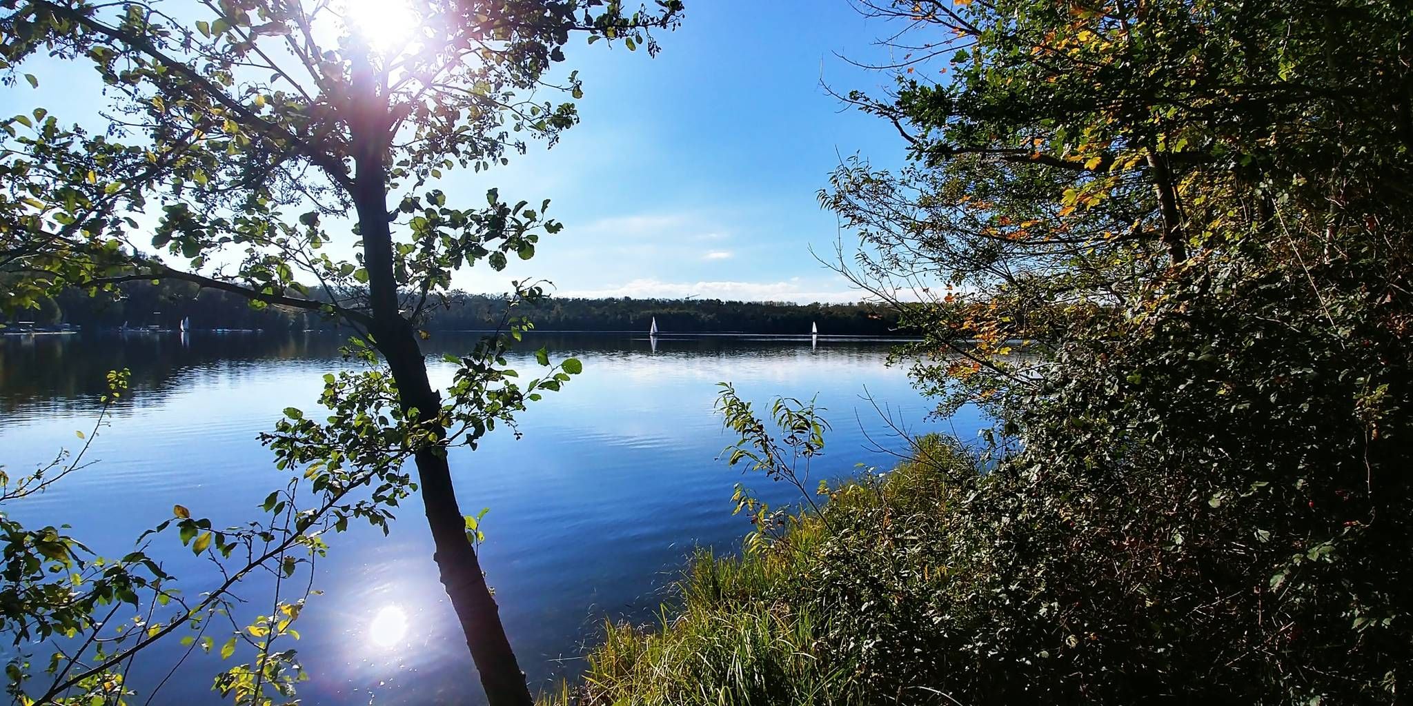
Here is a nice, big, clean playground. There is also one for dogs directly opposite. My real highlight is when the low sun shines through the first tender leaves in spring or through the colorful foliage in autumn (my photos)
0
0

Originally a Merovingian settlement
2
0
Frequently Asked Questions
How many urban hiking trails are available around Rotter Lake?
There are over 160 urban hiking trails around Rotter Lake, offering a wide variety of options for different preferences and fitness levels. Most of these, around 146, are classified as easy, making them accessible for many hikers.
Are there easy urban hikes suitable for beginners or families near Rotter Lake?
Yes, the majority of urban hikes around Rotter Lake are considered easy. For a pleasant, straightforward walk, consider the Rotter Lake – Kerpekreuz loop from Kriegsdorf, which offers gentle terrain and a distance of just over 7 kilometers. Another great option is the Rotter Lake – View of Rotter See loop from Spich, providing scenic views with minimal elevation gain.
What kind of landscapes can I expect on urban hikes around Rotter Lake?
While the guide focuses on urban trails, the broader Rotter Lake (Crater Lake) region is renowned for its unique volcanic landscapes. You can expect to see the stunning deep blue caldera lake, potentially distant views of features like Wizard Island, and areas with volcanic pinnacles. Many trails also pass through old-growth forests and offer views of diverse terrain, even within an urban context.
Are there any loop trails for urban hiking near Rotter Lake?
Yes, many of the urban trails around Rotter Lake are designed as loops, providing a convenient and varied hiking experience. Examples include the Rotter Lake – Kerpekreuz loop from Kriegsdorf and the Rotter Lake – View of Rotter See loop from Spich. These allow you to start and end at the same point without retracing your steps.
What do other hikers say about the urban trails in the Rotter Lake area?
The urban hiking trails around Rotter Lake are highly rated by the komoot community, with an average score of 4.47 stars. Reviewers often praise the accessibility of the trails, the pleasant natural surroundings even within urban settings, and the well-maintained paths that make for enjoyable walks.
Are there any urban hikes that offer views of the lake itself?
Yes, several urban routes provide excellent vantage points for viewing Rotter Lake. The Rotter Lake – View of Rotter See loop from Spich is specifically designed to offer scenic views of the lake. While direct access to the water's edge might be limited on urban trails, you can still enjoy the impressive blue waters from various points.
Can I find urban trails that are suitable for a quick walk, perhaps under an hour?
While many routes are longer, you can adapt some of the shorter loop trails for a quicker walk by doing a partial loop or selecting a section. For example, the View of Schilfsee – View of the Lake loop from Spich is just over 6 kilometers, which can be completed in about an hour for a brisk walker, offering views of a smaller lake nearby.
Are there any interesting points of interest or landmarks along the urban hiking trails?
Beyond the natural beauty of the lake, some urban trails might pass by local points of interest. For instance, the Kerpekreuz – 1. FC Köln Mural in Spich loop from Spich incorporates a unique cultural landmark. Other routes might lead you through local pedestrian zones or past charming cafes, offering a blend of nature and urban exploration.
What is the typical distance for urban hikes around Rotter Lake?
The urban hikes around Rotter Lake vary in distance, but many fall within the 6 to 8-kilometer range. For example, the Pedestrian zone Troisdorf – StadtBierhaus Troisdorf loop from Spich is approximately 7.4 kilometers, offering a good balance for a moderate urban walk.
Is it possible to combine urban hiking with other activities like visiting cafes or shops?
Absolutely. Many urban trails are designed to integrate with local amenities. Routes like the Pedestrian zone Troisdorf – StadtBierhaus Troisdorf loop from Spich specifically mention passing through pedestrian zones, making it easy to stop for a coffee or explore local shops during or after your hike.
Most popular routes around Rotter Lake

Get inspired with the komoot mobile app


Explore more
Browse the best Hikes in other regions.
