The best traffic-free bike rides around Lutterbach
3.9
(49)
488
riders
18
rides
No traffic touring cycling routes around Lutterbach offer diverse landscapes, from the scenic Thur River valley to extensive forested areas and nearby mountainous terrain. The region, situated in the Haut-Rhin department of France, provides a compelling environment for cyclists seeking varied experiences. Many routes feature mostly paved surfaces, making them accessible for touring cyclists of different skill levels. The area is also at the crossroads of major Euro-Velo routes, providing extensive cycling opportunities.
Best no traffic touring cycling routes around…
Last updated: October 6, 2026
20
riders
57.1km
03:33
500m
500m
Hard bike ride. Very good fitness required. Mostly paved surfaces. Suitable for all skill levels.
5.0
(1)
29
riders
74.0km
05:49
1,130m
1,130m
Hard bike ride. Very good fitness required. You may need to push your bike for some segments of this route.

21
riders
52.8km
04:22
630m
630m
Hard bike ride. Very good fitness required. Mostly paved surfaces. Suitable for all skill levels.
1.0
(1)
19
riders
27.1km
02:09
110m
110m
Moderate bike ride. Good fitness required. Mostly paved surfaces. Suitable for all skill levels.
5.0
(3)
18
riders
45.2km
03:33
240m
240m
Moderate bike ride. Good fitness required. Mostly paved surfaces. Suitable for all skill levels.
Get access to more routes and recommendations from other explorers.
Already have an account?
Our route recommendations are based on thousands of hikes, rides, and runs completed by other people on komoot.
Tips from the Community

The Églises Saint-Martin (Sint-Martinuskerk) in Masevaux is a historic, neoclassical church in Alsace. The church is particularly known for its impressive organ history and the annual international organ festival
6
0

Anyone who wants to know more about this should visit this page: https://sundgaufront.pharmafix.com/index.php/interaktive-frontkarte
1
0
Bahnhof Burnhaupt-le-Haut The Bahnhof Burnhaupt-le-Haut is located on the former railway line from Cernay to Sewen, which led through the Dollertal. The line was built in the 19th century and was of great importance for passenger and freight transport in the region. During the First World War, the station gained particular strategic importance. Burnhaupt was located immediately behind or close to the front line between German and French troops. The railway was used to transport soldiers, weapons, ammunition, and other supplies. Due to the fighting, the station was heavily damaged. After the war, the station building was rebuilt between 1921 and 1923. A building typical of the region with elements of Alsatian architecture was created. The station has largely been preserved to this day and serves as a reminder of the importance of the railway for the region's development and the destruction of the First World War. Regular passenger service on the line was discontinued in 1967, and the line was later closed. Part of the former railway line is now operated as a museum railway by Train Thur Doller Alsace. Historic locomotives and wagons run on the line through the Dollertal, making the history of the railway tangible for visitors. The Bahnhof Burnhaupt-le-Haut is therefore not only a former transport hub, but also a historic site where the history of the region, the railway, and the First World War converge. Further information and historical photos: Train Thur Doller Alsace – Bahnhof Burnhaupt
0
0

the Michelbach lake is a place where you can stop for a picnic during hikes or bike rides
0
0

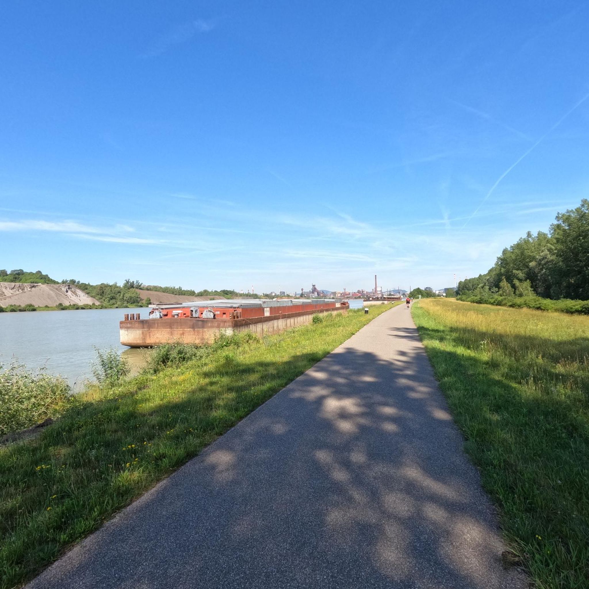
calm and well-rolling section
0
0

Thann's sloping vineyards are famous for their south-facing orientation with slopes that can reach 45°, offering spectacular and dizzying landscapes. These hillsides, located between 350 and 450 meters above sea level, extend over an area of 22 hectares and are renowned for their volcanic terroir and their proximity to the Thur River, which provides the humidity necessary for the grapes to ripen. Among the grape varieties cultivated are Riesling, Pinot Gris, Gewürztraminer, and Muscat, all grown in often rocky and well-exposed soil, which gives the wines great finesse. Viticulture on these steep terrains requires harvests that are often carried out with ropes to ensure safety on these very steep slopes. These vineyards, particularly the Grand Cru Rangen, are among the most emblematic of the region.
0
0

The oldest surviving mention of Lutterbach dates back to 735. It already had a church at that time. The village was dependent on the Murbach Abbey. From the beginning of the 14th century until the French Revolution, Lutterbach belonged to the Cistercian monastery of Lützel.
0
0

Frequently Asked Questions
How many no traffic touring cycling routes are available around Lutterbach?
There are 19 dedicated no traffic touring cycling routes around Lutterbach, catering to various skill levels. You'll find 2 easy routes, 10 moderate routes, and 7 more challenging options.
What kind of terrain can I expect on these no traffic cycling routes?
The routes around Lutterbach offer diverse terrain. Many follow the picturesque Thur River valley, featuring mostly paved surfaces suitable for all skill levels. More challenging rides, such as those incorporating the Hundsruck Pass, may include segments with greater elevation gain and potentially unpaved sections. You'll also find routes along the Rhône-Rhine Canal and dedicated cycle paths on old railway lines.
Are there any family-friendly no traffic cycling routes in Lutterbach?
Yes, Lutterbach offers several easy and moderate no traffic routes that are suitable for families. The routes along the Thur River valley are generally paved and less strenuous. The cycle path along an old railway line towards Ensisheim is also a great option, offering a flat, dedicated path away from traffic.
What natural features can I see along the no traffic touring cycling routes?
You can enjoy a variety of natural landscapes. Many routes offer scenic views of the Thur River valley. You might also pass through extensive forested areas like the Bois de Lutterbach, or alongside bodies of water such as Lac de Reiningue and the Doller and Soultzbach rivers. The Hardt forest, known for wild birds, is also nearby. The Rhône-Rhine Canal routes offer opportunities to spot coypu, ducks, and swans.
What historical landmarks or attractions can I visit while cycling near Lutterbach?
Several routes pass by interesting historical sites. For example, you can cycle past the Zillisheim Drawbridge and Lock No. 35 on the Canal du Rhône au Rhin. The nearby city of Mulhouse, just 5km away, offers thematic cycling tours focused on its industrial heritage and houses the world's largest automobile collection. In Lutterbach itself, you can find a 16th-century mill and the early 20th-century Sacré-Cœur Basilica.
Are there any routes that offer significant elevation gain for a challenge?
Absolutely. For a more challenging ride with significant elevation, consider routes like the Thur River – Hundsruck Pass loop from Lutterbach, which features over 580 meters of elevation gain. Another demanding option is the Hundsruck Pass – Thann Church loop from Lutterbach, with over 650 meters of ascent.
What do other touring cyclists enjoy most about cycling in Lutterbach?
The area is highly rated by the komoot community, with an average score of 3.59 stars from 37 reviews. Reviewers often praise the region's varied landscapes, the well-maintained cycle paths, and the opportunity to explore charming villages and natural beauty away from heavy traffic.
Are there any circular no traffic routes for touring cyclists?
Yes, many of the no traffic touring routes around Lutterbach are designed as loops, allowing you to start and end in the same location. Examples include the Michelbach Lake – Michelbach Dam loop from Lutterbach and the Chapel of Rammersmatt – Michelbach Dam loop from Lutterbach.
Can I access these routes using public transport?
Lutterbach has good public transport connections, including a train station, which can be a convenient starting point for many routes. This allows cyclists to reach the area without a car and easily access the trailheads for the no traffic routes.
Are there any specific cycle paths or 'Voies Vertes' (greenways) in the area?
Yes, the region benefits from dedicated cycle paths. Notably, there's a cycle path along an old railway line that leads towards Ensisheim, passing a beautiful railway bridge and ending at a lake. This provides a truly traffic-free experience. The area is also at the crossroads of major Euro-Velo routes (5, 6, and 15), which often utilize greenways or low-traffic roads.
What is the longest no traffic touring route available from Lutterbach?
One of the longest no traffic touring routes is the Thann Minster – Thur River loop from Lutterbach, which spans approximately 74.6 kilometers and includes over 1100 meters of elevation gain, offering a full day's adventure.
Most popular attractions around Lutterbach

Get inspired with the komoot mobile app


Explore more
Browse the best Cycling routes in other regions.
