The best road cycling routes around Roio Del Sangro
4.5
(3)
155
riders
13
rides
Road cycling around Roio Del Sangro features routes through varied mountainous terrain, characterized by significant elevation changes and scenic viewpoints. The region offers challenging climbs and descents, often passing through plateaus and alongside natural landmarks. Road bike trail length in this area typically ranges from moderate to long distances, catering to experienced cyclists.
Best road cycling routes around Roio Del Sangro
- The most popular road cycling route is Quarto Grande Plateau – Bar Stazione di Palena loop from Civitaluparella,…
Last updated: October 22, 2026
21
riders
83.7km
04:36
1,730m
1,730m
Hard road ride. Very good fitness required. Mostly well-paved surfaces and easy to ride.
16
riders
82.3km
04:34
1,050m
1,050m
Hard road ride. Very good fitness required. Some segments of this route may be unpaved and difficult to ride.

11
riders
48.8km
02:38
990m
990m
Hard road ride. Very good fitness required. Mostly well-paved surfaces and easy to ride.
9
riders
109km
06:00
2,310m
2,310m
Hard road ride. Very good fitness required. Mostly well-paved surfaces and easy to ride.
9
riders
68.6km
03:29
1,180m
1,180m
Hard road ride. Very good fitness required. Some segments of this route may be unpaved and difficult to ride.
Get access to more routes and recommendations from other explorers.
Already have an account?
Our route recommendations are based on thousands of hikes, rides, and runs completed by other people on komoot.
Start today with a free account
Your next adventure awaits.
Popular around Roio Del Sangro

Tips from the Community

The Guado Liscia refuge is nestled in the woods of Alto Molise, on the pass connecting Agnone and Capracotta, practically on the border with Abruzzo. It's a popular stopping point for hikers, motorcyclists, and cyclists, offering traditional cuisine, a simple yet welcoming atmosphere, and good reviews for the quality of the food. It's open year-round, and in winter, it becomes a strategic shelter along the area's often snow-covered roads, offering refreshment amidst unspoiled nature and mountain views.
0
0
Agnone is a village in Upper Molise, an Orange Flag awarded to the region's most beautiful landscapes, perched at an altitude of approximately 830–840 meters on a hill overlooking the Verrino Valley. It is world-famous for the Marinelli Pontifical Bell Foundry and the Bell Museum, among the oldest foundries in Italy and the world. The historic center, with its Venetian quarter, historic buildings, and numerous churches, reflects a long artisan tradition, particularly in metalworking and quality cheesemaking.
0
0

The sanctuary of the Madonna in Saletta is a religious building located in the middle of a pine and fir forest, three kilometers away from the center of the municipality of Castel del Giudice, in the province of Isernia
1
0

100 meters before the hill there is the station bar, an excellent refreshment point for sandwiches and trattoria
1
0

spectacular places, lots of wind.
0
0

The Sangro river originates from Mount Turchio at 1,400 meters and flows into the Adriatic Sea. It is 122 kilometers long and has become quite famous in the world of sport fishing.
2
0

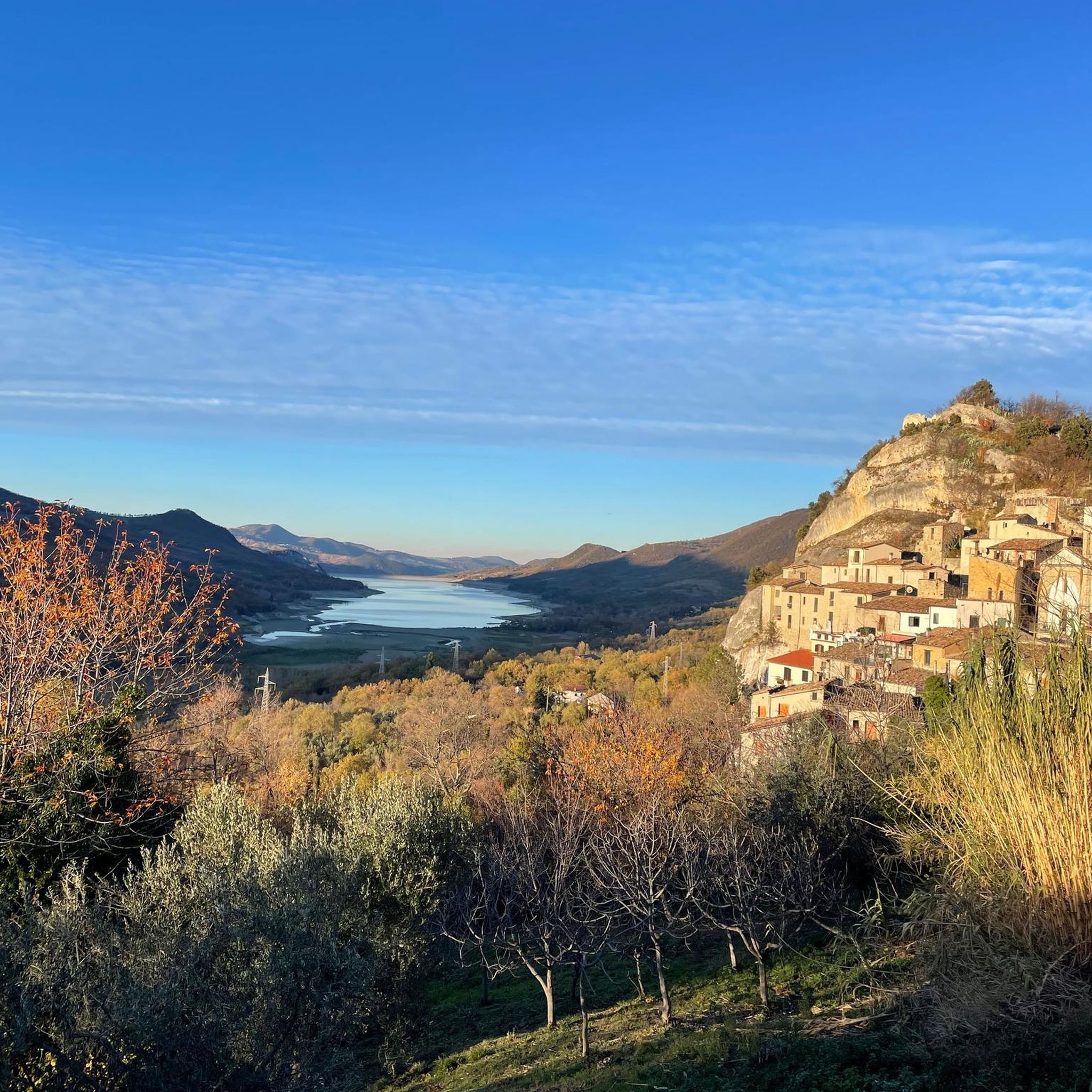
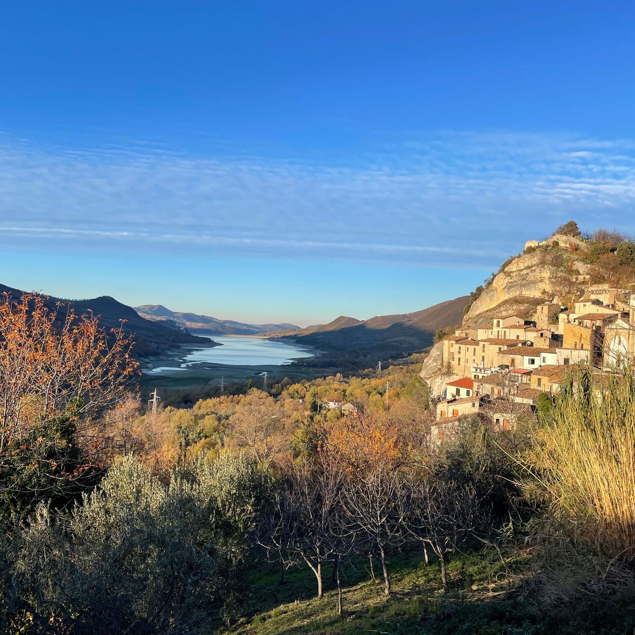
Pescopennataro is a village in upper Molise perched on a beautiful rocky ridge. The town offers enchanting views of the surrounding valleys. You can also enjoy a nature walk in the Pinocchio Park.
0
0

Passo Forchetta, connecting Roccaraso to Campo di Giove, offers a journey through a fresh and lush forest. The road, although the asphalt is not in perfect condition and subject to small landslides, offers a picturesque and fascinating driving experience.
1
0
Frequently Asked Questions
What kind of road cycling routes can I expect around Roio Del Sangro?
The region around Roio Del Sangro is characterized by varied mountainous terrain, offering challenging climbs and descents. Most routes are considered difficult, with significant elevation changes and scenic viewpoints across high plateaus and hilly landscapes. There is one moderate route available for those seeking a slightly less intense experience.
Are there any beginner-friendly or easy road cycling routes in Roio Del Sangro?
Road cycling around Roio Del Sangro is predominantly geared towards experienced cyclists, with 13 out of 14 routes rated as difficult. There is one moderate option available, but no easy routes are listed, indicating the region's challenging nature for road biking.
What are the typical lengths and durations of road cycling routes in this area?
Routes in Roio Del Sangro typically range from moderate to long distances. For example, the Scenic Viewpoint – Pietraferrazzana Rock Spur loop from Borrello is about 30 miles (48.6 km), while longer routes like the Sanctuary of Madonna in Saletta loop from Civitaluparella extend to over 53 miles (85.2 km). Durations vary based on distance and elevation, often taking 3 to 4.5 hours to complete.
Are there any circular road cycling routes or loops around Roio Del Sangro?
Yes, many of the road cycling routes in the area are designed as loops. Notable examples include the Quarto Grande Plateau – Bar Stazione di Palena loop from Civitaluparella and the Monte Pizzuto loop from Roccaspinalveti, both offering comprehensive tours of their respective areas.
What can I see along the road cycling routes in Roio Del Sangro?
The routes offer numerous scenic viewpoints and opportunities to explore natural landmarks. You might encounter highlights such as the View of the Pescopennataro Crags or the Waterfall in Gola di Pennadomo. The Capracotta – View of Monte Cavallerizzo loop from Pescopennataro is another route known for its views.
What do other road cyclists enjoy most about cycling in Roio Del Sangro?
The area is highly rated by the komoot community, with an average score of 4.9 stars from 5 reviews. Cyclists often praise the challenging climbs, panoramic views, and the varied mountainous terrain that defines the region's road biking experience.
When is the best time of year to go road cycling in Roio Del Sangro?
Given the mountainous terrain and significant elevation changes, the best time for road cycling in Roio Del Sangro is typically during the spring, summer, and early autumn months when weather conditions are more stable and temperatures are milder. Winters can bring colder temperatures and potential snow at higher elevations, making some routes less accessible or more challenging.
Are there any specific routes that offer particularly scenic viewpoints?
Many routes in the region are known for their scenic beauty. The Monte Pizzuto loop from Roccaspinalveti offers panoramic views as it circles the mountain, and the Scenic Viewpoint – Pietraferrazzana Rock Spur loop from Borrello explicitly highlights a scenic viewpoint.
Are there any hidden gem road cycling trails in Roio Del Sangro?
While the region is known for its challenging and popular routes, exploring less-trafficked roads can reveal hidden gems. Routes like the Capracotta – View of Monte Cavallerizzo loop from Pescopennataro, while difficult, might offer a more secluded experience away from the most frequented paths.
What are the typical elevation gains on road cycling routes in Roio Del Sangro?
Road cycling routes in Roio Del Sangro feature substantial elevation gains due to the mountainous landscape. For instance, the Quarto Grande Plateau – Bar Stazione di Palena loop from Civitaluparella involves over 1700 meters (5577 ft) of ascent, while the Monte Pizzuto loop from Roccaspinalveti includes over 1300 meters (4265 ft) of climbing.
Are there any attractions or points of interest near the cycling routes?
Beyond the natural beauty, you can find points of interest such as the Prato Gentile Hut or the Monte Campo Ridge Crossing. These can serve as interesting stops or landmarks along your ride.
Most popular routes around Roio Del Sangro
Most popular attractions around Roio Del Sangro

Get inspired with the komoot mobile app


Explore more
Browse the best Road cycling routes in other regions.
