The best cycling routes around Tornareccio
4.3
(25)
399
riders
59
rides
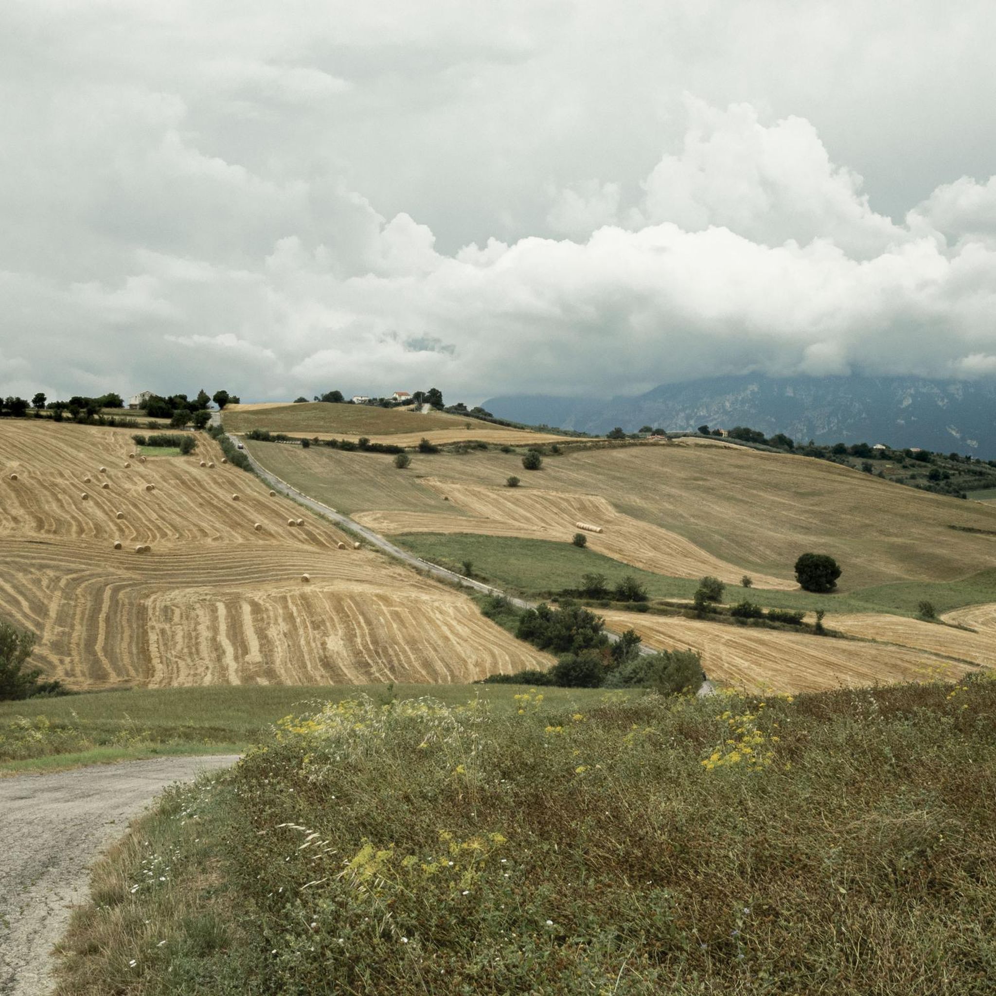
Touring cycling around Tornareccio offers diverse landscapes, from mountainous terrain to coastal vistas. The town is situated on the slopes of Monte Pallano at an elevation of 630 meters, providing expansive views stretching towards the Adriatic coast. The surrounding area features hills and woods, contributing to a sense of unspoiled nature typical of Abruzzo. This varied topography allows for routes that include challenging ascents and scenic descents through a network of paths.
Best touring cycling routes around Tornareccio
- The most…
Last updated: October 8, 2026
4.8
(6)
17
riders
96.0km
06:06
1,130m
1,120m
Hard bike ride. Very good fitness required. Mostly paved surfaces. Suitable for all skill levels.
5.0
(1)
13
riders
62.1km
04:10
940m
940m
Hard bike ride. Very good fitness required. Mostly paved surfaces. Suitable for all skill levels.

14
riders
57.8km
04:27
1,310m
1,310m
Hard bike ride. Very good fitness required. You may need to push your bike for some segments of this route.
5.0
(1)
12
riders
81.7km
05:59
1,770m
1,770m
Hard bike ride. Very good fitness required. Mostly paved surfaces. Suitable for all skill levels.
3.0
(1)
9
riders
40.0km
02:53
820m
820m
Hard bike ride. Very good fitness required. Mostly paved surfaces. Suitable for all skill levels.
Get access to more routes and recommendations from other explorers.
Already have an account?
Our route recommendations are based on thousands of hikes, rides, and runs completed by other people on komoot.
Start today with a free account
Your next adventure awaits.


Tips from the Community

Suitable for Gravel or MTB, less so for road bikes on the dirt sections
0
0

Historic Franciscan monastery in an oasis of peace. The Convento di San Pasquale (officially the monastery of Santa Maria degli Angeli) is hidden in the greenery on the hill of Vallaspra, just outside the medieval town of Atessa. This impressive complex was founded as early as 1408 by the blessed Tommaso da Firenze. It is built entirely of natural stone and exudes a serene, historic atmosphere. Although the interior and the beautiful monastery garden with the central well (from 1709) are unfortunately often closed to the public due to varying opening hours, the complex is an absolute sight to behold from the outside. Under the large portico at the front, you can still admire a centuries-old fresco of the Pietà. Moreover, the quiet, shady surroundings are perfect for a well-deserved break during your sporting tour. Fun fact: the monastery used to lend its name to the well-known local herbal liqueur "Amaro San Pasquale", which was originally prepared by the monks with herbs from this valley.
2
0
Sangro River – The liquid border of the Costa dei Trabocchi. Crossing the Sangro River via the imposing iron bridge is an iconic moment on the Via Verde dei Trabocchi! At 122 kilometers long, the Sangro is one of Abruzzo's mightiest rivers. It begins its journey high in the Apennines and carves its way down to flow into the Adriatic Sea right here, between Fossacesia and Torino di Sangro. From the old railway bridge, you can enjoy a vast panorama of the wide river mouth. This nature reserve forms an important ecological crossroads where river dunes, rare water birds, and the salty sea breeze converge. Why is this river a top highlight? The Gustav Line: The Sangro has a troubled history. During World War II, this river formed the natural barrier for the infamous German Gustav Line. Fierce fighting took place here at the time as the Allies attempted to cross the river. Access to the Lecceta: Immediately after crossing the river heading south, you'll roll straight into the magnificent Riserva Naturale Lecceta di Torino di Sangro, a rare Mediterranean holm oak forest.
0
0
Castello Aragonese – Historic viewpoint above the Adriatic Sea The Castello Aragonese is the impressive northern starting point of the Costa dei Trabocchi. This 15th-century fortress stands high on a steep cliff and offers you a magnificent view over the Adriatic Sea, the port of Ortona, and the coastline of the Via Verde dei Trabocchi. The massive round towers and thick fortress walls are reminiscent of a turbulent past. The castle withstood heavy fighting during World War II, after which part of the complex was lost. As if that were not enough, in 1946, a landslide caused almost half of the fortress to disappear into the sea. Today, it is one of the most beautiful viewpoints in Ortona and an ideal stop during your cycling or hiking tour. The castle ruins and inner courtyard are freely accessible. A short, steep climb awaits from the port, but it is amply rewarded with beautiful panoramas. Around the castle, you will also find cozy terraces and shady benches to catch your breath.
1
0
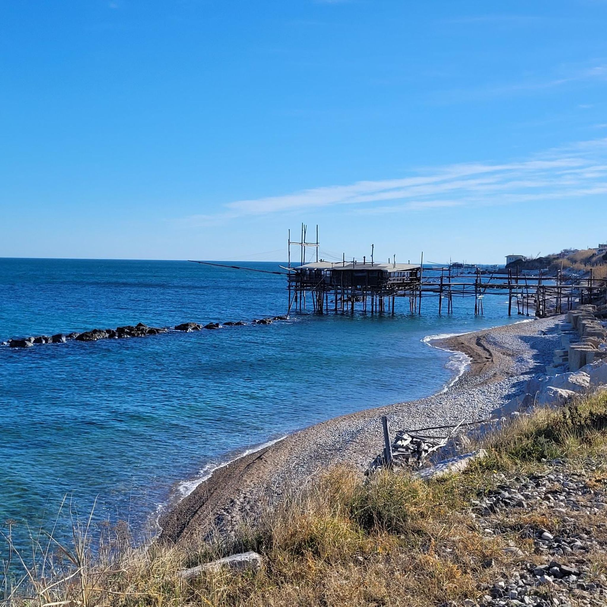
Trabocco Mucchiola – Picnic with sea view Trabocco Mucchiola is a lovely place to take a break during your tour along the Via Verde dei Trabocchi. Next to the cycle path, there is a shady picnic area with tables, ideal for resting, eating something, or simply enjoying the view of the Adriatic Sea. The charming wooden trabocco stands on the rocky Punta Mucchiola and is one of the first fishing platforms you will encounter south of Ortona. Thanks to its splendid location, this is also a beautiful stop along the route to capture a beautiful memory.
4
0
Trabocco Torre Il Sole – The wooden spider above the Adriatic Sea 🌊🪵 Along the Via Verde dei Trabocchi, you'll encounter special wooden fishing platforms, but the Trabocco Torre Il Sole is a real eye-catcher. This impressive 'wooden spider' hovers on high stilts above the waves, forming one of the most photogenic spots along the coast of San Vito Chietino. The trabocchi were built centuries ago not by seafarers, but by local farmers. They sought a safe way to fish without having to venture onto the dangerous open sea. With long wooden arms, nets, and an ingenious construction, they could catch deep-sea fish from the shore. Built from strong and flexible Aleppo pine wood, these special structures have defied the salty sea air and powerful coastal winds for generations. A perfect place to pause, enjoy the view, and take an unforgettable photo with the azure Adriatic Sea as a backdrop.
1
0
Imagine: the Adriatic Sea shimmering beside you, a fresh sea breeze on your face, and an endless cycle path winding along the coast. The Via Verde dei Trabocchi is one of those routes where you don't actually want the ride to end. This cycle path, over 50 kilometers long and largely flat, follows a former railway line and takes you along one of the most beautiful coastal stretches of Abruzzo. Along the way, you'll pass the iconic trabocchi: impressive wooden fishing platforms that seem to float above the sea on stilts. With their long arms and nets, they stand out against the horizon like gigantic wooden works of art.
5
0
The Ciclovia Adriatica in Abruzzo (better known as Bike to Coast) is a 131-kilometer cycle path that covers the entire coastline of the Abruzzo region. The route runs from Martinsicuro (coastal border with Marche) to San Salvo (border with Molise). The route is mostly flat, mostly car-free, and crosses 19 coastal municipalities.
5
0
Frequently Asked Questions
What is the general difficulty level of touring cycling routes around Tornareccio?
Touring cycling around Tornareccio is characterized by varied elevations and often significant climbs. While there are 5 moderate routes, the majority (46 out of 51) are considered difficult, offering challenging ascents and scenic descents through mountainous and hilly terrain. There are no easy routes listed.
Are there circular touring cycling routes available in the Tornareccio area?
Yes, many of the touring cycling routes around Tornareccio are designed as loops. For example, the Trabocco Punta Cavalluccio – Via Verde dei Trabocchi loop from Atessa is a popular circular trail offering coastal views. Another option is the Sangro River – Trabocco Punta Le Morge loop from Atessa, which combines riverine and seaside scenery.
Are there any family-friendly touring cycling routes near Tornareccio?
Given the challenging topography of the region, most touring cycling routes around Tornareccio feature significant climbs and are rated as moderate to difficult. There are currently no easy routes listed, so families with young children or those seeking very gentle rides might find options limited. However, experienced cycling families may enjoy some of the moderate routes.
Can I bring my dog on touring cycling routes around Tornareccio?
While there are no specific restrictions mentioned for dogs on the cycling routes themselves, the area is rich in natural landscapes like hills and woods. It's generally advisable to keep dogs on a leash, especially in areas with wildlife or near roads. Always ensure your dog is fit enough for the distance and elevation, and carry enough water for both of you.
Are there any waterfalls or notable natural features to see along the cycling routes?
Yes, the region boasts beautiful natural features. The Waterfall in Gola di Pennadomo is a notable natural spectacle in the vicinity. Additionally, the Monte Pallano Archaeological and Naturalistic Park, adjacent to Tornareccio, offers significant flora and a sense of unspoiled nature.
What historical or cultural landmarks can I explore while cycling in Tornareccio?
Tornareccio itself is known as the 'capital of honey' and features over ninety mosaics adorning house facades, turning the historic center into an open-air museum. Nearby, you can visit the ancient Megalithic Walls within the Monte Pallano Archaeological and Naturalistic Park. Other historical sites include Castello di Roccascalegna and the Convent of San Pasquale (Atessa), which can be incorporated into your cycling tours.
Are there touring cycling routes that offer views of the Adriatic coast?
Absolutely. Tornareccio's position on Monte Pallano provides expansive views that stretch towards the Adriatic coast. Routes like the Trabocco Punta Cavalluccio – Via Verde dei Trabocchi loop from Atessa specifically highlight coastal scenery and the distinctive Trabocchi fishing structures. The Sangro River – Trabocco Punta Le Morge loop from Atessa also extends towards coastal areas.
What do other touring cyclists enjoy the most about touring cycling in Tornareccio?
The area is highly rated by the komoot community, with an average score of 4.1 stars from around 20 reviews. Cyclists often praise the diverse landscapes, which range from challenging mountainous terrain to scenic coastal vistas, and the sense of 'wild nature' found in the hills and woods typical of Abruzzo.
Are there any scenic gravel road routes for touring cyclists?
Yes, the region offers scenic gravel roads that are popular among touring cyclists. The Fonte Gelata – Scenic Gravel Road loop from Atessa is a 30.2-mile trail that leads through hilly and wooded terrain, providing a great experience for those who enjoy gravel cycling.
How many touring cycling routes are available around Tornareccio?
There are over 50 touring cycling routes available around Tornareccio, offering a wide range of options for exploring the diverse landscapes of the Abruzzo region.
Are there any routes that pass by significant viewpoints?
Many routes in the Tornareccio area offer stunning panoramic views due to the town's elevation on Monte Pallano. The View from Roccascalegna Castle is a particularly noteworthy viewpoint that can be incorporated into a cycling tour, offering expansive vistas of the surrounding landscape.
What is the longest touring cycling route in the area?
The longest touring cycling route listed is the Trabocco Punta Cavalluccio – Via Verde dei Trabocchi loop from Atessa, which spans 59.6 miles (96.0 km) and typically takes over 6 hours to complete. This route offers extensive views of the Adriatic coast.
Are there any routes that explore the Monte Pallano area directly?
Tornareccio is perched on the slopes of Monte Pallano, and the surrounding area is characterized by hills and woods. While specific routes named 'Monte Pallano' are not detailed, many routes, such as the Church to the Fallen of the Julia – Scenic Gravel Road loop from Atessa, traverse the varied terrain and elevations typical of the Monte Pallano region, offering a sense of its wild nature.
Most popular attractions around Tornareccio

Get inspired with the komoot mobile app


Explore more
Browse the best Cycling routes in other regions.
