The best walks and hikes around Piansano
4.3
(94)
491
hikers
37
hikes
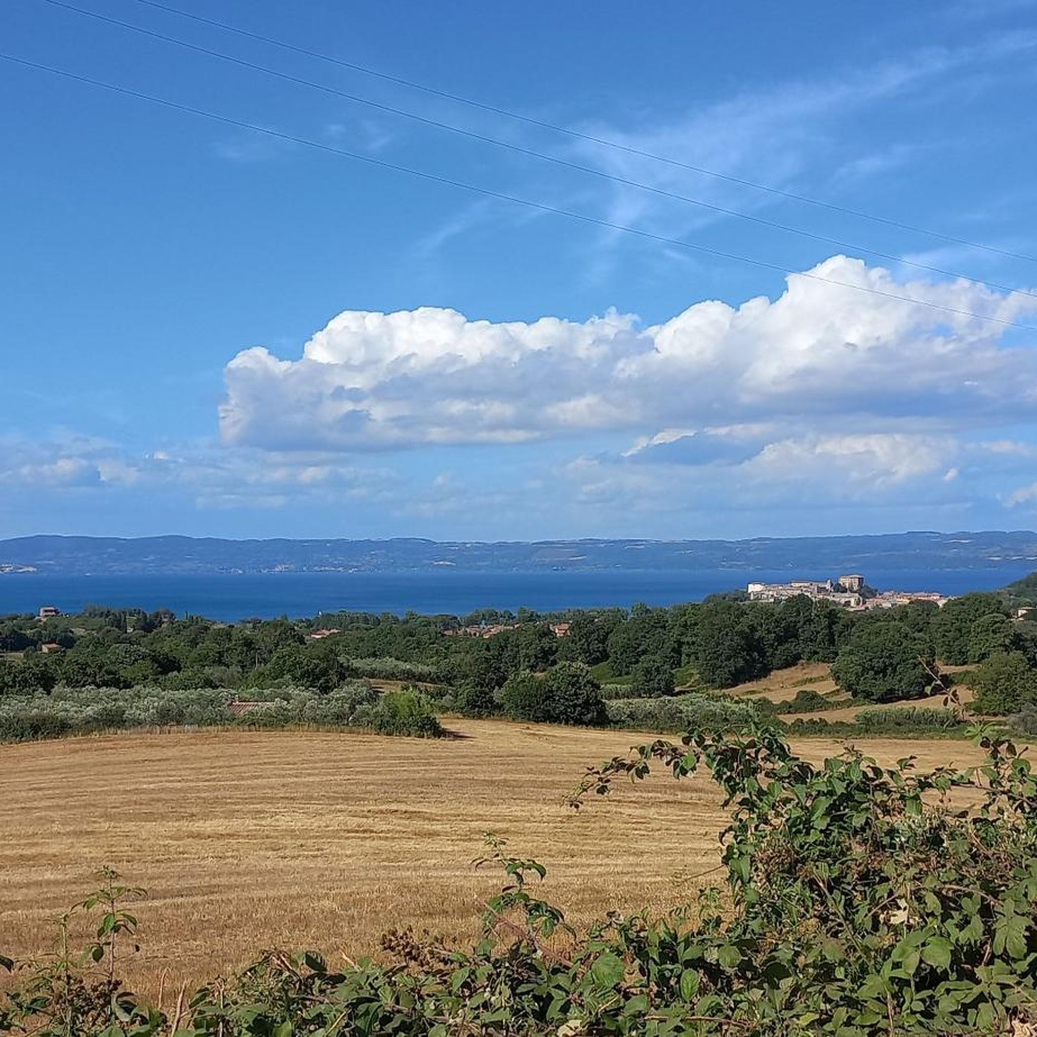
Hiking around Piansano offers exploration of a unique landscape shaped by volcanic activity and rolling hills. Situated in Italy's Lazio region, the area features expansive pastures, cultivated fields, and oak woods, providing diverse scenery for hikers. Its proximity to Lake Bolsena, Italy's largest volcanic lake, contributes to agreeable weather and scenic views. The region also integrates its rich Etruscan-Roman history into many of its trails.
Best hiking trails around Piansano
- The most popular hiking route is Walk through the villages…
Last updated: October 8, 2026
4.7
(3)
22
hikers
6.62km
01:45
60m
60m
The "Walk through the villages of Lake Bolsena from Capodimonte" offers an easy hike along Europe's largest volcanic lake. You will traverse lakeside paths and cultivated fields, enjoying charming views…
4.1
(22)
67
hikers
14.8km
03:50
80m
80m
Moderate hike. Good fitness required. Easily-accessible paths. Suitable for all skill levels.

4.8
(5)
43
hikers
Easy hike. Great for any fitness level. Easily-accessible paths. Suitable for all skill levels.
4.6
(5)
36
hikers
Easy hike. Great for any fitness level. Easily-accessible paths. Suitable for all skill levels.
3.3
(3)
28
hikers
29.0km
07:46
340m
340m
Hard hike. Very good fitness required. Easily-accessible paths. Suitable for all skill levels.
Get access to more routes and recommendations from other explorers.
Already have an account?
Our route recommendations are based on thousands of hikes, rides, and runs completed by other people on komoot.
Start today with a free account
Your next adventure awaits.

Other adventures around Piansano

Tips from the Community

Marta is a charming town on the southern shore of Lake Bolsena in the province of Viterbo, Lazio, Italy. It is known for its picturesque location, fishing port, and relaxed atmosphere. Here is some information about Marta on Lake Bolsena: * Location: Marta is located directly on Lake Bolsena, opposite Isola Martana, from which it takes its name. * Fishing Village: Marta is a traditional fishing village, and you can still see fishing boats in the harbor. Fishing, especially eels and other freshwater fish, plays an important role in the local cuisine. * Lakeside Promenade: The town has a pleasant lakeside promenade, ideal for strolling and enjoying the views of the lake and its islands. * Sights: * Torre dell'Orologio (Clock Tower): A striking tower in the historic center that can offer panoramic views. * Harbor: A lively spot where you can watch fishing boats and take ferries to the islands of Lake Bolsena. * Activities: * Water sports: The lake offers opportunities for swimming, boating, and fishing. * Local cuisine: Be sure to try the local seafood dishes in the town's restaurants. * Festivals: Marta is known for its traditional festivals, such as the "Barabbata" festival, which takes place in May and celebrates local culture and history. * Starting point: Marta is a good base for exploring other towns on Lake Bolsena and in the surrounding Tuscia region, including Bolsena, Capodimonte, and historic sites such as Civita di Bagnoregio. Marta offers an authentic Italian atmosphere and is an ideal place for a peaceful and relaxing stay on Lake Bolsena.
0
0
Isola Martana is the smaller of the two islands in Lake Bolsena and lies directly in front of the town of Marta, which gives the island its name. Features and History * Size and Location: It is the smaller of the two volcanic islands in the lake and has an area of approximately 10.3 hectares. It is clearly visible from the town of Marta. * Volcanic Origin: Like the lake itself and its larger sister island (Isola Bisentina), Isola Martana was formed by underground volcanic eruptions. Its crescent-shaped shape and steep, north-facing cliffs are testament to its volcanic past. * Historical Significance: Isola Martana holds a rich and often dark history: * Saint Christina: According to legend, the relics of Saint Christina were hidden here around 410 AD to protect them from barbarian invasions before eventually being returned to Bolsena. * Queen Amalasuntha: The island is most famous for the tragic assassination of Amalasuntha, Queen of the Ostrogoths and daughter of Theodoric the Great, in 535 AD. She was reportedly imprisoned and then murdered here on the orders of her cousin and husband, Theodahad. This event served as a pretext for the Byzantine Emperor Justinian to launch the Gothic War to reconquer Italy. * Monastic past: The island once housed a monastery, which was later abandoned. * Private property: Today, Isola Martana is privately owned and not open to the public.
0
0
Isola Bisentina in Lake Bolsena: This is the larger of the two islands and was historically significant. It is home to several chapels and gardens. Public access is not always available, but boat tours often offer the opportunity to see the island from the water.
0
0
Lake Bolsena is a large volcanic lake in central Italy, about 90 km north of Rome in the province of Viterbo, Lazio. It is a popular tourist destination, known for its natural beauty, clear waters, and relaxed atmosphere. The lake was formed by the collapse of a caldera of the Vulsini volcano. This geological history contributes to its black volcanic beaches, some of which are black in color. Lake Bolsena is known for its clean, spring-fed waters, which are excellent for swimming. The shores often slope gently, making it suitable for families with children. The lake has two islands, Bisentina and Martana, formed by underwater eruptions. Public access to the islands may be limited, but boat tours often offer views of them.
0
0
A rose-shaped plaque commemorating Noëlla Nabonnand, born in 1901. This plaque is part of the Lazio Region's "Bella Bestia" project, dedicated to commemorating the history of Monte Bisenzio. The QR code on the plaque allows you to hear the story associated with this person or place. The plaque is located near Monte Bisenzio, an archaeological site with an ancient Etruscan city.
0
0
Piazza Matteotti is a central square in Capodimonte and an important meeting place for the community. The square is a junction where the Corso della Repubblica and the Via Cassia meet. The square also houses the former Church of San Francesco.
0
0
The tower was built around 1780. It is constructed of hewn tuff blocks. The mechanical clock in the tower struck the hours with the ringing of two bells. The Torre dell'Orologio is a historic landmark in Capodimonte.
0
0
Parish and Collegiate Church of Santa Maria Assunta in Cielo. Construction period: Built in the 15th century. Commissioner: Erected by Ranuccio III Farnese. Restoration: Restored in the 16th century under the direction of Vignola.
0
0
Frequently Asked Questions
How many hiking trails are available around Piansano?
Piansano offers a diverse selection of hiking routes. There are over 30 trails available, catering to various preferences and skill levels. You'll find a good mix of easy and moderate paths to explore the region's unique landscapes.
What kind of landscape can I expect when hiking near Piansano?
The landscape around Piansano is characterized by soft, rolling hills and volcanic origins, offering picturesque views. You'll hike through expansive pastures, cultivated fields, and interspersed oak woods. The proximity to Lake Bolsena, Italy's largest volcanic lake, also means many routes offer scenic lakeside views and walks.
Are there hiking trails for all skill levels in Piansano?
Yes, Piansano provides options for various abilities. There are 17 easy routes perfect for a relaxed stroll, and 16 moderate trails for those seeking a bit more challenge. Currently, there are no difficult routes listed, making it accessible for most hikers.
What do other hikers say about the trails in Piansano?
The hiking routes in Piansano are highly regarded by the komoot community, holding an average rating of 4.4 stars from over 50 reviews. Hikers often praise the scenic beauty, the varied terrain, and the pleasant atmosphere of the trails, especially those around Lake Bolsena.
Are there any circular walks around Piansano?
Yes, many of the trails around Piansano are designed as loops, allowing you to start and end in the same location. For example, the View of Isola Martana – Rocca Farnese of Capodimonte loop from Capodimonte and the View of Isola Martana – View of Isola Bisentina loop from Capodimonte are popular circular options offering beautiful lake views.
Can I find family-friendly hikes near Piansano?
Absolutely. Many of the easy trails around Piansano are suitable for families. Routes like the Walk through the villages of Lake Bolsena from Capodimonte are relatively short and have minimal elevation gain, making them enjoyable for all ages.
What natural features or landmarks can I see along the hiking trails?
Piansano's trails offer a blend of natural beauty and historical significance. You can explore the scenic shores of Lake Bolsena, Italy's largest volcanic lake, and enjoy views of its islands like Isola Bisentina. The region also boasts Etruscan heritage, with sites like the Etruscan Necropolis of the Scalette and Monte Bisenzio Necropolis providing a glimpse into the ancient past.
Are there any historical sites or archaeological points of interest to explore?
Yes, Piansano is rich in Etruscan-Roman history. The area has Etruscan origins, and you can find ancient sites integrated into the hiking routes. The Necropolis of Norchia, for instance, is an important archaeological site with ancient Etruscan tombs. These historical elements add a fascinating dimension to your hike.
What is the best time of year to go hiking in Piansano?
Piansano enjoys a pleasant climate, making it suitable for hiking for much of the year. The spring and autumn months are particularly ideal, with mild temperatures and vibrant natural colors. The proximity to Lake Bolsena helps moderate the weather, providing agreeable conditions for outdoor activities.
Are there any longer, more challenging hikes available?
While many routes are easy to moderate, the region offers structured experiences like the 'Maternum Marathon' trails, which include non-competitive trekking routes of 11, 19, or 34 kilometers. These longer options provide more extensive exploration through green hills and varied terrain, showcasing both nature and historical insights.
Where can I find parking for hiking trails in Piansano?
Many trailheads, especially those starting from towns like Capodimonte or Marta, offer convenient parking options. For example, routes like the Marta Town Hall – Marta loop from Marta typically have parking available near the starting point in the respective towns.
Are there options for public transport to reach hiking areas around Piansano?
While specific public transport details for every trailhead are not always available, Piansano and nearby towns are generally accessible by local bus services within the Viterbo province. It's advisable to check local bus schedules for routes connecting to the starting points of your chosen hikes.
Most popular attractions around Piansano

Get inspired with the komoot mobile app


Explore more
Browse the best Hikes in other regions.
