The best cycling routes around Parzanica
4.4
(3928)
45,096
riders
173
rides
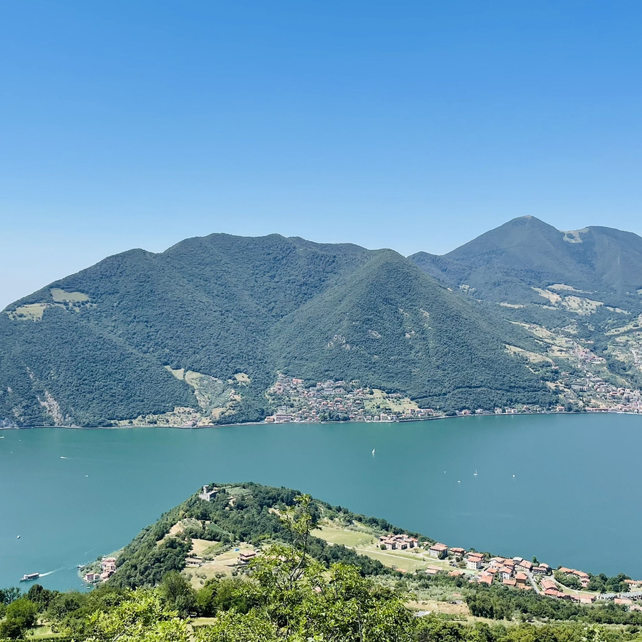
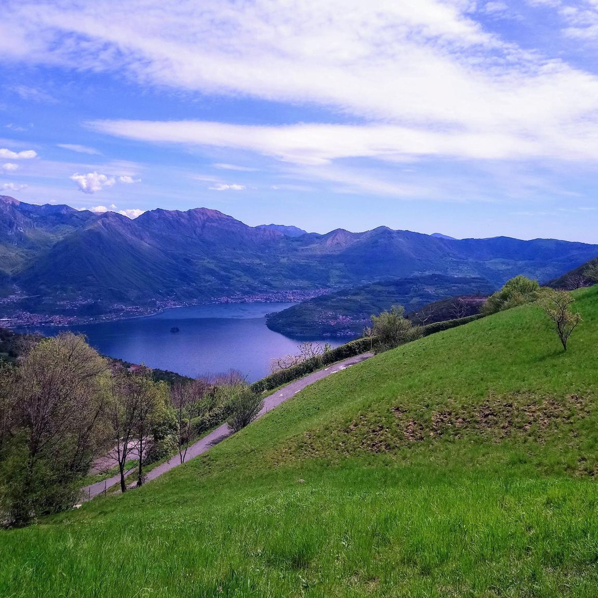
Touring cycling around Parzanica offers diverse routes through its elevated landscape in the Province of Bergamo, Italy. The region features panoramic views of Lake Iseo and Monte Isola from its position at 750 meters above sea level. Cyclists can explore varied mountainous terrain, including peaks like Monte Creò and Monte Cremona, alongside wooded trails and historical mule tracks. This combination provides a range of experiences from lakeside paths to challenging climbs.
Best touring cycling routes around Parzanica
- The most popular…
Last updated: July 5, 2026
4.2
(66)
565
riders
20.0km
01:10
80m
80m
Easy bike ride. Great for any fitness level. Mostly paved surfaces. Suitable for all skill levels.
5.0
(1)
117
riders
31.5km
02:53
1,190m
1,190m
Hard bike ride. Very good fitness required. Mostly paved surfaces. Suitable for all skill levels.

Sign up for free
4.7
(129)
691
riders
42.2km
02:40
500m
500m
Hard bike ride. Very good fitness required. Mostly paved surfaces. Suitable for all skill levels.
5.0
(3)
50
riders
8.63km
00:40
240m
240m
Moderate bike ride. Good fitness required. Mostly paved surfaces. Suitable for all skill levels.
44
riders
Moderate bike ride. Good fitness required. Mostly paved surfaces. Suitable for all skill levels.
Get access to more routes and recommendations from other explorers.
Sign up for free
Already have an account?
Our route recommendations are based on thousands of hikes, rides, and runs completed by other people on komoot.
Start today with a free account
Your next adventure awaits.
Login or Signup
Tips from the Community

Beautiful view of the magnificent Earth Pyramids of Zone.
0
0
Very remarkable works of art of nature - the path is in a protected area and must not be left.
0
0

The Pyramids of Zone are spectacular, imposing spires of earth located in Zone, in the province of Brescia, a short distance from the northeastern shore of Lake Iseo. These extraordinary geological formations, also known as "fairy chimneys", reach heights of up to 30 meters and are located within a protected regional nature reserve
0
0

The Rifugio Croce di Marone is located at 1,166 m on the southern slope of Monte Guglielmo, above Marone, and is one of the most convenient and frequented starting points for climbing the Guglielmo. 🏔️ Hut identity and location The refuge is located in the Croce di Marone area, reachable via the road that climbs from Marone → Cislano → Madonna della Rota, crossing the Valle dell’Opol. It is situated in a panoramic and strategic point for: Monte Guglielmo (1948 m) – classic and very frequented ascent Malga Guglielmo di Sotto and di Sopra Rifugio Almici Piani di Caregno The refuge is open all year round, has a restaurant, electric light, hot water, and about 15 beds. 🚗 How to get there By car from Marone Follow the signs for Zone. After about 4.5 km, past the cable car underpasses, you will find a sharp right turn with a sign for the refuge. The road becomes narrow and steep in the final kilometers. Paid parking with scratch card (3 € up to 4 hours, 5 € for longer). On foot from Zone (Englar) You can leave your car at the Englar restaurant (640 m). Ascent along the road/CAI 226 trail → approx. 1h20’–1h50’ depending on whether you cut corners. 🚶♂️ Main excursions from the refuge 1. Monte Guglielmo (E – approx. 2h) This is the shortest and most direct route to reach the summit of Guglielmo: Initial mule track Junction for Malpensata Section with white-blue 3V trail markers Malga Guglielmo di Sotto → Malga di Sopra Rifugio Almici → summit with the Monument to the Redeemer The panorama over the Sebino and the Prealps is considered one of the most beautiful in the area. 2. Rifugio Almici (1861 m) – 2h Simple and panoramic route along the mule track. 3. Piani di Caregno – 3h30’ Longer but very scenic route. 🏞️ Environment and atmosphere The area is characterized by: beech and fir woods open pastures views of Lake Iseo and Val Trompia presence of the 3V trail nearby It is an ideal spot for short excursions, longer treks, or family days out.
0
0

Isola di San Paolo: It is a private island, famous for once being a monastery and today owned by the Beretta family. It is not visitable internally, but it is clearly visible from Monte Isola, especially from the Sensole area.
0
0

a viewpoint with a balcony overlooking the lake, worth a stop
0
0
Climbing to Zone, it's impossible not to see these wonders of nature, you'll be amazed!
1
0

Beautiful seafront, very pleasant to walk along
0
0
Frequently Asked Questions
How many touring cycling routes are available around Parzanica?
There are over 170 touring cycling routes around Parzanica, offering a wide range of experiences for cyclists. These routes are highly rated by the komoot community, with an average score of 4.4 stars from over 3200 reviews.
Are there touring cycling routes for all skill levels in Parzanica?
Yes, Parzanica offers routes for various skill levels. You'll find over 40 easy routes, more than 50 moderate routes, and over 80 difficult routes, ensuring there's a suitable option whether you're a beginner or an experienced cyclist looking for a challenge.
What kind of views can I expect on touring cycling routes around Parzanica?
Many routes in Parzanica offer stunning panoramic views of Lake Iseo and Monte Isola due to the village's elevated position. You can experience these consistent lake views on routes like the Marone Lakefront – View of Monte Isola loop from Marone-Zone, which is an easy ride along the lakefront.
Are there any family-friendly touring cycling routes in the Parzanica area?
For families, the area around Lake Iseo offers gentler options. The Vello–Toline Cycle Path, part of the Oglio cycle route, provides a beautiful path completely close to the water, making it suitable for a relaxed family ride. A moderate route that incorporates this is the Old Road along Lake Iseo – Vello–Toline Cycle Path loop from Vello.
What natural features or landmarks can I see while cycling around Parzanica?
The region is rich in natural beauty and unique landmarks. You can cycle past the fascinating Pyramids of Zone, a geological formation, or explore the serene Torbiere del Sebino Nature Reserve. The Tavernola Bergamasca – Cypress Trees in Water loop from Vigolo offers a challenging ride with scenic views.
Are there any challenging touring cycling routes for advanced cyclists?
Yes, advanced cyclists will find plenty of challenging routes with significant elevation gains. For instance, the View of the Piramidi di Zone – Rifugio Croce di Marone loop from Marone-Zone is a difficult 34.8 km trail with over 1300 meters of ascent, leading through the Piramidi di Zone area and towards Rifugio Croce di Marone.
What is the best time of year to go touring cycling in Parzanica?
The spring and autumn months generally offer the most pleasant weather for touring cycling in Parzanica, with milder temperatures and beautiful scenery. Summer can be warm, especially at lower elevations, while winter cycling may be possible but requires checking local conditions for higher mountain passes.
Are there any circular touring cycling routes available?
Many of the touring cycling routes around Parzanica are designed as loops, allowing you to start and end in the same location. Examples include the Marone Lakefront – View of Monte Isola loop from Marone-Zone and the Old Road along Lake Iseo – Vello–Toline Cycle Path loop from Vello.
Can I access touring cycling routes in Parzanica using public transport?
While Parzanica itself is a tranquil village with historical isolation, the broader Lake Iseo area is more accessible. You can often reach starting points for routes around the lake by bus or ferry services that connect the various towns. It's advisable to check local public transport schedules for specific connections to your chosen starting point.
Where can I find parking when planning a touring cycling trip to Parzanica?
Parking is generally available in the villages and towns around Lake Iseo, including Parzanica and nearby Marone or Vello, which serve as common starting points for many routes. Look for designated parking areas in these locations, especially near the lakefront or village centers.
Are there any cultural or historical sites accessible by touring bike?
Yes, the region offers cultural insights. The Cultural Cycle Route Bergamo – Brescia, while not directly in Parzanica, connects two cities designated Capital of Culture 2023, passing through villages and cultural sites. Within Parzanica, the Church of the Santissima Trinità, with its 15th-century frescoes, is accessible via a steep but rewarding trail.
Most popular routes around Parzanica
Most popular attractions around Parzanica

Get inspired with the komoot mobile app


Explore more
Browse the best Cycling routes in other regions.
