The best running trails around Alta Val Tidone
4.4
(8)
614
runners
88
runs
Jogging around Alta Val Tidone offers routes through a landscape of rolling hills, vineyards, and forests in Emilia-Romagna, Italy. The region features diverse terrain, from lower elevations around 200 meters to higher points near 800 meters above sea level. Runners can explore paths along the Tidone stream, around the Molato Dam and Lake Trebecco, and through shaded woods. This varied topography provides a range of running experiences.
Best jogging routes around Alta Val Tidone
- The most popular jogging route is…
Last updated: July 5, 2026
13
runners
5.68km
01:06
370m
380m
Hard run. Very good fitness required. Sure-footedness, sturdy shoes and alpine experience required.
7
runners
15.6km
02:08
610m
610m
Hard run. Very good fitness required. Mostly paved surfaces. Suitable for all skill levels.

Sign up for free
4
runners
12.2km
01:39
400m
400m
Hard run. Very good fitness required. Mostly paved surfaces. Suitable for all skill levels.
5
runners
14.8km
01:41
360m
360m
Hard run. Very good fitness required. Sure-footedness, sturdy shoes and alpine experience required.
5.0
(1)
3
runners
6.23km
00:57
330m
330m
Hard run. Very good fitness required. Sure-footedness, sturdy shoes and alpine experience required.
Get access to more routes and recommendations from other explorers.
Sign up for free
Already have an account?
Our route recommendations are based on thousands of hikes, rides, and runs completed by other people on komoot.
Start today with a free account
Your next adventure awaits.
Login or Signup


Tips from the Community

Beautiful ride between the provinces of PV and PC to do not immediately after a day of rain, terrain in parts clay and muddy. At km. 6.40 take the low variant because the one that gives the track is impassable.
0
0

Very difficult area to reach. I recommend the Goccia one more
0
0

Nice smooth climb In the middle of the woods and in silence
2
0

Dam built on the Tidone river in the 1920s
1
0

Small rural church surrounded by greenery
26
0

This small bridge offers a pleasant view of the stream. Val Tidone is a narrow valley that extends across Emilia-Romagna and Lombardy, following the course of the Tidone stream from its source on Mount Penice to its confluence with the Po. If you want to explore this area, there is an official route: the Sentiero del Tidone. This path will take you to the beautiful Trebecco lake, not far from here.
1
0

Dam that creates Lake Trebecco and supplies irrigation to the entire Val Tidone
3
0

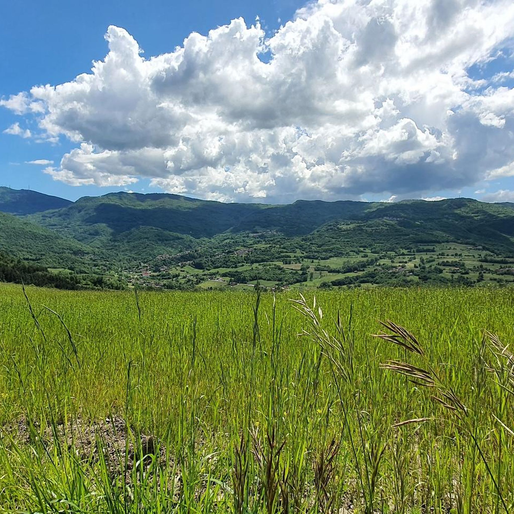
Nice panoramic point, why not take advantage of a snack break? ;-)
0
0
Frequently Asked Questions
How many running routes are available in Alta Val Tidone?
Alta Val Tidone offers a wide selection of running routes, with over 70 trails available for exploration. These routes traverse the region's diverse landscape of rolling hills, vineyards, and forests, providing varied experiences for runners.
What kind of terrain can I expect on the jogging trails in Alta Val Tidone?
The terrain in Alta Val Tidone is characterized by undulating hills, vineyards, and forests. You'll find paths ranging from packed earth and gravel, especially along sections of the Sentiero del Tidone, to more challenging inclines and descents through wooded areas. Routes often feature diverse environments, moving from lower elevations around 200 meters to higher points near 800 meters above sea level.
Are there any easy or beginner-friendly jogging routes in Alta Val Tidone?
While many routes in Alta Val Tidone are rated as moderate to difficult due to the hilly terrain, there are options that can be adapted for beginners. The region's trails offer diverse experiences, and you can find sections of paths like the Sentiero del Tidone that are less strenuous. It's recommended to check individual route profiles for elevation details to find the best fit for your fitness level.
What are some scenic points or landmarks I can see while jogging in Alta Val Tidone?
Jogging in Alta Val Tidone offers numerous scenic points. You can run around the picturesque Molato Dam and Lake Trebecco, or explore routes that pass by medieval castles such as Rocca d'Olgisio. Natural highlights include the distinct peak of Pietra Parcellara, offering 360-degree views, and the tranquil Carlone Waterfall. The Tidone Spring at Casa Matti is another natural monument worth discovering.
Are there any circular running routes in the region?
Yes, Alta Val Tidone features several circular running routes. For example, the Running loop from Pianello Val Tidone offers a challenging 6.2 km circular path. Another option is the Running loop from Pietra, which covers about 7.1 km. These loops allow you to start and finish in the same location, making logistics easier.
What do other runners enjoy most about jogging in Alta Val Tidone?
The area is highly rated by the komoot community, with an average score of 4.3 stars from over 5 reviews. Runners often praise the diverse and picturesque landscape, from rolling hills and vineyards to shaded forests. The variety of routes, including those around the Molato Dam and through historic areas, is also frequently highlighted as a major draw.
Can I find routes that offer views of the Molato Dam and Lake Trebecco?
Absolutely. The area around the Molato Dam and the artificial Lake Trebecco is a popular spot for runners. The Bridge over the Tidone – Molato Dam loop from Nibbiano is a scenic 12.2 km trail that specifically leads through this area, offering beautiful views of the water and the surrounding greenery.
Are there any routes suitable for running with dogs?
While specific dog-friendly designations for every trail are not always available, many natural paths and forest trails in Alta Val Tidone are generally suitable for running with dogs, provided they are kept under control. The Sentiero del Tidone, with its predominantly packed earth and gravel surfaces, can be a good option. Always ensure your dog is well-behaved and respect local regulations, especially near villages or protected areas.
What is the best time of year to go jogging in Alta Val Tidone?
Alta Val Tidone offers good jogging conditions for much of the year. Spring and autumn provide pleasant temperatures and vibrant scenery, with blooming flowers or colorful foliage. During warmer summer months, the higher parts of Val Tidone feature forests and woods, offering shaded and tranquil paths that are particularly appealing. Winters can be cooler, but many trails remain accessible, though some higher elevation paths might require more suitable gear.
Are there any routes that pass through vineyards?
Yes, the landscape of Alta Val Tidone is dominated by undulating hills dotted with vineyards. Many jogging routes will take you through or alongside these picturesque vineyards, offering rewarding views across the valley. This provides a unique and characteristic backdrop to your run, especially in areas like Pianello Val Tidone.
Where can I find parking for these running routes?
Parking availability varies by starting point. For routes originating from villages like Nibbiano or Pianello Val Tidone, you can often find parking within or on the outskirts of the village. For trails like the Sentiero del Tidone, specific starting points may have designated parking areas. It's advisable to check the details of your chosen route for specific parking recommendations.
Are there any routes that offer significant elevation gain for a challenging run?
Yes, Alta Val Tidone is known for its hilly terrain, providing excellent opportunities for challenging runs with significant elevation gain. Routes like the Passo della Crocetta loop from Cicogni, a 15.6 km path, include substantial ascents through the region's undulating landscape, making them ideal for runners seeking a more demanding workout.
Most popular routes around Alta Val Tidone
Most popular attractions around Alta Val Tidone

Get inspired with the komoot mobile app


Explore more
Browse the best Running Trails & Routes in other regions.
