The best road cycling routes around Maissana
4.4
(211)
4,582
riders
64
rides
Road cycling around Maissana features a landscape characterized by significant elevation changes and numerous mountain passes. The region's terrain includes winding roads through valleys and up to high points like Passo Cento Croci. Road cyclists can expect a mix of challenging climbs and scenic descents across this varied topography.
Best road cycling routes around Maissana
- The most popular road cycling route is From Varese Ligure to Passo Cento Croci – ring tour, a 37.2 miles (59.8 km) trail that…
Last updated: July 15, 2026
5.0
(2)
22
riders
59.8km
03:36
1,550m
1,550m
Hard road ride. Very good fitness required. Mostly well-paved surfaces and easy to ride.
17
riders
45.7km
02:41
1,150m
1,150m
Hard road ride. Very good fitness required. Mostly well-paved surfaces and easy to ride.

Sign up for free
8
riders
42.2km
02:37
1,170m
1,170m
Hard road ride. Very good fitness required. Mostly well-paved surfaces and easy to ride.
10
riders
42.6km
02:33
1,070m
1,080m
Hard road ride. Very good fitness required. Mostly well-paved surfaces and easy to ride.
4.0
(1)
7
riders
25.4km
01:33
680m
680m
Moderate road ride. Good fitness required. Mostly well-paved surfaces and easy to ride.
Get access to more routes and recommendations from other explorers.
Sign up for free
Already have an account?
Our route recommendations are based on thousands of hikes, rides, and runs completed by other people on komoot.
Start today with a free account
Your next adventure awaits.
Login or Signup

Tips from the Community

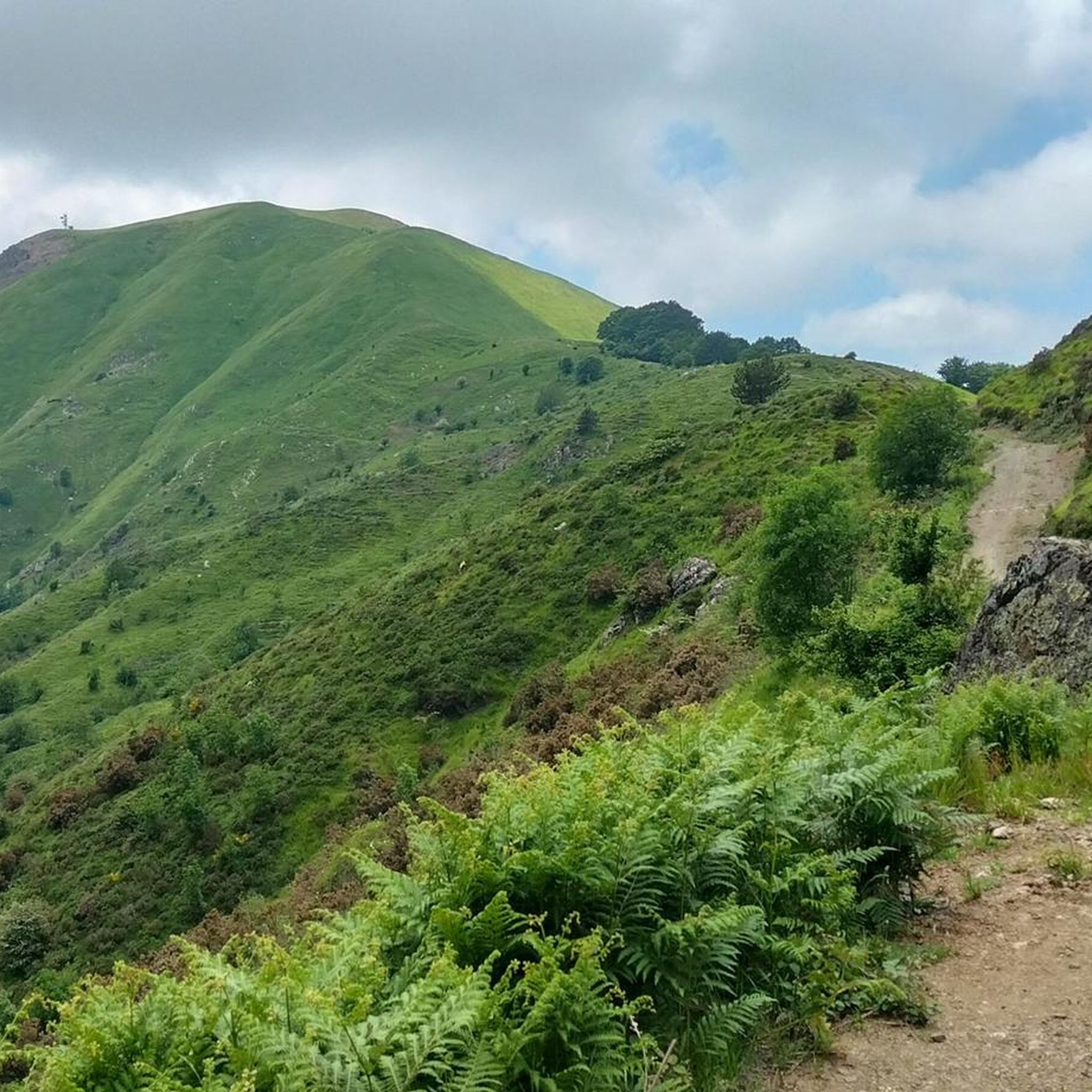
The Passo della Cappelletta (1,085 m a.s.l.) is a charming Apennine pass located on the border between Emilia-Romagna (province of Parma/Piacenza) and Liguria. It is famous for its imposing wind turbines and its proximity to Monte Gottero.
0
0

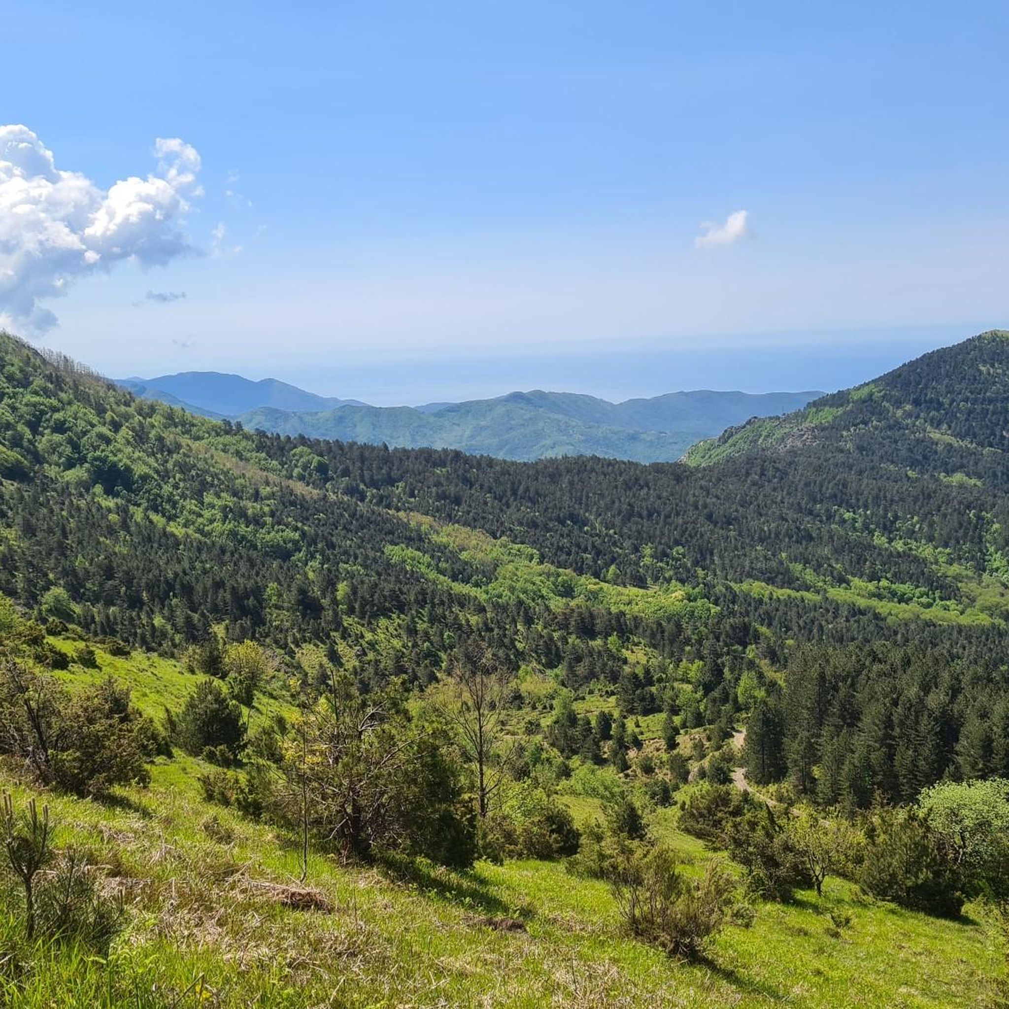
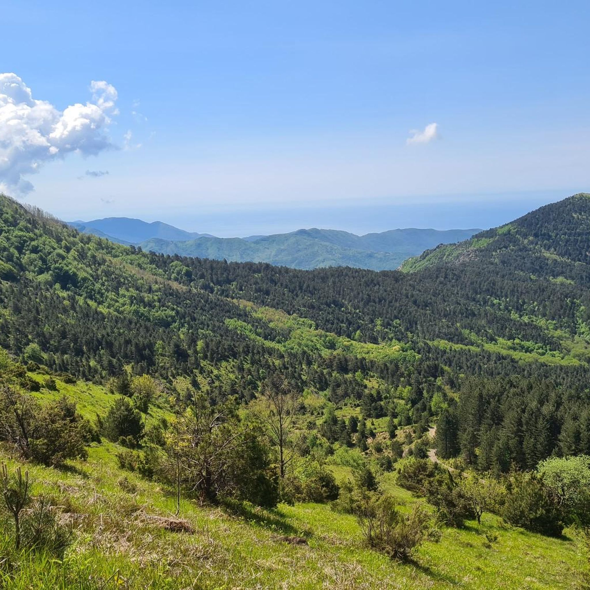
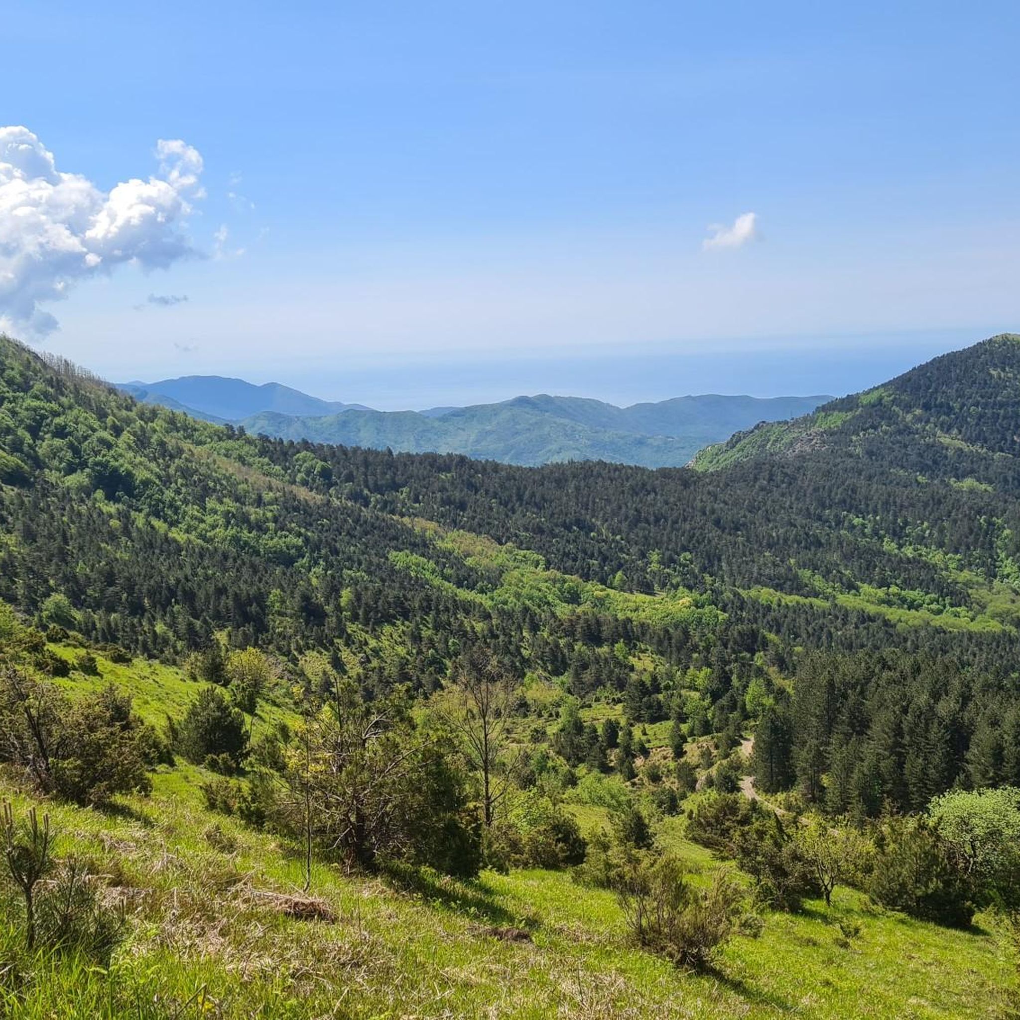
In the background you can see the Passo Cento Croci, where the wind turbines are located.
0
0

Update September 2025: Fieschi Castle is temporarily closed for renovations
0
0

possible excursions both on foot and by bike
0
0
beautiful excursions, simple and suitable for all levels, good opportunities to taste local products
0
0

The presence of the Counts of Lavagna in the territory of Varese dates back at least to the beginning of the 11th century; in 1161 they obtained the investiture from Emperor Frederick I. At the end of the 12th century, two branches of the Counts - Fieschi and Pinelli - settled in the current Cassego and from there they began to clear forests, build wooden buildings, sow, and start agriculture and livestock farming. Almost immediately the long season of conflicts between the two families began, when the Fieschis drove the Pinellis out of Cassego and forced them to take refuge in the nearby town of Carbello, where they built a tower called "Torre dei Pinelli". With a subsequent pact the two families divided the territory: the one to the west of the Torre belonged to the Fieschi family, the one to the east to the Pinelli family, while the lands beyond the Scagliana river remained joint property, that is, they were a comunaglia (hence the current toponym of Comuneglia).
0
0

The descent from the pass towards Varese Ligure is brand new and tarred - it works! The other side of the pass is not quite as scenic and the asphalt looks a bit like cobblestones.
2
0

Interesting route through beech woods, typically windy. Beautiful panorama from Monte Zuccone.
0
0
Frequently Asked Questions
How many road cycling routes are available around Maissana?
There are over 60 road cycling routes documented on komoot for the Maissana region, offering a wide range of options for different skill levels. These routes are highly rated by the komoot community, with an average score of 4.4 stars.
Are there any easy or beginner-friendly road cycling routes in Maissana?
While Maissana is known for its challenging terrain, there are a few easier routes available. The region features 3 routes classified as easy, and 26 as moderate, which might be suitable for beginners looking for less strenuous options or those building up their endurance. These routes often involve less significant elevation changes compared to the more difficult mountain pass ascents.
What are the characteristics of the more challenging road cycling routes in Maissana?
Challenging routes in Maissana are defined by significant elevation changes and numerous mountain passes. You can expect winding roads, substantial climbs, and scenic descents. Routes like From Varese Ligure to Passo Cento Croci – ring tour and Passo di Cento Croci (1,055 m) – Varese Ligure - start loop from Maissana offer difficult ascents and considerable elevation gain, typical of the mountainous terrain.
Are there any circular road cycling routes around Maissana?
Yes, many of the road cycling routes in Maissana are designed as loops, allowing you to start and finish in the same location. Examples include the Mola Pass (650 m) – Lungo Borsa to Tavarone loop from Carro and the Mola Pass (650 m) loop from Carro, which offer varied terrain and scenic views.
What kind of scenic viewpoints can I expect on road cycling routes in Maissana?
Road cycling in Maissana offers numerous scenic viewpoints, especially from the mountain passes. Riders often enjoy panoramic views of the valleys and surrounding Ligurian Apennines. Passes like Passo di Cento Croci (1,055 m), Bracco Pass, and Bocco Pass are well-known for their expansive vistas.
What is the best time of year for road biking in Maissana?
The best time for road biking in Maissana is typically from spring through autumn (April to October). During these months, the weather is generally milder and more stable, making for pleasant riding conditions. Summer can be warm, especially in the valleys, while late spring and early autumn offer comfortable temperatures and vibrant scenery. Winter can bring colder temperatures and potential snow at higher elevations, making some passes inaccessible.
Are there any specific landmarks or points of interest along the road cycling routes?
Yes, the region features several notable landmarks. Cyclists can encounter mountain passes like Passo di Cento Croci (1,055 m) and Passo del Biscia. You might also come across the Marco Pantani Fountain at Guaitarola Pass, a tribute to the famous cyclist, offering a unique point of interest during your ride.
What do other road cyclists enjoy most about road cycling in Maissana?
The komoot community highly rates road cycling in Maissana, with an average score of 4.4 stars from over 180 reviews. Riders frequently praise the challenging climbs, the rewarding scenic descents, and the varied topography that includes both winding valley roads and high mountain passes. The sense of accomplishment after conquering a pass is a common highlight.
Is public transport available to access road cycling routes in Maissana?
Accessing road cycling routes in Maissana primarily relies on personal transport due to the region's rural and mountainous nature. While some local bus services connect smaller towns, they may not always accommodate bicycles or align with route starting points. It's advisable to plan your journey with a car for flexibility, especially when targeting specific route access points.
Where can I find parking for road cycling trails in Maissana?
Parking is generally available in the towns and villages that serve as starting points for many routes, such as Varese Ligure or Carro. Look for public parking areas within these communities. For routes starting directly on a pass, limited parking might be available at the summit or nearby rest stops, but it's always best to check local signage.
Are there any cafes or refreshment stops along the road cycling routes in Maissana?
While the routes often traverse rural areas, you'll typically find cafes, bars, or small shops in the villages and towns along the way or at the summit of some major passes. These spots provide opportunities for a quick coffee, a snack, or to refill water bottles. Planning your route with potential stops in mind is recommended, especially on longer rides.
What are the winter conditions like for road biking in Maissana?
Winter conditions in Maissana can be challenging for road biking. Higher mountain passes may experience snow and ice, making them impassable or dangerous. Temperatures drop significantly, and daylight hours are shorter. While lower elevation roads might be clear, it's crucial to check local weather and road conditions before planning any winter rides and to be prepared for cold weather gear.
Most popular attractions around Maissana

Get inspired with the komoot mobile app


Explore more
Browse the best Road cycling routes in other regions.
