The best walks and hikes around Mezzanego
4.5
(1166)
4,900
hikers
10
hikes
Hiking around Mezzanego offers a diverse landscape characterized by the Ligurian Apennine foothills, featuring forested slopes, mountain passes, and prominent peaks like Monte Zatta and Monte Ramaceto. The region provides varied terrain, from challenging ridge walks to more moderate loops through natural environments. Elevation changes are common, contributing to the physical demands of many routes.
Best hiking trails around Mezzanego
- The most popular hiking route is Passo del Bocco and Monte Zatta – loop tour, a 5.6 miles (8.9 km) trail that takes 3 hours 22 minutes to complete. This moderate route offers views from the pass and ascent to Monte Zatta.
- Another top favourite among local hikers is A10 - Monte Zatta Loop, a moderate 4.3 miles (7.0 km) path. This route winds through forested areas and open sections around Monte Zatta.
- Local hikers also love the Alta Via dei Monti Liguri from Passo del Bocco to Monte Zatta, a 9.4 miles (15.1 km) trail leading through high mountain paths, often completed in about 5 hours 50 minutes.
- Hiking around Mezzanego is defined by mountain passes, forested slopes, and ridge walks. The network offers options for moderate to difficult ability levels, with no easy routes listed in the top selection.
- The routes in Mezzanego are highly rated by the komoot community with an average score of 4.5 stars from over 1,000 reviews. More than 4,000 hikers have used komoot to explore Mezzanego's varied terrain.
Last updated: October 24, 2026
4.9
(88)
239
hikers
8.94km
03:22
450m
450m
Embark on a moderate hike through the Aveto Natural Regional Park with the Passo del Bocco and Monte Zatta loop tour. This 5.6 miles (8.9 km) route features a significant elevation gain of 1492 feet (455 metres) and typically takes around 3 hours and 22 minutes to complete. You will wind through extensive beech forests, offering a cool and immersive experience, before reaching the undulating ridge of Monte Zatta, where you can enjoy 180-degree panoramic views stretching from the Ligurian Sea to distant islands on clear days.
Starting at Passo del Bocco, you will find convenient parking and amenities at the Rifugio Antonio Devoto. The trail is well-marked with red "A10" signs, making navigation straightforward. While generally considered moderately easy and suitable for families, some sections along the ridge can be exposed, and a brief equipped section near Zatta di Ponente adds a small adventurous touch. The best times to hike are autumn and spring for pleasant weather and vibrant colors, though the cool beech woods are inviting in summer.
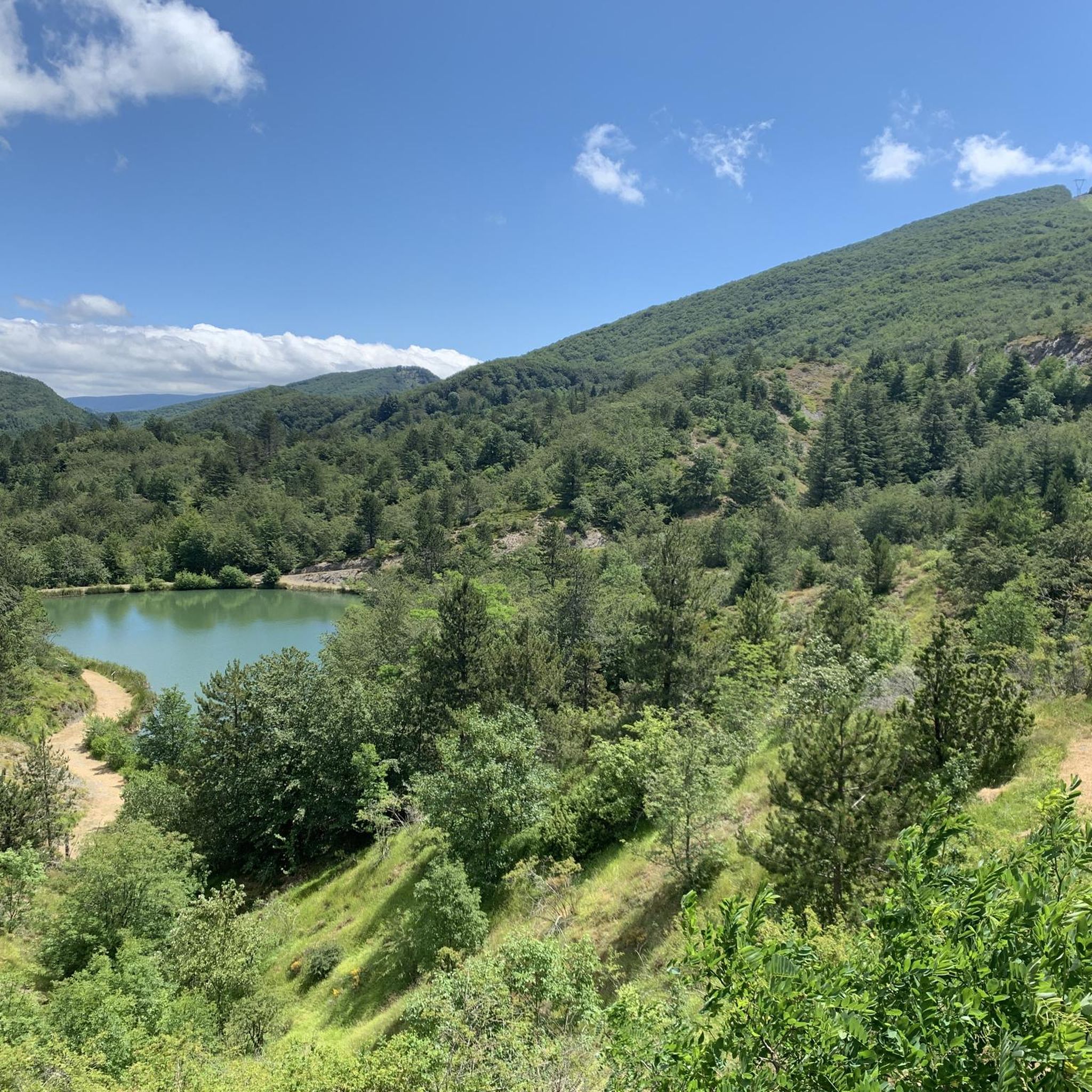
This loop tour offers a blend of natural beauty and historical intrigue within the Ligurian Apennines. You can discover historical landmarks like Poggio Buenos Aires, a picnic area with ties to 19th-century emigration, and the remains of the abandoned Colonia Devoto. Near the starting point, the small artificial Laghetto del Bocco provides a peaceful spot with a picnic area, adding to the diverse landscape of Val Graveglia, Val di Taro, Val di Vara, and Val Sturla.
4.9
(60)
158
hikers
7.00km
02:47
380m
370m
The A10 - Monte Zatta Loop offers a moderate hiking experience through the Ligurian Apennines. You will traverse cool beech woods, providing welcome shade as you ascend towards the Panoramic Ridge of Monte Zatta. From this vantage point, you can enjoy splendid views of the eastern Ligurian coast; on clear days, you might even spot Elba Island or Corsica in the distance. This rewarding loop covers 4.4 miles (7.0 km) with a total elevation gain of 1235 feet (376 metres). Expect to complete the hike in about 2 hours and 47 minutes, making it a perfect half-day adventure. The well-marked paths ensure a straightforward journey through diverse scenery.
To begin your hike, head to Passo del Bocco, a mountain pass that connects Liguria and Emilia Romagna. This is a convenient starting point, as you will find ample parking available there. The Rifugio Antonio Devoto is also located at the pass, offering a place to prepare or relax after your trek. Navigation along the route is made easy by clearly indicated and well-maintained paths. You will also find fresh water springs along the way, which are ideal for refilling your bottles during the hike.
This trail is situated within the beautiful Parco Naturale Regionale dell'Aveto, showcasing the natural splendor of the region. The diverse landscape, from shaded forests to open ridges, highlights the park's varied ecosystems. The Monte Zatta area is known for its unique geological features and rich biodiversity. Hiking here provides an excellent opportunity to immerse yourself in the natural environment of the Ligurian Apennines. It is a notable route for those seeking panoramic coastal views combined with a satisfying forest walk.

4.6
(5)
17
hikers
15.1km
05:50
920m
920m
Embark on a challenging hike along the Alta Via dei Monti Liguri, a difficult route spanning 9.4 miles (15.1 km). You will gain 3019 feet (920 metres) in elevation, requiring about 5 hours and 50 minutes to complete. The trail leads you through varied terrain, from dense forests to open ridges, offering a true mountain experience. As you approach Monte Zatta, the views open up, revealing expansive vistas across multiple valleys. This section provides a sense of accomplishment as you navigate its demanding ascents and descents.
To begin your hike, drive to Passo del Bocco, where you will find parking conveniently located near the starting point. The trail is clearly marked with the distinctive AV symbols, making navigation straightforward. Plan to start early in the day, especially given the trail's difficult rating and nearly six-hour duration. Always check local weather conditions before heading out, as mountain environments can change quickly.
This segment of the Alta Via dei Monti Liguri takes you through the Parco Naturale Regionale dell'Aveto, showcasing a rich natural landscape. You will traverse ancient trade routes that now offer a unique blend of history and wilderness. The route is part of a larger network of trails, highlighting why this region is a prime destination for mountain enthusiasts.
4.0
(2)
5
hikers
22.5km
09:41
1,340m
1,340m
Ridge hike through the Ligurian Apennines with 360-degree views from Alps to Corsica.
5.0
(1)
2
hikers
11.4km
05:35
900m
900m
Hike the difficult 7.1-mile Monte Zatta Loop in Aveto Natural Regional Park, gaining 2952 feet for panoramic views.
Get access to more routes and recommendations from other explorers.
Already have an account?
Our route recommendations are based on thousands of hikes, rides, and runs completed by other people on komoot.
Start today with a free account
Your next adventure awaits.

Other adventures around Mezzanego

Tips from the Community

Last part on asphalt but very beautiful
0
0

For almost the entire route you can enjoy a wonderful view of the Ligurian Sea
0
0

At this point you get a little lost, follow the A10 signs, turn right a little, climb slightly and, for Cima Zatta di Levante, take the path to the left of the post (see photo)
0
0
In the photo, on the right towards Colonia Devoto, central path that goes up to Cima di Levante. On the left the path ends.
0
0

The cross is located on the central peak of Monte Zatta
0
0

Mount Zatta is an imposing massif of the Ligurian Apennines, which forms part of the Apennine watershed between the Taro valley, the Graveglia valley and the Vara valley.
0
0
Mount Ramaceto (1,345 m a.s.l.) is located on the upper Via dei Monti Liguri. From its summit you can see Corsica. http://www.escursioniliguria.it/schede_monti/m_ramaceto.htm
1
0

Natural source, very good and very fresh.
0
0
Frequently Asked Questions
What is the general difficulty level of hiking in Mezzanego?
Hiking in Mezzanego primarily offers moderate to difficult routes. The terrain is characterized by the Ligurian Apennine foothills, featuring forested slopes, mountain passes, and prominent peaks like Monte Zatta and Monte Ramaceto. There are no easy routes listed among the top selections, so hikers should be prepared for elevation changes and varied conditions.
Are there easy hiking trails suitable for beginners in Mezzanego?
The top hiking routes in Mezzanego are generally rated as moderate to difficult, with no easy trails among the most popular selections. Hikers new to the area or those seeking less strenuous options should be aware that most trails involve significant elevation changes and varied terrain. It's advisable to check individual route details carefully on komoot for specific difficulty ratings.
Are there circular hiking routes available in Mezzanego?
Yes, Mezzanego offers several circular hiking routes. For example, the Passo del Bocco and Monte Zatta – loop tour is a popular option, providing a scenic loop around Monte Zatta. Another well-regarded circular path is the A10 - Monte Zatta Loop, which winds through forested areas and open sections.
What are the typical distances and durations for hikes in Mezzanego?
Hikes in Mezzanego vary in length and duration. Moderate routes, such as the Passo del Bocco and Monte Zatta – loop tour, are around 5.6 miles (8.9 km) and can take approximately 3 hours 22 minutes. More challenging routes, like the Alta Via dei Monti Liguri from Passo del Bocco to Monte Zatta, can extend to 9.4 miles (15.1 km) and require about 5 hours 50 minutes to complete.
Are the hiking trails in Mezzanego dog-friendly?
Many trails in the Mezzanego region are suitable for dogs, but it's always recommended to check specific route details on komoot for any restrictions or advice regarding pets. Given the varied terrain and potential for livestock in some areas, keeping dogs on a leash is generally a good practice. Always ensure your dog is well-behaved and capable of handling the moderate to difficult conditions.
Can I find family-friendly hiking options in Mezzanego?
While the top routes in Mezzanego are generally moderate to difficult, families with older children or those accustomed to hiking may find suitable options. The region's trails often involve significant elevation changes. For a family outing, consider shorter moderate loops and always assess the fitness level of all participants. It's best to review individual route descriptions on komoot for detailed information on terrain and difficulty.
What interesting landmarks or attractions can I see while hiking in Mezzanego?
The Mezzanego area offers several interesting landmarks and attractions. You can visit the Margherita Mountain Hut – Mount Pegge, or see the Statue of the Madonna on Monte Penna. Other notable sites include the Basilica Sanctuary of Our Lady of Montallegro and the Ruins of the Church of Sant'Anna. Many trails also offer panoramic views from summits like Monte Costello.
What is the best time of year to go hiking in Mezzanego?
The best time for hiking in Mezzanego is typically during spring (April-June) and autumn (September-October) when the weather is milder and the landscapes are vibrant. Summer can be hot, especially at lower elevations, while winter hikes are possible but may require appropriate gear for snow or ice, particularly on higher peaks like Monte Zatta and Monte Ramaceto.
Are there parking facilities available at the trailheads in Mezzanego?
Parking availability varies by trailhead in Mezzanego. Many popular starting points, especially near mountain passes or villages, offer designated parking areas. However, for some more remote trails, parking might be limited. It's always advisable to check the route description or local maps for specific parking information before you set out.
Are there cafes or places to eat along the hiking routes in Mezzanego?
While many trails in Mezzanego traverse natural, undeveloped areas, you might find small cafes or trattorias in villages near the trailheads or occasionally at mountain huts. For example, the Margherita Mountain Hut – Mount Pegge could offer refreshments. It's always recommended to carry sufficient water and snacks, especially on longer routes, as amenities can be sparse.
What should I wear or bring for hiking in Mezzanego?
Given the moderate to difficult terrain and elevation changes in Mezzanego, sturdy hiking boots with good ankle support are essential. Layered clothing is recommended to adapt to changing weather conditions, along with waterproof outer layers. Don't forget a backpack with water, snacks, a map or GPS device (like komoot), sun protection, and a first-aid kit. Trekking poles can also be beneficial on steeper sections.
What do other hikers enjoy the most about hiking in Mezzanego?
The hiking experience in Mezzanego is highly rated by the komoot community, with an average score of 4.5 stars from over 1,000 reviews. Hikers often praise the diverse landscape, including forested slopes and panoramic views from peaks like Monte Zatta. The challenging yet rewarding nature of the trails and the opportunity to explore the Ligurian Apennine foothills are frequently highlighted.
Most popular routes around Mezzanego
Most popular attractions around Mezzanego

Get inspired with the komoot mobile app


Explore more
Browse the best Hikes in other regions.
