The best mountain hikes around Zoppè Di Cadore
4.8
(37)
267
hikers
13
hikes
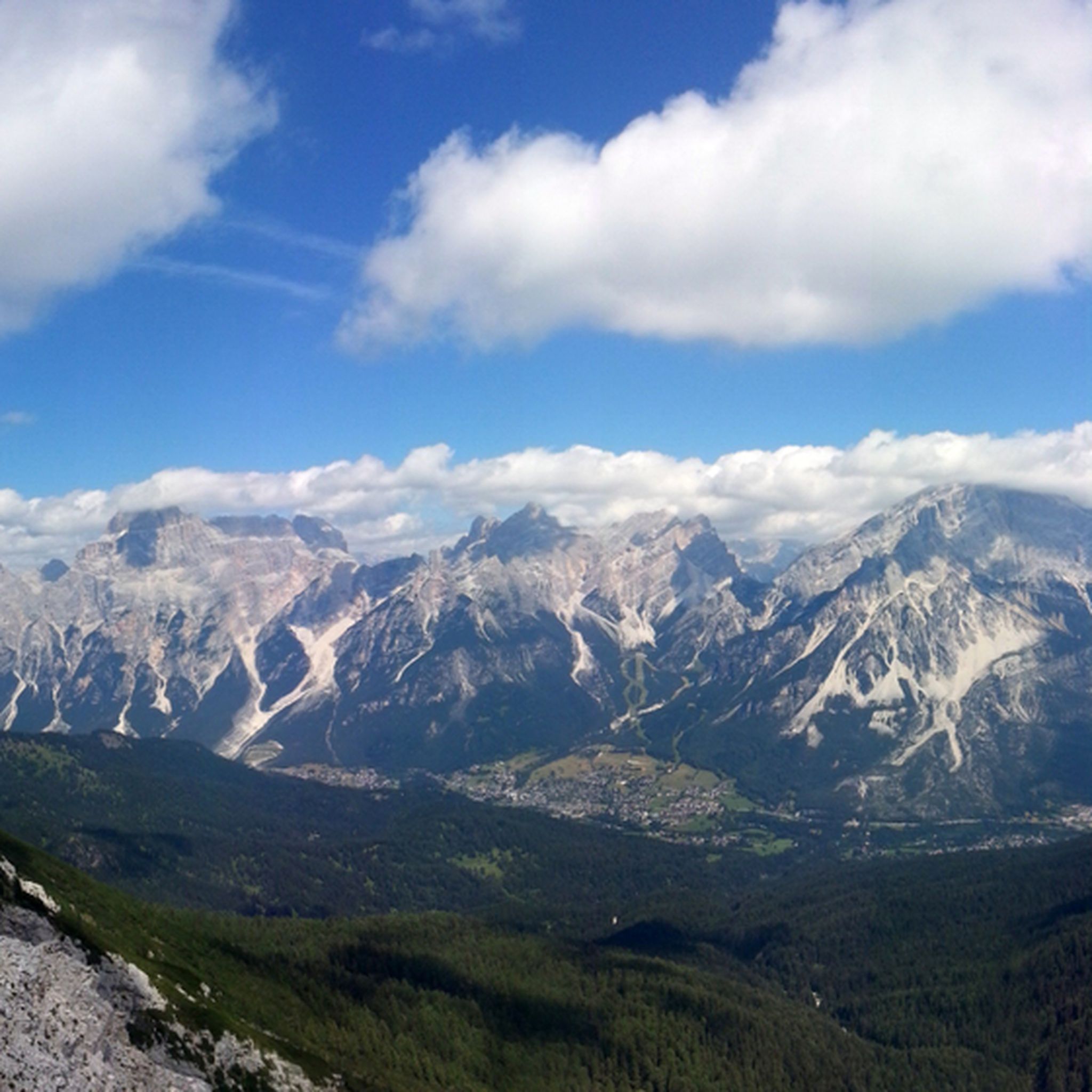
Mountaineering routes around Zoppè Di Cadore are situated in the Belluno region of the Italian Dolomites, characterized by dramatic peaks and diverse natural features. The area is dominated by the majestic Monte Pelmo, a 3,168-meter peak, alongside other significant Dolomite formations. The terrain includes challenging ascents, alpine valleys, and geological formations, offering a range of experiences for experienced mountaineers. This region is part of the Dolomites World Heritage Geotrail, showcasing millions of years of mountain history.
Best mountaineering routes around…
Last updated: October 8, 2026
4.6
(5)
38
hikers
15.8km
06:37
950m
950m
Hard mountaineering route. Very good fitness required. Sure-footedness, sturdy shoes and alpine experience required.
5.0
(3)
29
hikers
13.2km
06:26
840m
840m
Hard mountaineering route. Very good fitness required. Sure-footedness, sturdy shoes and alpine experience required.

4.5
(2)
14
hikers
11.4km
08:57
1,530m
1,530m
Hard mountaineering route. Very good fitness required. Sure-footedness, sturdy shoes and alpine experience required.
5.0
(1)
19
hikers
9.20km
07:15
1,260m
1,260m
Hard mountaineering route. Very good fitness required. Sure-footedness, sturdy shoes and alpine experience required.
4.7
(3)
19
hikers
15.5km
07:03
1,130m
1,130m
Hard mountaineering route. Very good fitness required. Sure-footedness, sturdy shoes and alpine experience required.
Get access to more routes and recommendations from other explorers.
Already have an account?
Our route recommendations are based on thousands of hikes, rides, and runs completed by other people on komoot.
Start today with a free account
Your next adventure awaits.

Tips from the Community

Yesterday we circumnavigated Monte Pelmo. The first part to the saddle on the north side is very borderline due to erosion. The rest goes to the saddle. The south side is also borderline because it is completely washed out. Paths sometimes difficult. Only for absolutely sure-footed, experienced people. Not a hiking trail, more like T4
0
0

Trail closed due to landslides after the Città di Fiume refuge.
0
0

Forcella di Val d'Arcia, descent towards Rif. Venezia challenging in the first section
0
0

The Ferrata Tissi is often descended in conjunction with the descent via the normal route from Civetta, for example after first climbing to Civetta via the Ferrata Alleghesi. It is classified as C/D, which is slightly more difficult than the Ferrata Alleghesi (C) and is more pleasant to descend than to ascend, as you can go a lot on friction. In addition, you have a longer scree field on the descent, which you would otherwise have to overcome laboriously on the ascent. But of course, you could also ascend the Tissi. Between the start of the via ferrata and the rest, there is usually a snowfield to cross.
0
0
Very beautiful hike, demanding exposed passages++ and very steep. anti-clockwise recommended from the pass. Stolenza despite everything, the ascent from the Venezia refuge to Val d'arcia is barely secured. Only one cable, to get out of the first pass, no rope afterwards on passages along the wall, passages on a single foot width... for experienced mountaineers!
0
0

A tough pass to reach, even more so in winter than in summer. Getting there, as usual, is worth the effort. To find out why, you have to go there.
0
0

The Staulanza Pass (1,766 m above sea level) is a Dolomite mountain pass located between the slopes of Mount Crot (Civetta Group) and those of Pelmetto (Pelmo Massif). It belongs to the municipality of Val di Zoldo, near the borders with Selva di Cadore and Borca di Cadore. It is crossed by the SP 251 road, which connects the Val di Zoldo with the Val Fiorentina. The Staulanza refuge stands at the pass. The pass is a convenient starting point for hikes around Pelmo, Civetta, and Croda da Lago.
1
0

I recommend staying overnight at the refuge and waking up early to see the sunrise
2
0
Frequently Asked Questions
What types of mountaineering routes are available around Zoppè Di Cadore?
Zoppè Di Cadore offers a diverse range of mountaineering routes, with 17 options available. You'll find 7 moderate routes, ideal for those with good fitness, and 10 difficult routes for experienced mountaineers seeking a challenge. The terrain features dramatic peaks, alpine valleys, and significant geological formations.
Are there any challenging mountaineering routes for experienced climbers?
Yes, Zoppè Di Cadore is known for its challenging ascents. For experienced mountaineers, the Monte Civetta Summit – Monte Civetta Summit loop from Malga Grava is a demanding 11.3 km route with over 1,500 meters of elevation gain, requiring very good fitness and alpine experience. Another difficult option is the Forcella Val d'Arcia (2,474 m) – Rifugio Venezia loop from Passo Staulanza, offering high alpine terrain and stunning views.
Are there any moderate mountaineering routes suitable for those with good fitness?
Absolutely. If you have good fitness but prefer a less extreme challenge, consider the Lake Coldai loop from Palafavera. This 11.4 km route features a 690-meter elevation gain and leads to the beautiful glacial Lake Coldai, known for its unique green color.
What natural landmarks or viewpoints can I expect to see on mountaineering routes in Zoppè Di Cadore?
Mountaineering routes in this region offer breathtaking views of iconic Dolomite peaks such as Monte Pelmo, Monte Civetta, Monte Antelao, and Monte Cristallo. You can also discover the stunning Lake Coldai, a glacial alpine lake, and high mountain passes like Forcella Val d'Arcia and Forcella Ambrizzola, which provide expansive panoramic vistas.
Are there mountain huts along the mountaineering routes for rest or overnight stays?
Yes, several mountain huts are accessible from Zoppè Di Cadore, providing essential rest stops and accommodation. Notable huts include the historic Venezia Hut at the foot of Monte Pelmo, the Città di Fiume Hut, and the Attilio Tissi Hut. These refuges are vital for multi-day treks and offer a chance to experience traditional alpine hospitality.
What do other mountaineers enjoy most about mountaineering in Zoppè Di Cadore?
The mountaineering routes in Zoppè Di Cadore are highly rated by the komoot community, with an average score of 4.7 stars from over 30 reviews. Mountaineers frequently praise the dramatic peaks, the diverse terrain, and the stunning panoramic views of the Dolomites, particularly those of Monte Pelmo and Monte Civetta.
Are there any circular mountaineering routes in the area?
Yes, many routes are designed as loops, allowing you to start and end in the same location. Examples include the challenging Monte Civetta Summit – Monte Civetta Summit loop from Malga Grava and the moderate Lake Coldai loop from Palafavera. These circular routes offer varied scenery without retracing your steps.
Is Zoppè Di Cadore suitable for family-friendly mountaineering or hiking?
While many mountaineering routes are challenging, the broader Zoppè Di Cadore region offers easily accessible paths suitable for families and those seeking less strenuous options. These trails often start directly from the village and provide a gentler introduction to the Dolomite landscape.
Can I bring my dog on the mountaineering trails in Zoppè Di Cadore?
Many trails in the Dolomites are dog-friendly, but it's crucial to keep dogs on a leash, especially in protected areas or near grazing livestock. Always check specific trail regulations and be mindful of other hikers and wildlife. Ensure your dog is fit enough for the chosen route and carry enough water for both of you.
What is the best time of year for mountaineering in Zoppè Di Cadore?
The best time for mountaineering in Zoppè Di Cadore is typically from late spring to early autumn (June to September) when the weather is most stable, and trails are clear of snow. During winter, many of these paths transform into ideal routes for snowshoeing and cross-country skiing, offering a different kind of alpine experience.
Where can I find parking for mountaineering routes near Zoppè Di Cadore?
Parking is generally available at common starting points for routes, such as Palafavera or near mountain passes like Passo Staulanza. It's advisable to arrive early during peak season to secure a spot. Always check local signage for any parking restrictions or fees.
Are there any unique ecosystems or naturalistic areas to observe?
Yes, the region boasts areas of significant naturalistic value, such as the "Complex of Serla." Here, you can find peat bogs and wetlands with a rich variety of plant species, fed by small springs. The landscape is characterized by an alternation of open spaces, meadows, and sparse woodland, with calcareous boulders and the dark green of Dwarf Mountain pine contrasting with white limestone.
Most popular attractions around Zoppè Di Cadore

Get inspired with the komoot mobile app


Explore more
Browse the best Mountain Hikes & Routes in other regions.
