The best running trails around Cottingwith
3.9
(12)
2,141
runners
155
runs
Jogging around Cottingwith offers access to a generally flat landscape, characterized by significant waterways and diverse nature reserves in the East Riding of Yorkshire. The area is situated on the edge of the Lower Derwent Valley National Nature Reserve, featuring flood meadows, pastures, and woodlands. The River Derwent and the Pocklington Canal provide distinctive corridors for running, with well-maintained towpaths and quiet country lanes. This terrain is suitable for various fitness levels, offering peaceful running experiences amidst natural surroundings.
Best…
Last updated: August 18, 2026
4.0
(1)
17
runners
8.03km
00:55
10m
10m
Moderate run. Good fitness required. Mostly paved surfaces. Suitable for all skill levels.
19
runners
8.59km
00:53
20m
20m
Moderate run. Good fitness required. Mostly paved surfaces. Suitable for all skill levels.

Sign up for free
11
runners
17.4km
01:59
30m
30m
Hard run. Very good fitness required. Mostly paved surfaces. Suitable for all skill levels.
8
runners
6.46km
00:41
10m
10m
Moderate run. Good fitness required. Mostly paved surfaces. Suitable for all skill levels.
9
runners
8.46km
00:52
10m
10m
Moderate run. Good fitness required. Mostly paved surfaces. Suitable for all skill levels.
Get access to more routes and recommendations from other explorers.
Sign up for free
Already have an account?
Our route recommendations are based on thousands of hikes, rides, and runs completed by other people on komoot.
Start today with a free account
Your next adventure awaits.
Login or Signup
Tips from the Community

Cracking woods located up a 1.5-mile backroad out of Wheldrake. Nice and quiet, dominated by Corsican pine, Scots pine, larch, and patches of spruce and fir, interspersed with oak and birch stands, and flowering rhododendron bushes in May. Apparently also home to a giant sequoia, which I missed when I trotted around it, so will need to go back for another look...
0
0
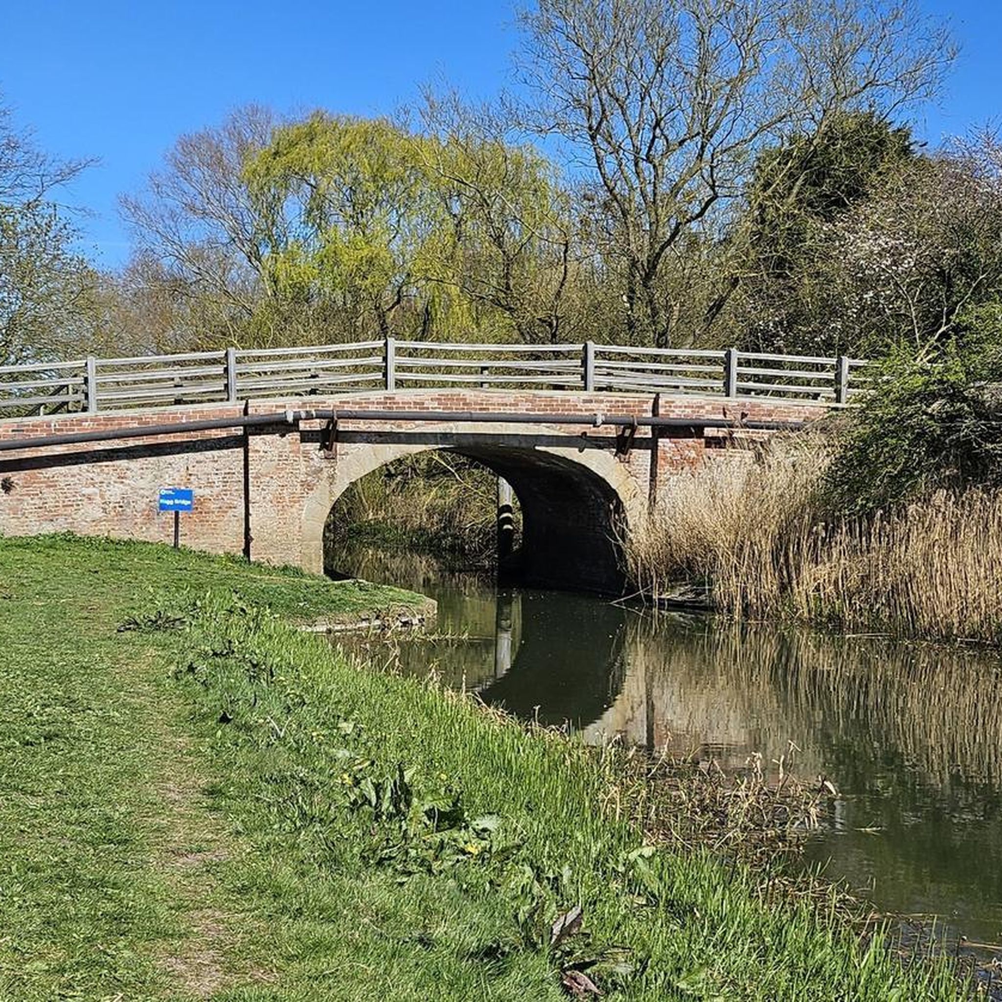
Links the village of Bielby to the road running between Melbourne and Allerthorpe. The disused Coat's Lock is immediately adjacent just to the north of the bridge, and the bridge was Grade II listed in 2010.
1
0
No longer used for mooring, the Bielby Arm marks the eastern limit of the canal's navigation. You can walk north to Coats Bridge on either side of the canal from the Bielby Arm.
2
0
Walbut Bridge carries the road from Melbourne to Allerthorpe, and Walbut Lock is immediately adjacent to the bridge.
1
0
Lock just 250m east of Church Bridge where there is some off-road parking. Grade II listed since 1987 and was restored along with Walbut Lock to create another 2 miles of navigable canal.
1
0
Carries Church Road which runs from Melbourne to Thornton. Grade II listed since 1987.
1
0
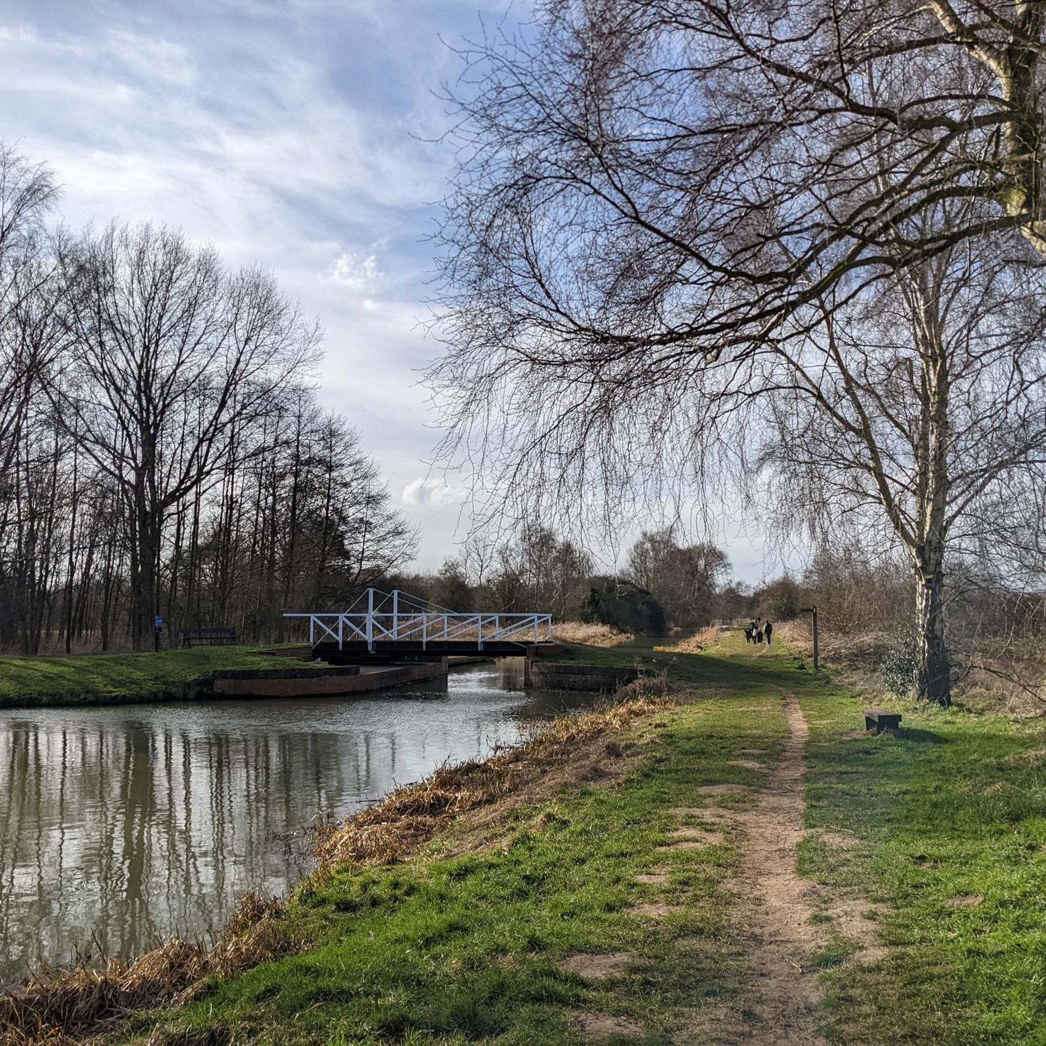
Swingbridge No. 7 and mooring for up to 11 boats moored against finger pontoons. There is a path that leads into the the village, emerging right next to the Melbourne Arms pub.
1
0
Pivots on the south bank of the canal, and the brick walls on the south bank and east side of the bridge make for a useful rest area as there are no other benches nearby.
1
0
Frequently Asked Questions
How many running routes are available in Cottingwith?
Cottingwith and its surrounding area offer a wide variety of running options, with over 150 routes available. These range from easy jogs to more challenging distances, ensuring there's something for every runner.
What are the typical difficulty levels for running trails in Cottingwith?
The running trails around Cottingwith cater to various fitness levels. You'll find a good selection of easy routes, over 100 moderate trails, and around 40 more difficult paths, providing options for beginners and experienced runners alike.
What kind of scenery can I expect on a run in Cottingwith?
Jogging in Cottingwith offers picturesque rural landscapes, characterized by significant waterways and diverse nature reserves. You can expect to run alongside the River Derwent and the Pocklington Canal, through flood meadows, pastures, and woodlands, especially within the Lower Derwent Valley NNR loop from Cottingwith. The area is known for its peaceful atmosphere and abundant wildlife.
Are there any easy running routes suitable for beginners or a relaxed jog?
Yes, Cottingwith's generally flat terrain makes it ideal for easy and relaxed runs. Many of the towpaths along the Pocklington Canal, for instance, are flat and wide. While specific easy routes are plentiful, you can explore options like the Allerthorpe Common loop from Thornton for a moderate yet accessible experience.
Can I find longer running routes in the Cottingwith area?
Absolutely. For those seeking a longer run, the area offers several options. A notable challenging route is the Pocklington Canal – Church Bridge loop from Thornton, which spans over 17 kilometers and follows the scenic canal, providing a flat yet engaging surface for an extended workout.
Are there circular running routes around Cottingwith?
Many of the running routes in Cottingwith are designed as loops, allowing you to start and finish in the same location. Examples include the Lower Derwent Valley NNR loop from Cottingwith and the Wheldrake Wood loop from Wheldrake, which are popular choices among local runners.
Are the running routes in Cottingwith dog-friendly?
Many of the rural paths, towpaths, and trails through woodlands and nature reserves around Cottingwith are suitable for running with dogs. However, always ensure your dog is under control, especially in areas with livestock or sensitive wildlife habitats like the Lower Derwent Valley National Nature Reserve. Check local signage for specific restrictions.
Are there family-friendly running trails in Cottingwith?
Yes, the flat and peaceful nature of many trails, particularly along the Pocklington Canal and through areas like Allerthorpe Common, makes them suitable for family runs. These routes often provide a safe and enjoyable environment for all ages to experience the outdoors together.
What interesting sights or landmarks can I see while running in Cottingwith?
While jogging, you can encounter several points of interest. The Pocklington Canal itself is a historical feature. You might also pass by the RAF Riccall Bomber Memorial at Skipwith Common or the Ancient Oak Trees of South Moor Field, Skipwith Common. The area's natural beauty, including the Lower Derwent Valley National Nature Reserve, is a highlight in itself.
What do other runners say about the trails in Cottingwith?
The running routes in Cottingwith are highly rated by the komoot community, with an average score of 3.75 stars from over 9 reviews. Runners often praise the peaceful, flat nature of the trails, the scenic waterways, and the diverse natural environments found within the nature reserves, making for an enjoyable outdoor experience.
Is parking available near the running trails in Cottingwith?
While specific parking details vary by starting point, many popular trailheads and access points in and around Cottingwith, especially near villages or nature reserve entrances, offer designated parking areas. It's advisable to check specific route descriptions for the most accurate parking information.
How can I get to the running trails using public transport?
Public transport options to Cottingwith and nearby trail access points may be limited due to its rural location. Local bus services might connect Cottingwith to larger towns like Pocklington or York, from where you could potentially access some trailheads. Planning your journey in advance using local bus timetables is recommended.
Are there running routes that go through nature reserves?
Yes, Cottingwith is ideally situated for runs through significant nature reserves. The Lower Derwent Valley NNR loop from Cottingwith takes you directly into this biodiverse area. Additionally, nearby Skipwith Common and Allerthorpe Common Nature Reserve offer varied paths through unique habitats.
Most popular attractions around Cottingwith

Get inspired with the komoot mobile app


Explore more
Browse the best Running Trails & Routes in other regions.
