The 17 Most Amazing Peaks around Tullybranigan
Mountain peaks around Tullybranigan are situated within the scenic Mourne Mountains in County Down, Northern Ireland. This region provides access to notable peaks and dramatic landscapes. The area offers a mix of woodland, open mountain, and distant vistas, with views stretching from Belfast to the Isle of Man. The terrain includes varied routes from moderate to strenuous, appealing to different fitness levels.
Best mountain peaks around Tullybranigan
- The most popular mountain peaks is Summit of Slieve Donard, a natural…
Last updated: October 4, 2026
Slieve Commedagh Summit
Highlight • Summit
Tip by

Slieve Binnian summit
Highlight • Summit
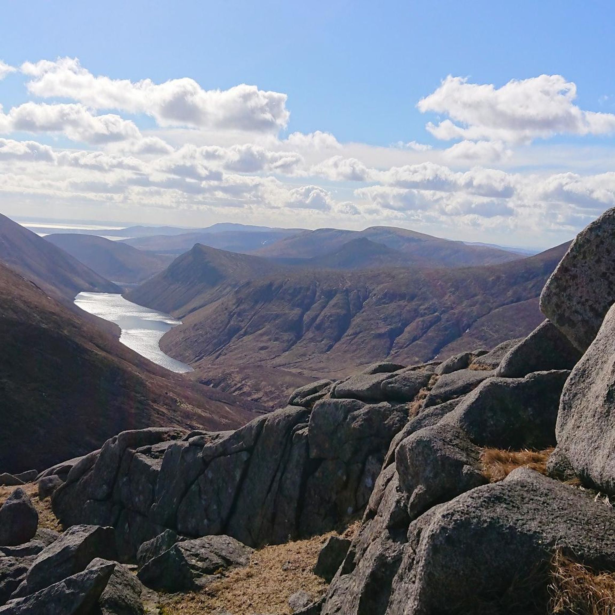
Fantastic views down to silent valley reservoir and south towards Carlingford.
As with any hill walking - be prepared for a change in weather and have good footwear. Enjoy
Tip by

Sign up now to discover places like this
Get recommendations on the best single tracks, peaks, & plenty of other exciting outdoor places.
Slieve Doan
Highlight • Climb
Tip by

Slieve Meelmore summit shelter
Highlight • Historical Site
Tip by

View of the Mourne Mountains
Highlight • Natural Monument
Translated by Google •
Tip by

Sign up for free to discover even more peaks around Tullybranigan.
Already have an account?
Start today with a free account
Your next adventure awaits.
Tips from the Community

Slieve Binnian is absolute magic. Standing as the third-highest peak in Northern Ireland (747 meters), it easily claims the title for the most dramatic silhouette in the Mournes, thanks to the massive, weathered granite towers—called tors—that guard its summit. https://www.expresstollpass.com
0
0

Starting from Carrick Little Car Park, the hiking path to Slieve Binnian offers a rewarding journey through the heart of the Mourne Mountains. This moderate to challenging loop, approximately 11.2 km in length, follows the Mourne Wall, a historic dry-stone structure built in the early 1900s, guiding hikers toward the summit of Slieve Binnian (747 m). The ascent is steady, with a mix of rocky terrain and scenic views. As you approach the summit, the path becomes more rugged, leading to the iconic South and North Tors. From the summit, panoramic vistas unfold, offering breathtaking views of the Silent Valley and the surrounding peaks.
1
0
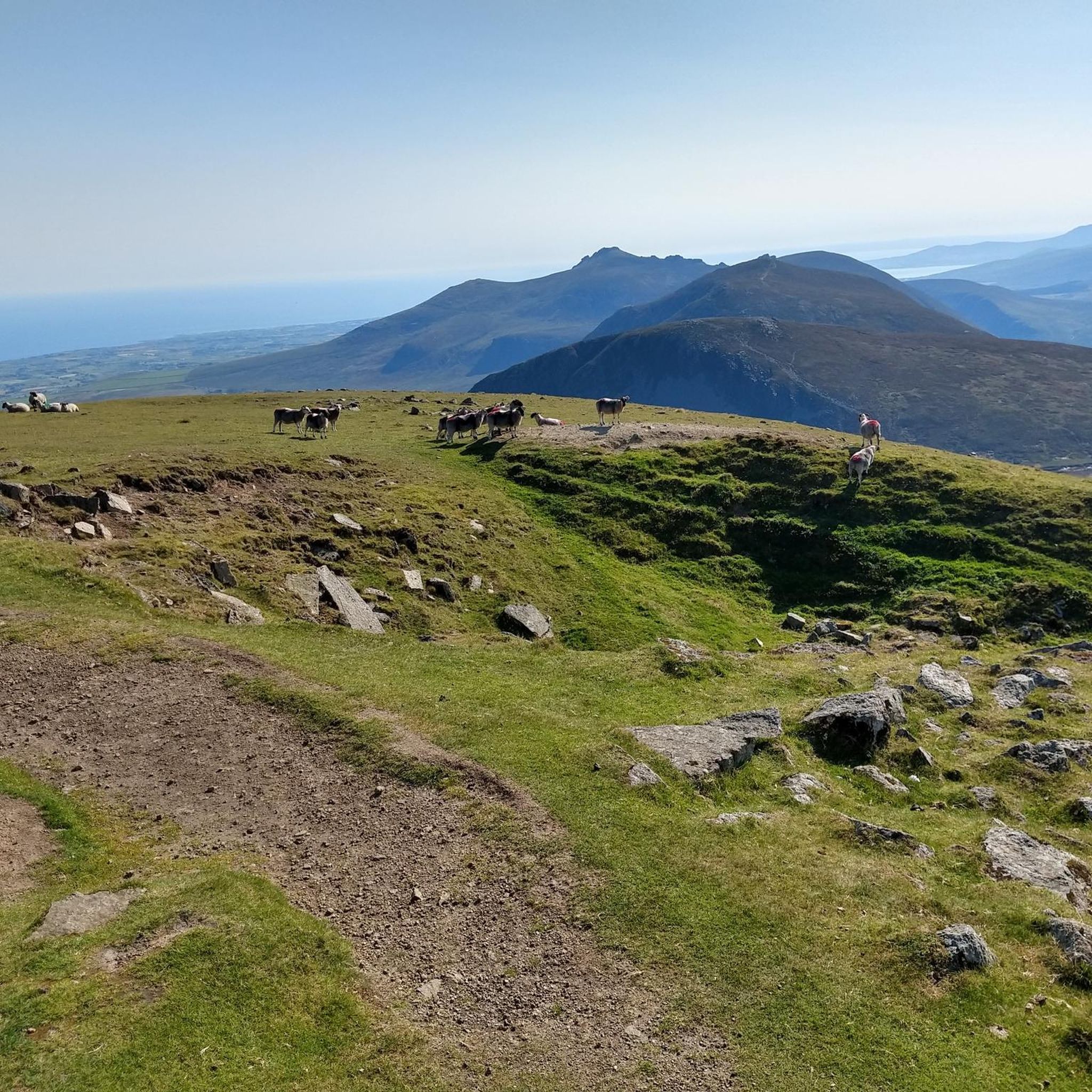
Slieve Commedagh, at 767 meters, is the second-highest peak in the Mourne Mountains and a rewarding climb for any hiker. Its summit offers sweeping views across the Mournes and out to the Irish Sea, a reminder of how close these mountains sit to the coast. The ascent is steep and demanding, often over pathless ground, but never overly technical in good weather. You can climb it on its own or link it with nearby peaks such as Slieve Donard, making for a truly memorable day in the heart of the Mournes.
3
0
On the summit of Slieve Meelmore stands a small stone shelter, a welcome spot to rest after the steady climb up. From here, the views stretch across the Mournes, with Slieve Bearnagh’s rocky tors dominating the skyline. The shelter gives hikers a place to pause, shielded from the wind, and enjoy the sweeping mountain scenery before continuing along the Mourne Wall.
3
0

Not a particularly high mountain but possibly the best 360 degree view in the Mournes!
0
0
One of the very best mountains in the Mournes! Not a huge climb but incredible views in every direction!
1
0
Frequently Asked Questions
What are some of the most popular mountain peaks to explore around Tullybranigan?
The region around Tullybranigan, nestled within the Mourne Mountains, offers several impressive peaks. Summit of Slieve Donard is Northern Ireland's highest peak, offering panoramic views. Other popular choices include Slieve Bearnagh, known for its rocky tors and challenging climb, and Slieve Binnian, recognized for its distinctive granite features. The View of the Mourne Mountains highlight provides a stunning perspective of peaks like Slieve Binnian, Slieve Lamagan, and Rocky Mountain.
What kind of terrain and difficulty can I expect when hiking in the Mourne Mountains near Tullybranigan?
The Mourne Mountains offer a range of terrain from moderate to strenuous. You can expect steep and rugged paths, with various natural obstacles. More challenging routes, such as the ascent to Slieve Commedagh which passes over Tullybrannigan, require navigation skills and mountain walking experience. Peaks like Slieve Donard and Slieve Bearnagh involve significant elevation gain and rocky sections, sometimes requiring scrambling.
Are there any significant landmarks or natural features to look out for on the mountain peaks?
Yes, a prominent landmark is The Mourne Wall, a 31 km dry-stone wall that snakes over many of the principal summits, including Slieve Donard and Slieve Bearnagh. This historic structure offers a unique element to many hikes. You'll also find distinctive granite tors on peaks like Slieve Binnian and rocky outcrops on Slieve Bearnagh. The summits themselves often feature cairns and offer expansive viewpoints.
What historical or cultural sites can be found on the mountain peaks around Tullybranigan?
The most significant historical feature is The Mourne Wall, a man-made monument built over nearly 20 years to enclose the Silent Valley Reservoir catchment area. On the summit of Slieve Meelmore, you can find a small stone shelter and evidence of old stonemasons' activity, suggesting it was a site for gathering materials for the wall. The summit of Slieve Donard also features the remains of two burial cairns alongside a stone tower.
What are the best times to visit the mountain peaks in the Mournes for hiking?
The Mourne Mountains are generally accessible year-round, but the best time to visit for hiking is typically during spring, summer, and early autumn when the weather is milder and days are longer. Clear days offer the most spectacular views, which can stretch from Belfast and Strangford Loughs to the Isle of Man. Winter hiking is possible but requires appropriate gear and experience due to potentially harsh conditions, including snow, ice, and strong winds.
Are there family-friendly hiking options among the mountain peaks near Tullybranigan?
While many of the major peaks in the Mournes, such as Slieve Donard and Slieve Bearnagh, are considered challenging, there are more moderate routes available in the broader Mourne Mountains area. For family-friendly options, look for trails that are less steep and shorter in duration. It's advisable to research specific routes for their suitability for children and to check current weather conditions before setting out.
What outdoor activities, besides hiking, can I do near the mountain peaks around Tullybranigan?
Beyond hiking, the area around Tullybranigan offers various outdoor activities. You can explore mountain biking trails, with options ranging from easy to moderate, such as the Castlewellan Lake – Bunkers Hill loop. Road cycling is also popular, with routes like the Spelga Reservoir loop offering scenic rides. For general cycling, you can find routes like the St John's Point Lighthouse loop.
What kind of views can I expect from the summits in the Mourne Mountains?
The summits in the Mourne Mountains offer spectacular panoramic views. From Slieve Donard, on a clear day, you can see the Isle of Man, Anglesey, and the West Coast of Scotland. From Slieve Commedagh, after traversing peaks like Tullybrannigan, the vista can include Newcastle, Murlough, the coastline, and even as far as Belfast or Strangford Lough. The View of the Mourne Mountains highlight itself promises phenomenal scenery.
Are there any specific tips for navigating the mountain peaks, especially for challenging routes?
For challenging routes in the Mourne Mountains, such as those involving Slieve Bearnagh or Slieve Donard, strong navigation skills are essential. The terrain can be steep and rugged, with various natural obstacles. It's recommended to carry a map and compass or a reliable GPS device, and to have mountain walking experience. The Mourne Wall can serve as a useful guide along many ridge walks, but always be prepared for changing weather conditions.
What do visitors enjoy most about the mountain peaks around Tullybranigan?
Visitors consistently praise the spectacular scenery and dramatic landscapes of the Mourne Mountains. The challenging yet rewarding walks, such as those taking in Slieve Donard and Slieve Bearnagh, are a major draw. The unique presence of The Mourne Wall adds a distinctive character to the hikes. Many appreciate the sense of immersion in nature and the inspiring views from the summits, making it a truly memorable experience.
Can I find wild camping opportunities in the Mourne Mountains near Tullybranigan?
Yes, the Mourne Mountains are a popular destination for wild camping. This allows visitors to fully immerse themselves in the natural environment and enjoy summit or valley camps. However, it's important to practice Leave No Trace principles, be respectful of the environment, and be aware of any local regulations or restrictions regarding wild camping.
Are there any specific geological features of interest in the Mourne Mountains?
The Mourne Mountains are rich in geological history, notably for their Mourne Granite. This granite has been used in famous structures worldwide. Visitors can explore areas like the Granite Trail to learn more about the region's quarrying heritage. Peaks like Slieve Binnian are known for their distinctive granite tors, showcasing the unique geology of the area.
Most popular attractions around Tullybranigan

Get inspired with the komoot mobile app


Explore more
See even more amazing summits around Tullybranigan with these guides:
