The best running trails around Großweil
4.5
(924)
15,140
runners
31
runs
Jogging routes around Großweil offer diverse terrain in the Bavarian Alps region. The area features a landscape of green meadows, lush forests, and clear lakes, providing varied running opportunities. The Loisach River flows through the community, offering accessible riverside paths. Expansive moorland and alpine meadows also contribute to the natural features suitable for running.
Best jogging routes around Großweil
- The most popular jogging route is Wooden Path in Upper Bavaria loop from Kleinweil, a 12.0 miles (19.3 km) trail…
Last updated: September 28, 2026
5.0
(4)
37
runners
19.7km
02:25
750m
750m
Hard run. Very good fitness required. Sure-footedness, sturdy shoes and alpine experience required.
1.0
(1)
37
runners
18.0km
01:55
30m
30m
Hard run. Very good fitness required. Mostly paved surfaces. Suitable for all skill levels.

15
runners
8.69km
01:01
200m
200m
Moderate run. Good fitness required. Mostly paved surfaces. Suitable for all skill levels.
13
runners
13.0km
01:28
300m
300m
Moderate run. Good fitness required. Mostly paved surfaces. Suitable for all skill levels.
14
runners
24.3km
02:42
250m
250m
Hard run. Very good fitness required. Sure-footedness, sturdy shoes and alpine experience required.
Get access to more routes and recommendations from other explorers.
Already have an account?
Our route recommendations are based on thousands of hikes, rides, and runs completed by other people on komoot.
Start today with a free account
Your next adventure awaits.
Tips from the Community

From Kochelsee to its mouth in the Isar It leaves the lake on its northern edge west of Kochel, passes Benediktbeuern and Penzberg and there definitively leaves the northern foothills of the Bavarian Alps. It still flows through Eurasburg and flows into the Isar north of Wolfratshausen in the Auwald Pupplinger Au. Source https://de.wikipedia.org/wiki/Loisach
2
0
From the source to the Bavarian border The Loisach rises in the state of Tyrol between the Lechtal Alps in the west and the Mieminger Mountains in the east, below and northeast of the Fern Pass. Its sources are located in the municipality of Biberwier, near the Mittersee lake, close to the B 179. From there, its water flows northwards through the Ehrwalder Becken and then along the B 187 through Ehrwald and westwards past the Zugspitze to the German border. From Garmisch-Partenkirchen to Kochelsee On the Bavarian side, it first passes Griesen in a northeasterly direction and then flows past Grainau to Garmisch, the largest district of Garmisch-Partenkirchen. Afterwards, it continues north between the Ammergau Alps in the west and the Estergebirge in the east. Via Farchant, Oberau and Eschenlohe, as well as past Ohlstadt and Murnau, the Loisach reaches Großweil, where it turns southeast and flows into the western part of Kochelsee near Schlehdorf, north of the Herzogstand. Source https://de.wikipedia.org/wiki/Loisach
3
0
The name is based on the Indo-Germanic root *leubʰ, meaning 'dear'. It is derived with an s as a suffix. The name refers to the pleasant course of the river.[3] Earlier name forms are Liubasa (1003), Lyubasa (ca. 1052), Liubisaha (1148–1155), Livbisaha (12th century), Liubsaha (1258), Leusach (1332), Leusach (1348), Lewsach (1424), Loysach (1536) and finally Loisach in 1553.[4] Source https://de.wikipedia.org/wiki/Loisach
3
0
The Loisach is a 113.2 km[1] long, south-southwesterly and left tributary of the Isar in Austria and Germany. It originates north of the Fern Pass in Tyrol and flows into the Isar after a northeasterly course near the Bavarian town of Wolfratshausen. Source https://de.wikipedia.org/wiki/Loisach
3
0

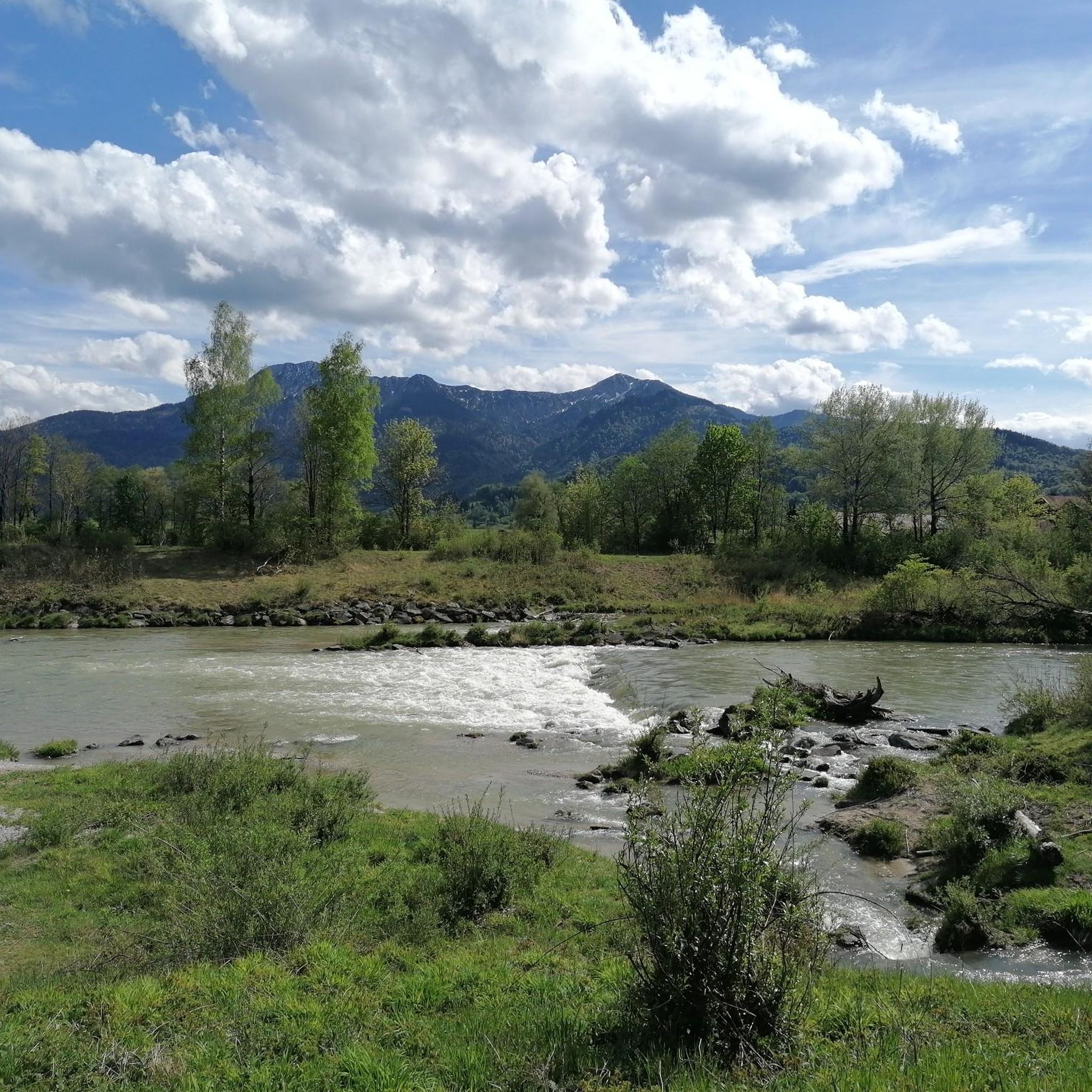
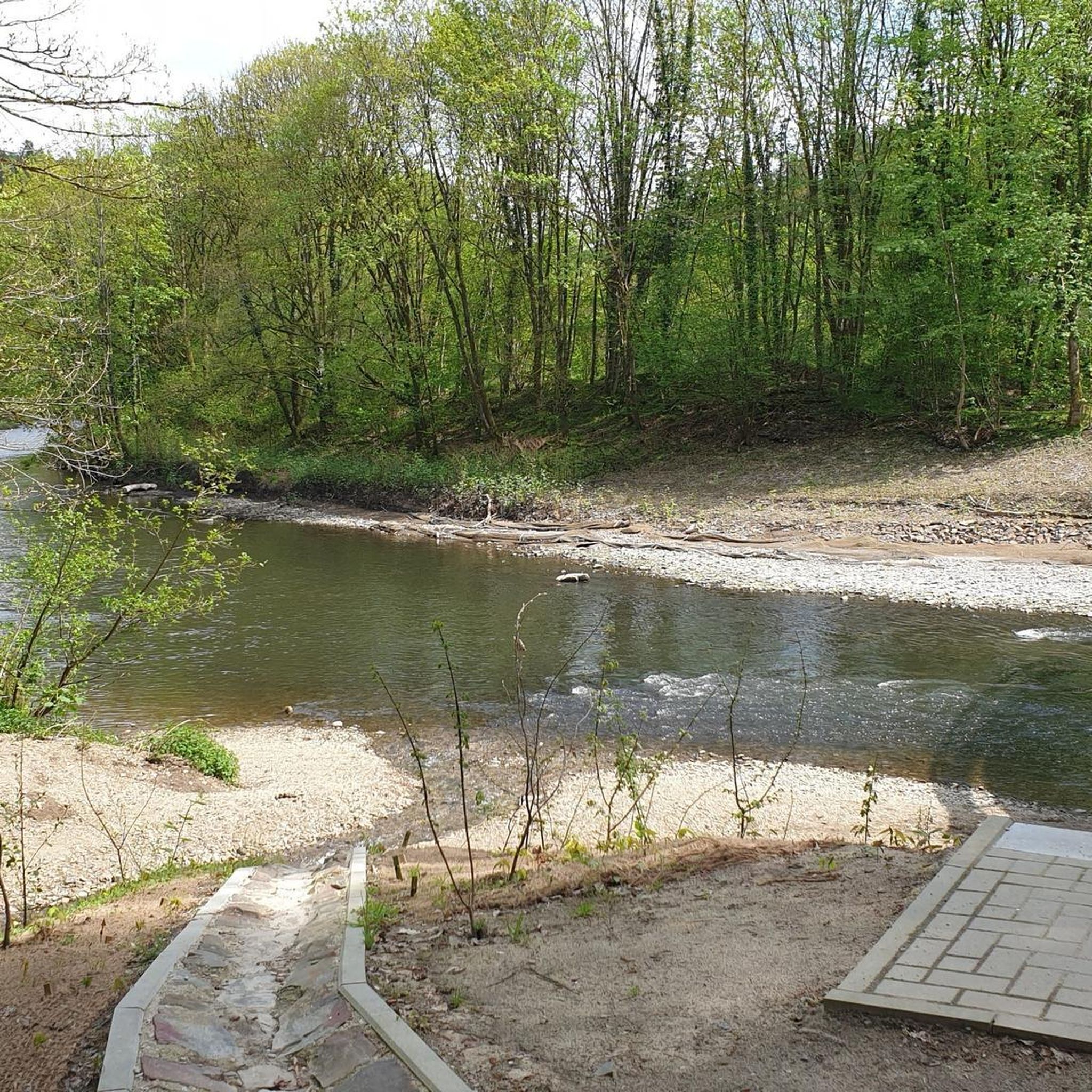
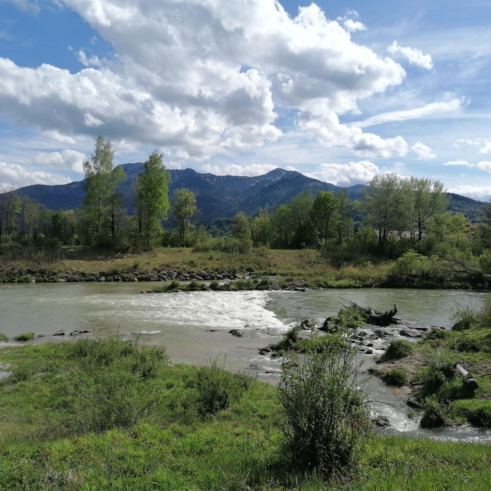
Completely clear water, invites you to swim!
0
0

The only and natural outflow of Kochelsee is the river Loisach. It leaves the lake in the northeast at Kochel am See, after having previously flowed into the lake on the west side (near Schlehdorf), and flows from there further north.
15
0

With luck and patience you can see kingfishers
0
0

The outflow of Lake Kochel is worth seeing even in thunderstorms
1
0
Frequently Asked Questions
How many running routes are available in Großweil?
There are over 20 running routes around Großweil, offering a variety of experiences. These include 6 easy routes, 13 moderate routes, and 3 more challenging options for experienced runners.
What kind of natural landscapes can I expect to see while jogging in Großweil?
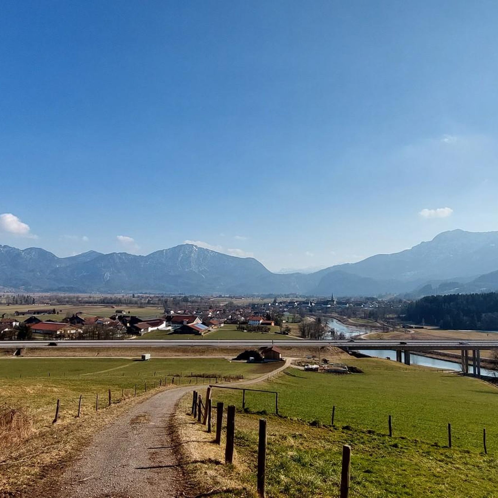
Großweil, nestled in the Bavarian Alps, offers a diverse and picturesque landscape for running. You'll find routes through green meadows, lush forests, and expansive moorland. The region is also characterized by numerous clear lakes like Staffelsee, Froschhauser See, Riegsee, Eichsee, and Kochelsee, as well as paths along the Loisach River.
Are there easy running routes for beginners in Großweil?
Yes, Großweil offers several easy running routes suitable for beginners or those looking for a more relaxed pace. While specific easy routes are not highlighted in the top favorites, the region has 6 routes classified as easy, providing gentle terrain through its scenic landscapes.
Can I find routes with significant elevation gain for a more challenging run?
Absolutely. For runners seeking a challenge, routes like the Wooden Path in Upper Bavaria loop from Kleinweil feature significant elevation gain, climbing over 735 meters. Another option is the Guglhör Mountain Inn loop from Großweil, which includes over 200 meters of ascent.
Are there any running routes that pass by lakes or rivers?
Yes, many running routes in Großweil incorporate the region's beautiful waterways. The Loisach Trail – Loisach outflow from Lake Kochel loop from Großweil follows the Loisach River and offers views of Lake Kochel. You can also find routes around other nearby lakes such as Staffelsee, Froschhauser See, Riegsee, Eichsee, and the larger Walchensee.
What do other runners say about the routes in Großweil?
The running routes in Großweil are highly rated by the komoot community, with an average score of 4.5 stars from over 700 reviews. More than 15,000 runners have explored the varied terrain, often praising the diverse landscapes, from quiet woodlands to scenic lake paths.
Are there any interesting landmarks or attractions I can see along the running paths?
While running, you can discover natural landmarks and cultural sites. For instance, the region features the Lainbach Waterfall, and the unique moorland landscapes like the Langer Filz boardwalk in Murnauer Moos. The Glentleiten Open-Air Museum is also nearby, offering a cultural highlight amidst nature.
Are the running routes in Großweil suitable for families or those jogging with children?
Yes, with a selection of 6 easy routes, Großweil offers options suitable for families or those jogging with children. These routes typically feature gentler terrain and provide a pleasant way to enjoy the natural surroundings together.
Can I bring my dog on the running trails in Großweil?
Many natural trails in the Großweil region are dog-friendly, allowing you to enjoy a run with your canine companion. However, it's always advisable to keep dogs on a leash, especially in nature reserves, near livestock, or in areas with wildlife, and to check specific route regulations if available.
What is the best time of year to go running in Großweil?
Großweil offers excellent running conditions throughout much of the year. Spring and autumn provide pleasant temperatures and beautiful scenery with blooming flowers or vibrant fall foliage. Summer is also popular, especially for routes near lakes, while winter can offer unique experiences on cleared paths, though some trails might be less accessible due to snow.
Are there options for longer distance running in Großweil?
Yes, Großweil has several routes suitable for longer distance running. For example, the East Shore of Lake Kochel – Lake Kochel loop from Großweil is a challenging 24.3 km route, and the Wooden Path in Upper Bavaria loop from Kleinweil covers 19.3 km.
Are there any circular running routes in the Großweil area?
Many of the popular running routes in Großweil are designed as loops, offering a convenient circular experience. Examples include the Loisach Trail – Loisach outflow from Lake Kochel loop from Großweil and the Guglhör Mountain Inn loop from Großweil.
Most popular routes around Großweil
Most popular attractions around Großweil

Get inspired with the komoot mobile app


Explore more
Browse the best Running Trails & Routes in other regions.
