The best running trails around Vahlberg
4.2
(455)
6,056
runners
422
runs
Jogging around Vahlberg offers a diverse range of routes, primarily located within the Landkreis Wolfenbüttel region of Germany. The terrain often features forested areas and gentle hills, providing varied running experiences. These trails allow for exploration of the local landscape, which includes both wooded sections and open views. Runners can find paths suitable for different fitness levels, from easy loops to more challenging ascents.
Best jogging routes around Vahlberg
- The most popular jogging route is Watzeberg – Rothenberg loop from…
Last updated: September 30, 2026
4.0
(1)
27
runners
4.59km
00:31
90m
90m
Easy run. Great for any fitness level. Mostly paved surfaces. Suitable for all skill levels.
5.0
(1)
22
runners
Moderate run. Good fitness required. Mostly paved surfaces. Suitable for all skill levels.

5.0
(1)
15
runners
5.95km
00:37
50m
50m
Moderate run. Good fitness required. Mostly paved surfaces. Suitable for all skill levels.
5.0
(2)
16
runners
6.94km
00:46
120m
120m
Moderate run. Good fitness required. Mostly paved surfaces. Suitable for all skill levels.
11
runners
Moderate run. Good fitness required. Mostly paved surfaces. Suitable for all skill levels.
Get access to more routes and recommendations from other explorers.
Already have an account?
Our route recommendations are based on thousands of hikes, rides, and runs completed by other people on komoot.
Start today with a free account
Your next adventure awaits.
Tips from the Community

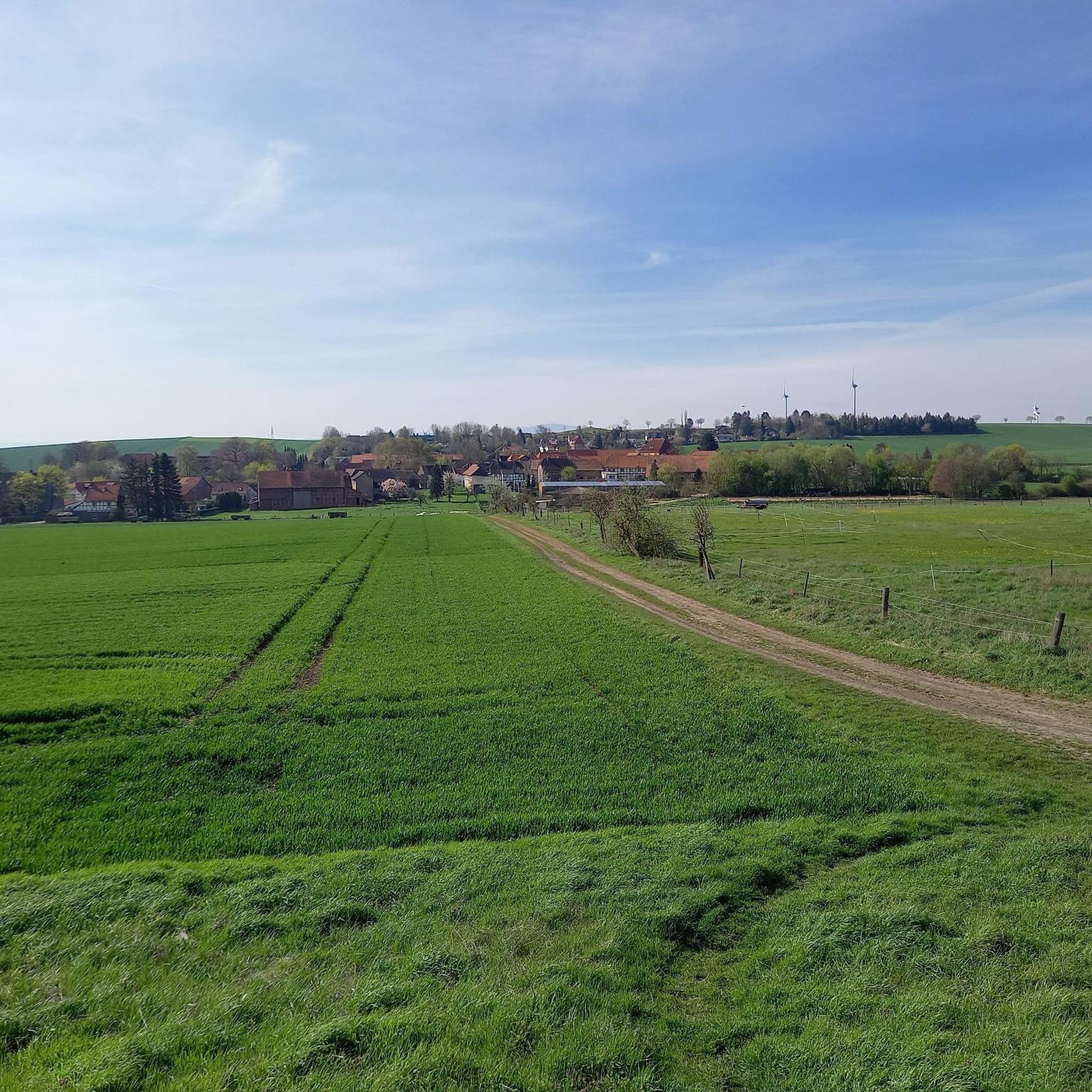
Beautiful bench on the hillside path with a view of Groß Denkte.
1
0

The campsite has been there since 1970. This year, the Wolfenbüttel district youth welfare office and the Wolfenbüttel city youth welfare office each held three-week holiday camps as a suburban recreational activity for the first time. In 1974, the Wolfenbüttel district acquired the site and since then the "Asselager" has been held there. A 14-day children's camp at the beginning of the summer holidays for children aged 6 to 12. (Source: https://www.hva-asse.de)
1
1
With this adventure trail, the Ostfalen Open Air and Adventure Museum (FEMO), the Asse collective municipality and the Lower Saxony Elm Forestry Office want to bring the natural and cultural history of the Asse closer to visitors in an exciting and diverse way. We invite you to enter the landscape, relax and enjoy nature. The hike begins at the "Waldhaus Asse" car park above Wittmar. The path leads through the Liebes-Allee to the Bismarck Tower and Asseburg, then back to the "Waldhaus Asse" inn. It is also possible to hike around the Röhrberg to the northern Muschelkalk ridge and return to the "Waldhaus Asse" via the Teichweg and the site of the former Asse I mine. 9 experience points explain aspects of geology, history, prehistory and early history, botany and mycology and highlight the connections between these disciplines. (Source: https://www.elm-asse.de)
0
0
Still waters (also known as standing waters, standing waters or stagnant waters) are natural or artificially created bodies of water in which there is no or only a slight flow rate. They are inland waters, and are the opposite of flowing waters. Oceans and seas are not still waters. Within hydrology, limnology deals with standing and flowing waters, primarily fresh waters, but also special forms of saline inland waters (such as saltwater lakes), which do not fall under oceanography. (Source: Wikipedia)
0
1
The excursion restaurant , built by Johann Friedrich , was also popular with the regional nobility at the time .
1
1
The best car park for a tour of the Asse, preferably directly via the Liebesallee to the Bismarkturm.
1
1

Almost all of the low-level and medium-level radioactive waste in the Federal Republic of Germany is disposed of in the Asse II mine. Around 67 percent of the waste volume comes from the plants of the energy supply companies. Typical types of waste are: filters, scrap metal, paper, laboratory waste, construction waste, wood, sludge or mixed waste. Further waste is delivered by research institutes, the nuclear industry and other waste producers (e.g. from medicine). Source: https://www.bge.de/de/asse/kurzinformationen/radioaktiv-abfaelle-in-der-schachtanlage-asse-ii/
1
0
Those responsible described the shaft in the former salt mine near Remlingen as "absolutely safe" when thousands of tons of nuclear waste were stored there between 1967 and 1978. But the so-called Asse II has not been safe for a long time. Since 1988, around 12,000 liters of groundwater have been flowing into the mine every day. This means there is a risk of radioactivity getting into the groundwater. That is why there was a law in 2013 for the retrieval of radioactive waste from the mine. But not much has happened since then. So far, it is neither clear how the waste can get out of the Asse II nor where it is supposed to go. Source: https://detector.fm/politik/versuchsendlager-asse-ii
2
0
Frequently Asked Questions
How many running routes are available around Vahlberg?
There are over 400 running routes around Vahlberg, offering a wide variety of options for all fitness levels. The komoot community has explored these trails more than 5000 times, highlighting the area's popularity for outdoor activities.
What kind of terrain can I expect on the running trails near Vahlberg?
The running trails around Vahlberg, located within the Landkreis Wolfenbüttel region of Germany, primarily feature forested areas and gentle hills. You'll find a mix of wooded sections and open views across the landscape, providing varied running experiences.
Are there running routes suitable for beginners in Vahlberg?
Yes, Vahlberg offers a good selection of routes suitable for beginners. There are 57 easy running trails available. An excellent option for an easy run is the Watzeberg – Rothenberg loop from Landkreis Wolfenbüttel, which is 2.9 miles (4.6 km) with gentle ascents through wooded areas.
What do other runners say about the trails in Vahlberg?
The running routes in Vahlberg are highly rated by the komoot community, with an average score of 4.3 stars from over 360 reviews. Runners often praise the varied forest terrain, the gentle hills, and the scenic open views that make for an enjoyable experience.
Are there any longer running routes for experienced runners?
Absolutely. For those seeking a more challenging run, Vahlberg has 47 difficult routes and 311 moderate routes. A great moderate option is the Wittmar Weather Station – View of Denkte loop from Landkreis Wolfenbüttel, which spans 7.8 miles (12.5 km) and includes a mix of forest paths and open sections with views.
Can I find routes that pass by lakes or water bodies?
While Vahlberg itself is not known for large lakes, the surrounding area offers several beautiful water features. You can find routes that pass near highlights such as the Wolfenbüttel Town Moat or the tranquil Veronikasee.
Are there any specific landmarks or points of interest to look out for while running?
Yes, the region around Vahlberg features several interesting landmarks and natural points of interest. You might encounter the Eilumer Horn Summit Cross, the Drachenberg Transmitter, or the Heeseberg Tower, offering unique sights along your run.
Are there circular running trails available in Vahlberg?
Many of the running routes around Vahlberg are designed as circular trails, making them convenient for starting and ending at the same point. For example, the Rothenberg – Watzeberg loop from Landkreis Wolfenbüttel is a moderate 3.2-mile (5.2 km) circular path through varied terrain.
Are there running routes that offer good viewpoints?
Yes, several routes provide excellent viewpoints. The landscape around Vahlberg includes open sections that offer scenic vistas. Consider the View of Denkte – Forest Path loop from Landkreis Wolfenbüttel, which is known for its varied forest terrain and potential for open views.
What is the best time of year to go running in Vahlberg?
Given the forested nature of the trails and gentle hills, running in Vahlberg is enjoyable across multiple seasons. Spring and autumn offer pleasant temperatures and beautiful foliage, while summer provides lush green scenery. Winter runs can also be picturesque, though conditions may vary.
Are there any running routes that are less crowded?
While specific crowd levels can vary, exploring some of the less popular or slightly longer routes might offer a more solitary experience. With over 400 routes available, you have many options to discover quieter paths away from the main trails.
Most popular routes around Vahlberg
Most popular attractions around Vahlberg

Get inspired with the komoot mobile app


Explore more
Browse the best Running Trails & Routes in other regions.
