The best cycling routes around Millers Falls
5.0
(49)
48
riders
18
rides
Touring cycling routes around Millers Falls traverse a landscape characterized by diverse natural features and historical infrastructure. The region offers a mix of rail trails, riverside paths, and access to state forests. Key features include the Connecticut and Millers Rivers, the French King Gorge, and areas of rare pine barrens.
Best touring cycling routes around Millers Falls
- The most popular touring cycling route is Power Canal Reservoir loop from Turners Falls, a 7.3 miles (11.8 km) trail that takes…
Last updated: June 29, 2026
14
riders
92.0km
07:59
1,640m
1,640m
Hard bike ride. Very good fitness required. Mostly paved surfaces. Suitable for all skill levels.
5.0
(1)
13
riders
Easy bike ride. Great for any fitness level. Mostly paved surfaces. Suitable for all skill levels.

Sign up for free
5.0
(1)
8
riders
12.2km
00:46
100m
90m
Easy bike ride. Great for any fitness level. Mostly paved surfaces. Suitable for all skill levels.
5.0
(14)
3
riders
43.1km
02:32
260m
260m
Moderate bike ride. Good fitness required. Mostly paved surfaces. Suitable for all skill levels.
5.0
(33)
3
riders
Moderate bike ride. Good fitness required. Mostly paved surfaces. Suitable for all skill levels.
Get access to more routes and recommendations from other explorers.
Sign up for free
Already have an account?
Our route recommendations are based on thousands of hikes, rides, and runs completed by other people on komoot.
Start today with a free account
Your next adventure awaits.
Login or Signup


Tips from the Community

There is a small green space near bridge that is a great place to stop for a snack or lunch.
0
0

The Connecticut River Greenway connects quite a few parks that are situated along the Connecticut River. There are about 8 parks along this greenway as you follow it across the state.
0
0

This multi-tiered roadside waterfall isn't very large, but it's quite pretty.
0
0


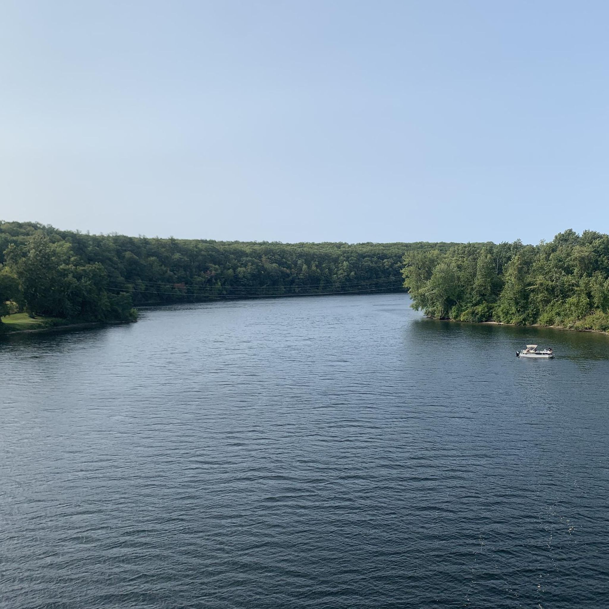
Nice bridge crossing the Connecticut River. The bridge is only open to walkers and cyclists, so when the bridge is quiet, you can take a minute to stop riding and enjoy the wonderful view.
0
0
The Canalside Trail is a short, rail trail that runs next to the Turner Falls Canal. The trail is completely flat, so it is an easy ride and gives you great views of the canal.
0
0

The views of the Connecticut River and the surrounding deciduous woodland and agricultural fields are stunning and particularly so in autumn when the trees turn a crimson colour. Fantastic traffic free cycling.
0
0
The Connecticut River Greenway connects quite a few parks that are situated along the Connecticut River. There are about 8 parks along this greenway as you follow it across the state.
0
0
Frequently Asked Questions
How many touring cycling routes are available in Millers Falls?
There are over 15 touring cycling routes around Millers Falls, offering a variety of experiences for different skill levels. The komoot community has explored 18 routes in total.
What are the difficulty levels of touring cycling routes in Millers Falls?
The routes in Millers Falls cater to a range of abilities. You'll find 5 easy routes perfect for a relaxed ride, 8 moderate routes for those seeking a bit more challenge, and 5 difficult routes for experienced touring cyclists looking for a demanding adventure.
Are there any family-friendly touring cycling routes in Millers Falls?
Yes, several routes are suitable for families. The region's rail trails, like sections of the Canalside Rail Trail, offer paved, relatively flat surfaces away from traffic. For an easy loop, consider the Power Canal Reservoir loop from Connecticut River Greenway State Park, which is 8.6 miles (13.8 km) long and has minimal elevation gain.
What kind of scenery can I expect on a touring cycling route in Millers Falls?
Millers Falls offers diverse scenery, from the tranquil banks of the Connecticut and Millers Rivers to unique pine barrens and state forests. You can expect views of the General Pierce Bridge, the French King Gorge, and the Beaver Hollow Wetland, especially vibrant during fall foliage. Routes often pass through quiet side streets and natural areas.
Are there any circular touring cycling routes in the Millers Falls area?
Yes, many of the touring cycling routes in Millers Falls are designed as loops, allowing you to start and end at the same point. Examples include the popular Power Canal Reservoir loop from Turners Falls and the more challenging Whitmore Pond Waterfall – Whitmore Pond loop from Montague.
What are some notable landmarks or attractions to see along the routes?
Along your rides, you can explore several interesting points. The Canalside Rail Trail - Canal Section offers scenic views, and the Turner's Falls Bridge is a significant landmark. You might also pass by the Connecticut River Greenway State Park. The French King Gorge and the Montague Plains Wildlife Management Area are also prominent natural features in the region.
Is gravel biking an option in Millers Falls?
While many routes are paved, the Millers Falls area, particularly within the broader Pioneer Valley, does offer opportunities for gravel biking. Areas like the Montague Plains Wildlife Management Area have dirt trails suitable for mountain biking and could be explored with a gravel bike. Some moderate and hard routes may incorporate unpaved segments.
What do other touring cyclists say about the routes in Millers Falls?
The touring cycling routes in Millers Falls are highly regarded by the komoot community, with an impressive average rating of 4.97 out of 5 stars from over 60 reviews. Cyclists often praise the diverse landscapes, the mix of rail trails and riverside paths, and the overall natural beauty of the area.
Where can I find parking for bike trails in Millers Falls?
Parking is generally available at various access points for popular trails. For instance, the Canalside Rail Trail has designated parking areas. It's advisable to check specific route details on komoot for recommended starting points and parking information.
Are there cafes or places to eat near the touring cycling routes?
Yes, the towns of Millers Falls and nearby Turners Falls offer various options for refreshments. You can find cafes, pubs, and restaurants to refuel after your ride. It's a good idea to plan your route to pass through these towns for convenient stops.
What is the best time of year to go touring cycling in Millers Falls?
The spring, summer, and fall months generally offer the best conditions for touring cycling in Millers Falls. The fall foliage season is particularly stunning, with vibrant red maples along the Millers River and wetlands. While accessible year-round, winter cycling may require specific gear due to colder temperatures and potential snow.
Can I reach the touring cycling routes using public transport?
While specific public transport options directly to every trailhead might be limited, the Millers Falls area is part of a broader regional network. For routes like the Canalside Rail Trail in Turners Falls, you may find local bus services that can get you close to access points. It's recommended to check local transit schedules for the most up-to-date information.
Most popular attractions around Millers Falls

Get inspired with the komoot mobile app


Explore more
Browse the best Cycling routes in other regions.
