Easy hikes and walks around Parco Regionale Naturale dei Monti Lucretili
4.4
(2629)
9,891
hikers
252
hikes
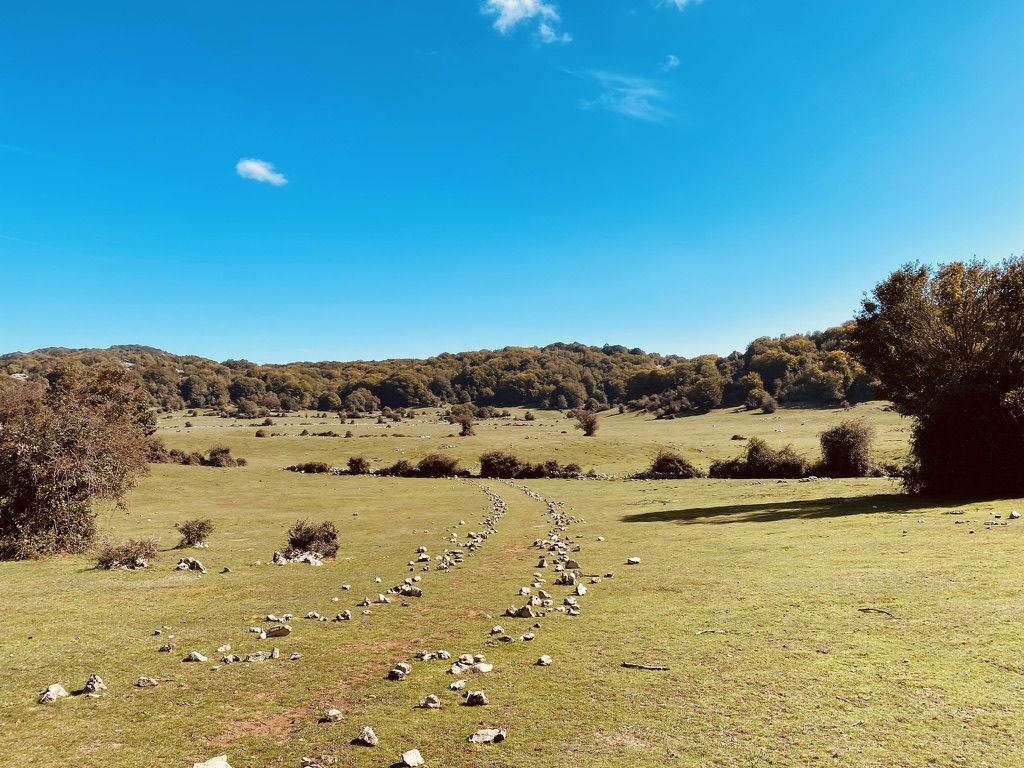
Easy hiking trails around Parco Regionale Naturale dei Monti Lucretili traverse a varied terrain of mountain peaks, dense forests, and unique karst plateaus. The geology is predominantly limestone, offering diverse landscapes for hikers. The park features extensive woods of beech and larch, wide plains, and small lakes, such as the Lagustelli di Percile. Lower altitudes include orchards and olive groves, while higher elevations reveal century-old pastures.
Best easy hiking trails around Parco Regionale Naturale dei Monti Lucretili
- The most popular…
Last updated: October 10, 2026
4.1
(26)
134
hikers
Easy hike. Great for any fitness level. Easily-accessible paths. Suitable for all skill levels.
5.0
(1)
3
hikers
4.78km
01:31
180m
180m
Easy hike. Great for any fitness level. Easily-accessible paths. Suitable for all skill levels.

4.3
(7)
19
hikers
5.04km
01:40
240m
240m
Easy hike. Great for any fitness level. Easily-accessible paths. Suitable for all skill levels.
5.0
(1)
3
hikers
4.46km
01:26
180m
180m
Easy hike. Great for any fitness level. Easily-accessible paths. Suitable for all skill levels.
5.0
(1)
9
hikers
5.50km
01:36
150m
150m
Easy hike. Great for any fitness level. Easily-accessible paths. Suitable for all skill levels.
Get access to more routes and recommendations from other explorers.
Already have an account?
Our route recommendations are based on thousands of hikes, rides, and runs completed by other people on komoot.
Start today with a free account
Your next adventure awaits.
Popular around Parco Regionale Naturale dei Monti Lucretili
Other adventures around Parco Regionale Naturale dei Monti Lucretili

Tips from the Community

As of today 08/08/26, everything is very abandoned and dry. We also found wolf droppings along the trail.
0
0

among the most beautiful villages in Italy
0
0
among the most beautiful villages in Italy
0
0
for 12 centuries guardian of the territory..
0
0

Gate along the Via Piana trail, the route continues further towards the small lakes.
0
0
View of Lake Marraone, not reachable because the path is closed due to dangerous banks.
0
0

The paved road will allow you to reach an acceptable altitude to tackle the Monti Lucertola and challenge Monte Gennaro. The split mountain is the entrance to the park from the San Polo dei Cavalieri side.
0
0

the famous pizza in Orvino, a must
0
0
Frequently Asked Questions
How many easy hiking trails are available in Parco Regionale Naturale dei Monti Lucretili?
There are 47 easy hiking trails in Parco Regionale Naturale dei Monti Lucretili. In total, the park offers over 225 routes across various difficulty levels, traversing diverse landscapes from mountain peaks to dense forests and unique karst plateaus.
What kind of terrain can I expect on easy hikes in Monti Lucretili?
Easy hikes in Monti Lucretili feature varied terrain, including extensive woods of beech and larch, wide plains, and unique limestone formations. You'll also encounter small lakes, such as the Lagustelli di Percile, and at lower altitudes, orchards and olive groves.
What natural features or landmarks can I see on easy hikes?
Many easy hikes offer views of the park's natural beauty. You can explore the serene Lagustelli di Percile, or discover the Pisciarello Stream – Maricella Stream Waterfall loop from Licenza. Other notable natural features include the Monte Gennaro Meadow and the Fraturno Lake.
Are there family-friendly easy hikes in Parco Regionale Naturale dei Monti Lucretili?
Yes, many easy trails are suitable for families. Routes like the Fontanile of the Monti Lucretili – Lagustelli di Percile loop from Lagustelli di Percile offer gentle elevation gains and scenic views, perfect for a family outing. The park's diverse landscapes provide engaging experiences for all ages.
Are there any easy circular walks in the Monti Lucretili?
Yes, several easy circular walks are available. A popular option is the Fontanile of the Monti Lucretili – Lagustelli di Percile loop from Percile, which is 7 km long. Another great choice is the Santa Maria del Piano – Orvinio Historic Center loop from Orvinio, offering a blend of nature and historical village exploration.
Can I find trails with waterfalls in Parco Regionale Naturale dei Monti Lucretili?
Yes, you can find trails that lead to waterfalls. The Pisciarello Stream – Maricella Stream Waterfall loop from Licenza is an easy 5 km trail that takes you through varied terrain, including streams and a beautiful waterfall.
Are there any charming villages to explore near the easy hiking trails?
Absolutely. The park is dotted with charming small borgoes (villages) like Orvinio, Roccagiovine, and Licenza. These villages feature narrow houses, ancient castles, and abbeys, offering a glimpse into the region's rich history and culture. The Santa Maria del Piano – Orvinio Historic Center loop from Orvinio is a great way to combine hiking with village exploration.
Is Parco Regionale Naturale dei Monti Lucretili accessible by public transport?
The park is generally accessible from Rome, making it a convenient escape. While some trailheads might require a short taxi ride from the nearest bus or train station, many villages within the park are served by local public transport. For detailed information on routes and schedules, it's best to consult local transport providers.
Where can I find parking near the easy trailheads?
Parking is typically available in or near the villages that serve as starting points for many trails, such as Percile, Licenza, Orvinio, and San Polo dei Cavalieri. Look for designated parking areas in these towns, especially near popular attractions like the Lagustelli di Percile.
Are dogs allowed on the easy hiking trails in Monti Lucretili?
Generally, dogs are allowed on trails within Parco Regionale Naturale dei Monti Lucretili, but they should be kept on a leash to protect wildlife and ensure the safety of other hikers. Always remember to clean up after your pet.
What do other hikers enjoy most about the easy trails in Parco Regionale Naturale dei Monti Lucretili?
The easy trails in Parco Regionale Naturale dei Monti Lucretili are highly rated by the komoot community, with an average score of 4.4 stars from over 1200 reviews. Hikers frequently praise the diverse and surprisingly wild environment, the well-signposted paths, and the enchanting views of the Roman countryside and Apennine peaks. The presence of small lakes and charming villages also adds to the appeal.
What is the best time of year to go hiking in Parco Regionale Naturale dei Monti Lucretili?
The park offers pleasant hiking conditions for much of the year. Spring and autumn are particularly ideal, with mild temperatures and vibrant natural colors. Summer can be warm, but higher elevations and shaded forest trails provide cooler options. Winter hiking is also possible, especially on easy routes, though some higher paths might be affected by snow or ice.
Are there places to eat or drink near the easy hiking trails?
Yes, the charming villages within and around the park, such as Orvinio, Licenza, and Palombara Sabina, offer various amenities including cafes, restaurants, and local shops where you can find refreshments and traditional cuisine after your hike.
Most popular routes around Parco Regionale Naturale dei Monti Lucretili
Most popular attractions around Parco Regionale Naturale dei Monti Lucretili

Get inspired with the komoot mobile app


Explore more
Browse the best Hikes in other regions.
