Top 20 Natural Monuments around Majaelrayo
Natural monuments around Majaelrayo are concentrated in the Sierra Norte of Guadalajara, within the Sierra de Ayllón and the Central System. This region is characterized by its mountainous terrain, featuring prominent peaks, waterfalls, and ancient forests. The landscape offers diverse opportunities for exploration, from challenging ascents to serene walks along rivers and through woodlands. It is a significant area for natural beauty and outdoor activities.
Best natural monuments around Majaelrayo
- The most popular natural monuments is Pico del Lobo,…
Last updated: July 1, 2026
Pico Ocejón
Highlight • Summit
Translated by Google •
Tip by

Despeñalagua Waterfall
Highlight • Waterfall
Translated by Google •
Tip by
Sign up now to discover places like this
Get recommendations on the best single tracks, peaks, & plenty of other exciting outdoor places.
Sign up for free
Hazel Beech
Highlight • Forest
Translated by Google •
Tip by

Aljibe Waterfall
Highlight • Waterfall
Translated by Google •
Tip by
Pico del Lobo
Highlight • Summit
Translated by Google •
Tip by

Sign up for free to discover even more natural monuments around Majaelrayo.
Sign up for free
Already have an account?
Start today with a free account
Your next adventure awaits.
Login or Signup

Other adventures around Majaelrayo

Tips from the Community

Within the beautiful Hayedo de la Pedrosa there are several centuries-old beech trees of great beauty.
0
0
Centenary beech trees in the La Pedrosa Beech Forest.
0
0

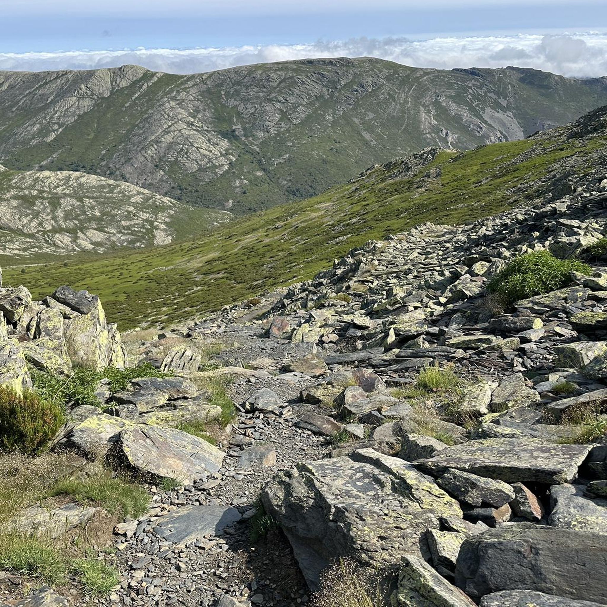
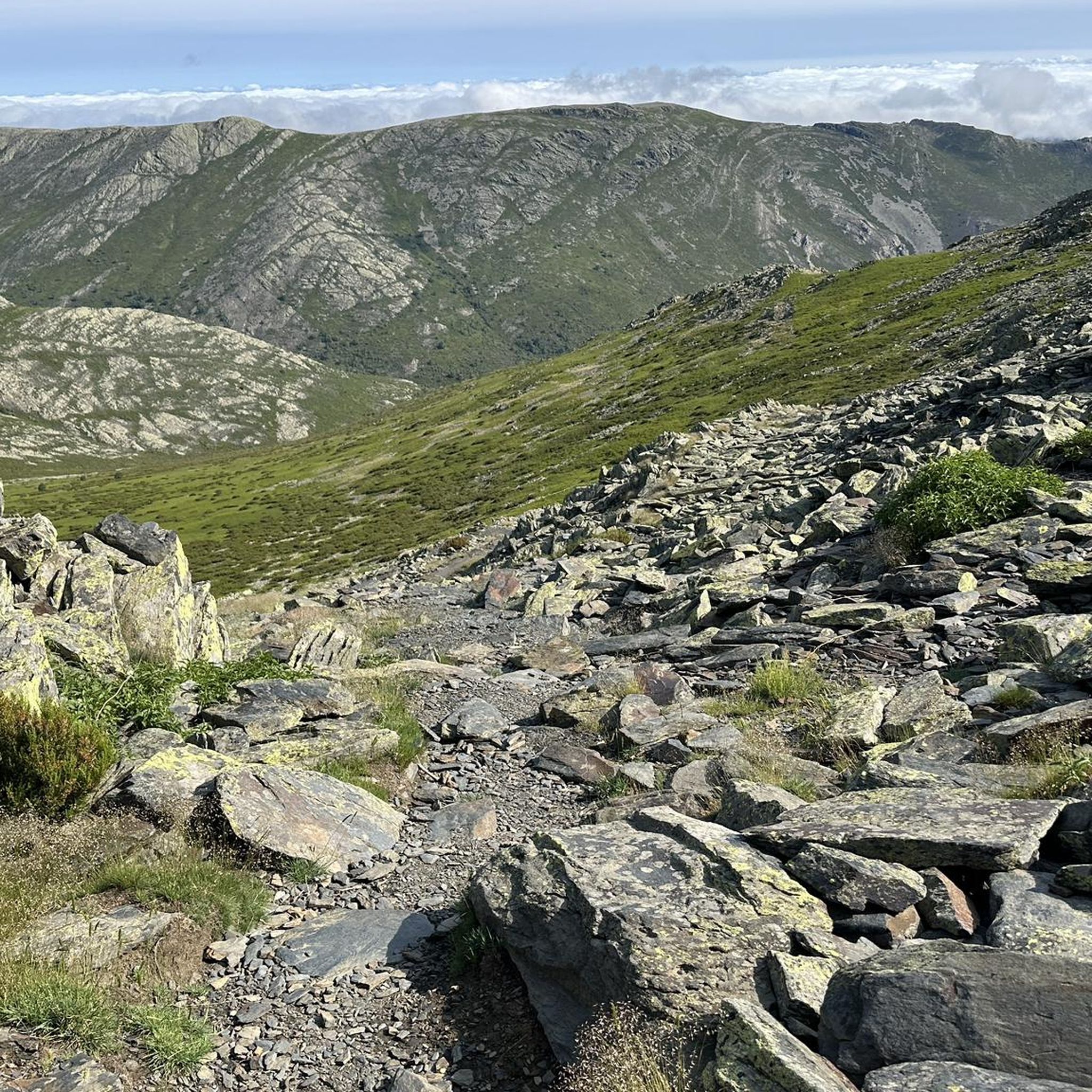
The most popular route to ascend Pico Ocejón begins in Valverde de los Arroyos and is known for its scenic beauty and moderate difficulty. The hike is approximately 14.74 km and typically takes around 6 hours with stops. Along the way, hikers can enjoy spectacular views and the rich biodiversity of the area.
6
0
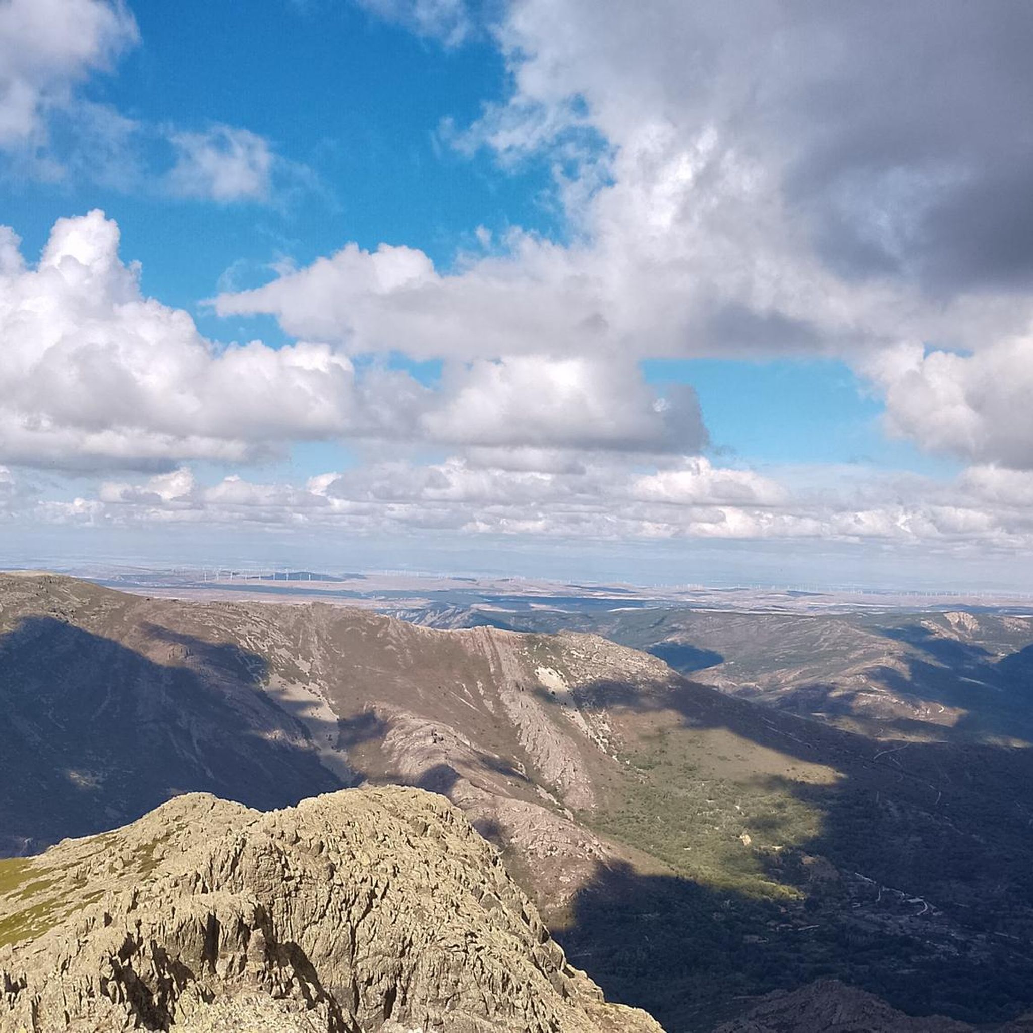
The highest peak in the province of Guadalajara is a special place to admire the landscape in all directions. In winter, with the snow, it is even more beautiful, but at the same time more demanding due to the cold.
1
1

The climb is hard, but it is worth it. Although we were not lucky enough to see all the scenery that should be seen from that height. The descent is almost harder than the ascent.
1
0
Pico del Lobo is the highest mountain in the Sierra de Ayllón and in the province of Guadalajara, with an altitude of 2,274 metres. It is a popular destination for hiking and offers spectacular views of both Segovia and Guadalajara.
7
0
At 2049 metres above sea level, it is one of the highest and most popular peaks for hiking in the region. There are several routes to climb Pico Ocejón, the most common being those starting from Majaelrayo and Valverde de los Arroyos. Both routes offer stunning landscapes and the opportunity to enjoy nature at its best.
6
0
The Chorreras de Despeñalagua are an impressive set of waterfalls located in the Chorrera stream, a tributary of the Sorbe river, on the northern slope of the Ocejón peak near Valverde de los Arroyos. The waterfall has a height of about 120 meters and flows throughout the year, especially during the thaw season. In winter, frost is often found, which adds a magical touch to the landscape. The route to visit the Chorreras de Despeñalagua is simple and suitable for the whole family. The path, approximately 4.5 km, offers spectacular views and allows you to explore the streets and buildings of Valverde de los Arroyos. Also, on the way to the town, you will pass through other charming black towns such as Palancares, Almiruete and Tamajón. Definitely a destination worth exploring! 😊
8
0
Frequently Asked Questions
What are some prominent natural landmarks in the Majaelrayo area?
The region around Majaelrayo is rich in natural monuments. Key highlights include Pico Ocejón, a popular peak for hiking at 2,049 meters, and Pico del Lobo, the highest peak in the Sierra de Ayllón at 2,274 meters. You can also visit the impressive Despeñalagua Waterfall, which cascades 120 meters.
Are there family-friendly natural monuments to visit near Majaelrayo?
Yes, the Despeñalagua Waterfall is an excellent choice for families. The route to visit it, starting from Valverde de los Arroyos, is described as simple and suitable for the whole family, covering approximately 4.5 km. The waterfall flows throughout the year, offering a beautiful sight.
What kind of hiking trails can I find near these natural monuments?
The area offers a diverse range of hiking trails. For challenging ascents, you can tackle routes to Pico Ocejón or Pico del Lobo. There are also more moderate paths, such as the one leading to the Despeñalagua Waterfall. For more options, explore the various routes in the Hiking around Majaelrayo guide.
What are the most challenging natural monuments to reach?
For those seeking a challenge, both Pico Ocejón and Pico del Lobo offer demanding hikes. The ascent to Pico Ocejón typically takes around 6 hours and covers about 14.74 km with significant elevation gain. The Aljibe Waterfall also involves a steep and difficult access path, requiring caution.
Are there any ancient forests or unique geological features to explore?
Absolutely. The region is home to the Hazel Beech, part of the renowned Hayedo de la Tejera Negra Natural Park, a UNESCO Biosphere Reserve known for its ancient beech forest. Pico Ocejón itself is composed of slate, and its two complementary peaks, Ocejoncillo and Peña Mala, showcase interesting geological formations.
What is the best time of year to visit the natural monuments around Majaelrayo?
The best time to visit depends on your preferred activity. Waterfalls like Despeñalagua Waterfall flow throughout the year, but are particularly impressive during thaw seasons or after rainfall. For hiking, spring and autumn offer pleasant temperatures and vibrant landscapes. Winter can bring a magical touch with frost, especially around waterfalls, but some high-altitude routes may be more challenging due to snow and ice.
Can I find viewpoints with panoramic views of the area?
Yes, several natural monuments offer spectacular views. The summit of Pico Ocejón provides commanding vistas of the surrounding area. Similarly, Pico del Lobo offers extensive views of both Segovia and Guadalajara provinces. Pico Campachuelo also provides magnificent views of the Hoyo de la Sierra Negra.
Are there opportunities for cycling or mountain biking near these natural monuments?
Yes, the region around Majaelrayo is popular for cycling and mountain biking. You can find various routes that pass through or near these natural monuments. For detailed information and route suggestions, refer to the Cycling around Majaelrayo and MTB Trails around Majaelrayo guides.
What do visitors particularly enjoy about the natural monuments in this region?
Visitors frequently praise the stunning landscapes and the opportunity to immerse themselves in nature. The challenging yet rewarding ascents to peaks like Pico Ocejón are highly regarded for their scenic beauty. The impressive cascades, such as the Despeñalagua Waterfall, are also a favorite, especially for their accessibility and year-round flow.
Are there any rivers or streams that are part of the natural landscape?
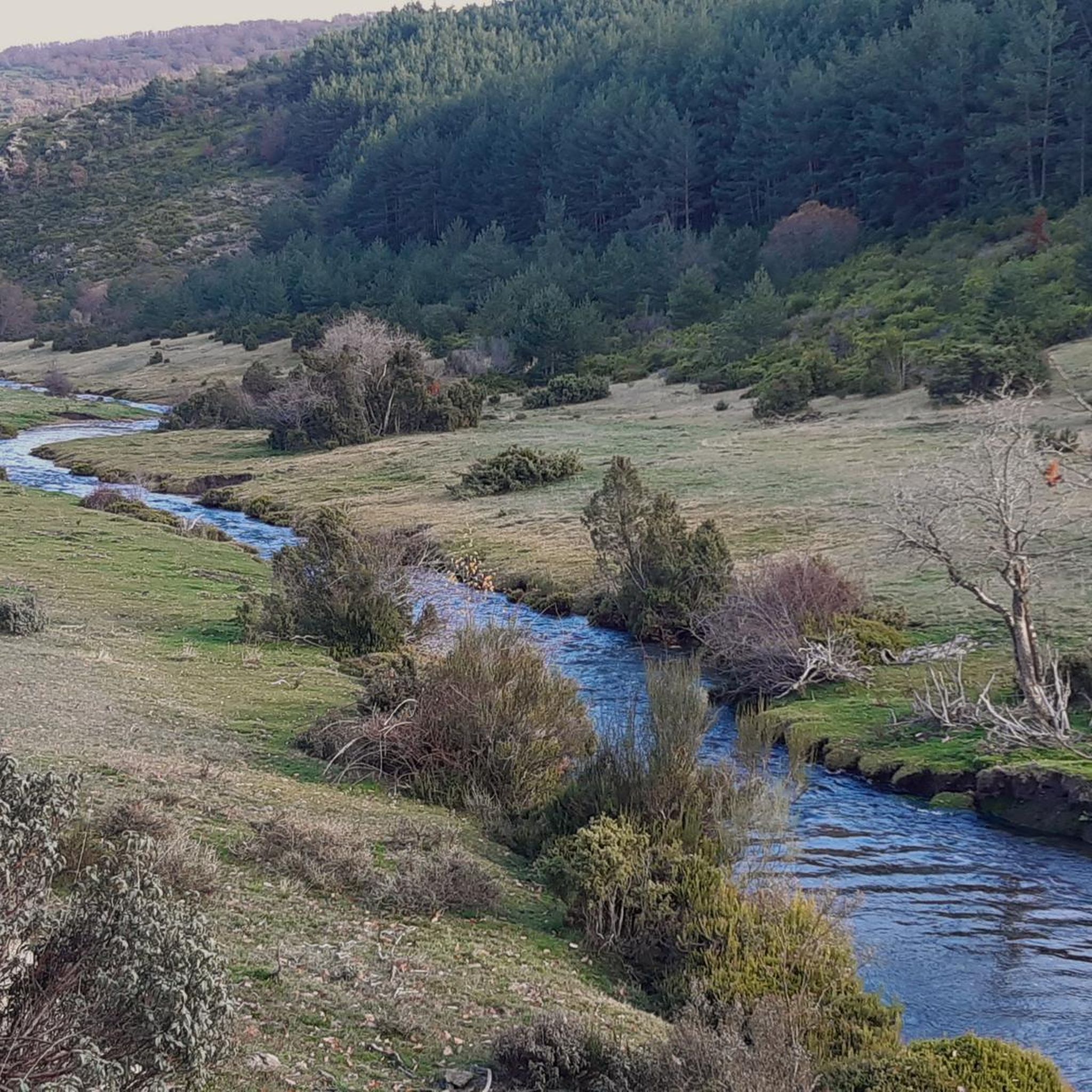
Yes, the Río Sorbe flows through the region, bringing vitality to the natural landscape around Majaelrayo. Its banks, along with the Jaramilla River, offer attractive routes for walkers and hikers. Numerous streams on the slopes of Pico Ocejón also contribute to the Jarama River system.
What is the elevation gain typically like for hikes to the major peaks?
Hikes to major peaks like Pico Ocejón can involve significant elevation gain. Routes to its summit often cover over 1000 meters of positive elevation, making them challenging and rewarding for experienced hikers.
Are there any circular walks available around the natural monuments?
Yes, many routes in the area are designed as circular walks, allowing you to experience diverse landscapes without retracing your steps. For example, the route to the Despeñalagua Waterfall from Valverde de los Arroyos can be part of a circular exploration of the 'black towns' region. You can find specific circular routes in the Hiking around Majaelrayo guide.
Most popular routes around Majaelrayo
Most popular attractions around Majaelrayo

Get inspired with the komoot mobile app


Explore more
Extend your search for the best caves by checking out these guides of the top ones around Majaelrayo:
