Top 13 Mountain Passes around Majaelrayo
Mountain passes around Majaelrayo are characterized by the mountainous landscapes of the Sierra Norte of Guadalajara. The region features challenging peaks and extensive hiking trails that traverse high-altitude points. These routes often involve navigating collados as part of ascents to prominent summits, with Pico Ocejón being a notable landmark. The area is also known for its "black architecture" and slate rock formations.
Best mountain passes around Majaelrayo
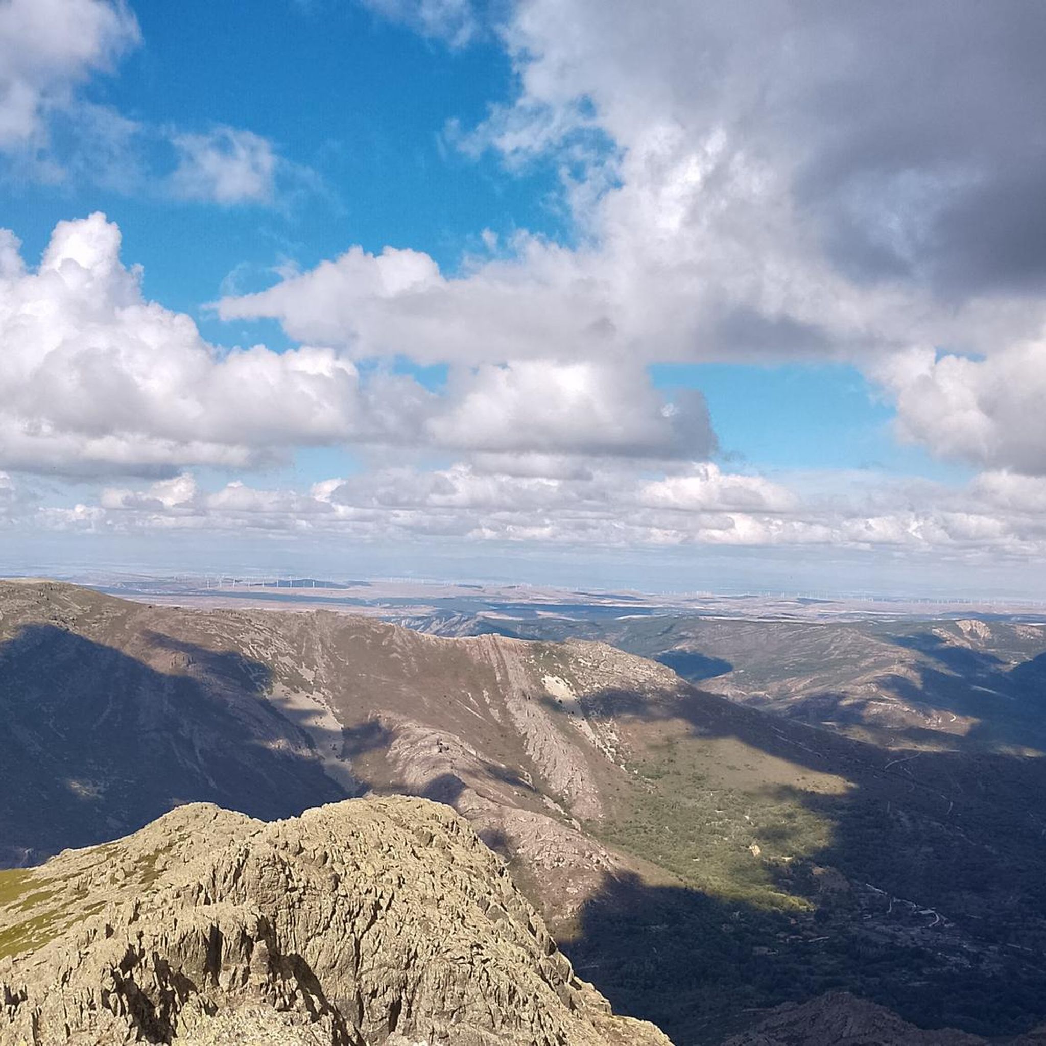
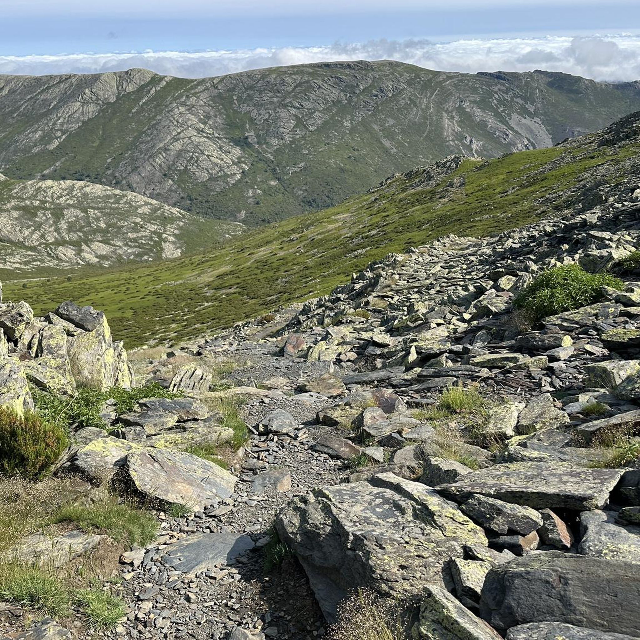
- The most popular mountain pass is Ascent to Collado del Aventadero, a mountain pass and viewpoint that offers a wide track ascending to the ridge. This route is a crossroads for trails leading to Pico del Lobo and its surroundings.
- Another must-see spot is Puerto de la Quesera, a mountain pass and viewpoint located between Riaza (Segovia) and Majaelrayo (Guadalajara). It marks the border between both provinces and autonomous communities, serving as a starting point for many routes.
- Visitors also love Puerto de La Hiruela, a mountain pass and cycle way with an excellent road surface. This pass is known for its low traffic and offers a stop at the town of La Hiruela.
- Majaelrayo is known for its collados, high-altitude points, and routes to prominent summits. The area offers a variety of mountain passes to see and explore, often integrated into challenging hiking trails.
- The mountain passes around Majaelrayo are appreciated by the komoot community, with 13 upvotes and 12 photos shared across the highlights.
Last updated: July 1, 2026
Ascent to Collado del Aventadero
Highlight (Segment) • Mountain Pass
Translated by Google •
Tip by

The ridge meadow
Highlight • Mountain Pass
Translated by Google •
Tip by

Sign up now to discover places like this
Get recommendations on the best single tracks, peaks, & plenty of other exciting outdoor places.
Sign up for free
Aventadero Pass
Highlight • Mountain Pass
Translated by Google •
Tip by
Puerto de la Quesera
Highlight • Mountain Pass
Translated by Google •
Tip by
East ascent to Ocejón
Highlight • Mountain Pass
Translated by Google •
Tip by
Sign up for free to discover even more mountain passes around Majaelrayo.
Sign up for free
Already have an account?
Start today with a free account
Your next adventure awaits.
Login or Signup

Other adventures around Majaelrayo

Tips from the Community

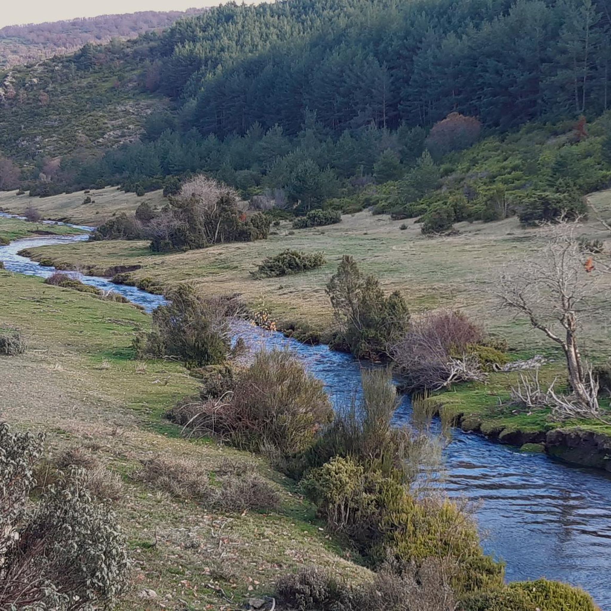
Place between Segovia and Guadalajara that is the starting point for many routes.
0
0

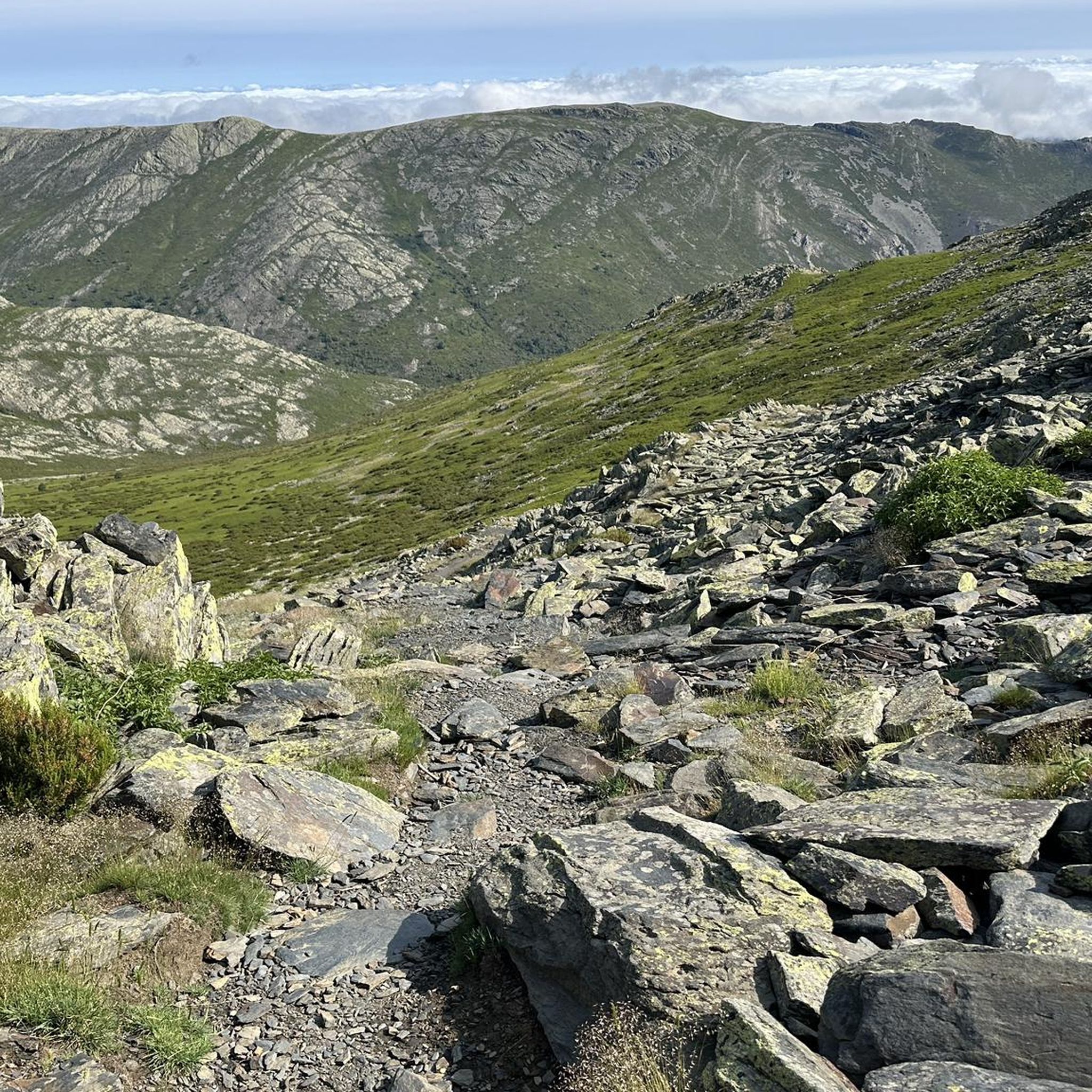
The climb to Pico Ocejón via the eastern slope is a popular route that begins in Valverde de los Arroyos. This route is known for its spectacular scenery and the opportunity to enjoy nature at its best.
4
0
Pico del Lobo Trail. Nature in the air.
0
1
The route to Collado del Aventadero is popular with hikers and mountaineers due to its stunning panoramic views and the diversity of landscapes that can be seen along the way. The trail passes through pine forests and offers spectacular views of the surrounding mountains.
4
0
It is the crossroads that, leaving from Puerto de La Quesera or La Pinilla, take us to Pico del Lobo and its surroundings.
0
1
The ridge meadow in Majaelrayo is a very popular hiking route in the Sierra Norte de Guadalajara, Castilla-La Mancha. This route is known for its impressive views and its connection to Pico Ocejón, one of the highest peaks in the area at 2,049 meters above sea level.
4
0
It is the Collado del GR 60 on the way up to Ocejón through Peña Mala.
1
0
The Collado de La Madita or Las Campanitas is a privileged place to observe the Landscape of the Sierra de Guadalajara, as well as the Black Villages that are in the valley area.
1
0
Frequently Asked Questions
What kind of terrain and landscapes can I expect on mountain passes around Majaelrayo?
The mountain passes and high-altitude points around Majaelrayo are characterized by the stunning mountainous landscapes of the Sierra Norte of Guadalajara. You'll encounter challenging peaks, extensive hiking trails, and varied scenery including oak forests, areas dotted with jara and wild blueberries, and distinctive slate rock formations. The region's unique 'black architecture' also reflects this geological characteristic.
What are some notable viewpoints or natural features found at these mountain passes?
Many passes offer impressive vistas. For instance, the Ascent to Collado del Aventadero is a mountain pass and viewpoint with wide tracks leading to a ridge, offering panoramic views. Puerto de la Quesera also serves as a viewpoint marking the border between provinces. The routes to Pico Ocejón, a dominant peak, provide views that can extend to Guadalajara and even Madrid on clear days. You might also encounter the Arroyo and Cascada de la Matilla, a picturesque stream and waterfall.
Are there challenging mountain passes for experienced hikers in the area?
Yes, the region is known for its challenging ascents. The routes to Pico Ocejón, for example, are highly popular among hikers, involving significant elevation gain. The The ridge meadow (Collado de La Madita) is part of a popular hiking route in the Sierra Norte de Guadalajara, known for its impressive views and connection to Pico Ocejón. The Ascent to Collado del Aventadero also leads to challenging trails towards Pico del Lobo.
What is the best time of year to visit the mountain passes around Majaelrayo?
The best time to visit is generally outside of winter. While the region is beautiful year-round, routes can be particularly challenging in winter due to snow and ice. Spring and autumn offer pleasant temperatures and vibrant landscapes, making them ideal for hiking and exploring. Summer is also suitable, though some routes might be more exposed to the sun.
Are there any specific considerations for visiting the mountain passes in winter?
Yes, winter conditions can be demanding. Routes to prominent peaks like Pico Ocejón become challenging, and areas like the Las Peñuelas crossing near Aventadero Pass can be dangerous due to ice sheets. It's crucial to be well-prepared with appropriate gear, check weather forecasts, and have experience with winter hiking if planning a visit during this season.
Is parking available near the mountain passes for hikers?
Parking is available at some key access points. For instance, Puerto de la Quesera is noted to have parking facilities, serving as a starting point for many routes. For other trails, parking might be available in nearby villages like Majaelrayo or Valverde de los Arroyos, from where routes typically begin.
What outdoor activities can I do near these mountain passes?
The mountainous terrain around Majaelrayo offers numerous opportunities for outdoor activities. You can enjoy extensive hiking, road cycling, and mountain biking. For hiking, explore routes like the 'Arroyo de la Prahihuela – Ocejoncillo Summit loop' or 'The ridge meadow – Pico Ocejón loop'. Cyclists can tackle routes such as the 'Sierra del Rincón Biosphere Reserve Loop' or 'Climb to Puerto de la Quesera'. Mountain bikers have options like the 'Puerto de la Quesera – Choza del Majadal loop'. You can find more details on these activities in the dedicated guides for Hiking around Majaelrayo, Road Cycling Routes around Majaelrayo, and MTB Trails around Majaelrayo.
Are there any less strenuous or family-friendly options for exploring the mountainous areas?
While many routes are challenging, there are options for a more relaxed experience. The Arroyo and Cascada de la Matilla, located northwest of Majaelrayo, offers a less strenuous but equally picturesque hiking destination. When choosing a route, look for trails described as moderate or those that focus on lower elevation points or waterfalls rather than summit ascents.
What do visitors enjoy most about the mountain passes around Majaelrayo?
Visitors particularly appreciate the stunning panoramic views and the deep immersion in nature. The diverse landscapes, from pine forests to slate rock formations, and the sense of accomplishment after a challenging hike are frequently highlighted. The low traffic and excellent road surface on passes like Puerto de La Hiruela are also a draw for cyclists.
Can I find amenities like cafes or pubs near the hiking routes?
Majaelrayo itself, and other nearby villages such as Valverde de los Arroyos or La Hiruela, offer amenities like cafes, pubs, and accommodation. It's a good idea to plan your route to pass through or end near these villages to enjoy a well-deserved break and refreshments after your outdoor adventure.
What is the significance of Pico Ocejón in the Majaelrayo region?
Pico Ocejón is a highly significant landmark, standing as one of the highest and most iconic peaks in Castilla-La Mancha. Its distinctive silhouette dominates the region, earning it the nickname 'Fujiyama of Guadalajara'. The ascent to Pico Ocejón is a popular and rewarding experience, offering breathtaking panoramic views and a profound sense of accomplishment.
Are there any historical or cultural aspects related to the mountain passes?
The region is known for its 'black architecture,' characterized by the use of local slate rock, which is also prominent in the mountain formations. Historically, paths like the 'Senda del Cartero' (Postman's Path), which includes The ridge meadow (Collado de La Madita), linked beautiful towns like Valverde de los Arroyos and Majaelrayo, reflecting the historical routes of communication through these mountainous terrains.
Most popular routes around Majaelrayo
Most popular attractions around Majaelrayo

Get inspired with the komoot mobile app


Explore more
See even more epic mountain passes by checking out these guides around Majaelrayo:
