The best traffic-free bike rides in Reserva Forestal Bosque Oriental De Bogotá
5.0
(9)
178
riders
11
rides
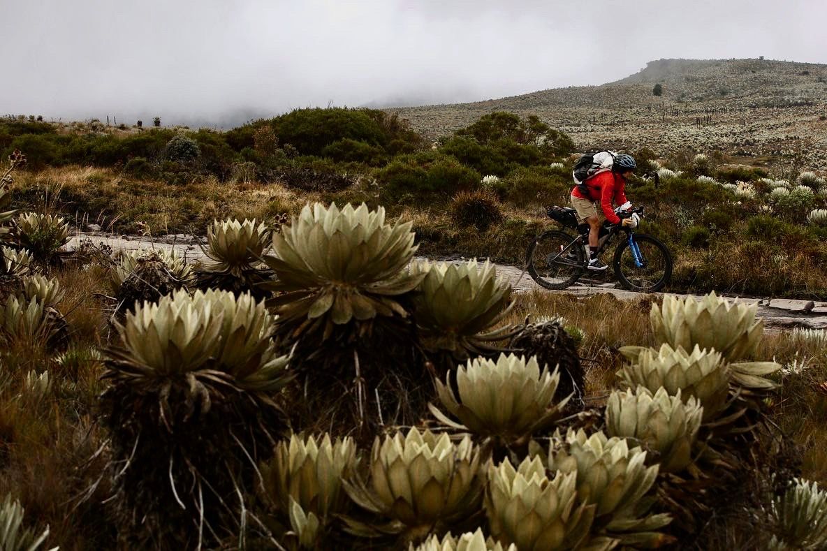
Gravel biking in Reserva Forestal Bosque Oriental De Bogotá offers extensive natural features and diverse landscapes for outdoor activities. This protected area spans approximately 13,224 hectares, forming a significant part of Bogotá's mountainous system. The terrain includes undulating slopes and well-vegetated areas, with elevations ranging from 2650 to 3600 meters above sea level, providing varied gradients suitable for adventurous rides. It acts as a crucial ecological corridor, connecting to larger natural parks and regulating water resources for the city.
Best…
Last updated: October 26, 2026
5.0
(2)
19
riders
60.5km
04:38
970m
970m
Hard gravel ride. Very good fitness required. Mostly paved surfaces.
11
riders
73.8km
05:28
1,450m
1,450m
Hard gravel ride. Very good fitness required. Mostly paved surfaces.

5.0
(2)
14
riders
35.6km
03:27
1,080m
1,080m
Hard gravel ride. Very good fitness required. Mostly paved surfaces.
5.0
(1)
15
riders
26.1km
02:08
510m
510m
Hard gravel ride. Very good fitness required. Mostly paved surfaces.
11
riders
29.5km
02:31
670m
670m
Hard gravel ride. Very good fitness required. Mostly paved surfaces.
Get access to more routes and recommendations from other explorers.
Already have an account?
Our route recommendations are based on thousands of hikes, rides, and runs completed by other people on komoot.
Start today with a free account
Your next adventure awaits.
Popular around Reserva Forestal Bosque Oriental De Bogotá

Other adventures in Reserva Forestal Bosque Oriental De Bogotá

Tips from the Community

Excellent route
0
0

A place to climb.
0
0

3km climb with a 6.6% slope 1.5 km of footprint plate 1.5 km unpaved road road that connects the municipalities of Tenjo and Chía
0
0

The view is very good, and it is worth going up
0
0


BEAUTIFUL LANDSCAPES AND GOOD TRAINING
1
1

If the day is sunny, the view is more enjoyable, but it is still demanding. Besides, as it is a paramo, the weather tends to change very easily, so you have to bring a coat just in case!
0
0
Frequently Asked Questions
How many no-traffic gravel bike trails are available in Reserva Forestal Bosque Oriental De Bogotá?
There are 12 curated no-traffic gravel bike trails in Reserva Forestal Bosque Oriental De Bogotá, ranging from moderate to difficult. These routes offer a fantastic way to explore the region's natural beauty away from vehicular traffic.
Are there any easy no-traffic gravel bike trails suitable for beginners or families?
While all 12 routes are rated moderate to difficult, the region's diverse terrain means some sections are more manageable. For a moderate challenge, consider the Welcome Sign to Tabio – Lourdes Church loop from Chía, which covers 32.7 km with 388m of elevation gain. It's a good option for those looking for a less intense ride while still enjoying the car-free environment.
What kind of landscapes and attractions can I expect to see along these gravel bike routes?
The trails wind through diverse landscapes, offering stunning views of Bogotá and the surrounding mountains. You can expect to encounter significant peaks like Monserrate Hill and Cerro de Guadalupe with its Christ the Redeemer Statue. The Patios Summit is also a popular spot, known for its lively atmosphere. The reserve is characterized by its Andean mountain systems, with undulating slopes and rich vegetation.
Are there any challenging no-traffic gravel bike routes for experienced riders?
Absolutely. Many of the routes are rated difficult, offering significant climbs and distances. For a substantial challenge, the Welcome Sign to Tabio – Alto de Canicas loop from Estación La Caro spans nearly 74 km with over 1400m of elevation gain. Another demanding option is the Plaza de La Calera – Alto de Chingaza loop from La Calera, which features over 1000m of climbing in 35.6 km.
What do other gravel bikers say about the no-traffic trails in Reserva Forestal Bosque Oriental De Bogotá?
The komoot community highly rates the experiences here, with an average score of 5.0 stars. Riders frequently praise the breathtaking mountain landscapes, the perfect mix of challenge and adventure, and the opportunity to explore extensive dirt roads away from traffic. The panoramic views from various viewpoints are also a common highlight.
Is public transport available to access the trailheads for these no-traffic routes?
Access to the Reserva Forestal Bosque Oriental De Bogotá is generally possible via public transport to areas bordering the reserve. From there, you may need to cycle a short distance to reach the specific trailheads. It's advisable to research local bus routes that serve the eastern hills of Bogotá, such as those heading towards La Calera or Chía, depending on your chosen starting point.
Where can I park my car if I drive to the no-traffic gravel bike trails?
Parking options vary depending on the specific trailhead you plan to use. Areas around towns like La Calera, Chía, or near the Estación La Caro may offer designated parking or suitable roadside spots. Always ensure you park legally and safely, respecting local regulations and private property.
Are there any circular no-traffic gravel bike routes available?
Yes, many of the routes are designed as loops, allowing you to start and end in the same location. For example, the View of Chía from Valvanera – Alto de la Valvanera loop from Chía is a 26 km circular route, perfect for exploring the area without needing a return trip arrangement.
What is the best time of year to go gravel biking in Reserva Forestal Bosque Oriental De Bogotá?
The region generally experiences two main seasons: a dry season (roughly December to March and July to August) and a rainy season (April to June and September to November). The dry season typically offers more stable weather conditions, making it ideal for gravel biking. However, the high altitude means temperatures can vary, so always be prepared for changing weather regardless of the season.
Are dogs allowed on the no-traffic gravel bike trails in the reserve?
Rules regarding dogs in protected areas like the Reserva Forestal Bosque Oriental De Bogotá can be strict to protect wildlife and maintain ecological balance. It's crucial to check the most current regulations from local authorities or the park administration regarding pet access before bringing your dog on the trails. Often, dogs may be allowed on a leash in certain areas, but restrictions can apply.
Are there places to eat or get refreshments near the no-traffic gravel bike routes?
Yes, especially around popular spots like the Patios Summit, which is well-known among cyclists for its lively atmosphere and dining options. Towns bordering the reserve, such as La Calera and Chía, also offer various cafes and restaurants where you can refuel before or after your ride.
Do I need a permit to access the Reserva Forestal Bosque Oriental De Bogotá for gravel biking?
Access requirements for protected areas can change. While many trails are publicly accessible, some specific sectors or trails within the Reserva Forestal Bosque Oriental De Bogotá might require prior registration or permits, especially for larger groups or certain activities. It's always best to consult official sources or local park authorities for the most up-to-date information before your visit.
Most popular routes in Reserva Forestal Bosque Oriental De Bogotá
Most popular attractions in Reserva Forestal Bosque Oriental De Bogotá

Get inspired with the komoot mobile app


Explore more
Browse the best Gravel rides in other regions.
