The best city hikes and walks in White River National Forest
4.6
(204)
7,079
hikers
12
hikes
If you've ever tried to plan hiking in White River National Forest, you know how quickly the sheer number of options can become overwhelming. With so many trails spanning such a vast area, it's tough to tell which routes are genuinely worth your time and which are just filler. That's where we come in. Our komoot community has explored, mapped, and reviewed countless routes here, and we've distilled that collective wisdom into a curated shortlist, saving you the guesswork.
White River National Forest, covering over 2.3 million acres, is a true gem in the central Rocky Mountains of Colorado. Expect majestic mountain ranges like the Gore, Tenmile, and Sawatch, alongside pristine alpine lakes and winding streams. The landscape shifts from high-elevation forests to lush riparian zones, offering a diverse backdrop for your adventures. While the forest offers everything from challenging multi-day treks, this guide focuses on accessible paths, perfect for those looking for easily accessible day hikes near towns.
If you only do one, we'd start with the Gore Creek Path. This 2.4 miles (3.8 km) trail is a fantastic introduction, following the scenic Gore Creek with minimal effort for maximum payoff. For another easy win, the Blue River Rec Path, at 2.2 miles (3.6 km), offers a relaxed stroll alongside the Blue River, perfect for families or a quiet afternoon. With over 7,000 hikers having explored these routes and an average rating of 4.7 stars, you know you're in good hands. Get out there and discover your next favorite trail!
Last updated: May 11, 2026
3
hikers
3.82km
01:00
10m
70m
The Gore Creek Path offers a wonderfully accessible and family-friendly escape into nature, right within Vail. This easy 2.4-mile (3.8 km) route meanders alongside the refreshing Gore Creek, featuring minimal elevation gain of just 49 feet (15 metres) and taking about 1 hour to complete. You'll find a mix of paved surfaces and softer singletrack sections that wind through open meadows and charming aspen groves, providing a pleasant journey for all.
This dog-friendly trail is conveniently located near Vail's hotels and amenities, making it incredibly easy to access. You won't need any special permits or have to pay fees to enjoy this tranquil walk. It's an ideal choice for a leisurely morning or afternoon stroll, offering a natural backdrop without venturing far from town.
Beyond the gentle terrain, the Gore Creek Path is known for its vibrant wildflowers in warmer months and the stunning golden aspens in autumn, providing beautiful viewpoints. It's a fantastic spot for wildlife spotting and offers a serene environment with the constant, soothing sound of flowing water, making it a popular choice for beginner hiking.
3.58km
00:56
0m
60m
The Blue River Rec Path offers a delightful, accessible stroll through the heart of Breckenridge, providing stunning vistas of the Tenmile Range and the lively Blue River. This paved trail meanders through evergreen forests and past residential areas, giving you a glimpse into local life while enjoying the mountain air. It’s a gentle journey, perfect for soaking in the natural beauty without a strenuous climb.
Planning your visit to this section of the Blue River Rec Path is straightforward, with convenient parking available at various points, including near the Breckenridge City Market. The trail is typically one of the first in Summit County to clear of snow in the spring, making it an excellent early-season option. You can enjoy its easygoing nature from spring through fall, and leashed dogs are always welcome.
This path is a crucial link in the extensive Summit County recreational pathway system, connecting resort towns and intersecting with other significant routes. It follows a historic rail line that once served the Colorado Mineral Belt, offering a blend of natural beauty and local history. The 2.2 miles (3.6 km) route is rated easy, with only 5 feet (2 metres) of elevation gain, and takes about 55 minutes, making it an ideal choice for a quick, family-friendly outing.

Sign up for free
55
hikers
4.03km
01:03
30m
30m
The Gore Valley Trail offers a delightful and easy escape into Vail's natural beauty, following the serene Gore Creek Path. You'll experience a continuous display of red-sandstone cliffs, peaceful aspen groves, and lush meadows, all framed by the majestic Rocky Mountains. It's a paved, multi-use path, making it incredibly smooth and accessible for everyone, including those with strollers.
This 2.5-mile (4.0 km) hiking route is rated easy, with a gentle 104 feet (32 metres) of elevation gain, taking approximately 1 hour and 3 minutes to complete. The trail is exceptionally well-marked and connects various parts of Vail, including Vail Village and Lionshead Village, making trailhead access convenient. It's a fantastic option for family-friendly hikes, especially in summer for wildflowers or fall for stunning golden foliage.
What makes the Gore Valley Trail truly notable is its blend of accessibility and continuous scenic beauty. It's a dog-friendly route (on leash) and provides a tranquil alternative to road travel through the valley. You might even spot deer and various bird species, particularly near the Vail Golf Course clubhouse, adding to the charm of this easy, high-payoff walk.
28
hikers
7.03km
01:54
100m
100m
The Gore Valley Trail offers a wonderfully accessible and scenic hike through the heart of Vail, following the tranquil Gore Creek. You'll experience a diverse landscape, from vibrant red-sandstone cliffs and peaceful aspen groves to meadows that bloom beautifully in summer, all set against a backdrop of majestic Rocky Mountain views. This easy 4.4-mile (7.0 km) route has a gentle 315 feet (96 metres) of elevation gain, making it a relaxing journey that typically takes about 1 hour and 54 minutes.
Planning your visit is straightforward, as the trail boasts multiple access points throughout Vail, including popular spots like Vail Village. It's a multi-use paved path, welcoming hikers, cyclists, and even dogs, making it a versatile option for various outdoor enthusiasts. The trail is well-marked, ensuring easy navigation, and its family-friendly nature means it's suitable for all ages and even strollers.
Beyond its natural beauty, the Gore Valley Trail is notable for its interpretive installations, featuring life-sized bronze sculptures of native animals and interactive elements. These exhibits, found along sections from the East Vail I-70 Interchange to Donovan Park, enhance your understanding of the creekside ecosystem and local wildlife. Keep an eye out for deer and various bird species, especially near the Vail Golf Course clubhouse, adding another layer of enjoyment to your walk.
3.0
(1)
16
hikers
6.58km
01:43
50m
50m
The Gore Valley Trail offers a delightful and easy escape into nature, tracing the tranquil Gore Creek through the heart of Vail. As you walk, you'll be treated to diverse scenery, from striking red-sandstone cliffs and peaceful aspen groves to open meadows bursting with summer blooms, all framed by continuous views of the Rocky Mountains. The trail's paved surface and gentle grades make it a perfect choice for a relaxed outing, allowing you to soak in the natural beauty without a demanding effort.
Planning your visit is straightforward, as the trail is highly accessible from various points in Vail, including Vail Village and Lionshead Village. It's a fantastic option for families and those seeking dog friendly options, just remember to keep your furry friend on a leash. The Gore Valley Trail is enjoyable year-round, with summer offering wildflowers and fall bringing spectacular golden foliage, making it a great choice for a leisurely stroll any time of day.
Beyond its scenic appeal, the Gore Valley Trail is notable for its accessibility and its role as a vital connection through town. A recent interpretive installation, completed in 2025, enhances the experience with exhibits and sculptures detailing the creekside ecosystem and stream restoration efforts. This trail provides a unique blend of natural beauty, easy hiking difficulty and distance, and educational insights into the local environment.
Get access to more routes and recommendations from other explorers.
Sign up for free
Already have an account?
Our route recommendations are based on thousands of hikes, rides, and runs completed by other people on komoot.
Start today with a free account
Your next adventure awaits.
Login or Signup



Other adventures in White River National Forest


Tips from the Community

This is where most of the shuttles in and out of Breckenridge will stop or start. There are many lines, so be sure to take the right color (green, grey, orange ...). Use the map to get an overview which line is heading where. There are also lines that will take you the the Bunkhouse Lodge, the CT/CDT Trailhead (Golden Hill) and even to Frisco. All shuttles are free and so is the gondola which is right at the station.
5
0
The City Market has a decent variety of groceries, pharmacy and regular things that you might expect in a town store. Prices are acceptable, although Breckenridge is pretty touristy.
3
0


Gore Creek Trail follows Gore Creek, a tributary of the Eagle River, which flows through the heart of downtown Vail. The path connects Lionshead and Vail Village via the scenic Gore Creek Path. This paved path offers a leisurely walk or bike ride, perfect for enjoying Vail’s charm. The trail spans 2 miles through town but extends nearly 19 miles as the Gore Valley Trail for those seeking a longer journey. Dog-friendly and easily accessible from most Vail hotels, the path has beautiful views, opportunities for fly fishing, and the peaceful ambiance of the mountain town.
1
0

Whether you want to call it the old town or not is up to you. In any case, you "hike" from the parking lot through the nice retort district to the cable car. In the evenings, Vale becomes a kitschy, test-tube town that still has a lot of flair. Made for hungry skiers looking for one of the nice restaurants to feed themselves. There are plenty of shops and restaurants here. The price level is quite high, adjusted to the flow of tourists. However, the quality is usually quite good. You should have seen it. If not, you haven't missed anything. By the way, the district is quite small and can be explored quickly. The restaurant search in the evening takes a little longer because the bars are very well stocked. It's worth booking in advance so you don't end up on the second shift eating.
0
0

Pretty walking trail from Four Seasons all the way to West Vail
0
1
Ford Park is worth a stroll, no matter if it is a lovely summer day or an ice-cold day in winter, when a blanket of snow creates a true winter wonderland in the romantic mountain town of Vail.
3
0
The Gore Creek Trail, also known as Village Streamwalk, winds beautifully along Gore Creek through the mountain town of Vail. Take a sit and relax at the calmly flowing creek.
2
0
Frequently Asked Questions
How many urban hiking trails are available in White River National Forest?
There are 12 urban hiking trails detailed in this guide for White River National Forest. All of these routes are rated as easy, making them accessible for a wide range of hikers.
What makes urban hiking in White River National Forest unique?
Urban hiking in White River National Forest offers a unique blend of natural beauty and accessibility. These trails often follow scenic river paths or greenways, providing a chance to experience the forest's diverse ecosystems and mountain views without venturing deep into the backcountry. They are perfect for those looking for a refreshing walk close to developed areas.
Are the urban hiking trails in White River National Forest suitable for families?
Yes, the urban hiking trails in White River National Forest are generally very family-friendly. All 12 routes in this guide are rated as easy, featuring gentle terrain and shorter distances, making them ideal for hikers of all ages and abilities. Consider the Gore Creek Path for a pleasant outing.
Can I bring my dog on the urban trails?
Many urban trails within White River National Forest are dog-friendly, but it's always best to check specific trail regulations before you go. Generally, dogs are welcome on a leash. Always remember to pack out waste and ensure your dog is well-behaved around other hikers and wildlife.
What kind of natural features can I expect to see on these urban hikes?
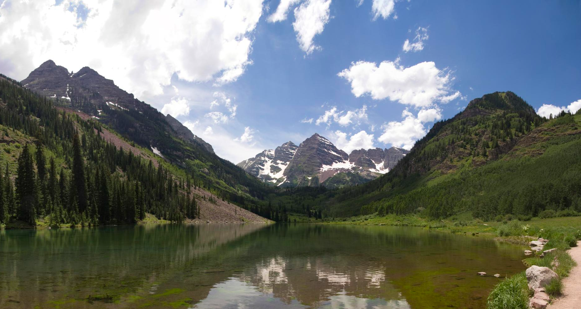
Even on urban hikes, you can enjoy the natural splendor of White River National Forest. Many trails follow rivers like the Colorado River or Gore Creek, offering scenic waterside views. You might also encounter aspen groves, wildflower meadows, and glimpses of the surrounding mountain ranges. While not directly on urban trails, iconic natural landmarks like Hanging Lake and Maroon Lake are within the broader forest area.
Are there any waterfalls accessible on or near the urban trails?
While the urban trails themselves might not lead directly to major waterfalls, the White River National Forest is home to several beautiful cascades. For example, Spouting Rock Waterfall and Booth Falls are notable highlights within the forest that can be accessed via other trails.
What is the best time of year for urban hiking in White River National Forest?
The best time for urban hiking in White River National Forest is typically from late spring through early autumn (May to October). During these months, the weather is generally mild, trails are clear of snow, and the landscapes are vibrant with greenery or fall colors. Winter can also be beautiful for snowshoeing or cross-country skiing on some paths, but conditions vary.
Are there any loop trails among the urban hiking options?
Yes, several urban trails offer loop options or can be combined to create circular routes, providing varied scenery without retracing your steps. The Gore Valley Trail, for instance, has sections that can be enjoyed as out-and-back or integrated into longer loops depending on your starting point and desired distance.
What do other hikers say about the urban trails in White River National Forest?
The komoot community highly rates the urban trails in White River National Forest, with an average score of 4.7 out of 5 stars from over 200 ratings. Reviewers often praise the well-maintained paths, scenic river views, and the ease of access, making them perfect for a relaxing stroll or a quick outdoor escape.
Is parking available for these urban hiking trails?
Parking is generally available near the access points for urban hiking trails, often in designated lots or street parking in nearby towns. Since these trails are close to developed areas, finding parking is usually more straightforward than for remote backcountry trailheads. Always check local signage for any parking restrictions or fees.
Are permits required for urban hiking in White River National Forest?
Generally, permits are not required for casual urban hiking on the trails listed in this guide. However, for certain popular or sensitive areas within the broader White River National Forest, such as Hanging Lake, a permit system is in place due to their popularity and ecological sensitivity. Always verify specific requirements for your chosen destination.
What are some good urban trails for beginners?
All 12 urban trails in this guide are rated as easy, making them excellent choices for beginners. The Blue River Rec Path is a great option, offering a relatively flat and well-maintained surface perfect for those new to hiking or looking for a leisurely walk.
Most popular routes in White River National Forest
Most popular attractions in White River National Forest

Get inspired with the komoot mobile app


Explore more
Browse the best Hikes in other regions.
