The best hikes from bus stations in White River National Forest
4.7
(236)
7,824
hikers
123
hikes
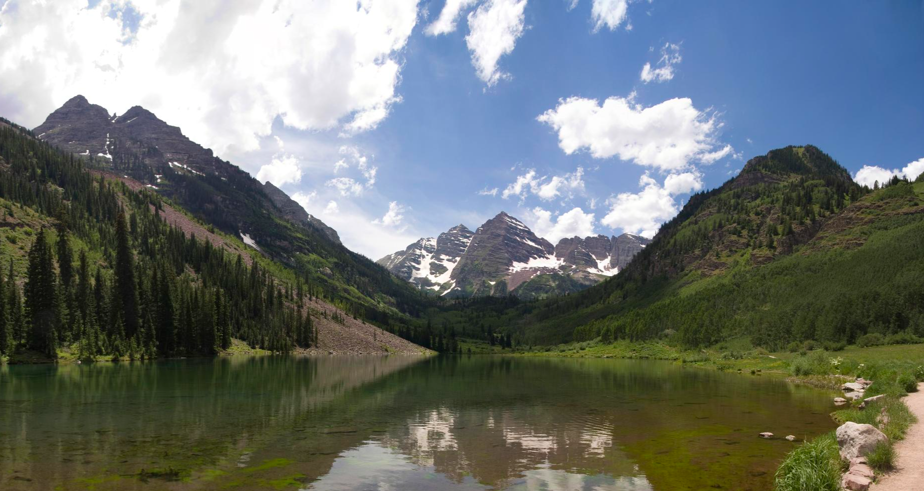
Bus station hiking trails in White River National Forest offer access to a vast landscape characterized by prominent Rocky Mountain ranges, including the Gore and Tenmile. The region features a dramatic elevation range, from river valleys to peaks over 14,000 feet. Hikers can explore diverse ecosystems, including extensive aspen groves, dense stands of pine, spruce, and fir, and high-elevation tundra. The forest also contains numerous alpine lakes, creeks, and rivers.
Best bus station hiking trails in White River National Forest
…Last updated: July 22, 2026
4.0
(1)
4
hikers
5.61km
01:35
130m
110m
Embark on an easy hiking adventure along the Upper Salt Lick, Too-pwech, So-uv Trail, a 3.5-mile (5.6 km) route that takes about 1 hour and 34 minutes to complete. You…
2
hikers
6.74km
02:28
710m
0m
Hike Bald Mountain via Baldy Road, a moderate 4.2-mile trail near Breckenridge, offering panoramic views and historic mining remnants.

Sign up for free
1
hikers
18.8km
05:02
260m
110m
Embark on a difficult hiking adventure along the Upper Blue Recpath, a challenging 11.7-mile (18.8 km) route that takes approximately 5 hours and 2 minutes to complete. You will gain…
3.58km
00:56
0m
60m
The Blue River Rec Path offers a delightful, accessible stroll through the heart of Breckenridge, providing stunning vistas of the Tenmile Range and the lively Blue River. This paved trail…
55
hikers
4.03km
01:03
30m
30m
The Gore Valley Trail offers a delightful and easy escape into Vail's natural beauty, following the serene Gore Creek Path. You'll experience a continuous display of red-sandstone cliffs, peaceful aspen…
Get access to more routes and recommendations from other explorers.
Sign up for free
Already have an account?
Our route recommendations are based on thousands of hikes, rides, and runs completed by other people on komoot.
Start today with a free account
Your next adventure awaits.
Login or Signup



Other adventures in White River National Forest


Tips from the Community

This is where most of the shuttles in and out of Breckenridge will stop or start. There are many lines, so be sure to take the right color (green, grey, orange ...). Use the map to get an overview which line is heading where. There are also lines that will take you the the Bunkhouse Lodge, the CT/CDT Trailhead (Golden Hill) and even to Frisco. All shuttles are free and so is the gondola which is right at the station.
5
0
The City Market has a decent variety of groceries, pharmacy and regular things that you might expect in a town store. Prices are acceptable, although Breckenridge is pretty touristy.
3
0
The shuttle will take you into Breckenridge or Frisco (other direction). It is for free, but it doesn't really follow a reliable schedule. There is an app that you can try to figure out the timetable ... or just wait. It will come eventually.
3
0
The Gold Hill Trailhead is a good access point for the Colorado Trail and the Continental Divide Trail. This is also where hikers can take the free shuttle bus into Breckenridge or Frisco.
3
0

A small detour from the main bikeway takes you to a collection of signposts that tell the story of gold dredging in the Blue River and life surrounding the gold rush.
0
0

Gore Creek Trail follows Gore Creek, a tributary of the Eagle River, which flows through the heart of downtown Vail. The path connects Lionshead and Vail Village via the scenic Gore Creek Path. This paved path offers a leisurely walk or bike ride, perfect for enjoying Vail’s charm. The trail spans 2 miles through town but extends nearly 19 miles as the Gore Valley Trail for those seeking a longer journey. Dog-friendly and easily accessible from most Vail hotels, the path has beautiful views, opportunities for fly fishing, and the peaceful ambiance of the mountain town.
1
0

Here the doubletrack road ends, and a singletrack trail winds its way up to the ridge where you can hike to the summit of Bald Mountain. The panoramic views across Breckenridge and the mountains are stunning and reward your efforts. Be sure to keep an eye out for the Iowa Mill and Carbonate Silver Mine down the mountain.
0
0

Great local accommodation for any time of year!
0
0
Frequently Asked Questions
How many hiking trails are accessible directly from bus stations in White River National Forest?
There are over 100 hiking routes in White River National Forest that are accessible directly from bus stations. These trails offer a convenient way to explore the diverse landscapes without needing a car.
What types of trails can I expect when hiking from bus stations in White River National Forest?
You'll find a wide variety of trails, from easy strolls to more challenging ascents. Approximately 60 of the bus-accessible routes are rated as easy, 42 as moderate, and 7 as difficult. This includes paths like the easy Upper Salt Lick, Too-pwech, So-uv Trail, the moderate Bald Mountain via Baldy Road, and the more difficult Upper Blue Recpath.
Are there any family-friendly hiking options accessible by bus?
Yes, many of the easy routes are suitable for families. Trails like the Blue River Rec Path and Gore Valley Trail offer gentle terrain and scenic views, perfect for hikers of all ages. The White River National Forest features extensive aspen groves and river valleys that are enjoyable for a family outing.
Can I bring my dog on these bus-accessible hiking trails?
Many trails within the White River National Forest are dog-friendly, but regulations can vary by specific area, especially within designated Wilderness Areas. Always check local signage and adhere to leash laws. It's recommended to confirm the specific trail's rules before heading out with your pet.
What kind of natural attractions can I see along bus-accessible routes?
The White River National Forest is rich in natural beauty. You might encounter stunning alpine lakes, thundering creeks, and diverse forest ecosystems. Notable attractions include several mountain passes like Kokomo Pass and Hoosier Pass, as well as beautiful waterfalls such as Spouting Rock Waterfall and Booth Falls. Some routes might even lead to iconic spots like Hanging Lake, though access to popular sites often requires permits or shuttle reservations.
What is the best time of year to hike from bus stations in White River National Forest?
The best time for hiking is generally from late spring through early fall (May to October) when trails are clear of snow and weather is milder. Summer offers lush greenery and wildflowers, while fall brings spectacular aspen foliage. Some higher elevation trails may remain snow-covered until July. Winter hiking is possible, but requires appropriate gear and awareness of avalanche risks.
Are there any permits or reservations required for bus-accessible trails?
While many trails do not require permits for day hiking, popular areas like Maroon Bells Scenic Area and Hanging Lake often require reservations for shuttle access or entry, especially during peak season. Some designated Wilderness Areas may also require permits for overnight backpacking. Always check the specific requirements for your chosen trail in advance.
What do other hikers enjoy most about hiking in White River National Forest?
The area is highly rated by the komoot community, with an average score of 4.66 stars. Reviewers often praise the stunning mountain scenery, the abundance of alpine lakes, and the diverse ecosystems ranging from aspen groves to high-elevation tundra. The convenience of accessing trails via public transport is also frequently highlighted.
Are there any loop hikes available from bus stations?
Yes, you can find several loop options among the bus-accessible trails. Loop routes provide a varied experience without retracing your steps. While specific loop names are not listed here, exploring the easy and moderate categories will reveal suitable circular paths.
What amenities are available near bus station trailheads?
Amenities vary depending on the specific bus station and trailhead. Larger towns and resort areas within or near the White River National Forest, such as Vail, Aspen, or Glenwood Springs, offer a range of services including cafes, restaurants, restrooms, and gear shops. Smaller bus stops might have limited facilities, so it's always best to come prepared with water and snacks.
How can I find out about bus schedules and routes to trailheads?
Information on bus schedules and routes to trailheads is typically available through local public transportation services in towns bordering the White River National Forest. Key areas like Vail, Aspen, and Summit County have robust bus systems that provide access to many popular hiking destinations. It's recommended to check their official websites for the most current timetables and route maps.
Most popular routes in White River National Forest
Most popular attractions in White River National Forest

Get inspired with the komoot mobile app


Explore more
Browse the best Hikes in other regions.
