The best walks and hikes in Embalse De Malpasillo
4.1
(12)
36
hikers
5
hikes
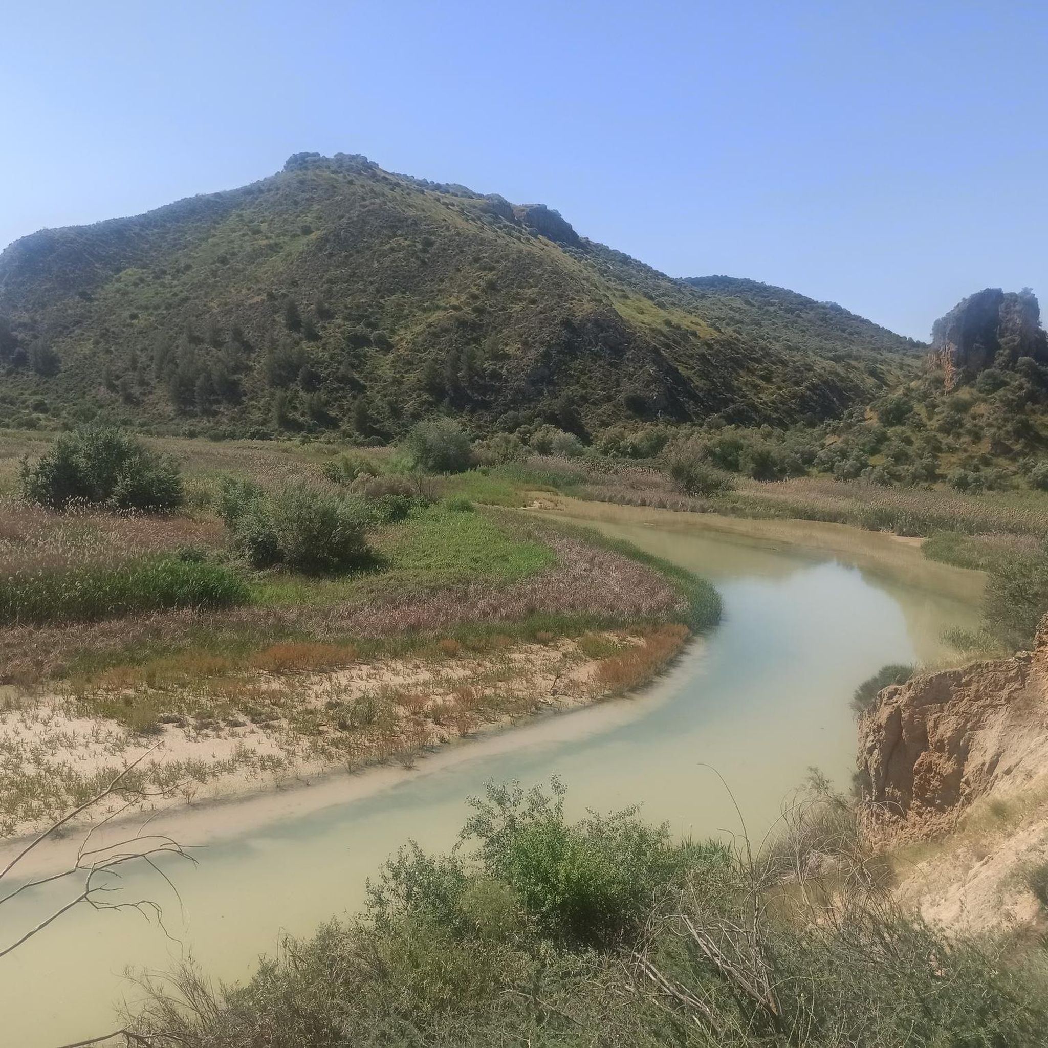
Hiking trails in Embalse De Malpasillo traverse a distinctive landscape shaped by the Genil River. The area features a rugged riverbed with steep slopes and a unique whitish water appearance due to the gypsiferous marl terrain. Lush riparian vegetation, including bulrushes and reeds, lines the reservoir's shores, providing a habitat for diverse wildlife. Upstream, the Genil River meanders offer additional scenic views for hikers.
Best hiking trails in Embalse De Malpasillo
- The most popular hiking route is Near the Genil…
Last updated: June 26, 2026
3.7
(3)
6
hikers
7.33km
02:01
120m
120m
Moderate hike. Good fitness required. Easily-accessible paths. Suitable for all skill levels.
3.8
(6)
18
hikers
8.95km
02:31
180m
180m
Moderate hike. Good fitness required. Easily-accessible paths. Suitable for all skill levels.

Sign up for free
4.7
(3)
12
hikers
9.15km
02:36
190m
190m
Moderate hike. Good fitness required. Easily-accessible paths. Suitable for all skill levels.
15.2km
04:00
130m
130m
Moderate hike. Good fitness required. Easily-accessible paths. Suitable for all skill levels.
Easy hike. Great for any fitness level. Easily-accessible paths. Suitable for all skill levels.
Our route recommendations are based on thousands of hikes, rides, and runs completed by other people on komoot.
Start today with a free account
Your next adventure awaits.
Login or Signup
Tips from the Community

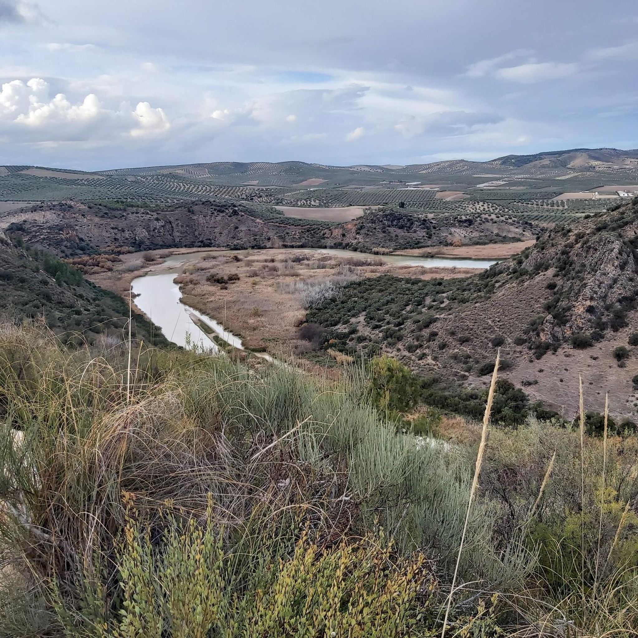
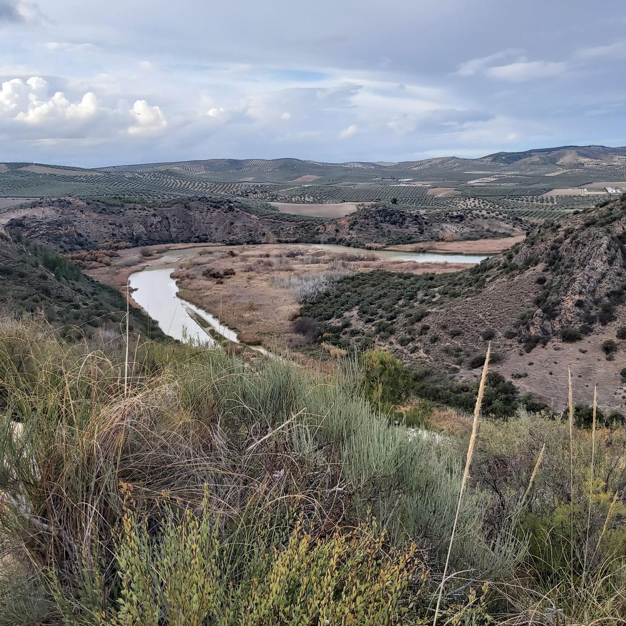
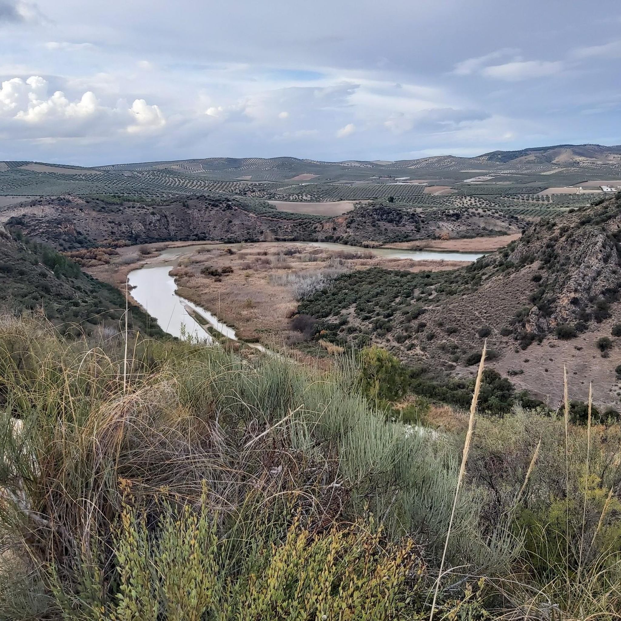
Beautiful valley through which the Río Genil runs and which offers a wide view of this area that is above the arrival of the reservoir.
0
0
Hermitage that still contains the style of a Mozarabic-style cave church in which the amplitude of its façade stands out, making it one of the few monuments of these characteristics in Andalusia.
0
0
Beautiful views of the Malpasillo Reservoir and you can also see the continuity of the Río Genil!
0
0

Outdoor adventure route, passing through the Hermitage of Nuestra Señora de la Fuensanta and the ruins of old mines.
1
0
View of the Malpasillo Dam on the Genil River on the outskirts of the town of Badolatosa. The slowing of the river creates a unique natural landscape and a habitat for wildlife. A great outdoor space for adventure.
1
0

From this point we can see the dam on the Genil river and the town of Badolatosa on our left. Going down the dirt road we will arrive at the famous meander of the Genil river (it is a 15-minute walk).
2
0
It is located on the outskirts of the municipality and was built between 1544 and 1620. It is a Mozarabic-style cave church in which the breadth of its façade stands out, making it one of the few monuments of these characteristics in Andalusia. .
1
0
One of the last meanders of the Genil river before reaching the Malpasillo Reservoir, close to the town of Badolatosa. Space to be there for a while, quietly and enjoying this beautiful landscape!
1
0
Frequently Asked Questions
What kind of hiking trails can I find in Embalse de Malpasillo?
Embalse de Malpasillo offers a variety of hiking trails that traverse a distinctive landscape. You can expect rugged riverbeds, areas with steep slopes, and lush riparian vegetation along the reservoir's shores. The trails also explore the picturesque meanders of the Genil River upstream. The water itself has a unique whitish color due to the gypsiferous marl terrain.
Are there easy hiking options suitable for families or beginners?
Yes, Embalse de Malpasillo has options for various ability levels. For an easier walk, consider the Path of the Arroyo de las Cañas - circular from Palenciana (PR-A 8), which is 4.3 km long and typically takes just over an hour to complete. This route offers varied terrain that is generally accessible.
What are the best times of year to go hiking in Embalse de Malpasillo?
Embalse de Malpasillo is an excellent destination for hiking year-round, especially for birdwatching. It serves as a crucial resting point during bird migration and is significant for nesting and wintering species. Spring and autumn generally offer pleasant temperatures for hiking, while winter can be ideal for observing a wider variety of waterfowl.
What kind of wildlife can I expect to see while hiking?
The embalse is an internationally important site for bird species, making it exceptional for birdwatching. Hikers can observe a wide array of waterfowl such as stiff-tailed ducks, northern shovellers, mallards, common pochards, Eurasian coots, and common moorhens. Raptors like western marsh harriers, peregrine falcons, and kestrels are also present. Recently, flamingos, avocets, and different plover species have been observed.
Are there any circular hiking routes in the area?
Yes, several circular routes are available. A popular choice is the Arroyo del Pontón – Genil River Meander loop from Badolatosa, a moderate 8.9 km path that explores the river's meanders. Another option is the Path of the Arroyo de las Cañas - circular from Palenciana (PR-A 8), which is 4.3 km.
What interesting landmarks or viewpoints can I discover along the trails?
Hikers can enjoy beautiful views of the Malpasillo Dam on the Genil River, particularly from vantage points like Views of the Malpasillo Dam and Genil River. You can also explore the Genil River Meander and the Arroyo del Pontón. Some routes, like Near the Genil River and Fuensanta Chapel — round trip from Badolatosa, pass by historical sites such as the Hermitage of Our Lady of Fuensanta.
Are dogs allowed on the hiking trails in Embalse de Malpasillo?
While specific regulations for dogs on every trail are not detailed, Embalse de Malpasillo is a natural area. Generally, dogs are welcome on trails in natural parks in Spain, but it's always recommended to keep them on a leash to protect local wildlife, especially in a Special Protection Area for Birds (ZEPA) like this one.
What do other hikers enjoy most about the trails in Embalse de Malpasillo?
The area is highly rated by the komoot community, with an average score of 4.1 stars from over 10 reviews. Hikers often praise the unique natural environment, the opportunities for birdwatching, and the scenic views of the Genil River and the Malpasillo Dam.
Are there any longer or more challenging hikes for experienced hikers?
Most of the trails in Embalse de Malpasillo are rated as moderate. For a longer moderate hike, consider the Ribera del Rio de las Yeguas — circular desde Casariche, which is over 15 km long and involves some elevation gain, offering a more extended exploration of the region's natural beauty.
Is there public transport or parking available near the trailheads?
While specific public transport links directly to all trailheads are not widely available, many routes, such as those starting from Badolatosa or Palenciana, are accessible by car. Parking is typically available in or near these villages, allowing convenient access to the hiking paths.
What should I pack for a hike in Embalse de Malpasillo?
Given the varied terrain and potential for steep sections, sturdy hiking shoes are recommended. Don't forget water, sun protection (hat, sunscreen), and snacks. If you're interested in birdwatching, binoculars are a must. Always check the weather forecast before you go and dress in layers.
Most popular routes in Embalse De Malpasillo
Most popular attractions in Embalse De Malpasillo

Get inspired with the komoot mobile app


Explore more
Browse the best Hikes in other regions.
