The best road cycling routes in Embalse De Malpasillo
82
riders
9
rides
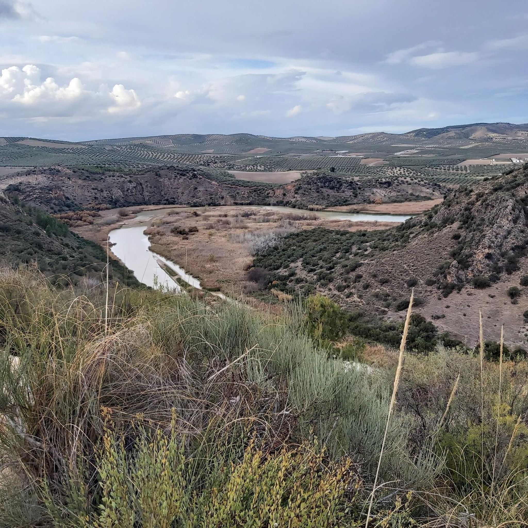
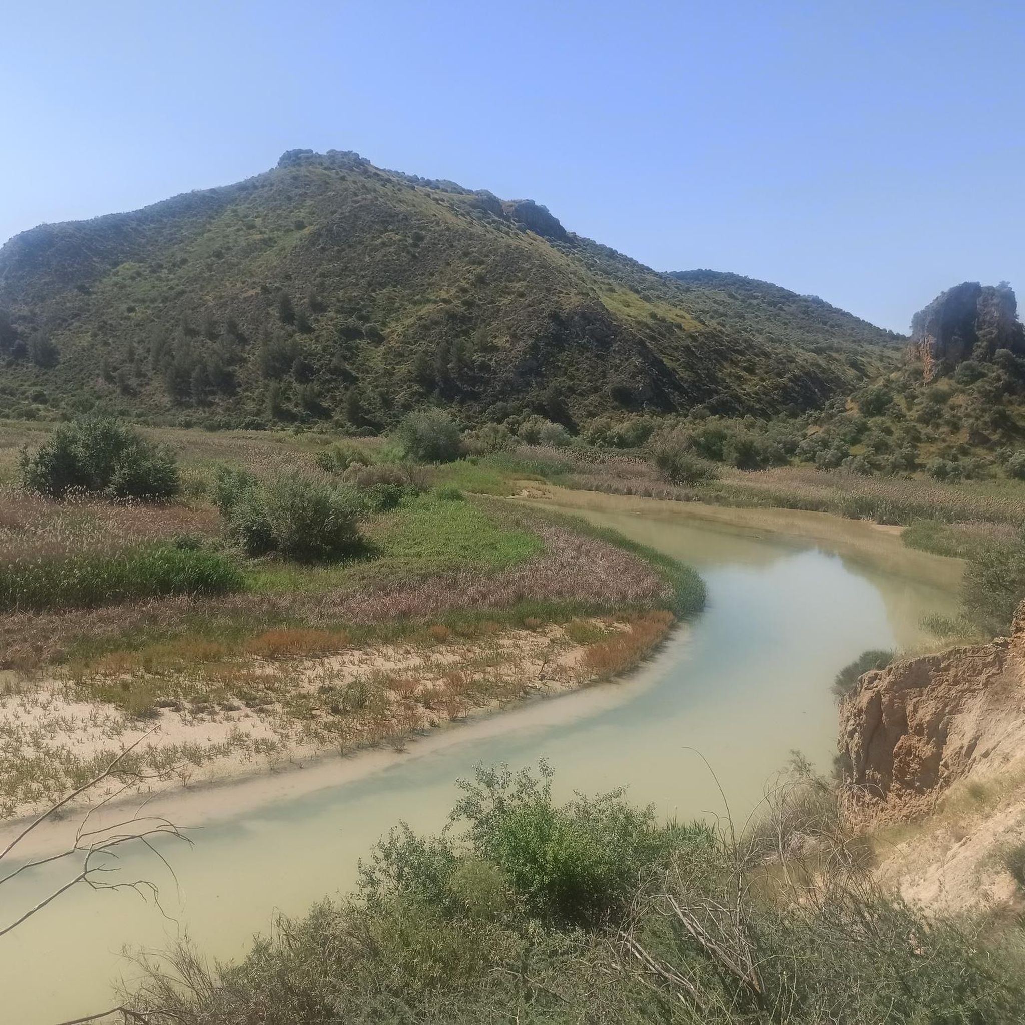
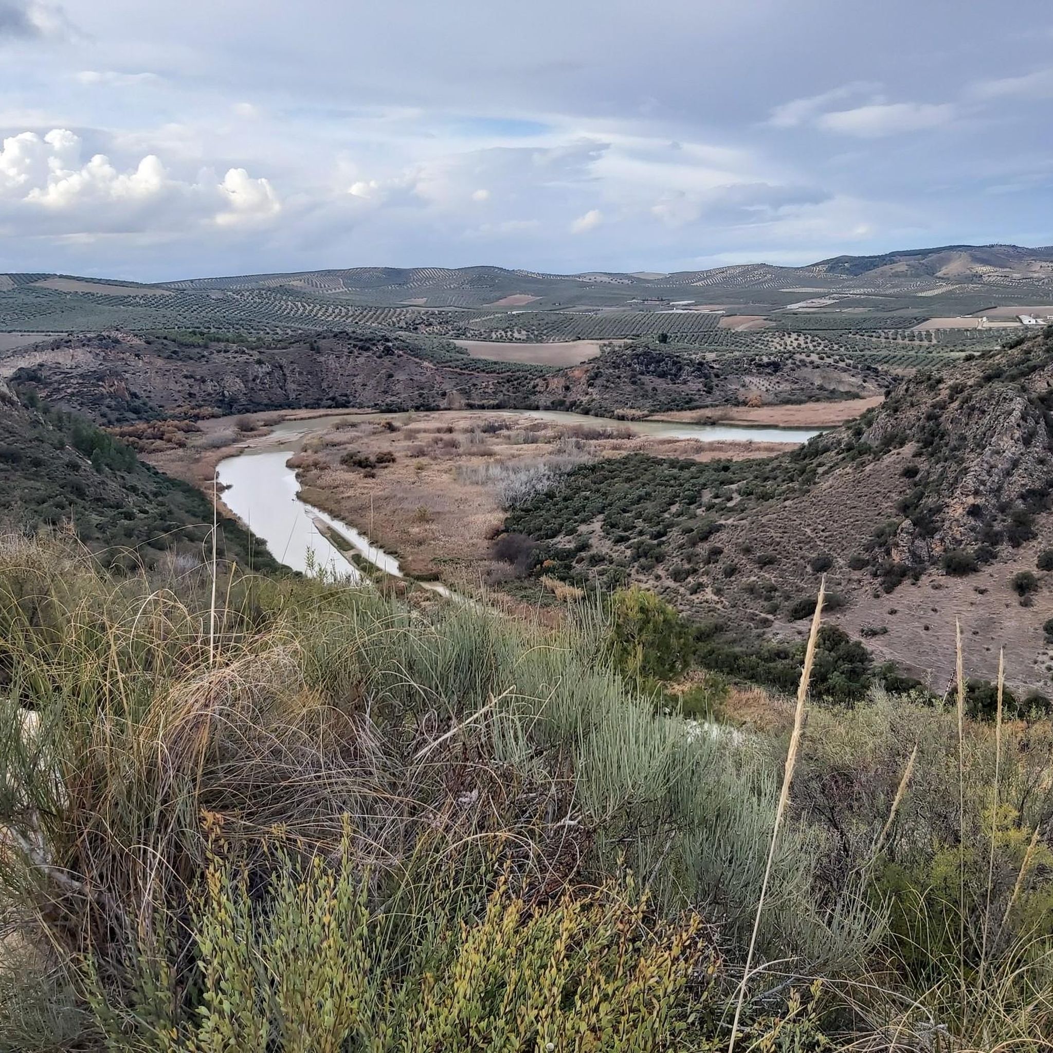
Road cycling routes in Embalse De Malpasillo traverse a rugged landscape characterized by steep slopes and gypsum marl soil, situated on the Río Genil's riverbed. The surrounding region, part of the Sub-Baetic unit of the Betic mountain ranges, features extensive olive groves and diverse terrain with challenging ascents. Cyclists can expect smooth asphalt roads that wind through picturesque valleys and charming villages, offering varied gradients.
Best road cycling routes in Embalse De Malpasillo
- The most popular road cycling route is…
Last updated: July 10, 2026
14
riders
63.3km
03:11
1,000m
1,000m
Hard road ride. Very good fitness required. Mostly well-paved surfaces and easy to ride.
14
riders
101km
04:18
790m
790m
Moderate road ride. Good fitness required. Some segments of this route may be unpaved and difficult to ride.

Sign up for free
11
riders
84.1km
04:13
980m
980m
Hard road ride. Very good fitness required. Some segments of this route may be unpaved and difficult to ride.
13
riders
104km
04:47
1,180m
1,180m
Hard road ride. Very good fitness required. Mostly well-paved surfaces and easy to ride.
9
riders
61.2km
03:23
1,180m
1,180m
Hard road ride. Very good fitness required. Some segments of this route may be unpaved and difficult to ride.
Get access to more routes and recommendations from other explorers.
Sign up for free
Already have an account?
Our route recommendations are based on thousands of hikes, rides, and runs completed by other people on komoot.
Start today with a free account
Your next adventure awaits.
Login or Signup
Popular around Embalse De Malpasillo

Tips from the Community

The Laguna de Fuente de Piedra provides an important habitat for large flamingo colonies and is one of the most significant breeding grounds for this bird species in Europe. The shallow salt lagoon offers ideal conditions for the birds, allowing them to be observed there in large numbers, especially during the warmer months.
1
0
Laguna de Fuente de Piedra is home to large flamingo colonies and is considered one of the most important breeding grounds for this bird species in Europe, where they can be observed particularly well in the warmer months.
3
0
The Vicaría Observatory (Mirador) is an official viewpoint at the Fuente de Piedra Lagoon and is one of the most important observation points in the nature reserve. From here, there is a good overview of the shallow salt lagoon.
2
0
Fuente de Piedra is a charming village whose name derives from an ancient spring believed to possess healing powers. The area was already settled in Roman times, and the spring was then referred to as "Fons Divinus." In the Middle Ages, a small settlement grew up around the spring, which later acquired its present name. During the 18th and 19th centuries, Fuente de Piedra was a renowned spa town thanks to its mineral waters, until the spring dried up. Today, the village's name evokes this past, while its history remains closely intertwined with the use and veneration of the water.
1
0
The Parish Church of Our Lady of the Immaculate Conception (Iglesia Parroquial de Nuestra Señora de la Inmaculada Concepción) is the main church of Alameda and is located in the town center. Built in 1633, it has been expanded several times over the centuries, including the 18th century with the addition of side aisles and a Baroque chapel. The church displays typical elements of Andalusian Baroque architecture, with a simple stone and brick facade and a striking round-arched portal. Inside, the high nave, flanked by two lower side aisles, and a barrel-vaulted ceiling create a harmonious atmosphere. The church is particularly famous as the burial place of the legendary bandit El Tempranillo, who died in Alameda in 1833. It also houses an elaborate image of the Virgen de los Dolores (Virgin of Sorrows), created in 1940 by the sculptor Castillo Lastrucci. The church is now a listed building and is considered one of the most important historical buildings in the town, combining both religious and cultural history.
2
0
The section near Alameda is a particularly attractive route for cyclists, leading through vast olive groves and rolling hills. The landscape is characterized by typical Andalusian agricultural landscapes, small farms, and extensive olive plantations that stretch for miles. The focus of this bike tour is less on the physical challenge and more on enjoying the peace, nature, and characteristic Andalusian scenery. The road offers numerous opportunities to take in the surroundings at your leisure and experience the beauty of the olive groves up close.
1
0
The Laguna de Fuente de Piedra is the largest natural lagoon in Andalusia and an important wetland in the northwest of the province of Málaga. It is best known for its large colony of greater flamingos, which nest here in spring and provide one of the region's most impressive natural spectacles. The shallow salt lagoon also attracts nearly 200 species of birds and is an important resting place for migratory birds. Surrounded by salt marshes, reed beds, and Mediterranean vegetation, the area offers ideal conditions for wildlife. A visitor center provides information about the flora and fauna, while birdwatching platforms and guided tours offer nature lovers exciting insights. The lagoon is an ideal spot for nature photography amidst a fascinating landscape. The Laguna de Fuente de Piedra is also an ideal destination for cyclists who want to combine nature experiences with physical activity. The area offers a variety of cycling routes of varying difficulty levels, leading through the picturesque landscape and along the largest natural lagoon in Andalusia. The “José Antonio Valverde” visitor center serves as a good starting point for cycling tours and offers information about the flora and fauna of the region.
4
0

Frequently Asked Questions
How many road cycling routes are available in Embalse De Malpasillo?
There are 9 road cycling routes available in the Embalse De Malpasillo area, offering diverse experiences for cyclists. These routes range from moderate to difficult, with the majority presenting a significant challenge.
What is the typical terrain like for road cycling in Embalse De Malpasillo?
Road cycling in Embalse De Malpasillo features a rugged landscape with steep slopes and gypsum marl soil, situated on the Río Genil's riverbed. You'll encounter extensive olive groves and diverse terrain with challenging ascents. The roads are generally smooth asphalt, winding through picturesque valleys and charming villages, providing varied gradients.
What are the difficulty levels of road cycling routes in this area?
The road cycling routes in Embalse De Malpasillo primarily cater to experienced cyclists. There is 1 moderate route and 8 difficult routes, characterized by significant elevation gains and challenging ascents through the region's rugged landscape and olive groves.
What is the best time of year for road cycling in Embalse De Malpasillo?
The region of Andalusia, where Embalse De Malpasillo is located, is well-known for its ideal cycling weather year-round. Cyclists can generally enjoy favorable conditions throughout most of the year, though spring and autumn offer particularly pleasant temperatures for tackling the area's challenging routes.
Are there any notable landmarks or points of interest along the road cycling routes?
Yes, several points of interest can be explored near the road cycling routes. You might encounter the Genil River Meander, the historic Hermitage of Our Lady of Fuensanta, or the scenic Arroyo del Pontón. Additionally, many routes offer stunning Views of the Malpasillo Dam and Genil River.
Are there any circular road cycling routes in Embalse De Malpasillo?
Yes, many of the routes in Embalse De Malpasillo are designed as loops. For example, you can try the challenging Castillo del Moral loop from Badolatosa, or the Palenciana – Olive Grove Trail loop from Palenciana, which offers challenging ascents through extensive olive groves.
Is there parking available for road cyclists near Embalse De Malpasillo?
While specific parking areas for cyclists are not detailed, as a natural park area, you can typically find parking in nearby villages like Palenciana or Badolatosa, which serve as common starting points for many routes. Always check local signage for parking regulations.
Can I reach Embalse De Malpasillo by public transport for road cycling?
Direct public transport options to the immediate vicinity of Embalse De Malpasillo may be limited. However, you can likely find public transport connections to larger nearby towns such as Lucena, from which you can cycle to the reservoir area. Planning your route from these towns would be advisable.
Are permits required for road cycling in Embalse De Malpasillo?
Generally, permits are not required for road cycling on public roads in the Embalse De Malpasillo area. However, always respect local regulations, especially when cycling through protected natural areas or private land. No specific cycling permits are mentioned for this region.
What kind of wildlife can I expect to see while road cycling in Embalse De Malpasillo?
Embalse De Malpasillo is an internationally important resting and nesting site for numerous bird species, including stiff-tailed ducks, northern shovellers, mallards, flamingos, and various herons. While cycling, you might spot these birds, especially near the reservoir's shores and surrounding agricultural lands, which serve as a vital stopover point during migration.
Are there any cafes or places to stop for refreshments along the routes?
The road cycling routes often pass through or near charming villages such as Palenciana and Badolatosa. These villages typically offer local cafes, bars, and small shops where you can stop for refreshments, water, or a meal. It's always a good idea to carry sufficient water and snacks, especially on longer routes.
What is the longest road cycling route available in the area?
The longest road cycling route in the area is the Castillo del Moral loop from Badolatosa, which spans 83.4 miles (134.2 km) and typically takes around 5 hours and 57 minutes to complete. This difficult route winds through rugged landscapes towards a historic landmark.
Are there any routes that pass by the Fuente de Piedra Lagoon?
Yes, the Olive Grove Trail – Fuente de Piedra Lagoon loop from Palenciana is a 62.3 miles (100.2 km) route that leads through olive groves and past the natural wetland of Fuente de Piedra Lagoon, offering a unique scenic experience.
Most popular routes in Embalse De Malpasillo
Most popular attractions in Embalse De Malpasillo

Get inspired with the komoot mobile app


Explore more
Browse the best Road cycling routes in other regions.
