The best road cycling routes around Montenerodomo
4.5
(20)
456
riders
23
rides
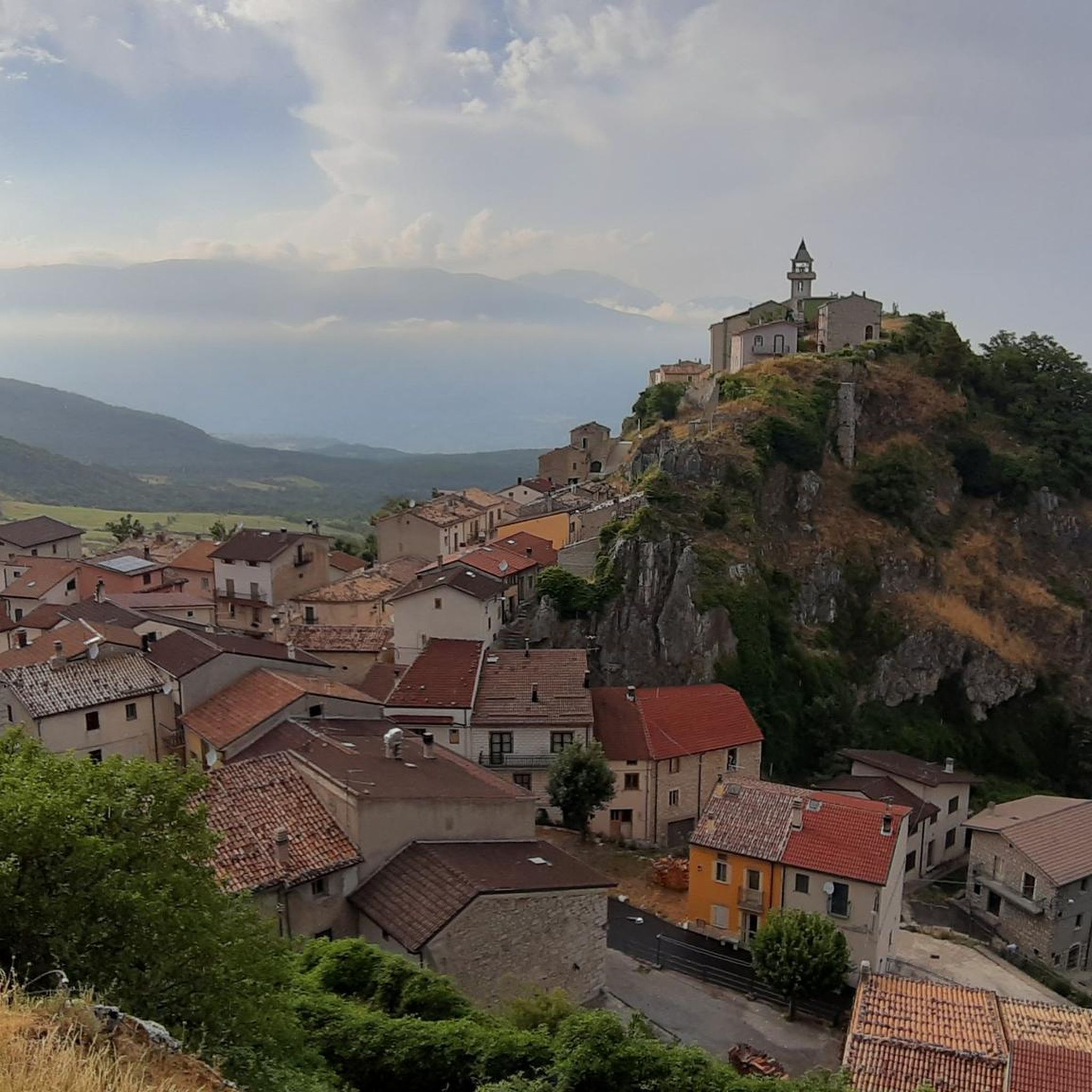
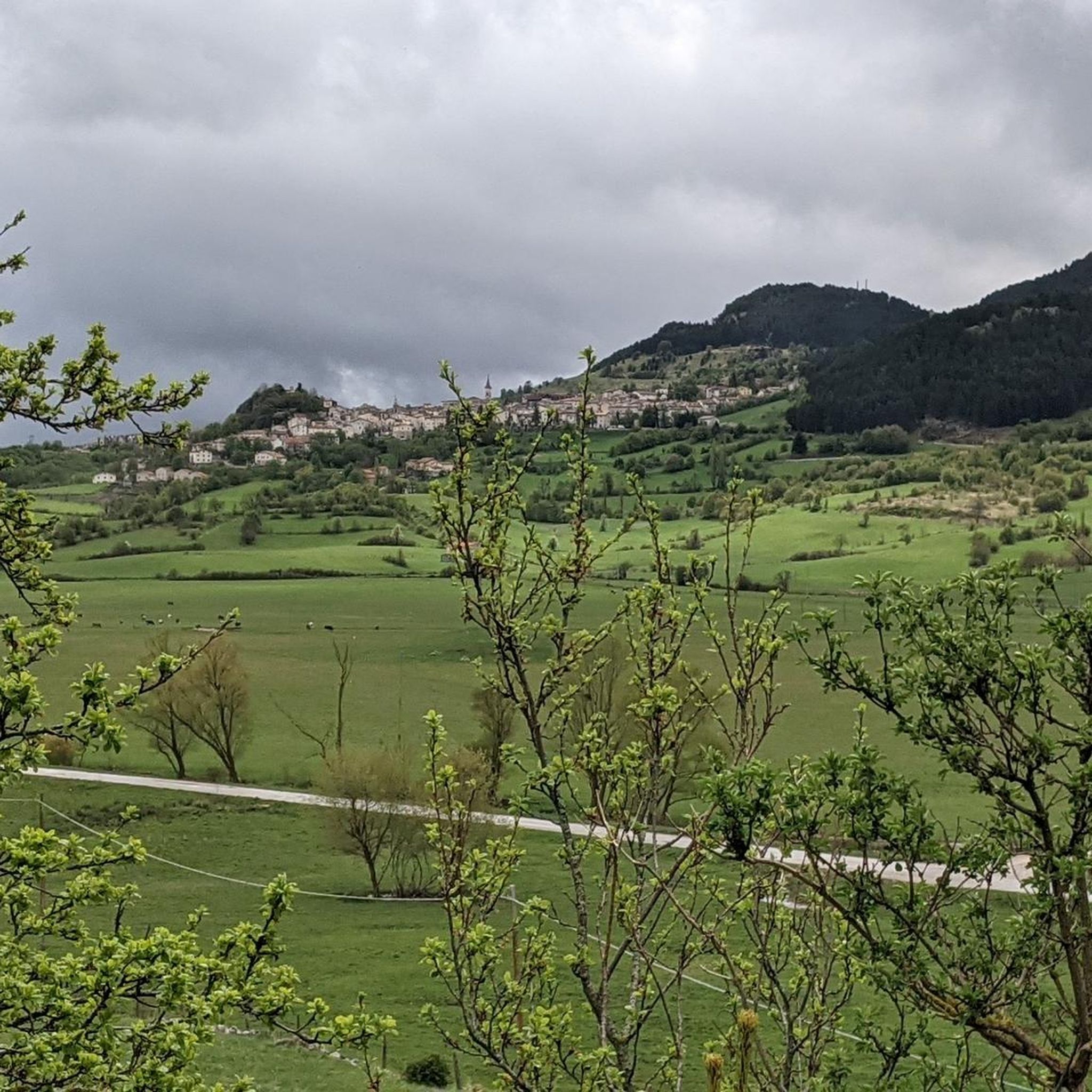
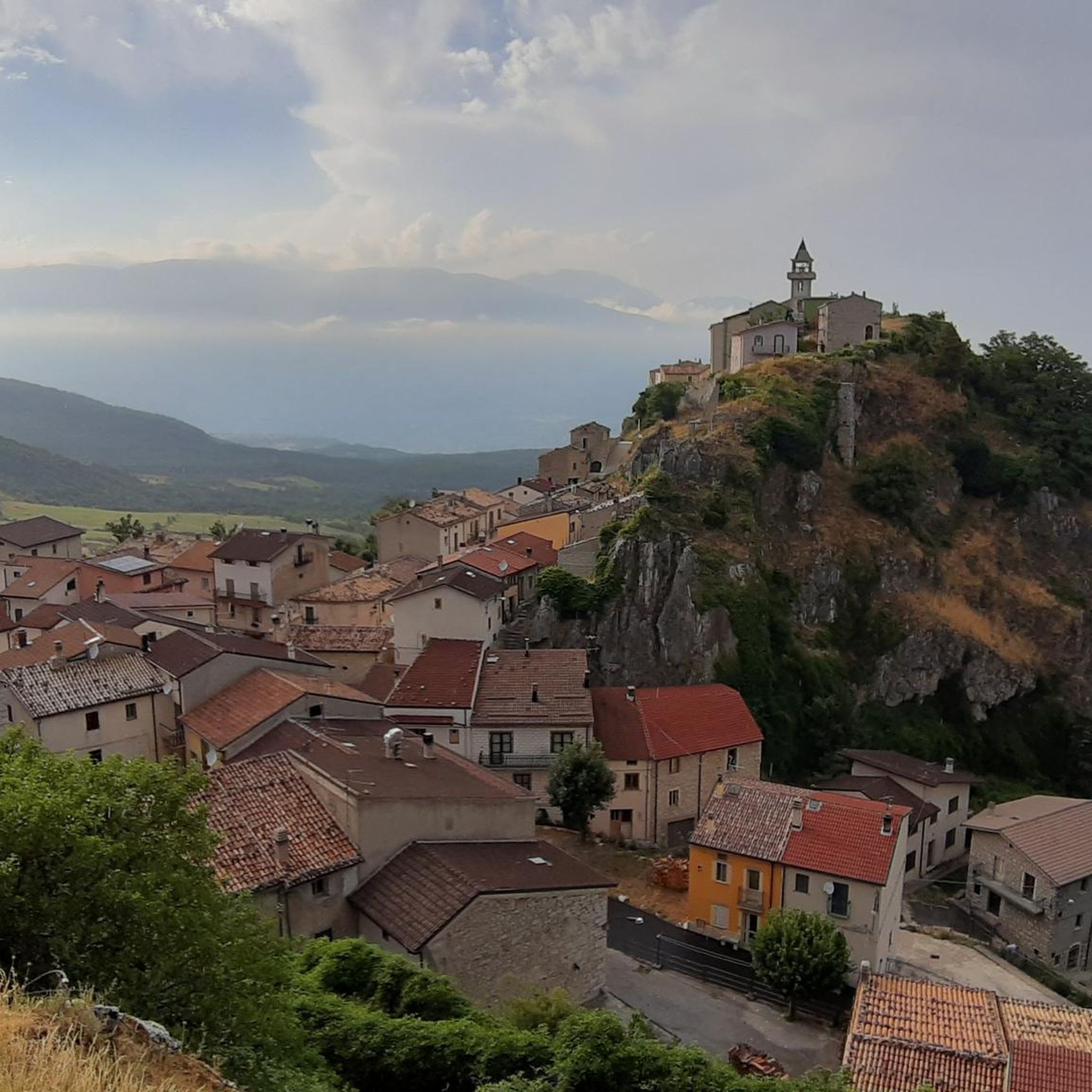
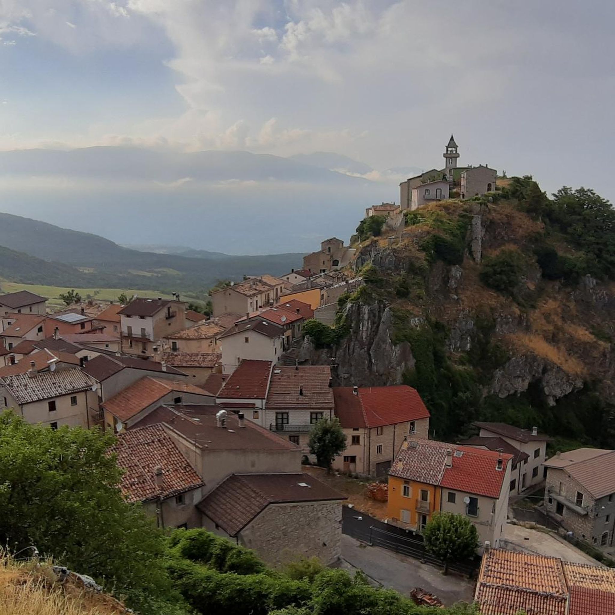
Road cycling routes around Montenerodomo are situated in a remote mountain hill town within Italy's Abruzzo region, perched on a rocky ridge at an elevation of 1165 meters. The terrain features significant elevation changes, offering panoramic views of surrounding valleys and the Maiella mountain range. This area is part of the Maiella National Park, characterized by diverse landscapes including rocky ridges and extensive valleys, providing a challenging environment for road cyclists.
Best road cycling routes around Montenerodomo
- The most popular…
Last updated: October 8, 2026
5.0
(1)
37
riders
66.6km
03:35
1,340m
1,340m
Hard road ride. Very good fitness required. Mostly well-paved surfaces and easy to ride.
21
riders
83.7km
04:36
1,730m
1,730m
Hard road ride. Very good fitness required. Mostly well-paved surfaces and easy to ride.

26
riders
132km
07:31
3,000m
3,000m
Hard road ride. Very good fitness required. Mostly well-paved surfaces and easy to ride.
4.0
(2)
23
riders
77.4km
03:59
1,220m
1,220m
Hard road ride. Very good fitness required. Some segments of this route may be unpaved and difficult to ride.
3.0
(1)
21
riders
49.7km
02:50
1,030m
1,030m
Hard road ride. Very good fitness required. Mostly well-paved surfaces and easy to ride.
Get access to more routes and recommendations from other explorers.
Already have an account?
Our route recommendations are based on thousands of hikes, rides, and runs completed by other people on komoot.
Start today with a free account
Your next adventure awaits.
Tips from the Community

The inhabitants of Abruzzo and the neighboring region of Lazio have their own local observation related to this Passo Lanciano. When the sun sets in the spring behind the mighty Majella massif, it quickly gets dark on the Abruzzo side (i.e., where Passo Lanciano is located) and dusk falls, while on the other side of the mountains, in Lazio, it is still bright daylight. Locals joke that at the same moment, one half of Italy goes to sleep, and the other goes for an aperitivo.
0
0

The sanctuary of the Madonna in Saletta is a religious building located in the middle of a pine and fir forest, three kilometers away from the center of the municipality of Castel del Giudice, in the province of Isernia
1
0

100 meters before the hill there is the station bar, an excellent refreshment point for sandwiches and trattoria
1
0


You can get here by train with your bike and go for a ride.
8
0
End of the climb before the Palena station
1
0

Passo Lanciano connects the two Abruzzo villages of Pretoro and Lettomanoppello. It is a place much loved by the locals, both in the summer and in the winter months: in fact, various hiking trails start from here and there are ski slopes. There is no shortage of restaurants where you can eat the typical arrosticini.
0
0

San Pietro Avellana is located on the border between Molise and Abruzzo. Walking among the streets of the town, the Cyclopean Walls are visible, the remains of the Samnite fortresses. Two other points of historical and cultural interest are the Fontana Grande, dating back to the 18th century, and the Museum of civilizations and traditions.
2
0
Frequently Asked Questions
What kind of terrain can I expect when road cycling around Montenerodomo?
Road cycling around Montenerodomo offers a challenging experience due to its mountainous terrain. Situated on a rocky ridge at 1165 meters, you'll encounter significant elevation changes, deep valleys, and panoramic views of the Maiella mountain range. The routes traverse diverse landscapes within the Maiella National Park, characterized by rocky ridges and extensive valleys, making it ideal for experienced cyclists seeking a good workout.
How many road cycling routes are available around Montenerodomo?
There are over 25 road cycling routes available around Montenerodomo on komoot. The majority of these, 21 routes, are classified as difficult, with 4 routes rated as moderate. This indicates a focus on more challenging rides in the region.
Are there any road cycling routes suitable for less experienced cyclists?
While the Montenerodomo area is known for its challenging climbs, there are a few routes rated as moderate difficulty. However, the region primarily caters to experienced cyclists due to the significant elevation profiles. It's advisable to check the specific route details for elevation gain and distance before setting out.
What natural features can I see while road cycling in the Montenerodomo area?
The Montenerodomo area, being part of the Maiella National Park, is rich in natural beauty. You can expect to see rocky ridges, expansive valleys, and the distant peaks of the Maiella mountain range. Specific natural highlights include the Quarto Grande Plateau, Mount Porrara, and the Bosco di Sant'Antonio forest, known for its beech and Turkey oaks. The Gola di Pennadomo gorge with its waterfall is also a notable feature.
Are there any historical sites or landmarks to explore near the cycling routes?
Yes, Montenerodomo boasts a rich history. You can explore the visible remains of the ancient Roman city of Juvanum, including an Acropolis, Forum, theater, and basilica. Other historical attractions include sections of megalithic walls from the 3rd century B.C., the medieval village itself, and historical buildings like the Fanzago Palace. The Hermitage of San Michele Arcangelo of Pescocostanzo and the Basilica of Santa Maria del Colle are also nearby religious sites.
Where can I find panoramic views during my road cycling tour?
Montenerodomo itself offers extensive panoramic views from its elevated position, overlooking the surrounding valleys and the distant Maiella peaks. Many routes are designed to maximize these vistas. For specific viewpoints, consider routes that pass near the Panoramic Ridge of Monte Porrara or the Scenic Viewpoint – Pietraferrazzana Rock Spur loop from Borrello, which is specifically named for its scenic outlooks.
What do other road cyclists enjoy most about road cycling in Montenerodomo?
The area is highly rated by the komoot community, with an average score of 4.75 stars from over 10 reviews. Reviewers often praise the challenging climbs, the rewarding panoramic views, and the unspoiled natural beauty of the Maiella National Park. The sense of accomplishment after tackling the significant elevation changes is a common highlight.
Are there any circular road cycling routes available?
Yes, many of the road cycling routes around Montenerodomo are designed as loops. For example, the Scenic Road Above Lettopalena – View of Palena loop from Taranta Peligna and the Quarto Grande Plateau – Bar Stazione di Palena loop from Civitaluparella are popular circular options that allow you to start and finish in the same location.
What is the best time of year for road cycling in Montenerodomo?
Given Montenerodomo's mountain location and significant elevation, the best time for road cycling is typically during the warmer months, from late spring through early autumn (May to October). During this period, the weather is generally more stable, and mountain passes are clear of snow. Always check local weather forecasts before planning your ride, especially for higher elevations.
Is Montenerodomo suitable for family-friendly road cycling?
Due to the challenging terrain and significant elevation changes, Montenerodomo's road cycling routes are generally not considered family-friendly for younger children or those new to cycling. The routes are primarily geared towards experienced cyclists. For families, it might be better to look for flatter, dedicated cycling paths in other parts of the Abruzzo region.
Can I bring my dog on road cycling routes in Montenerodomo?
While the Maiella National Park is generally welcoming to visitors, specific rules regarding dogs on cycling routes can vary. It's always best to keep dogs on a leash, especially in protected areas, to protect wildlife and ensure safety. Given the challenging nature of the road cycling routes, it might be difficult for dogs to keep pace or for you to manage them safely on a bike.
Are there any specific long-distance road cycling routes I should consider?
For longer distances, you might consider routes like the View of Palena – Castello di Roccascalegna loop from Palena, which covers approximately 66.4 miles (106.9 km) and involves significant climbs. Another option is the Sanctuary of Madonna in Saletta loop from Civitaluparella, spanning about 53 miles (85.2 km).
Most popular attractions around Montenerodomo

Get inspired with the komoot mobile app


Explore more
Browse the best Road cycling routes in other regions.
