Top 17 Mountain Passes around Betpouey
Best mountain passes around Betpouey are situated in the French Pyrenees, offering access to several mountain passes. This region is characterized by its challenging climbs and panoramic views of the surrounding peaks. The passes are significant for outdoor activities, including cycling and hiking. The area provides diverse terrain, from high-altitude routes to tranquil valleys.
Best mountain passes around Betpouey
- The most popular mountain passes is Luz-Ardiden, a viewpoint that is one of the most notable climbs in the Pyrenees,…
Last updated: July 10, 2026
Luz-Ardiden
Highlight • Viewpoint
Translated by Google •
Tip by

Tourmalet Pass
Highlight • Mountain Pass
Translated by Google •
Tip by
Sign up now to discover places like this
Get recommendations on the best single tracks, peaks, & plenty of other exciting outdoor places.
Sign up for free
Col de Bastanet
Highlight • Mountain Pass
Translated by Google •
Tip by
Voie Fignon
Highlight (Segment) • Trail
Translated by Google •
Tip by

Ascent of the Col de Tentes from Luz-Saint-Sauveur via the Cirque de Gavarnie
Highlight (Segment) • Mountain Pass
Translated by Google •
Tip by

Sign up for free to discover even more mountain passes around Betpouey.
Sign up for free
Already have an account?
Start today with a free account
Your next adventure awaits.
Login or Signup


Tips from the Community

Very poorly maintained road (stones, dung, etc.) but without any cars. A good alternative for a quiet climb, definitely to be avoided on the descent.
0
0

The road is reserved for bicycles and pedestrians, it's really pleasant, especially with everything else being full of cars... it's a nice break, plus the view is magnificent, we really appreciate it!
0
0

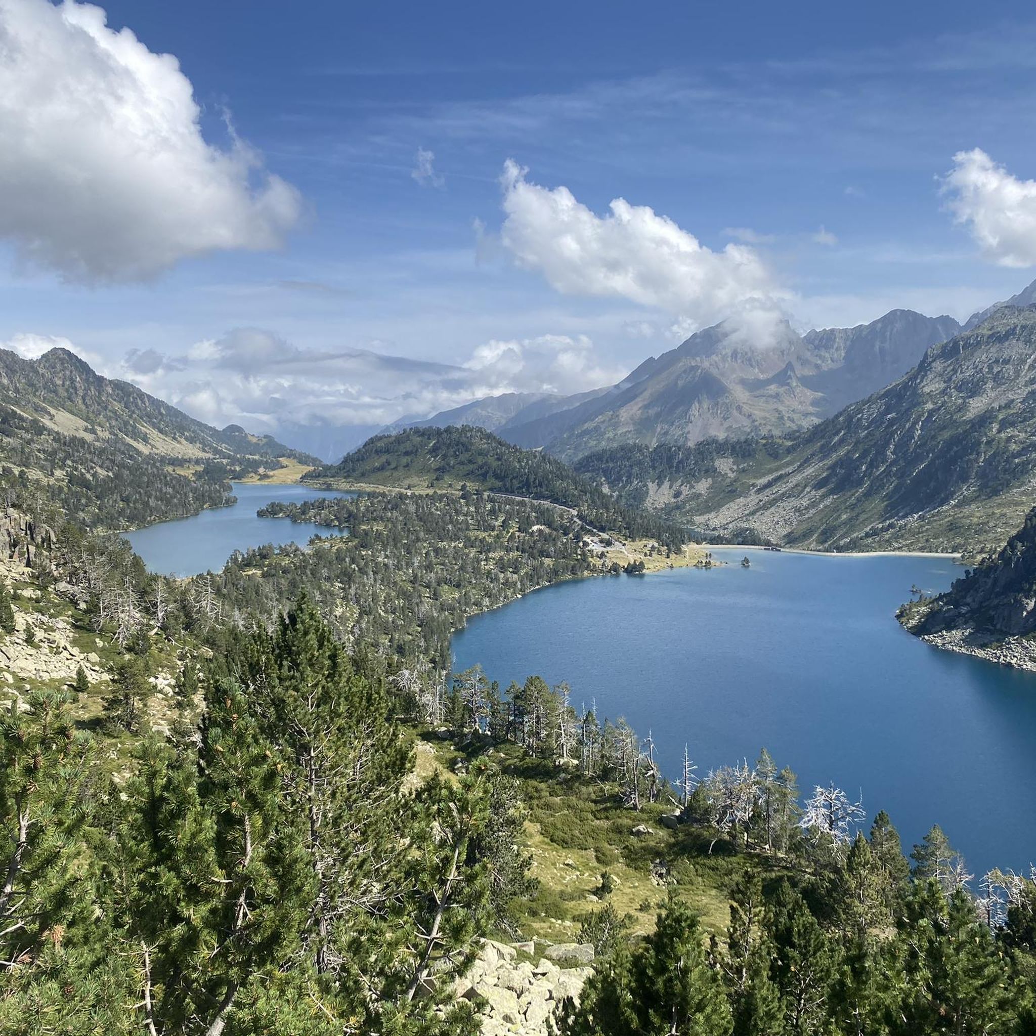
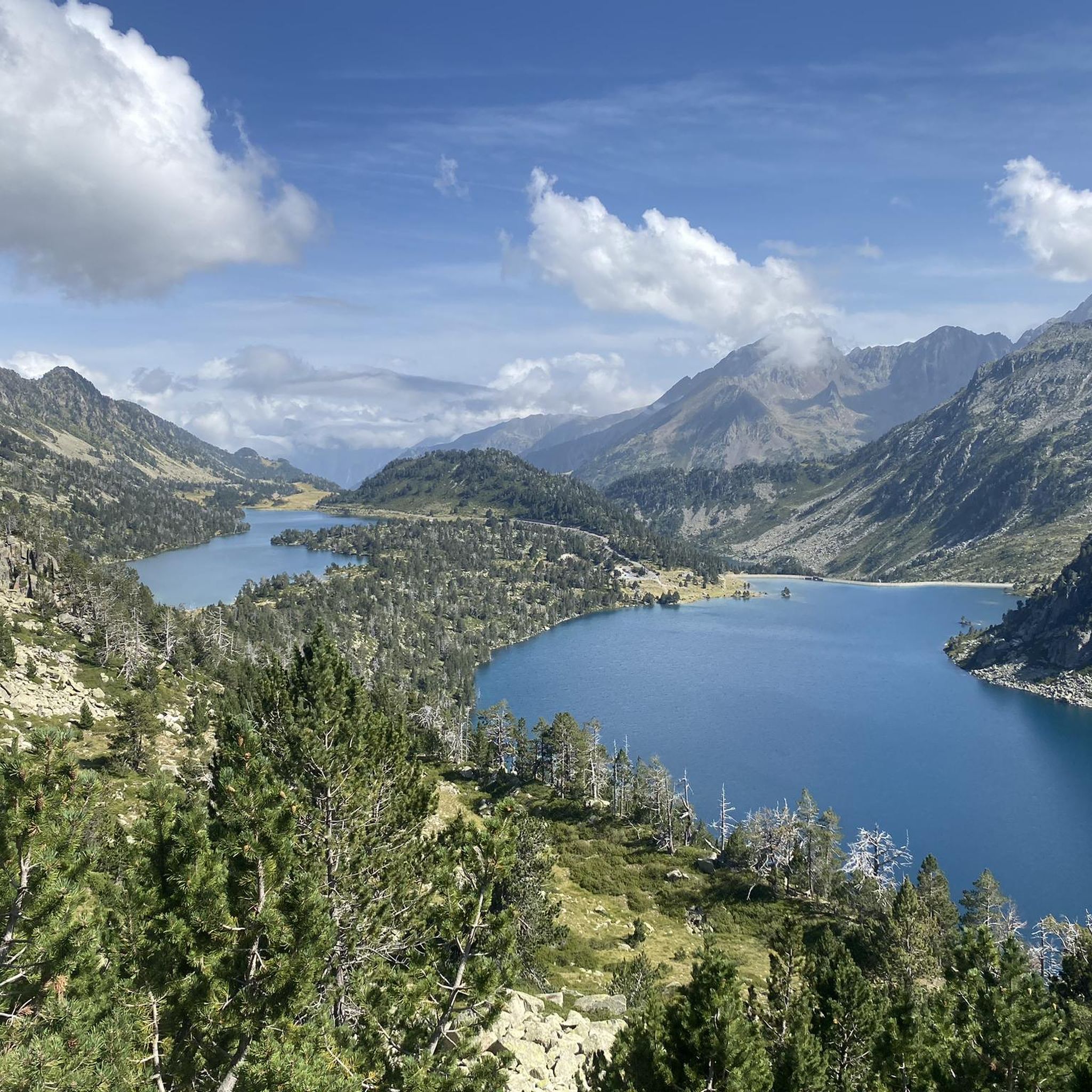
A family-friendly walk with magnificent views of several lakes. The Bastanet Pass and the peak are not far away if you have good footwear.
0
0
No cars, no motorcycles. This section of the Tourmalet is very pleasant. The surface is a little rough, but passable.
0
0

For the first 20 kilometers, the climb is gentle, crossing the picturesque landscapes of the Gavarnie cirque. Then once you reach the town of Gavarnie, the real climb begins, with much steeper gradients that can exceed 10%, reaching an altitude of 2,200 meters.
1
0

Uncleaned road, lots of stones and gravel + dirt. Possibly take it on the way up if you are fed up with cars on the main road, but otherwise stay on the main road. On the way down, there is no question: don't take this road!
1
0

mythical and EPIC port of the Pyrenees. It is the highest 2115mts
2
0

The 19km to Gavarnie are easy and on foot, 705 meters in altitude. The next 10 kilometers are tough and grueling with about 830 meters of elevation gain. Moreover, you go above 2000m, which also makes it more difficult.
0
0
Frequently Asked Questions
What are some of the most notable mountain passes around Betpouey?
Beyond the legendary Tourmalet Pass, the region boasts several other significant passes. These include Luz-Ardiden, known for its challenging climb and panoramic views, and the Col de l'Aubisque, offering exceptional vistas of the Gourette cirque. The Col du Soulor provides a tranquil experience through the Val d'Azun, while the Col du Pourtalet serves as a cross-border route into Spain with stunning views of the Pic du Midi d'Ossau.
What are the best mountain passes for cycling around Betpouey?
The area is a cyclist's paradise. The Tourmalet Pass is a legendary climb, frequently featured in the Tour de France. Other challenging and rewarding cycling passes include Luz-Ardiden, the Col de l'Aubisque, and the Col de Marie-Blanque, notorious for its steep 14% gradients. Many routes, like the "Col du Tourmalet from Luz-Saint-Sauveur," are available for cycling enthusiasts. You can find more cycling routes in the Cycling around Betpouey guide.
Are there challenging climbs for experienced cyclists in the Betpouey area?
Absolutely. The Pyrenees around Betpouey are famous for their formidable ascents. The Tourmalet Pass, especially the Ascent of Col du Tourmalet from Luz-Saint-Sauveur, presents a significant challenge with 1,400 meters of elevation gain over 18 km. The Col de Marie-Blanque is known for sections with a 14% gradient, and the Col de Tentes climb from Luz-Saint-Sauveur via the Cirque de Gavarnie is considered one of the hardest in the Pyrenees due to its length and steep final kilometers.
What mountain passes offer great hiking opportunities around Betpouey?
For hikers, the region offers diverse trails. The Col d'Aoube is ideal for a tranquil experience leading to Lac Bleu and Lac Vert. The Col de Bareilles provides a pleasant loop exploring multiple lakes. From the Tourmalet Pass, you can hike to Lac d'Oncet for stunning vistas. The Col du Pourtalet also offers access to areas rich in biodiversity within the National Park. Discover more options in the Mountain Hikes around Betpouey guide.
Are there any family-friendly mountain walks near Betpouey?
While many passes are challenging, some areas offer more accessible options. The Col d'Aoube, described as an easy pass, provides a serene environment suitable for families seeking a tranquil hiking experience amidst pristine nature and high mountain lakes. For specific family-friendly routes, it's best to check local trail difficulty ratings and choose shorter, less steep sections.
When is the best time to visit the mountain passes around Betpouey?
The best time to visit is typically from late spring to early autumn (May to October) when the passes are clear of snow and weather conditions are most favorable for cycling and hiking. During this period, you can enjoy pleasant temperatures and clear views. Some passes, like the Tourmalet Pass, are usually open from June to October, depending on snowmelt and early snowfall.
What kind of views can I expect from these mountain passes?
The mountain passes around Betpouey offer breathtaking panoramic views of the Pyrenean peaks. From the Tourmalet Pass, you can see expansive vistas of the surrounding mountains and the iconic Pic du Midi de Bigorre. The Col de l'Aubisque provides exceptional views, especially of the Gourette cirque, while the Col du Pourtalet offers an unmissable view of the majestic Pic du Midi d'Ossau. Many passes feature wild landscapes, pastoral valleys, and picturesque high mountain lakes.
Which mountain passes are known for their historical significance, especially in cycling?
The Tourmalet Pass is arguably the most famous, having been a staple of the Tour de France since 1910 and often playing a decisive role in the race. The Col de l'Aubisque is another legendary pass frequently featured in the Tour de France, known for its dramatic scenery and historic road. The Col de Marie-Blanque also regularly appears in the Tour, presenting a significant challenge for professional cyclists.
Can I find easy mountain passes near Betpouey for beginners?
Yes, for those seeking a less strenuous experience, the Col d'Aoube is described as an easy pass, offering a serene transition into a wilder valley and leading to picturesque lakes. While many passes in the Pyrenees are challenging, some sections or alternative routes can be found for beginners or those looking for a more relaxed outing. Always check the specific route details and elevation profiles before heading out.
Are there mountain passes that connect to other regions or countries?
Yes, the Col du Pourtalet, located at 1,984 meters, serves as a cross-border route into Spain, specifically the Tena Valley. This pass not only offers a gateway to another country but also provides stunning mountain panoramas and access to areas rich in biodiversity and traditional pastoralism.
What other outdoor activities can I do near the mountain passes?
Besides road cycling and hiking, the area around Betpouey offers excellent opportunities for mountain biking. You can find routes like the "Tourmalet Pass – Oncet Lake loop from Betpouey" or the "Tourmalet pass – Barèges Bike Park loop from Esterre." For more details on mountain biking, refer to the MTB Trails around Betpouey guide.
Do I need permits for hiking or cycling on these mountain passes?
Generally, permits are not required for hiking or cycling on the main mountain passes and marked trails in the Pyrenees around Betpouey. However, if you plan to venture into specific protected areas, nature reserves, or engage in activities like mountaineering or bivouacking, it's always advisable to check with local authorities or park information centers for any specific regulations or permits that might apply.
Are the mountain passes around Betpouey dog-friendly?
Many trails and passes in the Pyrenees are dog-friendly, especially if your dog is well-behaved and kept on a leash. However, specific restrictions might apply in certain protected areas, national parks (like the nearby Pyrenees National Park), or around grazing livestock. It's recommended to check local signage or park regulations for the specific pass or trail you plan to visit to ensure it's suitable for dogs.
Most popular attractions around Betpouey

Get inspired with the komoot mobile app


Explore more
See even more epic mountain passes by checking out these guides around Betpouey:
