The best cycling routes around Lai da Curnera
4.4
(278)
7,717
riders
19
rides
Touring cycling around Lai da Curnera features routes through the mountainous terrain of Graubünden, characterized by significant elevation changes and views of the reservoir. The region offers a mix of challenging ascents and descents, often following roads that traverse alpine passes. Cyclists can expect varied landscapes, including open mountain vistas and sections near the lake. The area's topography provides a demanding environment for touring cyclists.
Best touring cycling routes around Lai da Curnera
- The most popular touring cycling route is…
Last updated: July 7, 2026
20
riders
14.2km
01:07
370m
370m
Moderate bike ride. Good fitness required. Mostly paved surfaces. Suitable for all skill levels.
15
riders
9.51km
00:56
400m
400m
Moderate bike ride. Good fitness required. Mostly paved surfaces. Suitable for all skill levels.

Sign up for free
4.8
(11)
156
riders
19.0km
01:38
630m
630m
Hard bike ride. Very good fitness required. Mostly paved surfaces. Suitable for all skill levels.
4.7
(17)
372
riders
24.2km
01:56
630m
630m
Hard bike ride. Very good fitness required. Mostly paved surfaces. Suitable for all skill levels.
4.8
(9)
91
riders
18.8km
01:35
620m
620m
Hard bike ride. Very good fitness required. Mostly paved surfaces. Suitable for all skill levels.
Get access to more routes and recommendations from other explorers.
Sign up for free
Already have an account?
Our route recommendations are based on thousands of hikes, rides, and runs completed by other people on komoot.
Start today with a free account
Your next adventure awaits.
Login or Signup
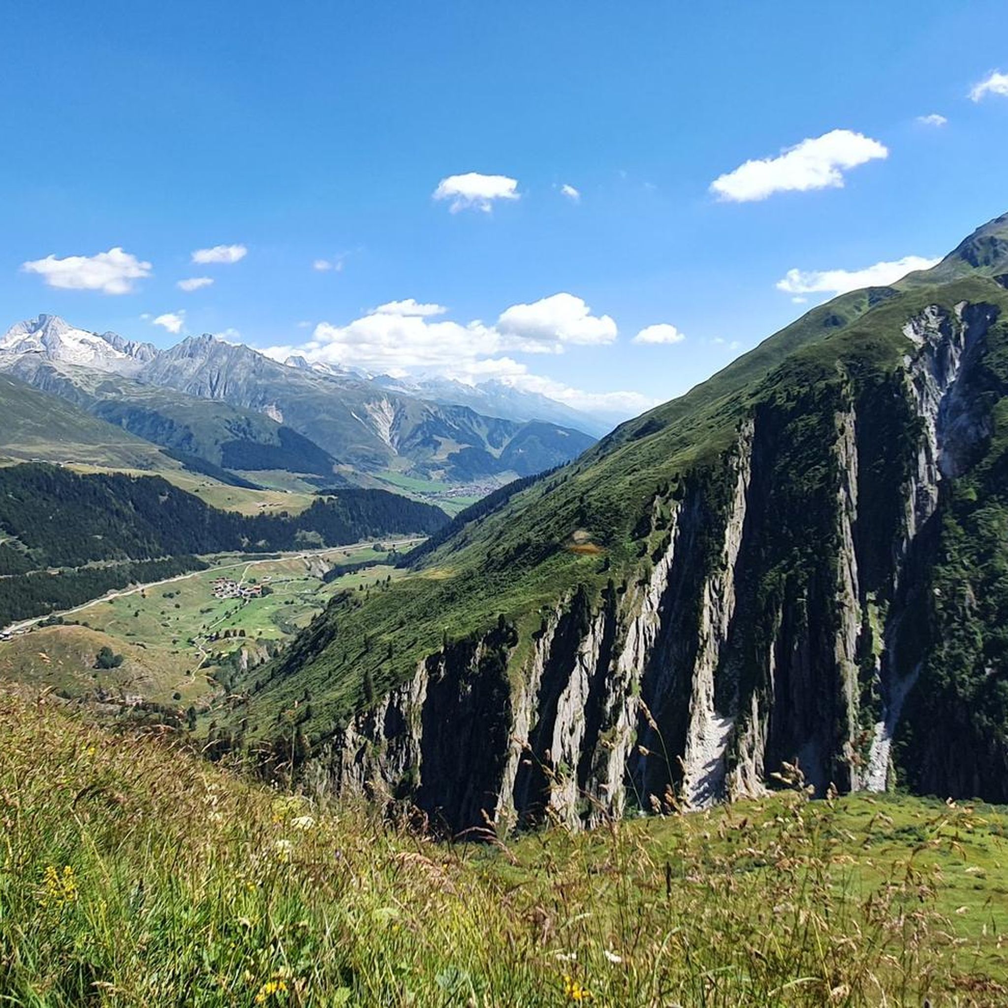
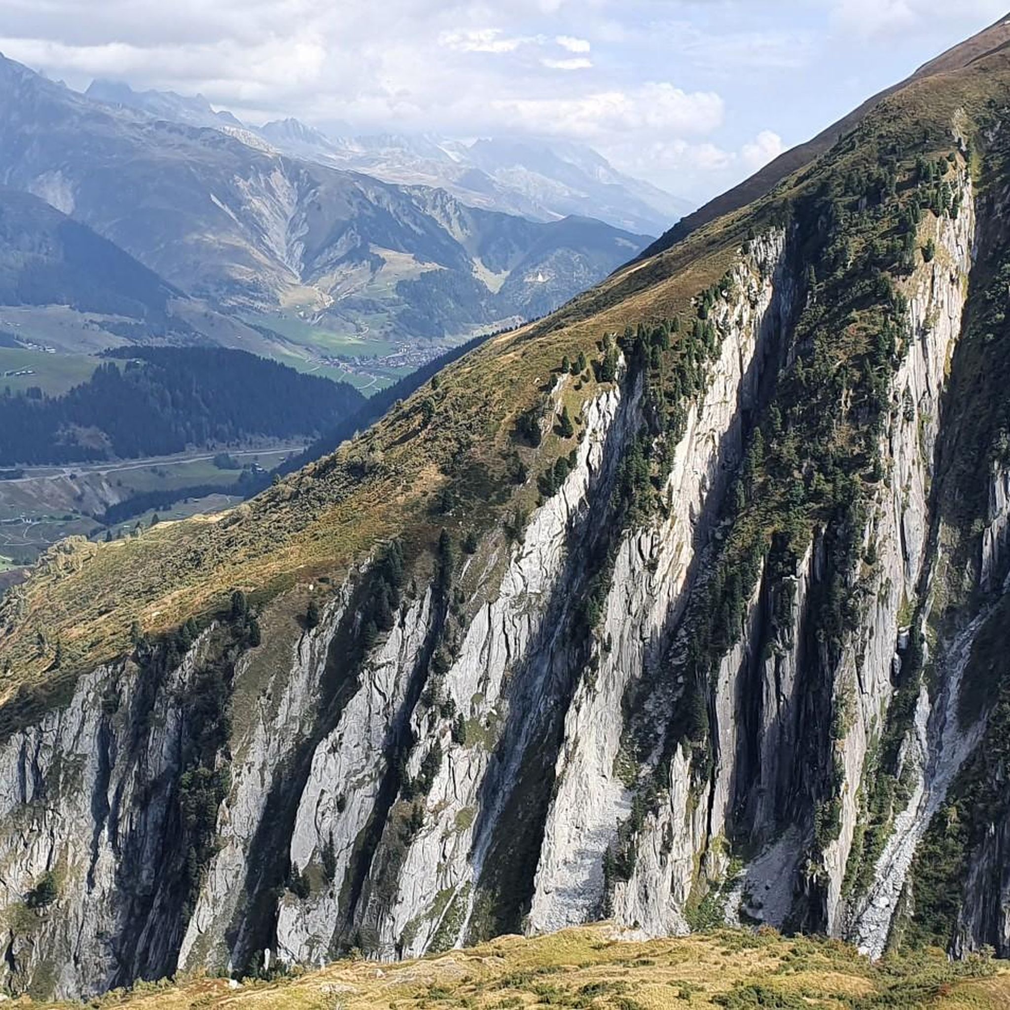
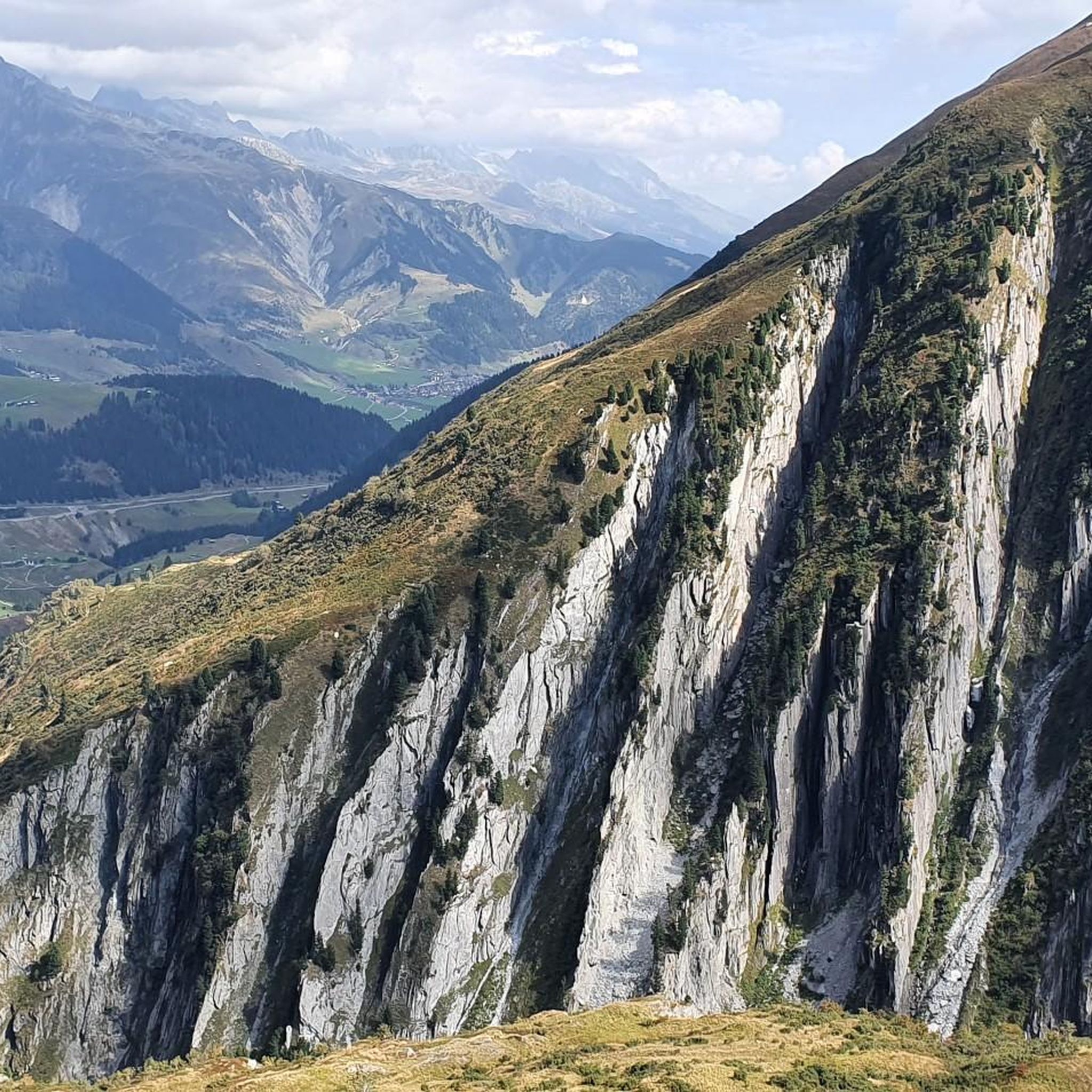

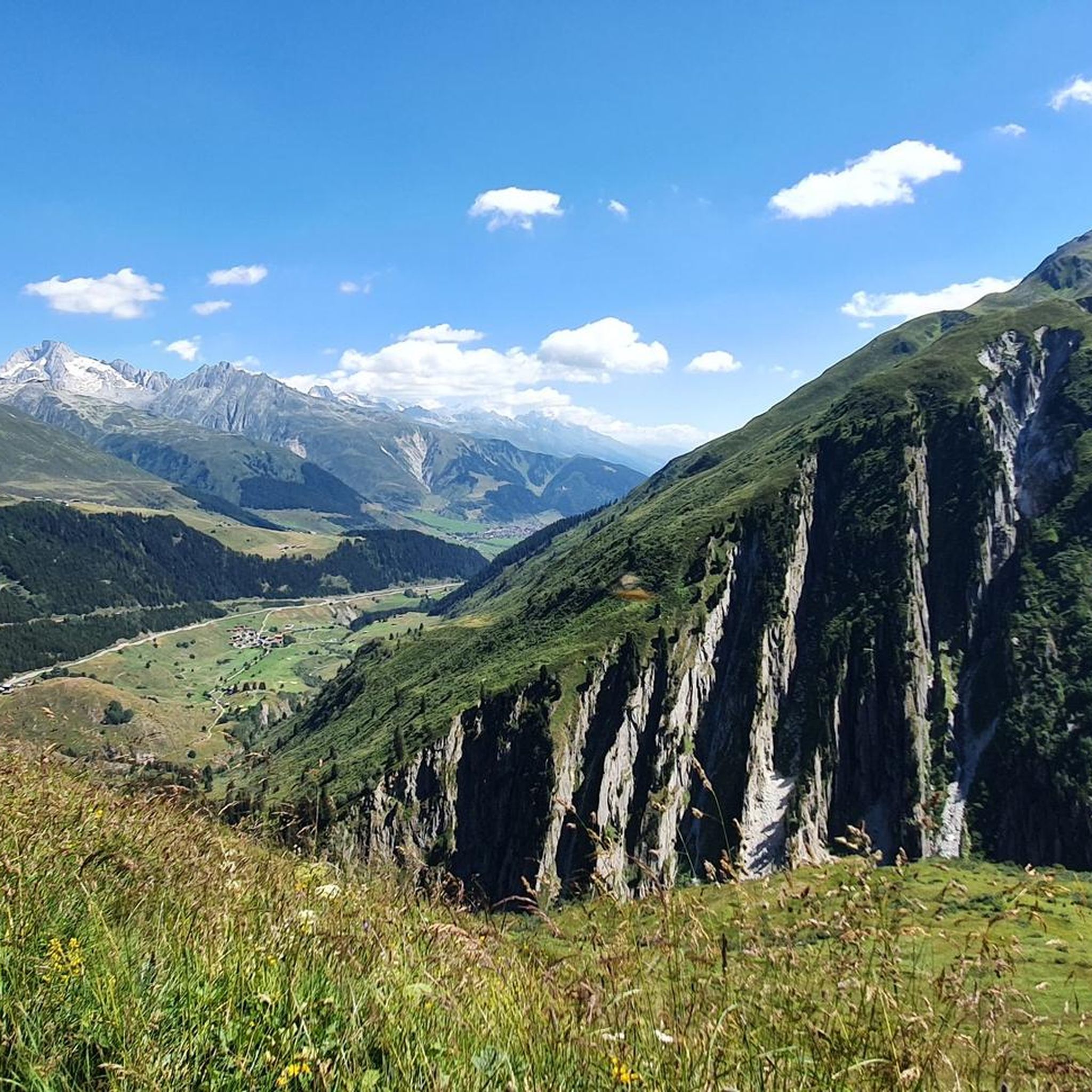

Tips from the Community

beautiful valley to spend time outdoors
0
0

Starting point for cycling and hiking tours with seating, bicycle service station and sculpture "Ursern - The Valley of the Three Passes".
0
0

It’s beautiful… but it’s a bit of a pain 🤩
0
0

The train journey between Disentis and Andermatt should definitely be included in any trip.
0
0

Oberalp Pass (2,044 m). The highest lighthouse in the world is located here. It is a replica of the "Hoek van Holland" lighthouse, which served for 70 years (from 1900 to 1970) at the mouth of the Rhine in Rotterdam. It serves as a reminder that the source of the Rhine is not far from the Oberalp Pass: it is located at Lake Toma (Lai da Tuma).
0
0

How did this lighthouse get here? Great photo opportunity
0
0

A beautiful campsite! Friendly and uncomplicated operators
1
0

Beautiful little place, a must see
0
0
Frequently Asked Questions
How challenging are the touring cycling routes around Lai da Curnera?
The touring cycling routes around Lai da Curnera are predominantly challenging, with 16 out of 20 routes rated as 'difficult'. These routes feature significant elevation changes, often traversing alpine passes and demanding mountain roads. There are also 4 'moderate' routes available for those seeking a less strenuous experience.
Are there family-friendly touring cycling routes near Lai da Curnera?
While many routes are challenging, there are options suitable for families or those looking for a more relaxed ride. The Tschamut-Selva train station – Tschamut at the Oberalp Pass loop from Tschamut-Selva is a moderate 9.0-mile (14.5 km) path with a steady elevation gain, offering views of the Oberalp Pass area without extreme difficulty. It's a good choice for families with some cycling experience.
When is the best time of year to go touring cycling around Lai da Curnera?
The best time for touring cycling around Lai da Curnera is typically from late spring to early autumn (June to September). During these months, the alpine passes are generally clear of snow, and the weather is more stable, offering ideal conditions for cycling through the mountainous terrain. Always check local weather and road conditions before heading out.
What kind of scenic views can I expect on these routes?
Touring cycling around Lai da Curnera offers breathtaking views of the reservoir itself, along with expansive open mountain vistas. You'll traverse alpine valleys and passes, providing diverse landscapes from high mountain scenery to sections alongside the lake. The region's topography ensures a visually rewarding experience.
Are there circular touring cycling routes available?
Yes, many of the routes around Lai da Curnera are designed as loops, allowing you to start and finish at the same point. Examples include the popular Oberalp Pass – Schöllen Gorge loop from Tschamut-Selva and the shorter Bike loop from Tujetsch, which leads through alpine valleys.
What are some challenging touring cycling routes for experienced riders?
For experienced riders seeking a challenge, the Oberalp Pass – Schöllen Gorge loop from Tschamut-Selva is an excellent choice. This 47.6-mile (76.7 km) route features substantial climbs and descents, taking approximately 6 hours 16 minutes to complete. Another demanding option is the Oberalp Pass – View of Lake Oberalp loop from Dieni, which covers 19.0 miles (30.6 km) with significant elevation changes.
Is the terrain suitable for touring bikes, or is mountain biking more appropriate?
The routes around Lai da Curnera are specifically curated for touring bicycles, often following roads that traverse alpine passes. While the terrain is mountainous and challenging, it is designed to be navigable with a touring bike. However, given the significant elevation changes and mountain roads, a touring bike with appropriate gearing and robust tires is recommended.
What do other touring cyclists enjoy the most about touring cycling in Lai da Curnera?
The area is highly rated by the komoot community, with an average score of 4.4 stars from over 180 reviews. Reviewers often praise the stunning alpine scenery, the challenge of the mountain passes, and the rewarding views of the reservoir. The varied terrain and well-maintained roads are also frequently highlighted.
Are there places to eat and drink along the touring cycling routes?
Given the mountainous and sometimes remote nature of the routes, it's advisable to carry sufficient water and snacks. However, key points like the Oberalp Pass often have facilities such as restaurants or cafes. Small villages along some routes may also offer dining options. It's always a good idea to check for available services on your chosen route beforehand.
Where can I park or start my cycling tour around Lai da Curnera?
Many routes, such as the Tschamut-Selva train station – Tschamut at the Oberalp Pass loop from Tschamut-Selva, indicate starting points near train stations or villages like Tschamut-Selva, which often have parking facilities. The Oberalppass itself is a common starting point, as seen in the Oberalp Pass – View of the Rhine Source loop from Oberalppass. Look for designated parking areas in towns or at major pass crossings.
Can I bring my dog on touring cycling routes around Lai da Curnera?
While many outdoor areas in Switzerland are dog-friendly, specific rules can vary. On touring cycling routes, especially those on paved roads or well-maintained paths, dogs are generally permitted if kept on a leash and under control. However, always be mindful of other cyclists, hikers, and local wildlife. Ensure your dog is fit enough for the distance and elevation, and carry enough water for both of you.
What should I wear for touring cycling in the Lai da Curnera region?
Due to the alpine environment and potential for rapid weather changes, layering is key. Wear moisture-wicking base layers, an insulating mid-layer, and a windproof/waterproof outer shell. Cycling shorts are recommended for comfort. Don't forget gloves, a helmet, sunglasses, and sun protection, even on cloudy days, as UV radiation is stronger at higher altitudes.
Most popular routes around Lai da Curnera

Get inspired with the komoot mobile app


Explore more
Browse the best Cycling routes in other regions.
