The best cycling routes around Gillenfeld
4.4
(342)
1,646
riders
49
rides
Touring cycling around Gillenfeld is characterized by its unique volcanic landscape within the Vulkaneifel district of Germany. The region features numerous maars, which are volcanic crater lakes, alongside gently rolling hills and extensive forests. Many routes utilize former railway lines, such as the Maare-Mosel Cycle Path, providing accessible and scenic paths for cyclists. The terrain offers varied surfaces, including paved paths and unpaved segments, suitable for different cycling preferences.
Best touring cycling routes around Gillenfeld
- The most popular touring cycling…
Last updated: August 20, 2026
4.7
(181)
1,000
riders
Moderate bike ride. Good fitness required. Mostly paved surfaces. Suitable for all skill levels.
4.1
(16)
47
riders
17.3km
01:12
190m
190m
Moderate bike ride. Good fitness required. Mostly paved surfaces. Suitable for all skill levels.

Sign up for free
4.5
(22)
112
riders
19.8km
01:15
230m
230m
Moderate bike ride. Good fitness required. Mostly paved surfaces. Suitable for all skill levels.
4.0
(8)
35
riders
38.4km
03:13
640m
640m
Hard bike ride. Very good fitness required. Mostly paved surfaces. Suitable for all skill levels.
3.9
(9)
33
riders
22.2km
01:40
290m
290m
Moderate bike ride. Good fitness required. Mostly paved surfaces. Suitable for all skill levels.
Get access to more routes and recommendations from other explorers.
Sign up for free
Already have an account?
Our route recommendations are based on thousands of hikes, rides, and runs completed by other people on komoot.
Start today with a free account
Your next adventure awaits.
Login or Signup
Popular around Gillenfeld



Tips from the Community


Nice place to stop for refreshments after a hike to the Pulvermaar.
1
0


A truly amazing experience for young and old. Turn on the lights – even though the tunnel is lit. And in hot weather, it's like riding through a "refrigerator."
0
0

Very interesting and worth seeing place.
2
0

"Old Station" Schalkenmehren Passenger service between Daun and Wittlich was discontinued on November 1, 1981. Schalkenmehren. Approaching the Old Station in Schalkenmehren on the former railway line, today's Maare-Mosel cycle path, and seeing the station building, it's hard to believe that it was opened as a fourth-class railway station exactly 100 years ago. But how did it all begin 100 years ago? Surveying for the Daun-Wittlich railway line began as early as 1897. General preparatory work for the single-track line began in 1907. But it would take some time before the Daun-Schalkenmehren-Gillenfeld section opened on December 1, 1909, with the line running over the 28-meter-high Daun viaduct and through the 560-meter-long Schalkenmehren railway tunnel, "Großes Schlitzohr" (Great Sly Fox). The extension from Gillenfeld to Manderscheid to Pantenburg was completed on May 1, 1910, and the extension from Manderscheid-Pantenburg to Wittlich, signifying the completion of the entire line, was completed on July 1, 1910. The completion of the Daun-Wittlich railway line brought rapid development to the village of Schalkenmehren. In the first year of the line's existence (1910), 18,968 tickets were sold in Schalkenmehren, followed by 25,057 in 1913, 27,969 in 1919, and even 30,279 in 1922. In addition, Schalkenmehren station was designed for general cargo traffic and the receipt and dispatch of wagonloads. Text / Source: www.volksfreund.de/ https://www.volksfreund.de/region/vulkaneifel/ein-schmuckstueck-fuer-nostalgiker_aid-5712448
13
0
Old Railway Tunnel "Großes Schlitzohr" near Daun At the end of the first decade of the 20th century, the railway tunnel was driven 560 meters through the mountain. 80 years later, it was converted into a cycle path. The tunnel contains several niches with rounded arches, through which the water seeping in above is drained. The sound of this water has been a part of this place for almost 100 years. Text / Source: Institut Denkunternehmung, Hörscheider Straße 20, 54552 Darscheid https://denkunternehmung.de/alter-eisenbahntunnel-grosses-schlitzohr-bei-daun
16
0
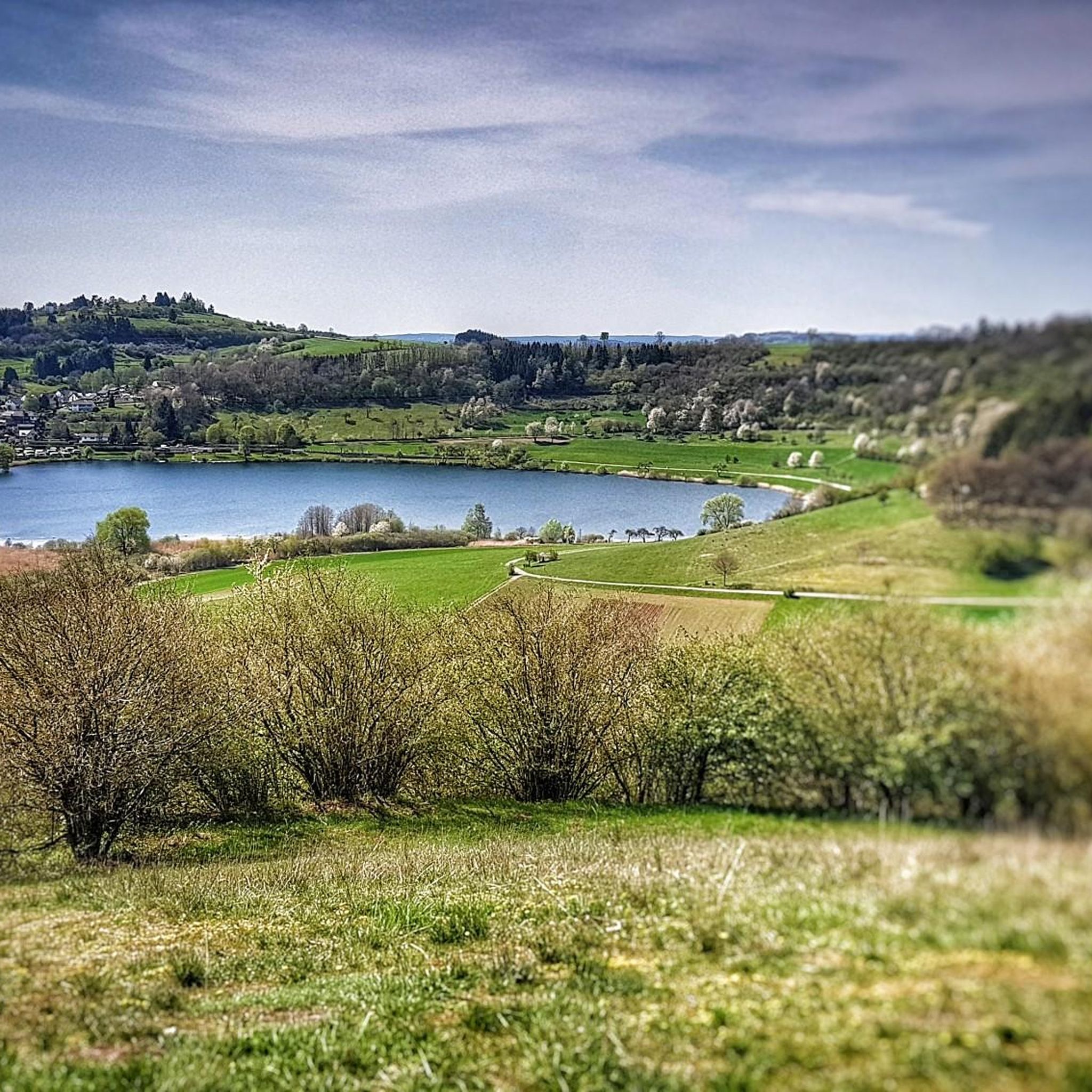
Weinfelder Maar - Impressive Evidence of Explosive Geological History The Weinfelder Maar – also known as Totenmaar – is one of the three so-called Daun Maars. It is located about 2 kilometers from our district town of Daun, near the municipality of Schalkenmehren, between the Gemünden and Schalkenmehren Maars. It has a diameter of approximately 525 meters and a depth of 51 meters, making it the deepest of the three Daun Maars. It is the youngest and, at 487 meters above sea level, the highest of the three closely adjacent maars, which formed between 20,000 and 30,000 years ago. Text / Source: Natur- und Geopark Vulkaneifel GmbH, Mainzer Str. 25, Daun https://www.geopark-vulkaneifel.de/eifel/landschaft/maare-und-kraterseen/weinfelder-maar.html
12
0
Frequently Asked Questions
How many touring cycling routes are available around Gillenfeld?
Gillenfeld offers a wide selection of touring cycling routes, with over 45 options available. These routes cater to various skill levels, including easy, moderate, and difficult trails.
What do other cyclists say about the touring routes in Gillenfeld?
The touring cycling routes around Gillenfeld are highly regarded by the komoot community, holding an average rating of 4.4 stars from over 150 reviews. Cyclists often praise the unique volcanic landscapes, the well-maintained paths, and the scenic views of the Maare.
Are there easy touring cycling routes suitable for beginners or families?
Yes, Gillenfeld has 14 easy touring cycling routes perfect for beginners or families. The Holzmaar – Cycle path on a railroad line loop from Gillenfeld is a moderate 17.5 km path that follows a former railway line, making it relatively flat and enjoyable. The Maare-Mosel Cycle Path, accessible from Gillenfeld, is also known for its gentle gradients, with a section from Daun to Gillenfeld specifically designed as a children's cycle route.
Can I find more challenging touring cycling routes in the Gillenfeld area?
For those seeking a greater challenge, there are 11 difficult touring cycling routes around Gillenfeld. An example is the Weinfelder Maar viewpoint – View of the Schalkenmehrener Maar loop from Gillenfeld, a 38.4 km route with significant elevation changes, offering rewarding views of the volcanic lakes.
Are there circular touring cycling routes around Gillenfeld?
Many touring cycling routes in Gillenfeld are circular, allowing you to start and end at the same point. For instance, the popular Schalkenmehren Maar – Schalkenmehrener Maar loop from Gillenfeld is a 20.4 km circular trail that offers views of two prominent volcanic crater lakes.
What natural features or landmarks can I see while cycling around Gillenfeld?
The region is rich in natural wonders. You can cycle past several volcanic crater lakes (Maare) like Pulvermaar, Holzmaar, Weinfelder Maar, and Schalkenmehrener Maar. The Immerath Maar – Strohner Lava Bomb loop from Gillenfeld will take you past the unique Strohner Lava Bomb, a geological curiosity. You might also encounter the Falkenlay Stone Shelter and Viewpoint, offering panoramic vistas.
Is the Maare-Mosel Cycle Path accessible from Gillenfeld?
Yes, the Maare-Mosel Cycle Path is easily accessible from Gillenfeld. This highly regarded route follows former railway lines, making it particularly suitable for touring cyclists due to its mostly flat or downhill gradients. A section between Daun and Gillenfeld is even designed as a children's cycle route.
Are dogs allowed on the touring cycling routes in Gillenfeld?
Generally, dogs are welcome on most public cycling paths in the Vulkaneifel region, including those around Gillenfeld, provided they are kept on a leash. However, specific nature reserves or private properties might have restrictions, so it's always advisable to check local signage.
Where can I find parking for touring cycling routes in Gillenfeld?
Parking is available in and around Gillenfeld, particularly near popular starting points for cycling routes. For routes accessing the Maare-Mosel Cycle Path, you can often find designated parking areas in towns along the route, including Gillenfeld itself or nearby Daun. Parking is also typically available near major Maare like Pulvermaar.
How can I reach the touring cycling routes around Gillenfeld using public transport?
Public transport options, such as regional buses, connect Gillenfeld with surrounding towns and train stations. Some bus lines are equipped to transport bicycles, especially during peak season, making it possible to access various starting points for touring cycling routes. It's recommended to check the local public transport schedules and bicycle transport policies in advance.
Are there places to eat or stay overnight near the cycling routes?
Yes, Gillenfeld and the surrounding villages offer various options for refreshments and accommodation. You'll find restaurants, cafes, and guesthouses. For example, the Heidsmühle Hotel & Restaurant is a notable spot. There are also several huts and shelters, like the Balduin Hut, which can serve as resting points along your journey.
What is the best time of year for touring cycling in Gillenfeld?
The Vulkaneifel region, including Gillenfeld, is generally pleasant for touring cycling from spring through autumn. Spring (April-May) offers blooming landscapes, while summer (June-August) provides warm weather. Autumn (September-October) is particularly scenic with vibrant fall colors. Always check the local weather forecast before heading out.
Most popular routes around Gillenfeld
Most popular attractions around Gillenfeld

Get inspired with the komoot mobile app


Explore more
Browse the best Cycling routes in other regions.
