The best mountain hikes in Naturpark Rieserferner-Ahrn - Parco Naturale Vedrette Di Ries-Aurina
4.5
(39)
463
hikers
21
hikes
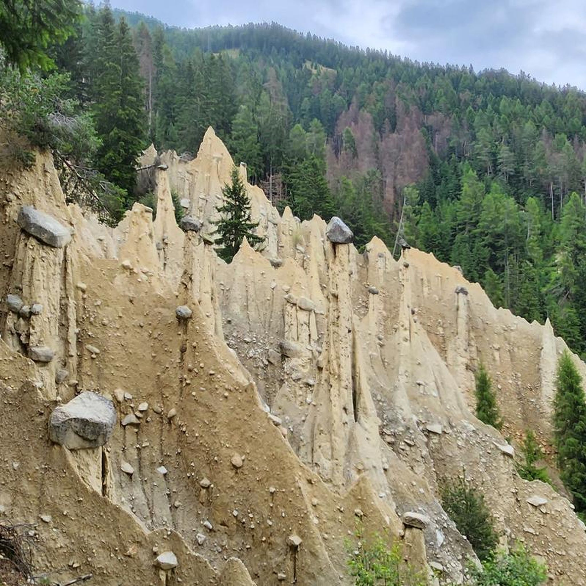
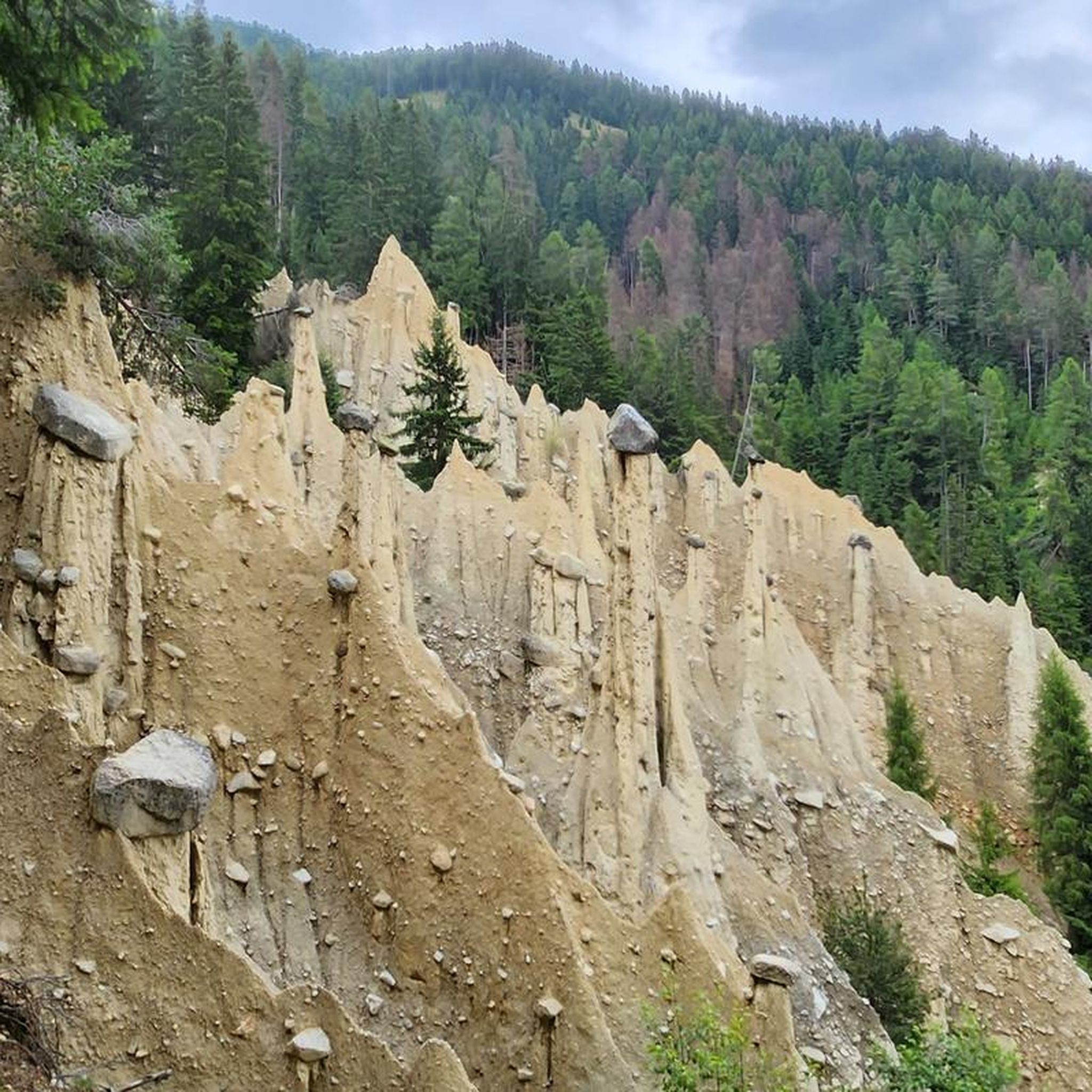
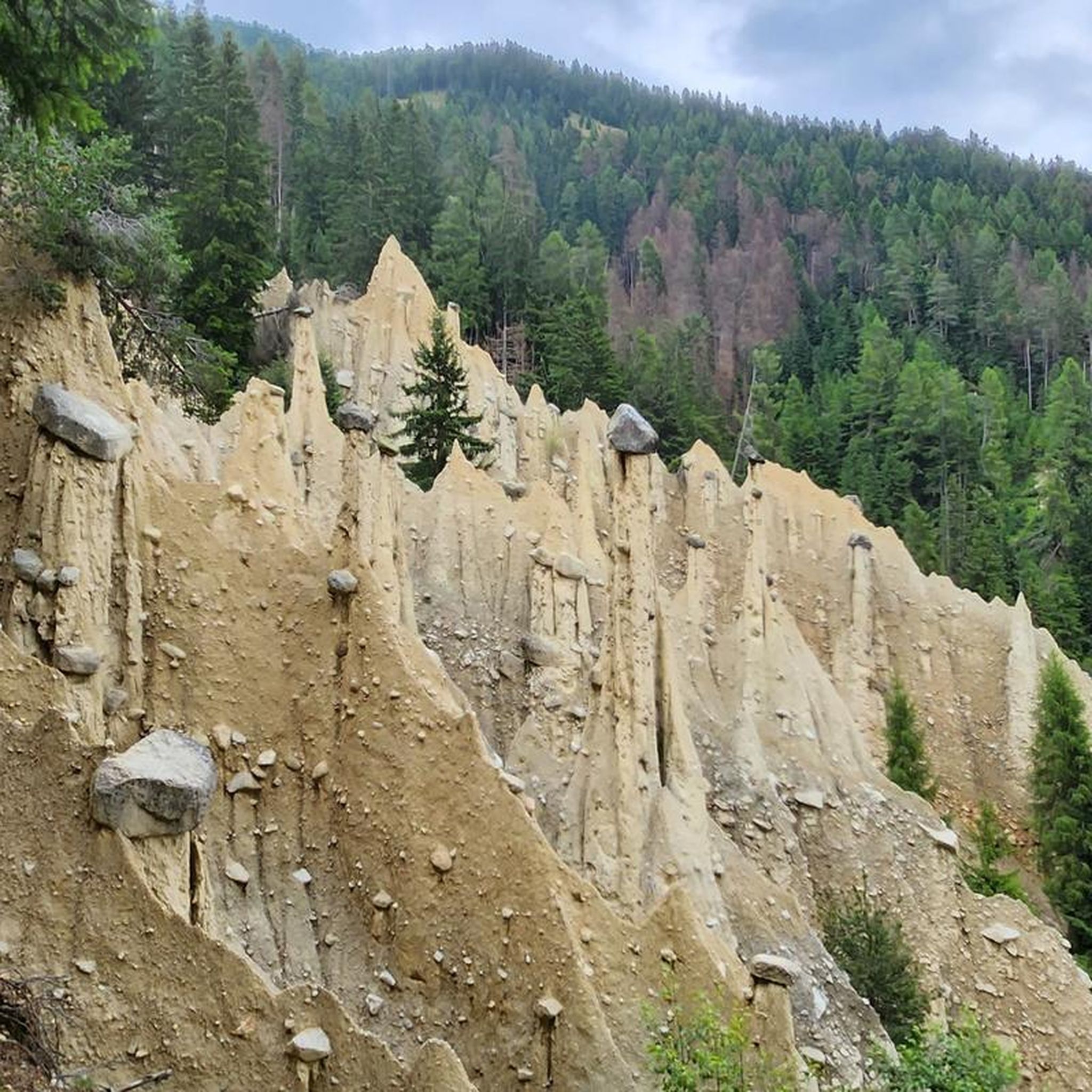
Mountaineering in Naturpark Rieserferner-Ahrn - Parco Naturale Vedrette Di Ries-Aurina is characterized by dramatic alpine landscapes and significant geological features. The region features a high concentration of peaks exceeding 3,000 meters (9,842 feet) and extensive glaciers, making it the most glacier-rich nature park in South Tyrol. Abundant water features, including numerous mountain brooks, clear mountain lakes, and impressive waterfalls, are present throughout the park. Unique geological formations, such as the Centralgneiss of the Tauern Window and the Earth Pyramids of Platten, contribute to the diverse terrain.
Best mountaineering routes in Naturpark Rieserferner-Ahrn - Parco Naturale Vedrette Di Ries-Aurina
- The most popular mountaineering route is Große Windschar – Huber Alm loop from Mühlbachtal, a 9.5 miles (15.3 km) trail that takes 6 hours 35 minutes to complete. This difficult route offers views of high alpine terrain and the surrounding peaks.
- Another top favourite among local mountaineers is Huber Alm loop from Mühlbachtal, a difficult 8.5 miles (13.7 km) path. This route traverses rugged mountain scenery with significant elevation gain.
- Local mountaineers also love the Lercher Alm – Gönneralm (1970 m) loop from Abzweigung Schießstand - Bivio Poligono, a 9.3 miles (15.0 km) trail leading through high mountain pastures and valleys, often completed in about 7 hours 22 minutes.
- Mountaineering in Naturpark Rieserferner-Ahrn - Parco Naturale Vedrette Di Ries-Aurina is defined by high peaks, extensive glaciers, and numerous mountain lakes. The network offers options for experienced mountaineers seeking challenging ascents and multi-day routes.
- The routes in Naturpark Rieserferner-Ahrn - Parco Naturale Vedrette Di Ries-Aurina are highly rated by the komoot community with an average score of 4.6 stars from around 30 reviews. More than 400 mountaineers have used komoot to explore Naturpark Rieserferner-Ahrn - Parco Naturale Vedrette Di Ries-Aurina's varied terrain.
Last updated: September 27, 2026
5.0
(4)
68
hikers
15.3km
08:36
1,360m
1,360m
Hard mountaineering route. Very good fitness required. Sure-footedness, sturdy shoes and alpine experience required.
4.5
(6)
62
hikers
13.9km
07:31
1,330m
1,330m
Hard mountaineering route. Very good fitness required. Sure-footedness, sturdy shoes and alpine experience required.

4.0
(1)
47
hikers
15.3km
07:24
1,040m
1,050m
Hard mountaineering route. Very good fitness required. Sure-footedness, sturdy shoes and alpine experience required.
4.4
(10)
39
hikers
Hard mountaineering route. Very good fitness required. Mostly accessible paths. Sure-footedness required.
5.0
(1)
36
hikers
Hard mountaineering route. Very good fitness required. Sure-footedness, sturdy shoes and alpine experience required.
Get access to more routes and recommendations from other explorers.
Already have an account?
Our route recommendations are based on thousands of hikes, rides, and runs completed by other people on komoot.
Start today with a free account
Your next adventure awaits.
Popular around Naturpark Rieserferner-Ahrn - Parco Naturale Vedrette Di Ries-Aurina
Unforgettable MTB routes through South Tyrol's quiet valleys
A superb hut-to-hut adventure over the main Alpine ridge – Dreiländertour
Impressive hikes in the mountains around South Tyrol’s Bruneck

The most beautiful waterfalls of the Alps
Hiking in Naturpark Rieserferner-Ahrn - Parco Naturale Vedrette Di Ries-Aurina
Road Cycling Routes in Naturpark Rieserferner-Ahrn - Parco Naturale Vedrette Di Ries-Aurina
Cycling in Naturpark Rieserferner-Ahrn - Parco Naturale Vedrette Di Ries-Aurina
MTB Trails in Naturpark Rieserferner-Ahrn - Parco Naturale Vedrette Di Ries-Aurina
Running Trails in Naturpark Rieserferner-Ahrn - Parco Naturale Vedrette Di Ries-Aurina

Gravel biking in Naturpark Rieserferner-Ahrn - Parco Naturale Vedrette Di Ries-Aurina
Other adventures in Naturpark Rieserferner-Ahrn - Parco Naturale Vedrette Di Ries-Aurina


Tips from the Community

After a two-year planning phase, which was very bureaucratic due to strict environmental and building regulations from the Office for Nature, the summit cross was completely renewed in autumn 2024. The initiative primarily came from the hut landlord of the nearby Kasseler Hütte. https://www.instagram.com/reel/DBLjU2hpb1m/?igsi=MWVpMzh4NWdzdDFtOA==
0
0
The Schneebige Nock (Italian Monte Nevoso) is, at 3,358 meters, the second-highest mountain in the Rieserfernergruppe in South Tyrol. Due to its distinctive pyramid shape, it is considered one of the best-known and most rewarding tour destinations in the Tauferer Ahrntal valley. The classic starting point for ascents is Rein in Taufers.
0
0

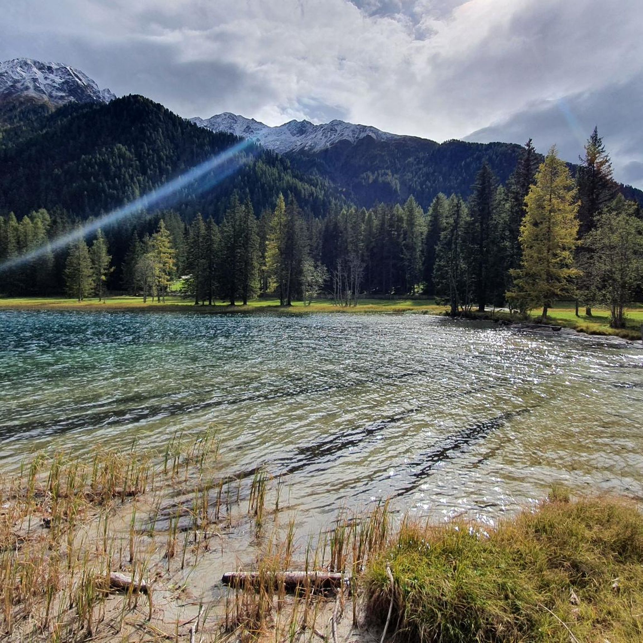
On the north bank, you can walk along the lake on a boardwalk, beautifully integrated into the shore landscape.
8
0


The wooden plank walkways were laid across marshland on the northern shore of the lake to protect the fragile natural environment. They offer spectacular views of the lake and the surrounding mountains of the Rieserferner Group. The plank walkways are part of the 3.4 to 3.5-kilometer circular trail, which provides information about the local flora and fauna, as well as the formation of the lake, via information panels.
3
1
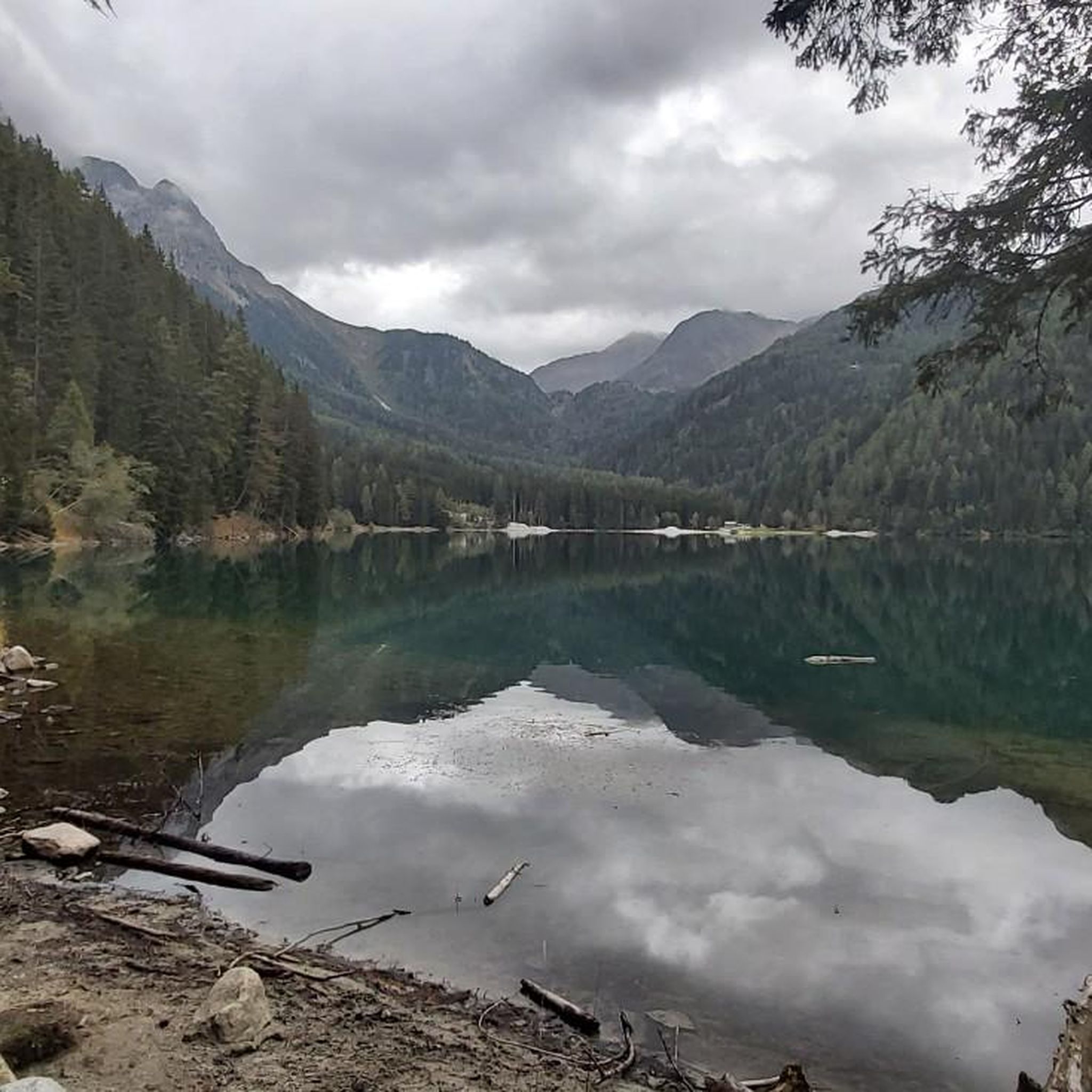
The lake's water shimmers in impressive turquoise-green hues. With a surface area of approximately 44 hectares, it is the third-largest natural lake in South Tyrol. It has a maximum depth of 38 meters. It probably formed at the end of the last Ice Age by a natural landslide or rockslide that blocked the valley and dammed the water. Due to its altitude and low water temperature (below 17°C year-round), it is not a bathing lake, but a typical cold mountain lake. A lovely path, partly on wooden boardwalks, leads us around the lake.
3
0
The lake's water shimmers in impressive turquoise-green hues. With a surface area of approximately 44 hectares, it is the third-largest natural lake in South Tyrol. It has a maximum depth of 38 meters. It probably formed at the end of the last Ice Age by a natural landslide or rockslide that blocked the valley and dammed the water. Due to its altitude and low water temperature (below 17°C year-round), it is not a bathing lake, but a typical cold mountain lake. A lovely path, partly on wooden boardwalks, leads us around the lake.
1
0
Frequently Asked Questions
How many mountaineering routes are available in Naturpark Rieserferner-Ahrn - Parco Naturale Vedrette Di Ries-Aurina?
There are over 20 mountaineering routes in Naturpark Rieserferner-Ahrn - Parco Naturale Vedrette Di Ries-Aurina. These include a mix of moderate and difficult trails, catering to various experience levels.
What kind of terrain can I expect on mountaineering routes in this region?
The region is characterized by dramatic alpine landscapes, significant geological features, and a high concentration of peaks exceeding 3,000 meters. You'll encounter extensive glaciers, numerous mountain brooks, clear mountain lakes, and impressive waterfalls. The geology includes unique formations like the Centralgneiss of the Tauern Window and the Earth Pyramids of Platten.
Are there any family-friendly mountaineering options or trails suitable for children?
While many mountaineering routes are challenging, the park also offers simpler paths suitable for families. Some trails, like the 3 km path around Lake Anterselva, are educational and interactive, providing a good experience for families. Always check the specific route details for suitability.
Are there any notable natural landmarks or viewpoints to see along the mountaineering routes?
Yes, the park is rich in natural landmarks. You can find impressive waterfalls like the First Reinbach Waterfall and the Klammbach Waterfalls. The region also features clear mountain lakes such as Lake Anterselva, Lake Gola, the three Laghi Maler, and the Laghi Kofler. The Earth Pyramids of Platten are another unique geological formation worth seeing.
What do other mountaineers say about the routes in Naturpark Rieserferner-Ahrn - Parco Naturale Vedrette Di Ries-Aurina?
The routes in Naturpark Rieserferner-Ahrn - Parco Naturale Vedrette Di Ries-Aurina are highly rated by the komoot community, with an average score of 4.6 stars from around 30 reviews. Mountaineers often praise the challenging ascents, breathtaking views, and the diverse natural beauty of the high alpine environment.
Are there mountain huts available for overnight stays or refreshments along the trails?
Yes, the park has several mountain huts and refuges that provide essential resting points and add to the mountaineering experience. Notable huts include Rieserferner Hut (Rifugio Vedrette di Ries), Kasseler Hut / Rifugio Roma, and Gönner Alm. Schwarzensteinhütte is also one of the highest in South Tyrol.
Can you recommend a challenging circular mountaineering route?
For a challenging circular route, consider the Oberseehütte at Stallersattel – Alpine Valley Landscape loop from Antholzer See - Lago di Anterselva. This difficult 14.7 km path involves over 700 meters of elevation gain and typically takes around 5 hours 23 minutes to complete, offering stunning alpine valley views.
What is the best time of year for mountaineering in Naturpark Rieserferner-Ahrn?
The best time for mountaineering typically spans from late spring to early autumn (June to September) when the weather is more stable and snow has largely receded from higher elevations. However, due to the presence of extensive glaciers and high peaks, conditions can change rapidly, and some routes may require specialized equipment even in summer.
Are there any routes that offer particularly high elevation gains or are considered very strenuous?
Yes, for a very strenuous experience with significant elevation gain, the Lake Above Kasseler Hut loop from Naturpark Rieserferner-Ahrn - Parco Naturale Vedrette di Ries-Aurina is an excellent choice. This difficult 14.8 km route features over 1700 meters of ascent and descent, taking approximately 10 hours 6 minutes to complete.
What kind of wildlife and flora can I expect to see in the park?
Naturpark Rieserferner-Ahrn is a habitat for rare alpine species. You might spot animals like the mountain hare and rock ptarmigan. The flora includes resilient alpine plants such as the Alpine rock-jasmine, which can thrive at elevations of 3,000 meters above sea level.
Is public transport available to access mountaineering trailheads in the region?
The Ahrn Valley, located within the park, is known for its accessibility. While specific public transport details for every trailhead are best checked locally, the region generally offers options to reach various starting points for hikes and mountaineering tours.
Most popular routes in Naturpark Rieserferner-Ahrn - Parco Naturale Vedrette Di Ries-Aurina
Most popular attractions in Naturpark Rieserferner-Ahrn - Parco Naturale Vedrette Di Ries-Aurina

Get inspired with the komoot mobile app


Explore more
Browse the best Mountain Hikes & Routes in other regions.
