The best gravel rides around North Cowichan
4.8
(22)
211
riders
16
rides
Gravel biking around North Cowichan offers a diverse landscape characterized by the Cowichan Valley, extensive forest trails, and the shores of Lake Cowichan. The region features a network of former railway lines, now converted into multi-use trails, alongside logging roads and quiet rural paths. Elevation changes are present, ranging from gentle valley routes to more challenging climbs through forested hills. This area provides varied terrain suitable for gravel biking.
Best gravel bike trails around North Cowichan
- The most popular gravel bike trail is Lake Cowichan – 66 Mile Trestle loop from Duncan, a 44.6 miles (71.8 km) trail that takes 6 hours 12 minutes to complete. This difficult route explores the area around Lake Cowichan and features the historic 66 Mile Trestle.
- Another top favourite among local gravel bikers is Cowichan Valley Trail – Kinsol Trestle loop from Glenora, a moderate 15.4 miles (24.7 km) path. This route follows sections of the scenic Cowichan Valley Trail, leading to the impressive Kinsol Trestle.
- Local gravel bikers also love the Lake Cowichan Bridge – Lake Cowichan loop from Duncan, a 36.5 miles (58.8 km) trail leading through the Lake Cowichan area, often completed in about 3 hours 52 minutes.
- Gravel biking around North Cowichan is defined by valley trails, forested paths, and historic trestles. The network offers options for different ability levels, from moderate valley loops to more challenging routes with significant elevation gain.
- The routes in North Cowichan are highly rated by the komoot community with an average score of 4.7 stars from over 10 reviews. More than 100 gravel bikers have used komoot to explore North Cowichan's varied terrain.
Last updated: October 6, 2026
5.0
(1)
37
riders
70.4km
04:29
590m
590m
Hard gravel ride. Very good fitness required. Mostly paved surfaces. Suitable for all skill levels.
5.0
(1)
19
riders
24.7km
01:22
210m
210m
Moderate gravel ride. Good fitness required. Mostly paved surfaces. Suitable for all skill levels.

4.8
(4)
27
riders
60.4km
03:09
450m
450m
Moderate gravel ride. Good fitness required. Mostly paved surfaces. Suitable for all skill levels.
4.3
(4)
16
riders
18.4km
00:59
110m
110m
Easy gravel ride. Great for any fitness level. Mostly paved surfaces. Suitable for all skill levels.
12
riders
44.2km
03:51
630m
630m
Hard gravel ride. Very good fitness required. Mostly paved surfaces. Suitable for all skill levels.
Get access to more routes and recommendations from other explorers.
Already have an account?
Our route recommendations are based on thousands of hikes, rides, and runs completed by other people on komoot.
Start today with a free account
Your next adventure awaits.
Tips from the Community

Great rest stop with drinking water, flush toilets and sheltered tables.
0
0

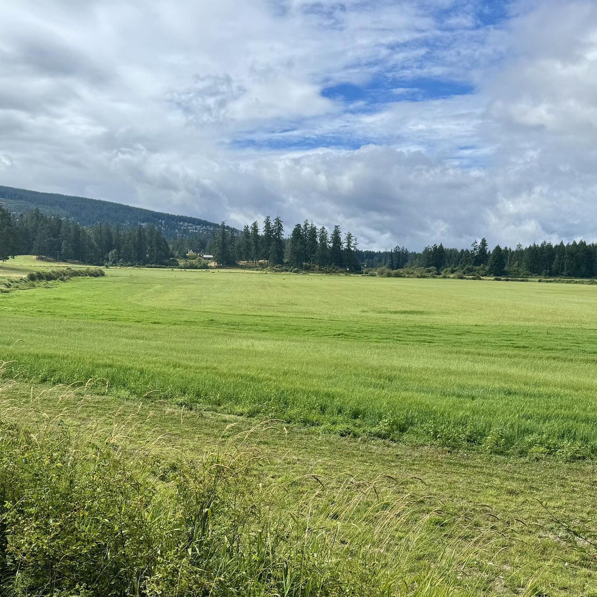
This section of the Cowichan Valley Trail runs between Waters Road and Mountain Park, following the former railway corridor through the Cowichan Valley. It’s a beautiful, mostly flat route that passes through forest and rural surroundings, with plenty of access to several parks and waterways along the way.
0
0

The Greendale Trestle Bridge was once part of the Canadian Pacific Railway, and has now been converted into a pedestrian and cyclist footbridge, part of the Cowichan Valley Trail and Trans Canada Trail. Beneath the bridge is crystal-clear water. In summer, the water is dotted with colourful inner tubes. In the autumn, it's a great vantage point to peer down and watch salmon spawning in the Cowichan River gravels.
0
0
The Cowichan Valley Trail, which spans 122 kilometres, is divided into a handful of sections. The Malahat to Shawnigan Lake stretching 19 kilometres, Shawnigan Lake to Duncan spanning 25 kilometres, and the Duncan to Lake Cowichan section coming in the longest, 28 kilometres. There are also the northern extensions of the trail, Duncan to Chemainus, and then Chemainus to Saltair. This is the Duncan to Lake Cowichan segment which follows the 1913 CN railway grade up to the Trans Canada Trail western terminus. It passes through Cowichan River Provincial Park, crosses the Holt Creek and Marie Canyon trestles. The surface of the trail is made up of mostly hard-packed crushed gravel, rather than pavement or loose dirt. The trail is also pretty wide and flat since it's a rail trail.
0
0

Information about the Kinsol Trestle can be found on the Cowichan Valley Regional District (CVRD) website, including a fact sheet on its history and a brochure. https://www.cvrd.ca/1379/Kinsol-Trestle
2
0
This trestle was closed for repair until recently, but is now open. Trail widening and surfacing was also done near the trestle.
0
0

The Kinsol Trestle is an old wooden railway bridge. With a length of 187 metres and a height of 44 metres, it is one of the largest and most spectacular bridges of its type. It was built between 1911 and 1920 to transport timber. After the railway connection was closed in 1979, the bridge was no longer maintained, which is why its condition continued to deteriorate. After extensive renovation, it was reopened to pedestrians and cyclists in 2011. The Trans Canada Trail runs over the bridge.
1
0

Great for swimming and with the option of wild camping. Directly above the water between bushes and trees. Good privacy and very quiet after 7 p.m. It is also tolerated. There are no no camping signs either.
0
0
Frequently Asked Questions
How many gravel bike trails are available in North Cowichan?
North Cowichan offers a good selection of gravel bike trails, with over 10 routes documented on komoot. These routes cater to various skill levels, from moderate loops to more challenging rides with significant elevation gain.
Are there easy gravel bike trails for beginners in North Cowichan?
While many routes in North Cowichan are rated moderate to difficult, some sections of the former railway lines, like parts of the Cowichan Valley Trail, offer gentler terrain. For a moderate option, consider the Cowichan Valley Trail – Kinsol Trestle loop from Glenora, which is 15.4 miles (24.7 km) long and features the impressive Kinsol Trestle.
What are some challenging gravel bike routes in the North Cowichan area?
For experienced gravel bikers seeking a challenge, North Cowichan has several difficult routes. The Lake Cowichan – 66 Mile Trestle loop from Duncan is a demanding 44.6 miles (71.8 km) ride with over 600 meters of elevation gain. Another difficult option is the Wild Deer Lake loop from Glenora, covering 44.2 miles (71.1 km) with similar elevation.
What kind of terrain can I expect on gravel bike trails in North Cowichan?
The gravel bike trails in North Cowichan are characterized by a diverse landscape. You'll encounter extensive forest trails, former railway lines converted into multi-use paths, and quiet rural roads. Expect varied elevation changes, from flat valley routes to more challenging climbs through forested hillsides, especially around Lake Cowichan.
Are there any family-friendly gravel biking options in North Cowichan?
For families, sections of the Cowichan Valley Trail are generally flatter and more accessible. While specific 'easy' routes are limited, the moderate Cowichan Valley Trail – Kinsol Trestle loop from Glenora offers a scenic ride to a notable landmark, which can be adapted for shorter family outings.
What are the best seasons for gravel biking in North Cowichan?
Gravel biking in North Cowichan is enjoyable for much of the year. Spring and fall offer pleasant temperatures and vibrant scenery. Summer is also popular, though some trails might be dusty. Winter riding is possible, but be prepared for potentially wet and muddy conditions, especially on forest trails, and check local conditions before heading out.
What can I see along the gravel bike trails in North Cowichan?
Many gravel routes in North Cowichan feature significant landmarks. You can ride to the impressive Kinsol Trestle, one of the tallest free-standing timber railway trestles in the world. The 66 Mile Trestle is another historic structure you might encounter, particularly on routes around Lake Cowichan. The Cowichan Valley Trail — Rainforest Section also offers unique natural beauty.
Are there loop gravel bike trails available in North Cowichan?
Yes, many of the gravel bike trails in North Cowichan are designed as loops, making them convenient for starting and ending at the same point. Examples include the Lake Cowichan – 66 Mile Trestle loop from Duncan and the Lake Cowichan Bridge – Lake Cowichan loop from Duncan.
Where can I find parking for gravel biking trails in North Cowichan?
Many trailheads and community parks in the North Cowichan area offer parking. For instance, the Glenora Trails Head Community Park is a common starting point with parking facilities, especially for routes accessing the Cowichan Valley Trail and Kinsol Trestle.
What do other gravel bikers enjoy the most about gravel biking in North Cowichan?
The area is highly rated by the komoot community, with an average score of 4.7 stars. Reviewers often praise the diverse terrain, from scenic valley trails to challenging forest climbs, and the opportunity to explore historic trestles and the beautiful Lake Cowichan area. The variety of routes ensures there's something for every skill level.
Are there gravel bike routes near Duncan, BC?
Yes, Duncan serves as a popular starting point for many gravel bike adventures in North Cowichan. Routes like the Lake Cowichan – 66 Mile Trestle loop from Duncan and the Lake Cowichan Bridge – Lake Cowichan loop from Duncan both begin and end in Duncan, offering convenient access to the region's trails.
Can I find routes that combine gravel biking with scenic viewpoints in North Cowichan?
Absolutely. Many gravel routes in North Cowichan traverse elevated sections through forested hills, offering glimpses of the Cowichan Valley and Lake Cowichan. While specific named viewpoints might not be on every route, the natural landscape itself provides numerous scenic spots, especially along the lake and higher forest roads.
Most popular routes around North Cowichan
Most popular attractions around North Cowichan

Get inspired with the komoot mobile app


Explore more
Browse the best Gravel rides in other regions.
