The best MTB trails around Area P (Rivers and the Peaks)
4.3
(9)
117
riders
8
rides
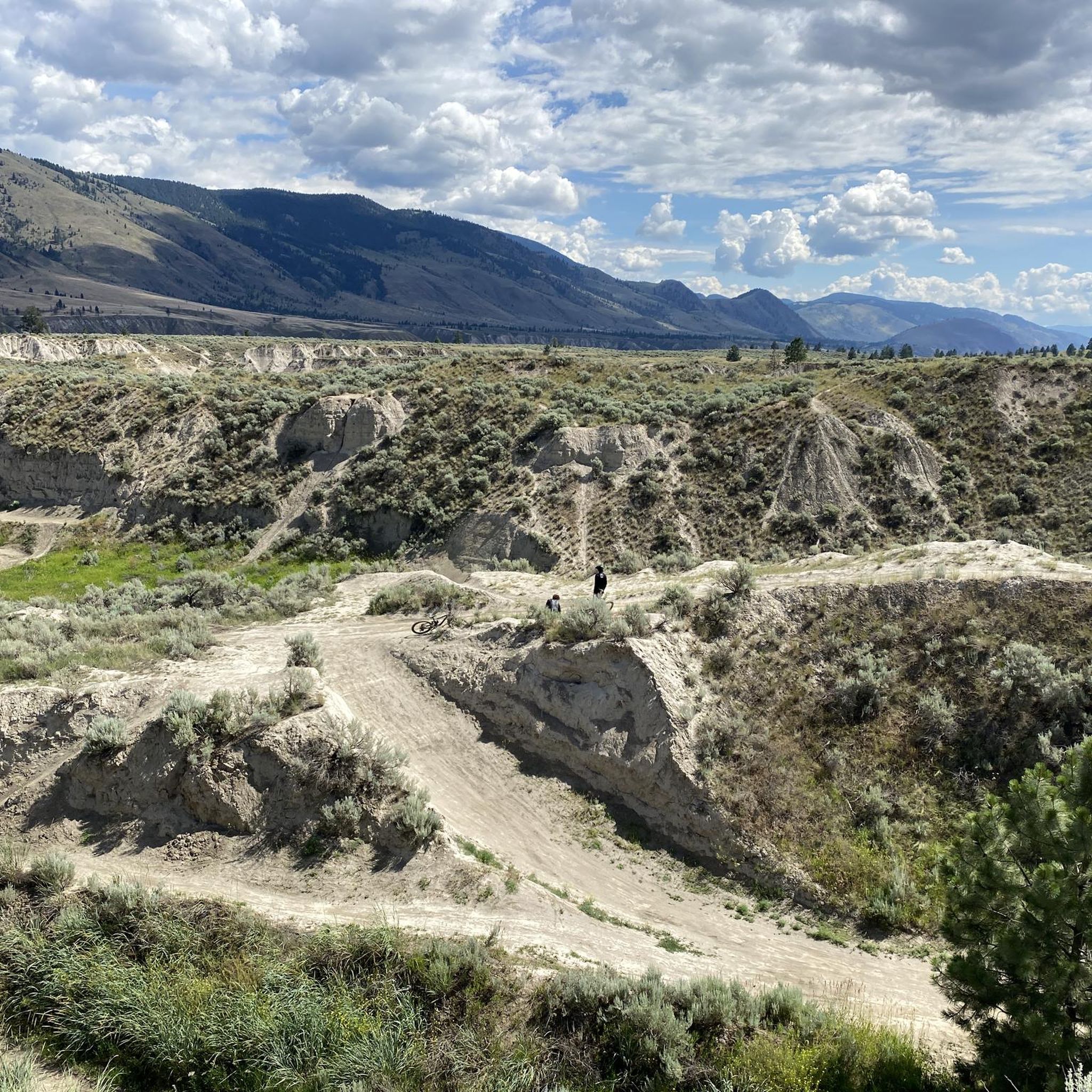
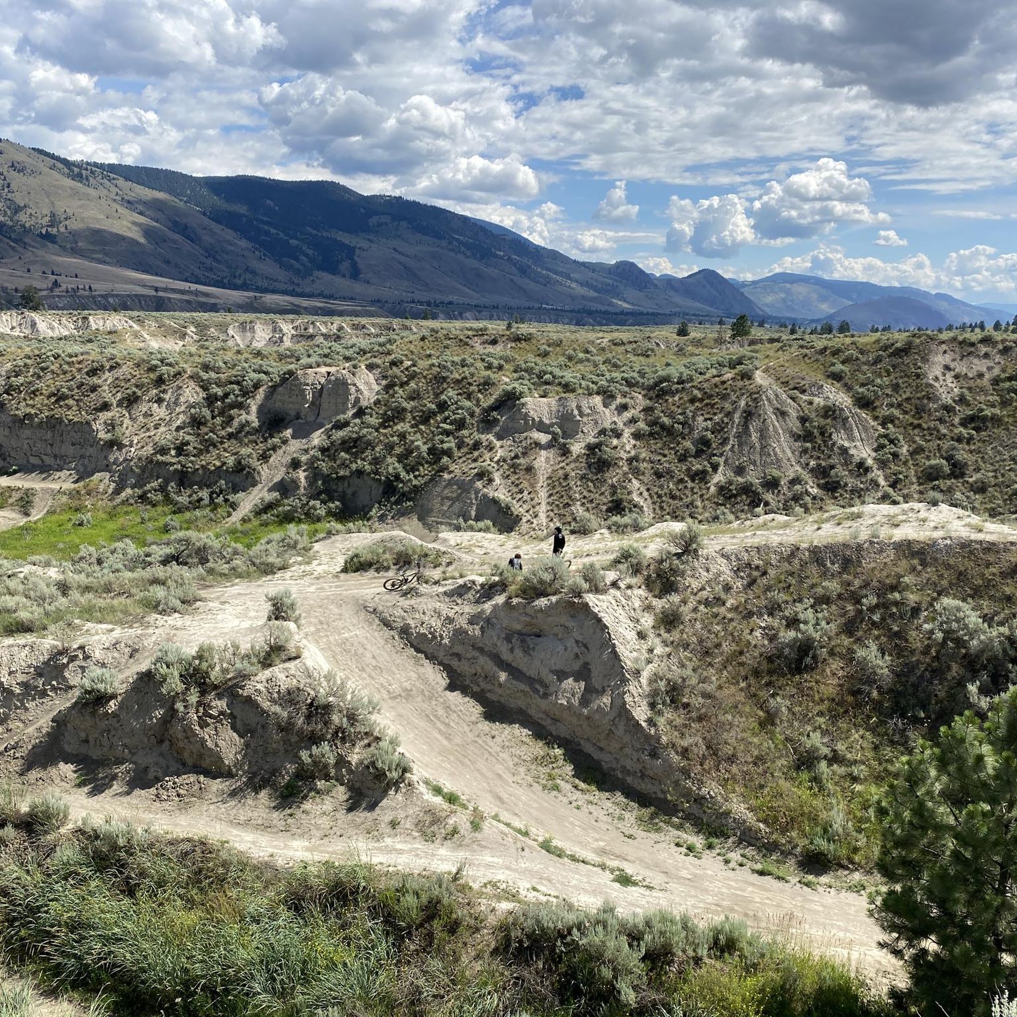
Mountain biking around Area P (Rivers and the Peaks) offers diverse terrain characterized by majestic rivers and impressive mountains. The region features varied landscapes, from forested paths to open views, often with unique rock formations. This blend of flowing water and rugged topography creates an engaging environment for mountain biking enthusiasts. The area provides a network of trails suitable for different skill levels, including both moderate and challenging routes.
Best mountain bike trails around Area P (Rivers and the Peaks)
…Last updated: September 30, 2026
33
riders
20.0km
02:04
450m
450m
Moderate mountain bike ride. Good fitness required. Advanced riding skills necessary.
4.0
(1)
24
riders
18.0km
01:52
480m
480m
Hard mountain bike ride. Good fitness required. Advanced riding skills necessary. Some portions of the route may require you to push your bike.

17
riders
13.3km
01:40
530m
530m
Hard mountain bike ride. Good fitness required. Advanced riding skills necessary. Some portions of the route may require you to push your bike.
10
riders
11.4km
00:55
230m
230m
Moderate mountain bike ride. Great for any fitness level. Advanced riding skills necessary.
5.0
(2)
9
riders
6.97km
00:40
120m
120m
Moderate mountain bike ride. Great for any fitness level. Advanced riding skills necessary.
Get access to more routes and recommendations from other explorers.
Already have an account?
Our route recommendations are based on thousands of hikes, rides, and runs completed by other people on komoot.
Start today with a free account
Your next adventure awaits.
Popular around Area P (Rivers and the Peaks)

Vancouver roundtrip — Bikepacking British Columbia

Canada by train – scenic hikes from Western stations

Pacific charm and peak happiness in British Columbia

Forests, desert, wilderness - day tours in British Columbia
Hiking around Area P (Rivers and the Peaks)
Running Trails around Area P (Rivers and the Peaks)
Cycling around Area P (Rivers and the Peaks)
Road Cycling Routes around Area P (Rivers and the Peaks)

Gravel biking around Area P (Rivers and the Peaks)
Other adventures around Area P (Rivers and the Peaks)


Tips from the Community


very beautiful and uninhabited easy to Sun Peaks by bike
0
0
Frequently Asked Questions
How many mountain bike trails are available in Area P (Rivers and the Peaks)?
Area P (Rivers and the Peaks) offers a network of over 10 mountain bike trails. These routes traverse diverse terrain, characterized by majestic rivers and impressive mountains, providing a range of experiences for riders.
What kind of terrain should I expect on mountain bike trails in Area P (Rivers and the Peaks)?
The terrain in Area P (Rivers and the Peaks) is highly varied, reflecting its 'Rivers and Peaks' designation. You can expect a mix of forested paths, open vistas, and rugged sections, often featuring unique rock formations, volcanic rock, and high desert characteristics. Trails frequently incorporate switchbacks, berms, and technical rock sections, with opportunities for both uphill climbs and thrilling descents.
Are there mountain bike trails suitable for beginners in Area P (Rivers and the Peaks)?
While Area P (Rivers and the Peaks) is known for its varied terrain, the current selection of komoot mountain bike routes primarily features moderate to difficult trails. There are no routes specifically graded as 'easy' in this guide, but moderate trails like the Fast and Flowy Trail loop from Pineview offer an enjoyable experience for those with some riding experience.
Are there challenging mountain bike trails for experienced riders in Area P (Rivers and the Peaks)?
Yes, experienced riders will find several challenging options. Approximately 3 of the routes in Area P (Rivers and the Peaks) are graded as difficult. For example, the Python Lake loop from Dufferin is a difficult 11.5-mile path featuring significant elevation changes and scenic views around Python Lake. Another challenging option is the Skating Pond loop from Paul Lake Provincial Park.
Can I find circular mountain bike routes in Area P (Rivers and the Peaks)?
Yes, many of the mountain bike routes in Area P (Rivers and the Peaks) are designed as loops, allowing you to start and finish at the same point. Examples include the Batchelor Lake loop from McArthur Island and the McGillivray Lake loop from Sun Peaks Mountain Resort Municipality.
What are some notable natural features or viewpoints I can see while mountain biking in Area P (Rivers and the Peaks)?
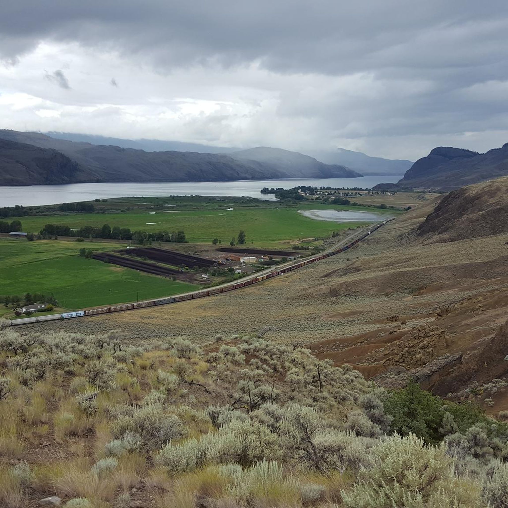
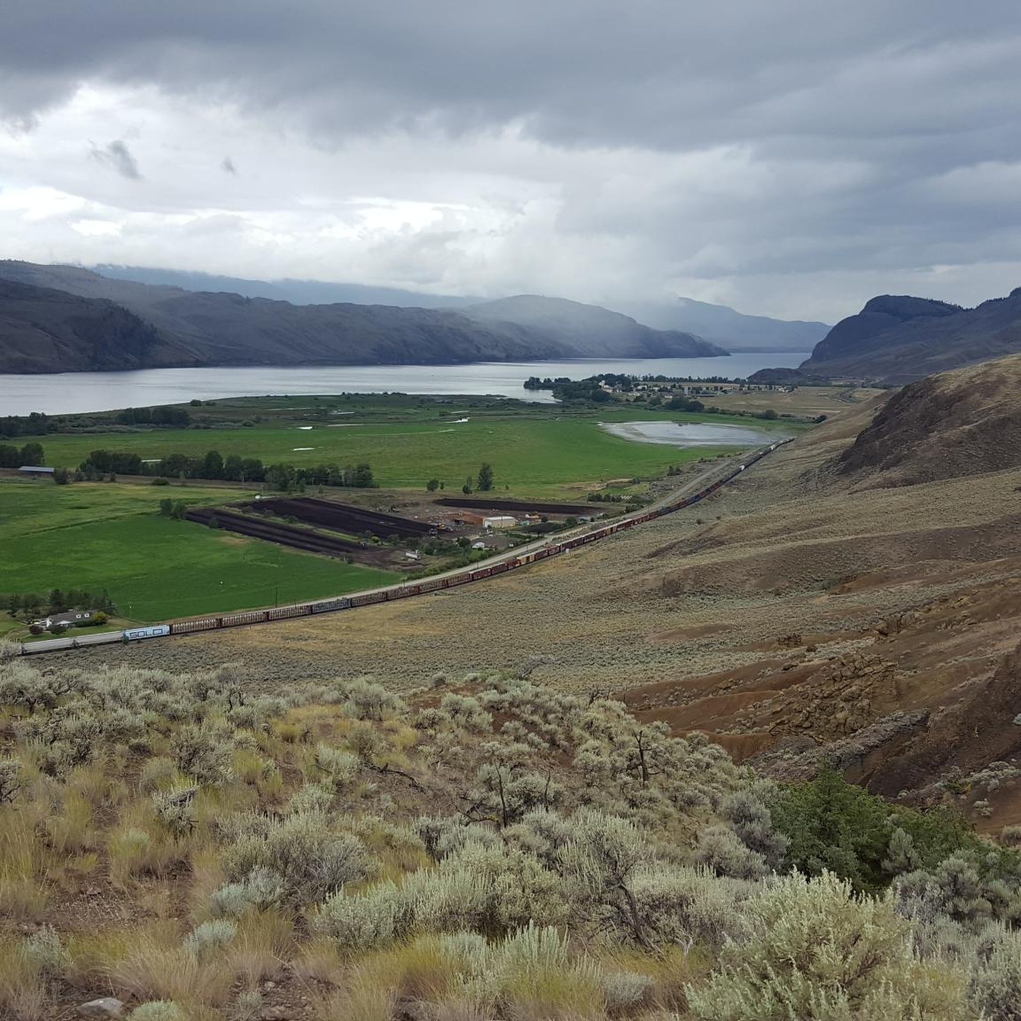
The region is rich in natural beauty. Along the trails, you might encounter impressive natural features such as basalt columns, hoodoos and rock formations. There are also stunning viewpoints like the Battle Bluff Cairn and View of Kamloops Lake, offering panoramic vistas of the surrounding landscape.
What do other mountain bikers enjoy most about the trails in Area P (Rivers and the Peaks)?
The komoot community highly rates the mountain biking experience in Area P (Rivers and the Peaks), with an average score of 4.5 stars from over 8 reviews. Riders often praise the varied terrain, the blend of forested paths and open views, and the engaging challenge offered by the trails. The scenic beauty, especially around lakes and rivers, is also a frequently mentioned highlight.
Are there any lakes or rivers accessible from the mountain bike trails?
Yes, the 'Rivers and Peaks' character of the area means many trails offer access to or views of water bodies. For instance, the Python Lake loop from Dufferin takes you around Python Lake, and the Batchelor Lake loop from McArthur Island explores areas near Batchelor Lake. You can also find highlights like Tod Lake and Riverside Park Beach nearby.
What is the best time of year for mountain biking in Area P (Rivers and the Peaks)?
Given the region's diverse topography with rivers and mountains, seasonal considerations are important. While specific data isn't provided, such areas typically offer excellent riding conditions from late spring through early autumn. During these months, trails are generally clear of snow, and the weather is conducive to outdoor activities. Always check local conditions before heading out, especially after heavy rain or during shoulder seasons.
Are there any places to explore or visit near the mountain bike trails?
Beyond the trails, Area P (Rivers and the Peaks) offers several attractions. You could visit Sun Peaks Village for amenities or explore other natural highlights like the Battle Bluff Cairn and View of Kamloops Lake. The region is known for its outdoor adventure opportunities, including hiking, water activities, and wildlife watching.
How long do mountain bike trails typically take to complete in Area P (Rivers and the Peaks)?
The duration of mountain bike trails varies depending on their length and difficulty. For example, a moderate trail like the Fast and Flowy Trail loop from Pineview, which is 12.0 miles (19.3 km), typically takes around 2 hours 1 minute. Shorter, moderate routes like the McGillivray Lake loop (7.1 miles / 11.4 km) can be completed in about 55 minutes.
Most popular routes around Area P (Rivers and the Peaks)
Most popular attractions around Area P (Rivers and the Peaks)

Get inspired with the komoot mobile app


Explore more
Browse the best MTB trails in other regions.
