The best walks and hikes around Genazzano
4.4
(199)
741
hikers
54
hikes
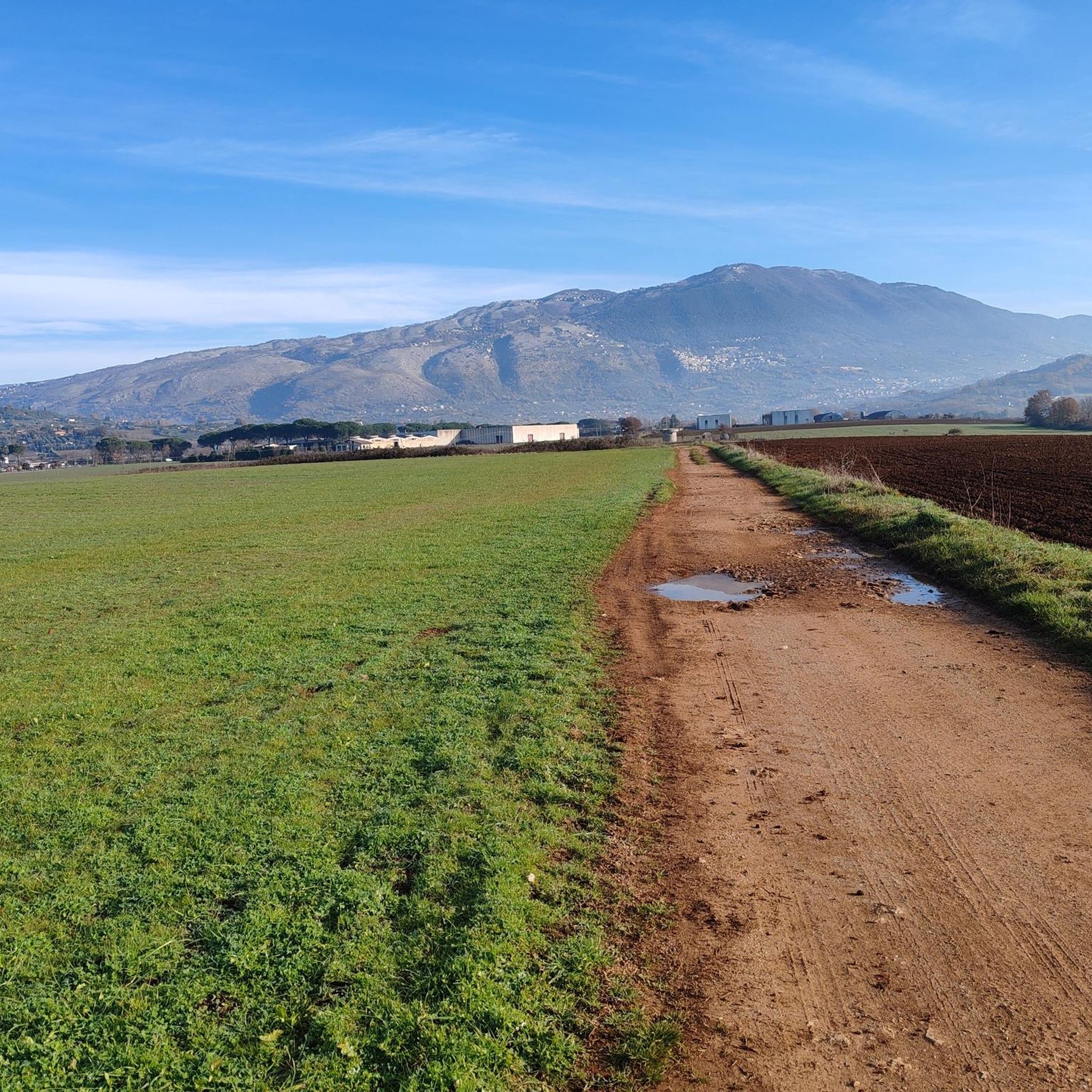
Hiking around Genazzano offers exploration of a landscape characterized by its position on volcanic tufa rock and a tuff spur, providing varied terrain. The region features the foothills of the Monti Prenestini, with wooded areas, olive groves, and vineyards. Deep ravines and the Sacco River valley contribute to the diverse vistas available to hikers.
Best hiking trails around Genazzano
- The most popular hiking route is Capranica Prenestina – Monte Calo Summit loop from Capranica Prenestina, a 6.3 miles (10.1…
Last updated: July 8, 2026
4.3
(23)
54
hikers
10.1km
03:11
320m
320m
Moderate hike. Good fitness required. Mostly accessible paths. Sure-footedness required.
5.0
(2)
16
hikers
23.3km
08:05
820m
820m
Hard hike. Very good fitness required. Mostly accessible paths. Sure-footedness required.

Sign up for free
4.0
(4)
9
hikers
14.8km
05:05
750m
750m
Hard hike. Very good fitness required. Easily-accessible paths. Suitable for all skill levels.
3.7
(3)
14
hikers
10.1km
03:06
380m
380m
Moderate hike. Good fitness required. Easily-accessible paths. Suitable for all skill levels.
5.0
(3)
12
hikers
9.95km
02:55
280m
280m
Moderate hike. Good fitness required. Easily-accessible paths. Suitable for all skill levels.
Get access to more routes and recommendations from other explorers.
Sign up for free
Already have an account?
Our route recommendations are based on thousands of hikes, rides, and runs completed by other people on komoot.
Start today with a free account
Your next adventure awaits.
Login or Signup

Other adventures around Genazzano

Tips from the Community

really really very tiring
0
0

Looking west you can see the vast area of the city of Rome and its province. In the valley below the town of San Gregorio da Sassola and, following on the right side, the city of Tivoli in the middle of the valley.
0
0
This area is characterized by the presence of various fields full of animals, such as this one on your left where many cows graze blissfully. In front of you, seen from below, the beautiful Rocca di Cave standing out on the top of the hill surrounded by nature.
0
1
The trail starts in the centre of Rocca di Cave, where there are bars, water fountains and other information before heading down the path.
0
0


Small, well-kept village in the Prenestine mountains.
0
0

To reach it the road has several very pleasant hairpin bends
0
0
Frequently Asked Questions
How many hiking trails are available around Genazzano?
Genazzano offers a diverse network of over 50 hiking routes. These trails cater to various skill levels, from easy walks to more challenging mountain ascents, allowing explorers to discover the region's unique volcanic terrain and lush woodlands.
What kind of terrain can I expect when hiking in Genazzano?
The terrain around Genazzano is characterized by its foundation on volcanic tufa rock, leading to dramatic geological formations and deep ravines. Hikers will traverse the foothills of the Monti Prenestini, encountering dense forests, olive groves, and vineyards, with scenic views over the Sacco River valley.
Are there hiking routes suitable for families in Genazzano?
Yes, Genazzano has several routes suitable for families. There are 10 easy trails available, perfect for a leisurely outing. These paths often wind through gentle landscapes, allowing families to enjoy the natural beauty without strenuous climbs.
Can I bring my dog on the hiking trails in Genazzano?
While specific regulations can vary, many natural areas in Italy are dog-friendly, provided dogs are kept on a leash and owners clean up after them. It's always recommended to check local signage or specific trail rules, especially in protected areas like the Natural Monument La Selva Genazzano, to ensure a pleasant experience for everyone.
Are there any circular hiking routes in Genazzano?
Yes, many of the trails around Genazzano are designed as circular routes, offering varied scenery without retracing your steps. An example is the Stone Steps to Piazza loop from Genazzano, which is a moderate 6.3-mile (10.2 km) trail leading through historical areas and natural surroundings.
What historical or natural landmarks can I see while hiking near Genazzano?
Hiking in Genazzano offers a blend of natural beauty and historical significance. You can explore the designated Natural Monument La Selva Genazzano, a vast forest within the Monti Prenestini. The region is also home to the historic Karol Wojtyła Trail, leading to the ancient Sanctuary of Mentorella. Additionally, hikers can encounter highlights such as the Monte Calo Summit, offering panoramic views, and the Monumental Oak of Pierluigi da Palestrina.
What is the best time of year to go hiking in Genazzano?
Spring and autumn are generally the best seasons for hiking in Genazzano. In spring, the Monti Prenestini come alive with wildflowers, making trails like the Karol Wojtyła Trail particularly vibrant. Autumn offers pleasant temperatures and beautiful foliage. Summers can be hot, while winters may bring cooler temperatures, especially at higher elevations.
How can I get to the hiking trails in Genazzano using public transport?
Genazzano is accessible by public transport, typically via bus services connecting it to larger towns and Rome. Once in Genazzano, some trailheads are within walking distance of the town center. For specific routes further afield, local transport options or a short taxi ride might be necessary to reach the starting points.
Where can I park my car when hiking in Genazzano?
Parking is generally available in and around the town of Genazzano. For specific trailheads, especially those outside the main town, it's advisable to check the route details on komoot for information on designated parking areas or suitable roadside spots near the starting points of popular trails like the Capranica Prenestina – Monte Calo Summit loop.
What are the difficulty levels of hikes in Genazzano?
Genazzano offers a range of difficulty levels. There are 10 easy routes, 35 moderate trails, and 6 difficult paths. This variety ensures that both casual walkers and experienced hikers can find suitable challenges, from gentle strolls through woodlands to demanding ascents in the Monti Prenestini.
What do other hikers enjoy most about hiking in Genazzano?
The hiking experience in Genazzano is highly rated by the komoot community, with an average score of 4.4 stars from over 160 reviews. Hikers often praise the diverse landscapes, from volcanic formations to dense woodlands, and the panoramic views over the Sacco River valley. The blend of natural beauty with historical pathways, such as sections of the Via Francigena, is also frequently highlighted.
Are there any long-distance or pilgrimage routes passing through Genazzano?
Yes, Genazzano is a recognized stage on the Southern Via Francigena, an ancient pilgrim route. This integration into a historic long-distance trail system allows hikers to experience both nature and cultural heritage, discovering features like the 'Torre dei Piscoli' along the way.
What makes the Monti Prenestini area special for hiking?
The Monti Prenestini, at whose foothills Genazzano lies, offer beautiful wooded areas and scenic views. They contribute to the town's charming backdrop of olive groves, vineyards, and dense forests. The mountains provide varied and engaging terrain, making them a prime location for immersive nature walks and tranquil hikes, including the expansive La Selva Genazzano natural monument.
Most popular attractions around Genazzano

Get inspired with the komoot mobile app


Explore more
Browse the best Hikes in other regions.
